logo

1700. plan des villes forts et Citadelles de Strasbourg . . . (with Kehl)

  • plan des villes forts et Citadelles de Strasbourg . . . (with Kehl)

plan des villes forts et Citadelles de Strasbourg . . . (with Kehl) information:

Year of creation: 
Resolution size (pixels): 
 13540x8613 px
Disk Size: 
 19.3222MiB
Number of pages: 
 1
Place: 
 n.p.
Author: 

Print information. Print size (Width x height in inches):
Printing at 72 dpi 
  188.06 х 119.63
Printing at 150 dpi 
 90.27 х 57.42
Printing at 300 dpi 
 45.13 х 28.71

An example of detailing the file of this map of in a printable high-resolution:

Click to open in high resolution (open in new tab).
Attention! this is just the central piece (central area 960x960 px) of the map file!
This is an example, so that you can see and study the level of detail of a given map. The entire Map will be fully available after payment!

plan des villes forts et Citadelles de Strasbourg . . . (with Kehl)

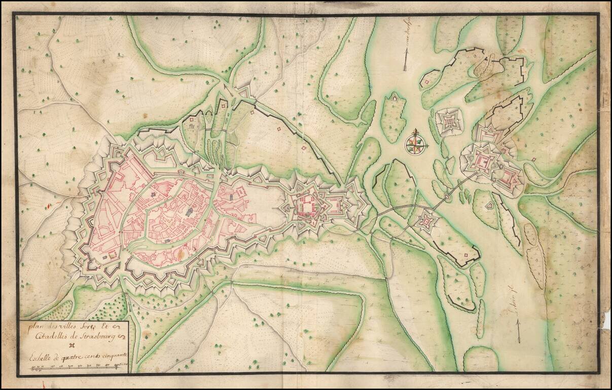
Manuscript Plan of Strasbourg and Environs, including the fortifications at Kehl.

Detailed hand drawn plan of Strasbourg, focusing on its fortifications in the Vauban style.


Special conditions for students!

If you are a student, write to us in telegram: @antiquemaps and indicate what material you need and for what work you need a map in high detail. We are ready to provide material on special terms. For students only!

Item information:

Year of creation:
Size:
13540x8613 px
Disk:
19.3222MiB
Number of pages:
1
Place:
n.p.
Author:
Anonymous.
$14.99

Related item