
Rare old maps of the United States.
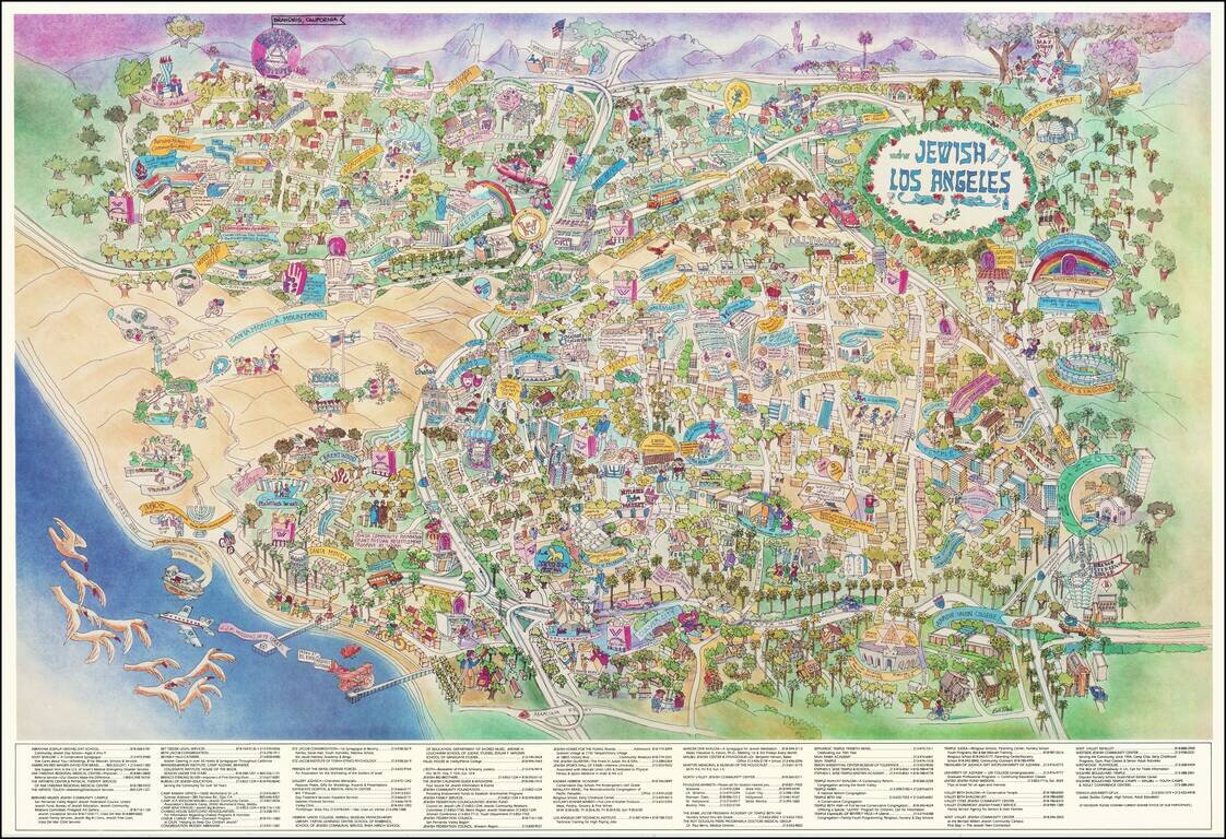
Rare promotional pictorial map of "Jewish Los Angeles," providing a whimsical look at Great Los Angeles and its various Jewish businesses, schools, temples and other public and private institutions. The map includes a directory of businesses and...
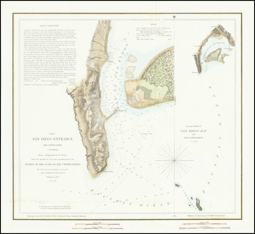
First American Map of the Bay of San Diego Nice example of the first edition of the US Coast Survey's first mapping of San Diego Bay. This first edition can be distinguished from the 2nd edition by the addition of the official seal of the US Coast...
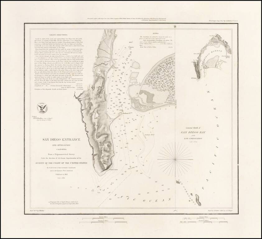
Rare Separately Issued Variant Edition of The First Modern Map of San Diego Bay -- Thick Paper -- Presentation Copy: Rare variant of the 1853 US Coast Survey's first mapping of San Diego Bay. The present example has several changes for the standard...
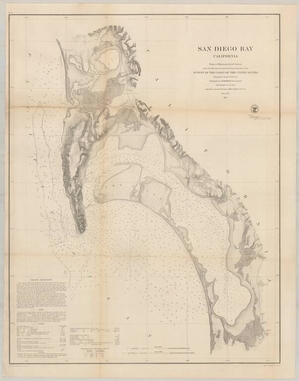
Nice example of the much sought after large format survey of San Diego Bay, form the US Coast Survey. Extends from False (Mission) Bay and the Pacific Beach area, south to Imperial Beach and the Mexican border. Hundreds of soundings. Shows several of...
![[San Diego] Views of Southern California. Prominent Places in and about San Diego](/map/small/69182.jpg)
Rare double page color printed image of "Prominent Places" in the San Diego area, which appeared in The WASP magazine. The views include: Hotel Josephine (Coronado), with Coronado Railroad in the foreground Chadbourne's New Building (4th & C...
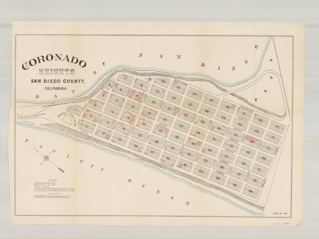
Rare plan of the north end of Imperial Beach, which at the time was planned as a community to be called Coronado Heights, just south of Coronado and the Strand. Located immediately south of the Strand, Coronado Heights would ultimately become a part...
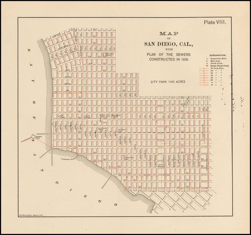
Rare map of San Diego. Shows the Downtown area from Juniper and Curlew Street to 30th Street and N Street. A number of early structures are showing, including: Florence Hotel California Southern Depot Court House Horton House Brunswick Hotel...
![[San Diego & San Diego Bay]](/map/small/45945.jpg)
Scarce map of the San Diego Bay & Vicinity, prepared during the time period when San Diego was actively soliciting the US Government to consider San Diego for future military installations. The names of many of the original landowner's of the...
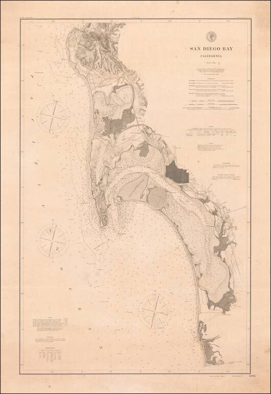
Rare 1895 Coast & Geodetic Survey Chart of San Diego Bay, published February 1895. The map extends north to La Jolla, La Hoya Valley (La Jolla Shores) and Rose Canyon and south to Otay Valley, the Tijuana River and the monument locating the...
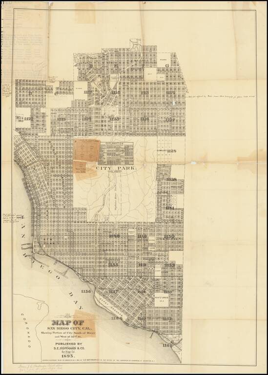
A San Diego Rarity Extremely rare large format separately published map of San Diego, published by S.E. Hoffman & Co. in 1895. The map includes a number of pencil and pen annotations, including: Florence Heights Add. No #2 New $50,000...
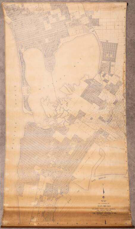
Large wall map of the San Diego neighborhoods of Point Loma, Mission Bay, Mission Beach, Pacific Beach, and Bay Park. This is a very large and detailed wall map of these neighborhoods, depicting them at 1:400 feet. One of the most interesting aspects...
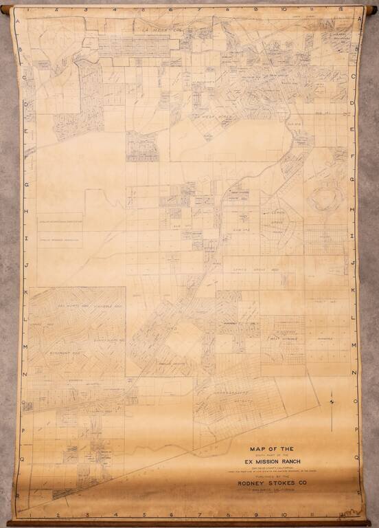
Large wall map of eastern San Diego, showing parts of Lemon Grove and La Mesa. In the west, the map is bounded by Lake Chollas, and the Chollas Heights Naval Radio Station, which is now military housing. There is plot level detail in the areas that...
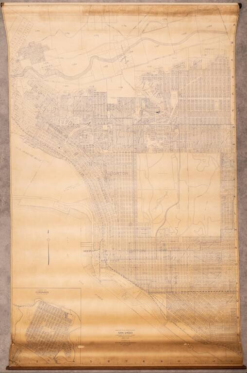
Large wall map of San Diego, showing Downtown, Balboa Park, and the neighborhoods of North Park, Banker's Hill, Little Italy, Mission Hills, and with an inset of Coronado. This is a very large and detailed wall map of central San Diego, shown at 1:400...
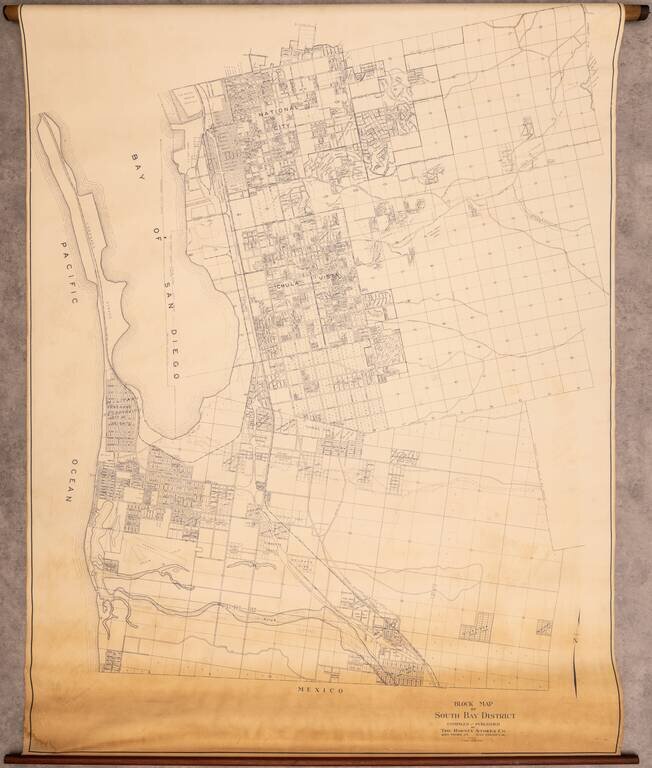
Rare Wall Map of the South Bay Interesting map of the area south of San Diego, extending from National City to Tijuana, centered on Chula Vista. The map covers what is today Imperial Beach, National City, Chula Vista, San Ysidro, and Bonita, however,...
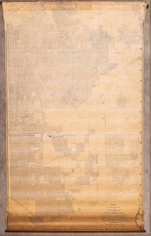
Very large wall map of a portion of San Diego, centered on City Heights and extending through the Mountain View and Southcrest neighborhoods to San Diego Bay in the lower-left corner of the map. At the top edge of the map is Kensington and Kensington...
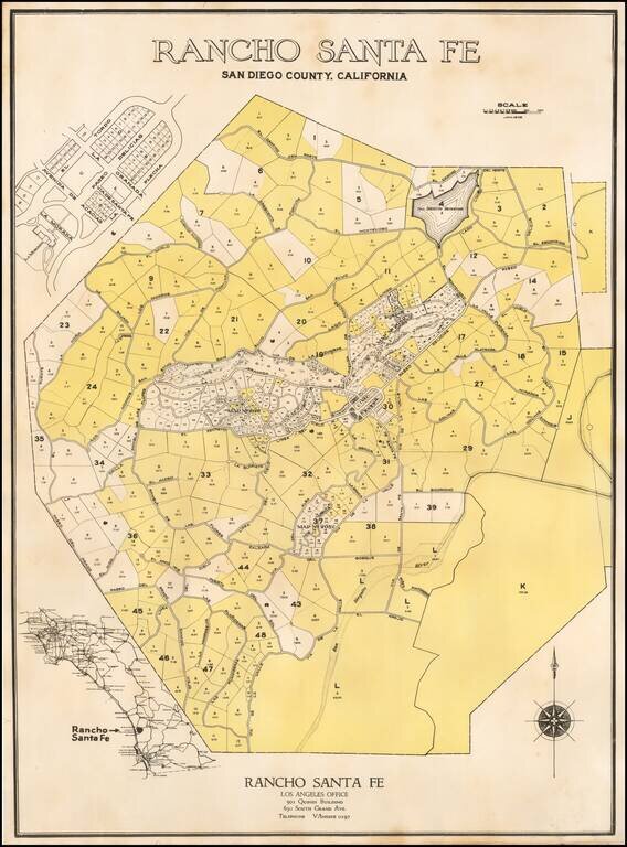
The First Plan of Rancho Santa Fe Fine example of the original subdivision map for Rancho Santa Fe, California, published in January of 1929. The map Includes lot and tract numbers, with acreage, street names, At the center is the "Civic Center",...