
Rare old maps of the United States.
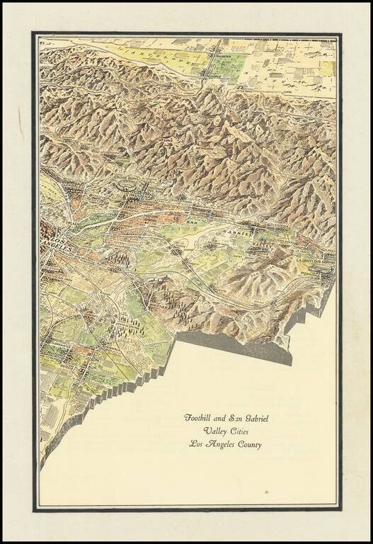
Interesting promotional map of the Eastern portion of Los Angeles County, likely published at about the time of the1932 Olympics. The map is centered on Pasadena and the the San Gabriel Valley, stretching north to Lancaster and south to Artesia and...
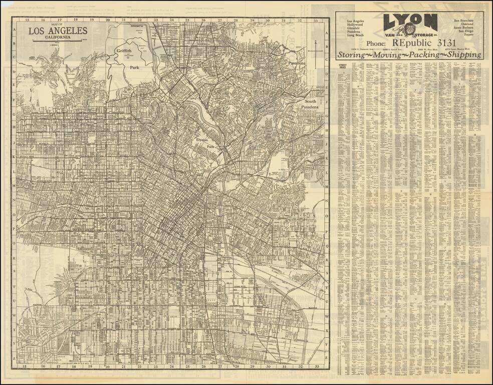
Detailed street map of 1930s Los Angeles, focusing specifically on Downtown Los Angeles and adjacent neighborhoods. On the verso is a "Map of Western Portions of Los Angeles" also by E.F. Hill, that stretches from Vista Del Mar to Santa Monica. The...
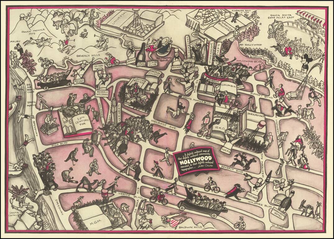
Hollywood in the 1930s Pictorial map of Hollywood section of Los Angeles, also incorporating surrounding areas. Shows streets, locations of film producers and directors, studios, and other points of interest with cartoon illustrations. Landmarks...
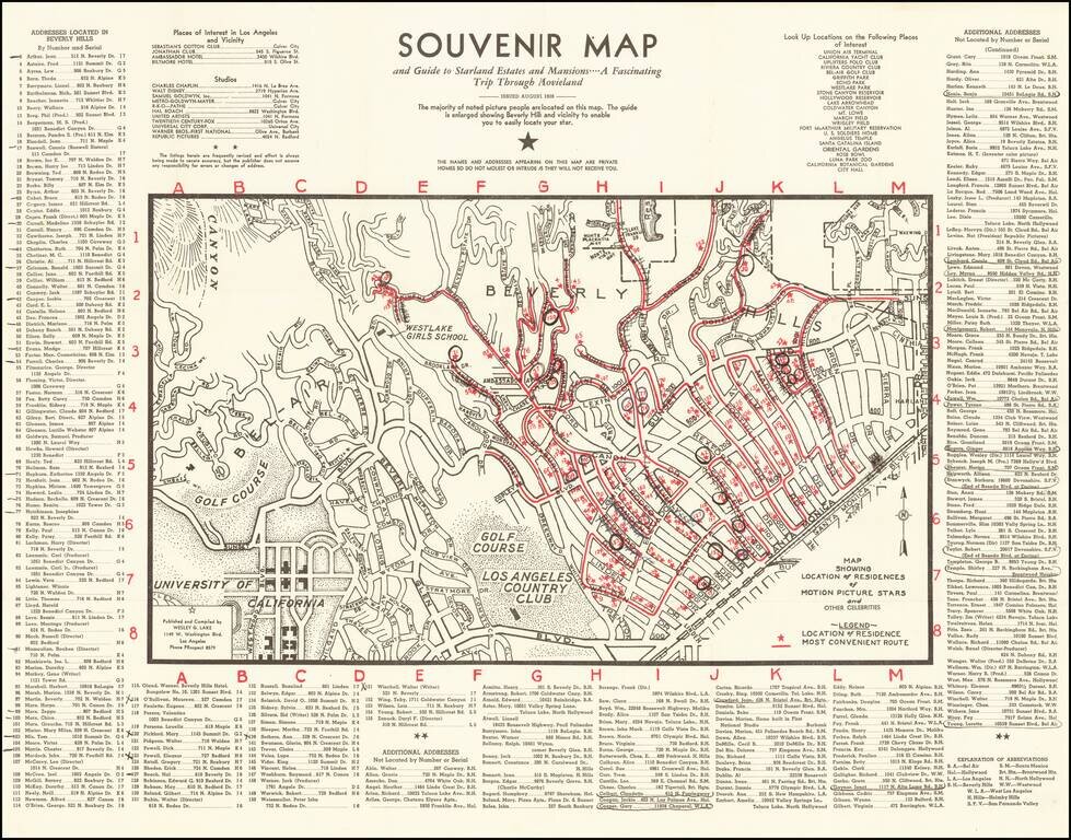
1938 Hollywood Stars Souvenir Map Scarce early map of Beverly Hills and Westwood, showing the locations of prominent movie star homes, published in the August 1938. Stars named include Fred Astaire, James Cagney, Charles Chaplin, Marlene Dietrich,...
![[Los Angeles]](/map/small/63225.jpg)
Striking pictorial map of Southern California, appearing on the verso of the menu for the Ollie Hammond's Steak House in Los Angeles, Feb 2, 1946. The map provides a striking birdseye view of Los Angeles and surrounding areas, along with the location...
![[Official Route Map Los Angeles]](/map/small/70212.jpg)
Los Angeles is the Wonderland of the World and to see it properly is to see it by Streetcar and Coach! Fascinating transportation map of Los Angeles, highlighting the lines of the Los Angeles Transit Company. The map is very interesting in that it...
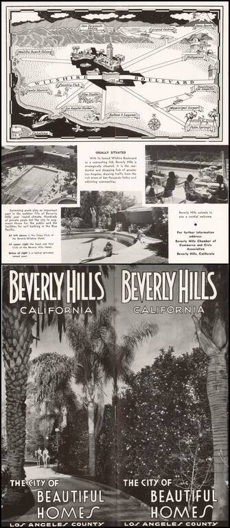
Pictorial map of the Los Angeles Basin, centered on Wilshire Boulevard and Downtown Los Angeles, drawn by C.A. Stanley. Places illustrated include the Malibu Beach Colony, Flim Studios, Municipal Airport, etc.
![[Public Transit in Los Angeles] Los Angeles Transit Lines](/map/small/69627.jpg)
Rare Early Los Angeles Transit Lines Map Fascinating transportation map of Los Angeles, highlighting the lines of the Los Angeles Transit Company. The map very interesting, in that it provides one of the final snapshots of Los Angeles before the...
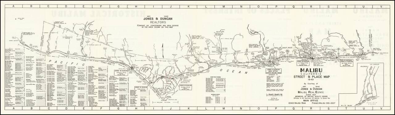
An Early Map of Malibu Rare early promotional map of Malibu, California, published by Art. Jones & Dave Duncan, Realtors, published less than 20 years after the first subdivisions of the area by the Rindge family. Stretching from Topanga Canyon...
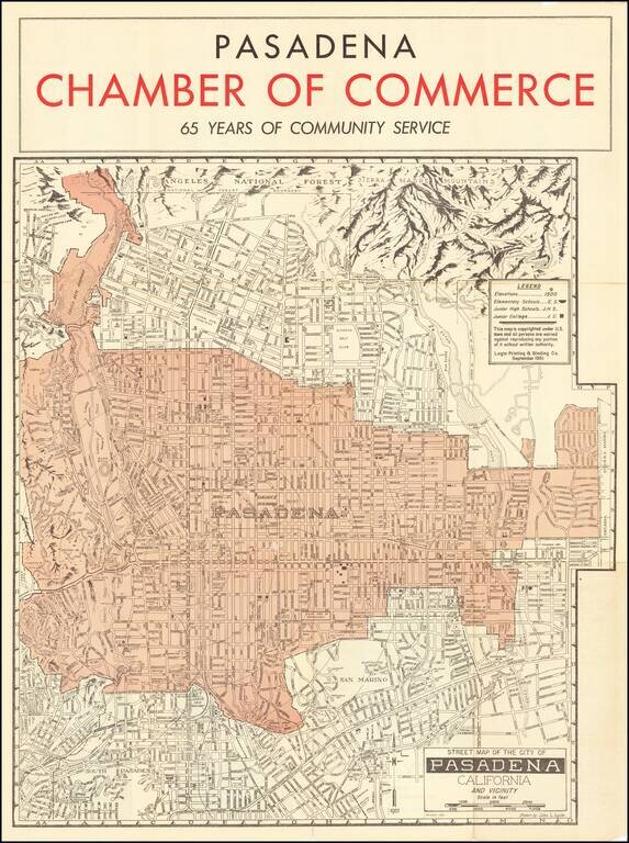
Striking map of the area around Pasadena, including a pictorial representation of the Sierra Madre Mountains and Angeles National in the north. The map is produced by the Pasadena Chamber of Commerce and focuses on the location of local schools in the...
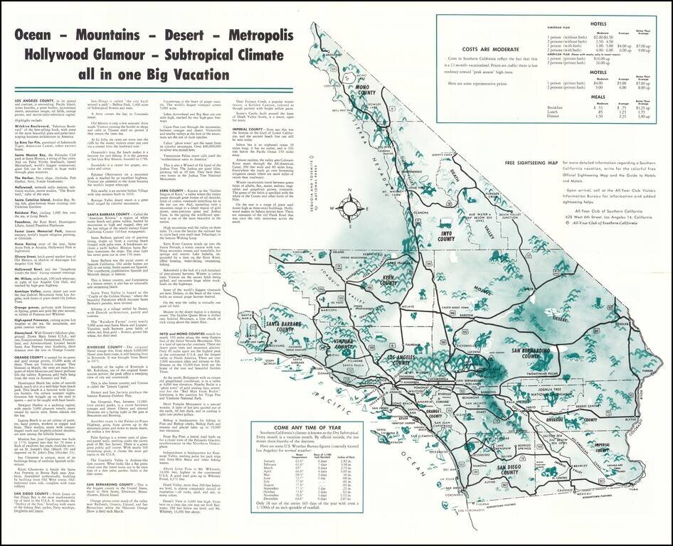
Vintage pictorial map of Southern California, issued by The All-Year Club of Southern California to promote tourism to the region in the middle of the 20th century. The main map includes an overview of Southern California (stretching up to Mono...
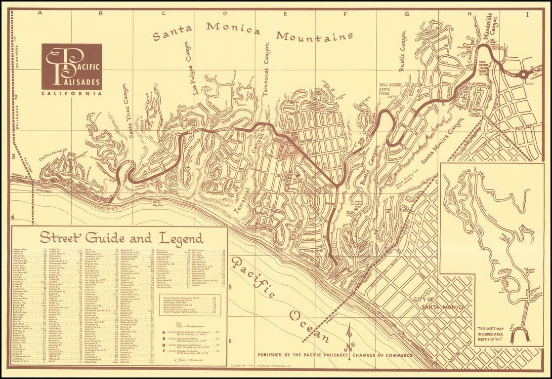
Fine promotional map and separate brochure, promoting the community of Pacific Palisades, Published by the Pacific Palisades Chamber of Commerce, the brouchure includes numerous photographs and testimonial to the benefits of residential life in the...
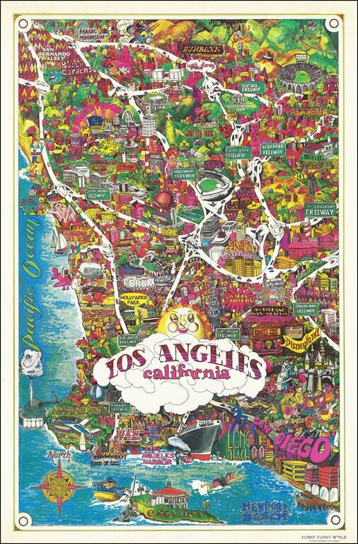
Bright and whimsical pictorial map of Los Angeles, published by Funny Funny World in 1976. The map emphasizes the famous tourist attractions of Southern California, including: Disneyland Queen Mary Marineland Ports of Call Knotts Berry Farm and...
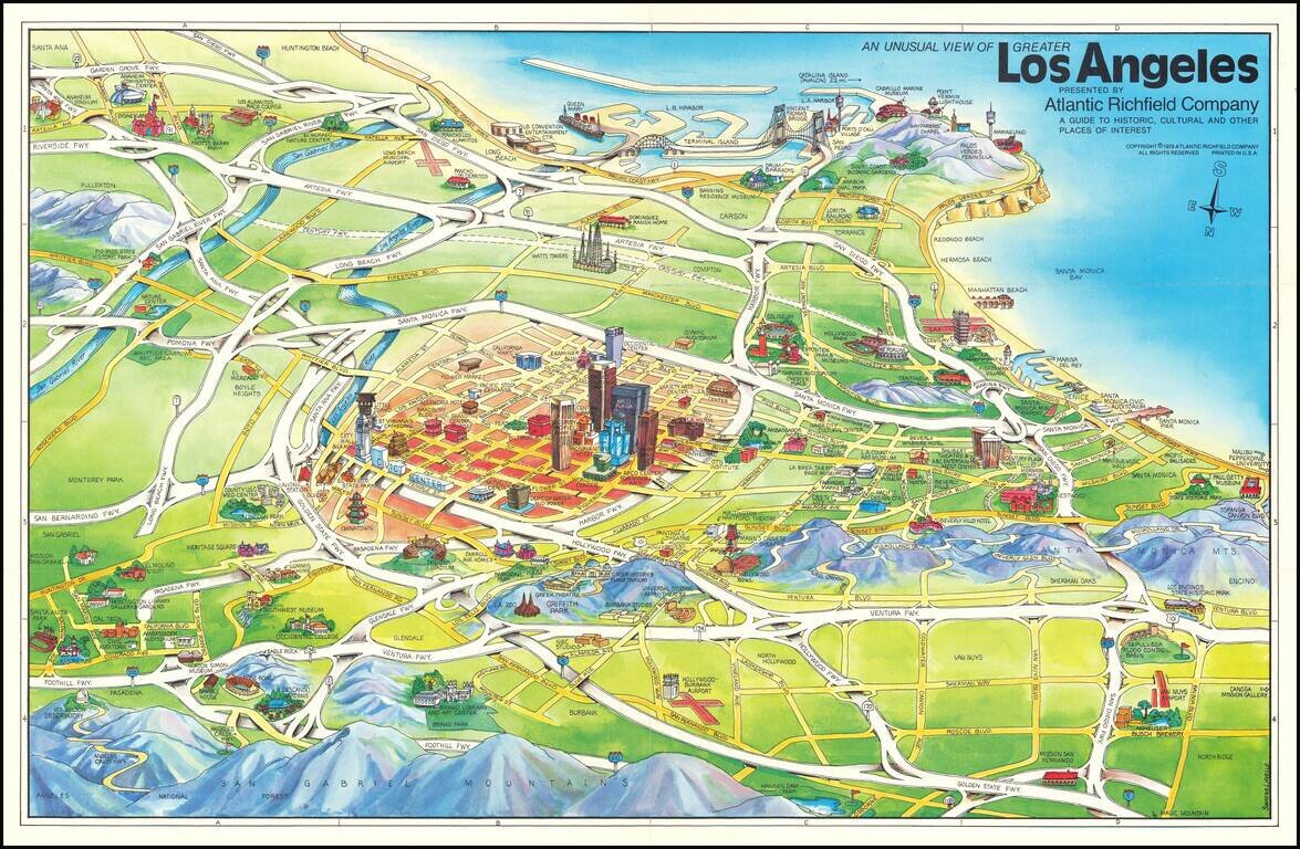
Los Angeles in 1979 -- A Pictorial View Striking pictorial view map of Los Angeles, looking south from above the San Gabriel Mountains toward Long Beach and Palos Verdes. The map was featured in Glen Creason's Los Angeles Magazine on line article,...
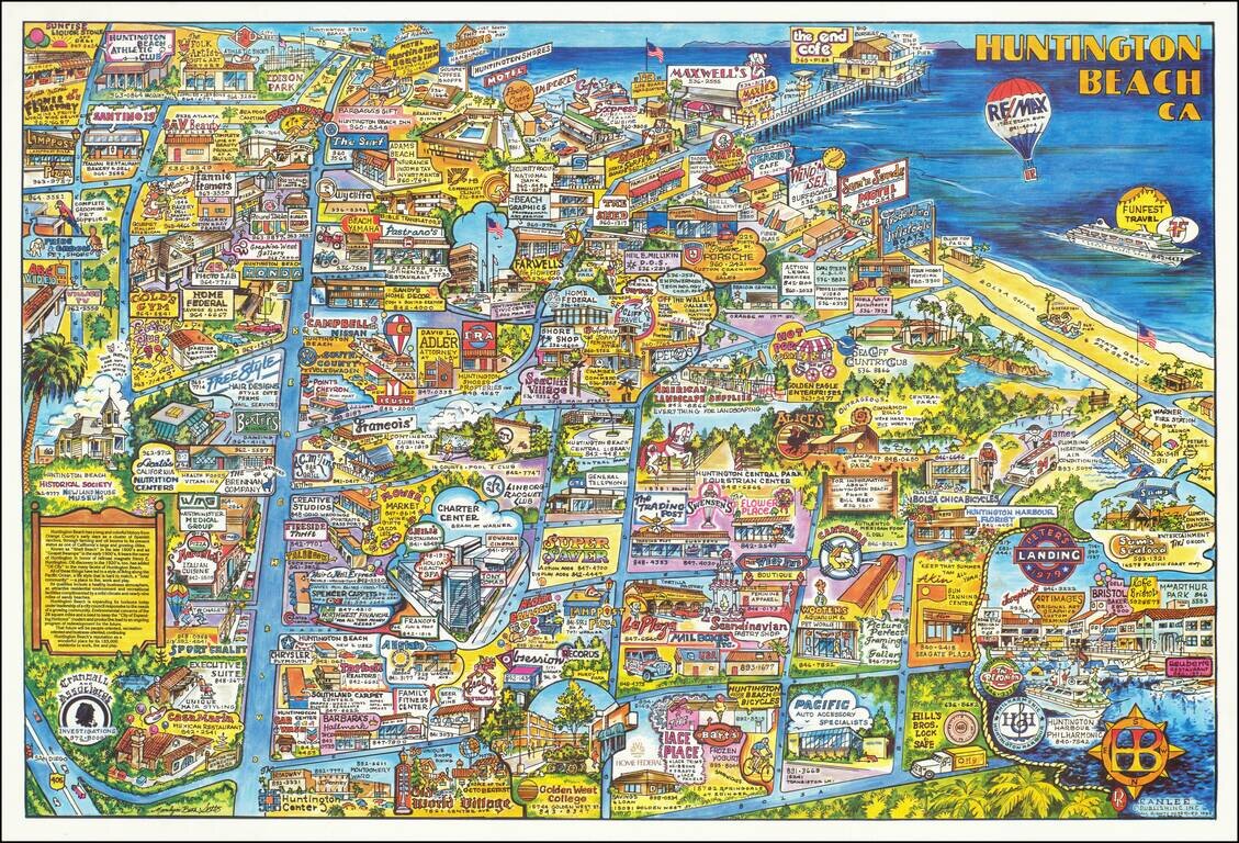
This is a great pictorial map of Huntington Beach, the southern California beachside city. Taken from the north, the map shows the community in bright colors, with the ocean visible on the right. Numerous advertisements dot the map, including many...
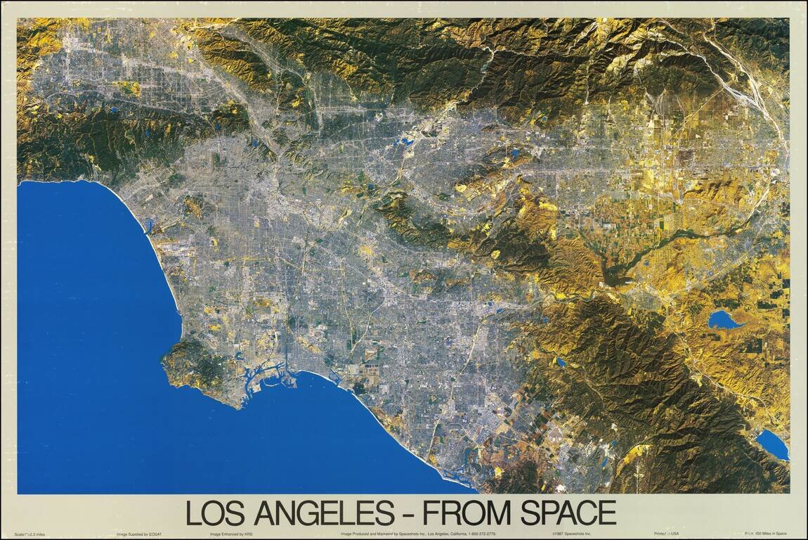
A fabulous color satellite image of Los Angeles, taken 450 miles from the surface of the earth. The scope of the image ranges from the San Fernando Valley to Laguna Beach, and inland past Riverside. The image was taken by EOSAT and printed at a scale...