Map size in jpg-format: 47.3094MiB
Click to open in high resolution (open in new tab).
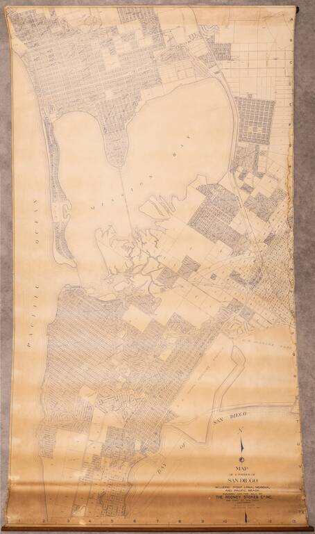
Large wall map of the San Diego neighborhoods of Point Loma, Mission Bay, Mission Beach, Pacific Beach, and Bay Park.
This is a very large and detailed wall map of these neighborhoods, depicting them at 1:400 feet.
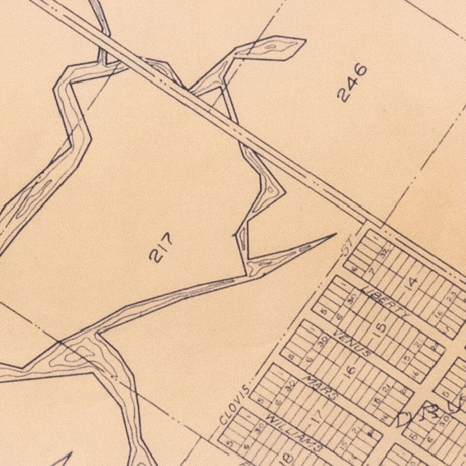
One of the most interesting aspects of this map is the additions inside present-day Mission Bay (at its lower-right corner), which show large neighborhoods that were never built. The map depicts the Bay prior to the significant dredging and hydroengineering of the 1940s, which created almost all of the Mission Bay waterfront that one sees today.
The Sellore Addition, Electric Line Addition, and Mission Beach Addition are all either underwater or now part of Fiesta Island.
An outline for Shelter Island is shown off the coast of Point Loma.
If you are a student, write to us in telegram: @antiquemaps and indicate what material you need and for what work you need a map in high detail. We are ready to provide material on special terms. For students only!
![(California-Mexico Border Survey) Datos de los trabajos astronómicos y topográficos. [bound with:] Variedades de la civilizacion, nueva epoca (Tomo I)](/map/small/70777.jpg)