Map size in jpg-format: 586375B
Click to open in high resolution (open in new tab).
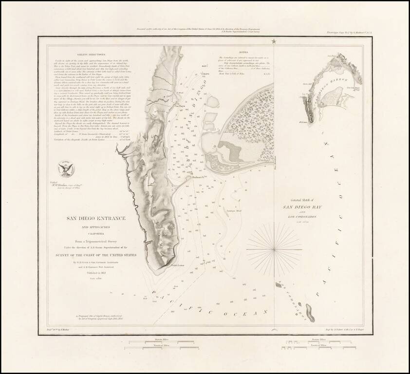
Rare Separately Issued Variant Edition of The First Modern Map of San Diego Bay -- Thick Paper -- Presentation Copy:
Rare variant of the 1853 US Coast Survey's first mapping of San Diego Bay.
The present example has several changes for the standard 1853 edition. The title has been changed slightly (J. No. 4 is not present). The plate number (45) at the top left is not present, and a 2 line presentation note is added at the top center.
This first edition can be distinguished from the second edition by the addition of the official seal of the US Coast Survey in the left of the map on the second edition.
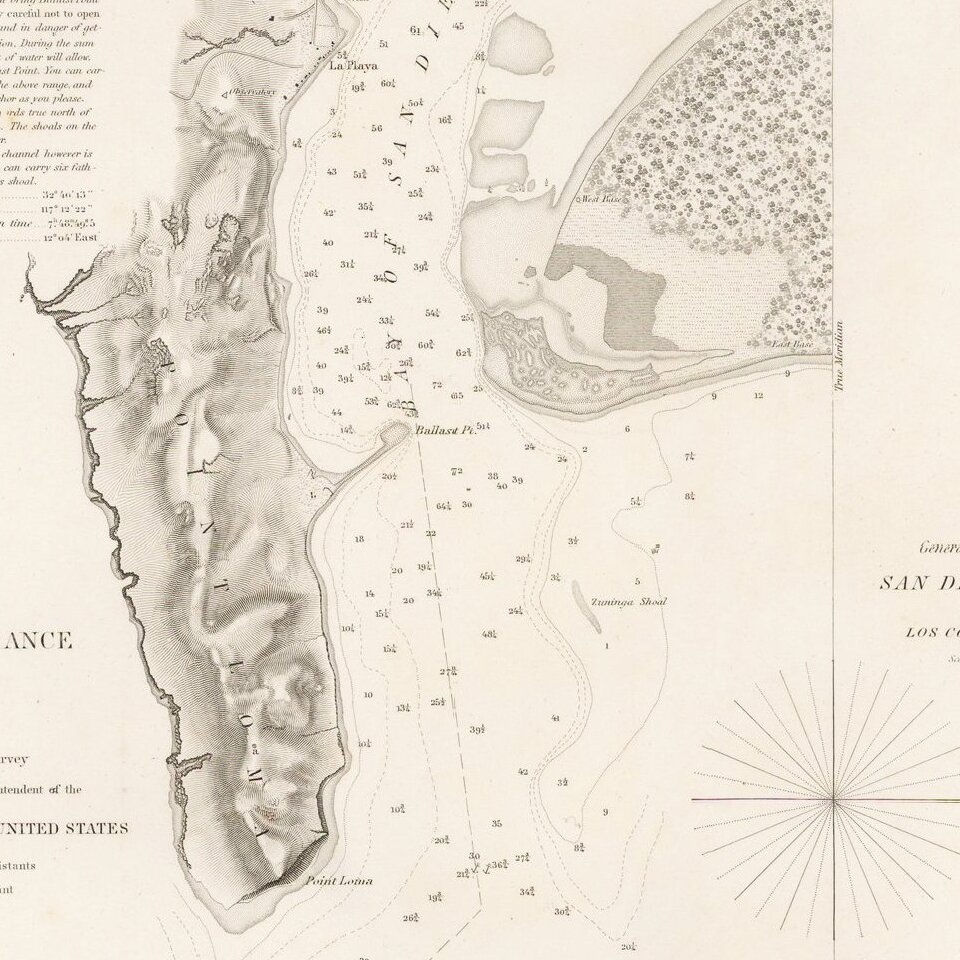
The plan of the harbor covers the area from Point Loma and La Playa in the west to Shelter Island, with extensive soundings taken. Point Loma, Ballast Point, La Playa, an Observatory, ship wreck and various buoys are noted. Larger inset diagram shows the entire bay. Extensive sailing notes in the upper left corner. One of the earliest obtainable maps of San Diego.
The presentations examples on thick paper are very rare on the market.
If you are a student, write to us in telegram: @antiquemaps and indicate what material you need and for what work you need a map in high detail. We are ready to provide material on special terms. For students only!

![(California-Mexico Border Survey) Datos de los trabajos astronómicos y topográficos. [bound with:] Variedades de la civilizacion, nueva epoca (Tomo I)](/map/small/70777.jpg)