
Rare old maps of the United States.
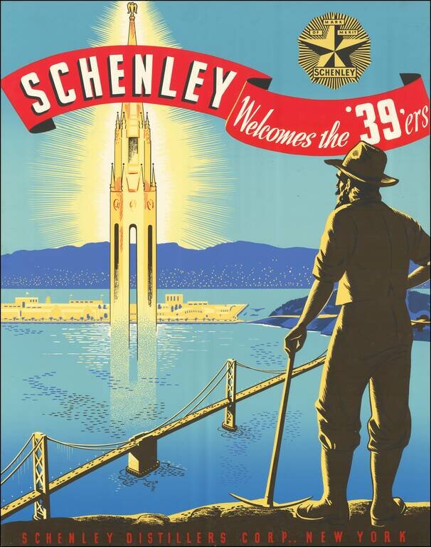
Unrecorded Poster for the 1939 Golden Gate Exposition. Beautiful and extremely rare color-printed poster prepared by the Schenley Distillers Corporation of New York as a promotional for the 1939 Golden Gate Exposition. The map features a '49er gold...
Sports Playland of America Detailed birdseye view style map of San Francisco, prepared by the Convention & Tourism Bureau for the 1939 World's Fair. A view of the Fair Grounds in the mIddle of San Francisco Bay is shown in an oval, with a larger...
![[San Francisco] A cartograph of Treasure Island in San Francisco Bay Golden Gate International Exposition](/map/small/70375.jpg)
Fine example of Ruth Taylor White's large format map of Treasure Island and the San Francisco Golden Gate Exposition Fairgrounds, published in 1939. The map provides an aerial panorama of the exposition grounds, with a portion of San Francisco in the...
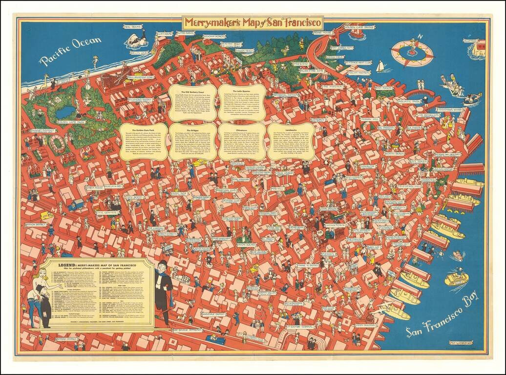
A Pilot for Pixilated Philanderers with a Penchant for Getting Pickled Scarce map of San Francisco, intended for tourists, sailors and other revelers. The map includes a guide noting Restaurants (including Joe Di Maggios), Foreign Atmosphere...
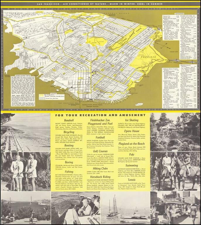
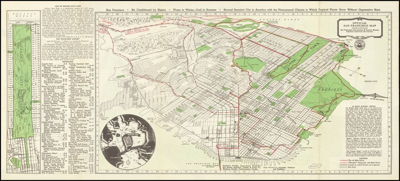
Interesting tourist map and promotional brochure of San Francisco, published in the early 1950s by the San Francisco Convention and Visitors Bureau. The map illustrates "The 49-Mile Drive" and the "'Wonder' Peninsula 100-Miles Drive", with a detailed...
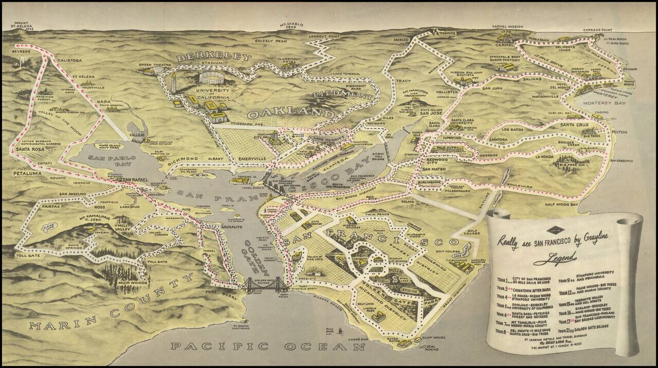
Birdseye view style map of the Bay Area, publisehd by the Gray LIne. The map illustrates 13 Gray Line sightseeking tours around the Bay area, extending out to Napa Valley, Mt. Diablo, Yosemite, Monterey, Carmel by the Sea, Half Moon Bay and the Muir...
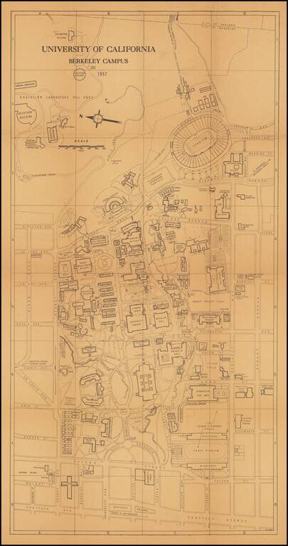
This is a great 1950s map of Berkeley, showing the campus in detail as it stood at the time. Many dozens of buildings on campus are named, as well as some features from the surrounding neighborhood. The verso includes an extensive index of places on...
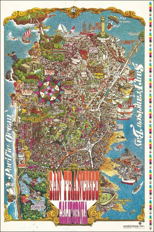
Decorative vintage pictorial map of San Francisco, published by Funny Funny World. The map shows the city in an absolute hustle and bustle; a game is being plaid at Candlestick Park, ships are lined up all along the waterfront, certain important...
![샌프란시스코 항구. 극동이 시작되는 곳 [Port of San Francisco. Where the Far East Begins]](/map/small/69449.jpg)
Rare Korean Language Edition! Striking example of this interesting Korean language promotional map of San Francisco, published in 1984. Published by the Port of San Francisco to promote Trans-Pacific Trade, the map provides a fascinating distortion...
Rare separately issued vintage pictorial map of Stanford University and the surrounding areas of Palo Alto, California. Most of the major buildings of the Stanford campus are labeled. Businesses that paid the publisher have their signs and contact...
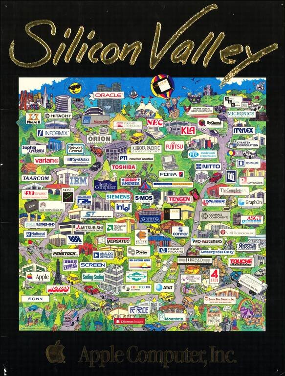
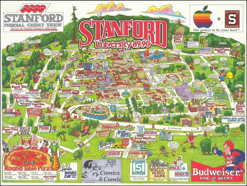
Apple's Perspective on the Silicon Valley of 1990 This wonderful pictorial map depicts the corridor running south from San Francisco to San Jose, though with no attempt at a consistent scale. The emphasis is almost entirely on the ecosystem of the...
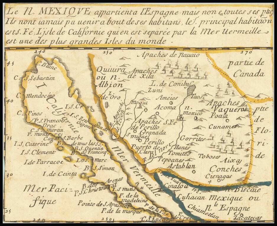
"The first map devoted so much to California"-- Burden A little, very rare, gem of a map of California as an Island, stretching eastwards into lands little known. Many places throughout this region are named, and colonial claims are shown. A long...
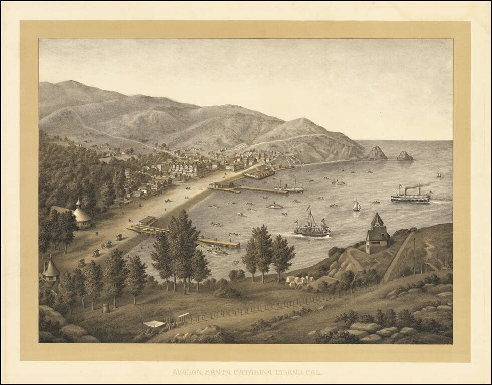
Rare birdseye view of Avalon, on Catalina Island, which was most likely lithographed in the 1880s by Kurz & Allison, prior to the acquisition of the island by the Banning Brothers in 1892. Juan Cabrillo originally discovered and claimed Catalina...
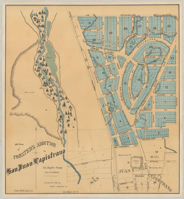
Earliest Printed Map To Detail The Mission San Juan Capistrano and Environs Rare plan of the Forster Addition, within the City of San Juan Capistrano, showing the Mission San Juan Capistrano and surrounding neighborhoods. The lands covered are those...
![[Los Angeles] Southern California. Scenes About Los Angeles.](/map/small/69098.jpg)
Rare double page color printed image of important places in the Los Angeles area, which appeared in The WASP magazine. The views include: The Belmont and Grounds, Summer & Winter Resort. Clark & Patrick Proprietors Philadelphia Brewery,...
![[Los Angeles and San Diego] Southern California. Scenes In and About Los Angeles.](/map/small/69136.jpg)
Rare double-page color-printed image of important places in the San Diego and Los Angeles area, which appeared in The WASP magazine. The views include: The Burbank Villa Hotel 10 Miles from Los Angeles New-United States Hotel Los Angeles Cal....