Map size in jpg-format: 37.9534MiB
Click to open in high resolution (open in new tab).
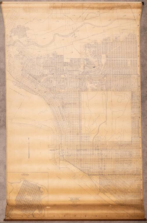
Large wall map of San Diego, showing Downtown, Balboa Park, and the neighborhoods of North Park, Banker's Hill, Little Italy, Mission Hills, and with an inset of Coronado.
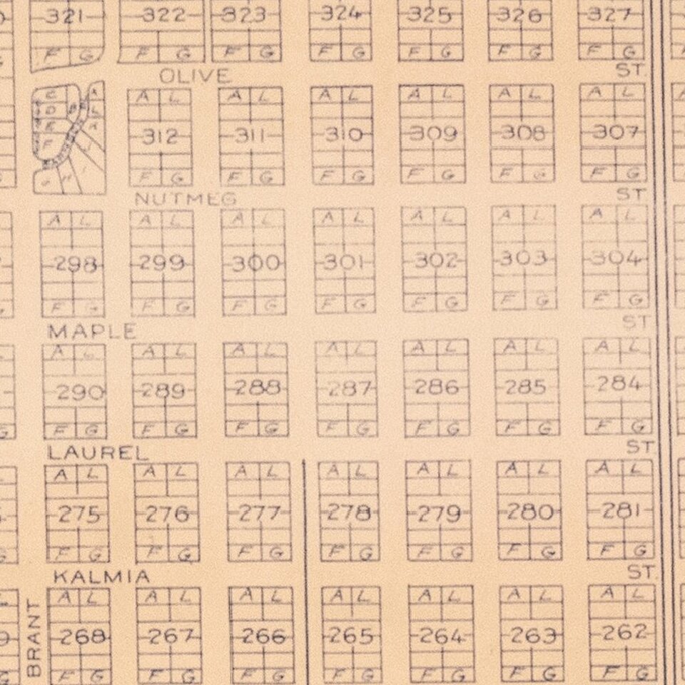
This is a very large and detailed wall map of central San Diego, shown at 1:400 ft.
The map includes extensive plot-level detail, as well as information about the additions and subdivision within the city.
The map was probably originally published in the 1920s, with this example an updated state from November 1943.
If you are a student, write to us in telegram: @antiquemaps and indicate what material you need and for what work you need a map in high detail. We are ready to provide material on special terms. For students only!
![(California-Mexico Border Survey) Datos de los trabajos astronómicos y topográficos. [bound with:] Variedades de la civilizacion, nueva epoca (Tomo I)](/map/small/70777.jpg)