

Detailed map of the Ohio Valley and regions to the East Nice example of Robert de Vaugondy's map of the Northern British Colonies, French interests to the North of the Great Lakes, and contested "Back Settlements," including a fine detailed treatment...
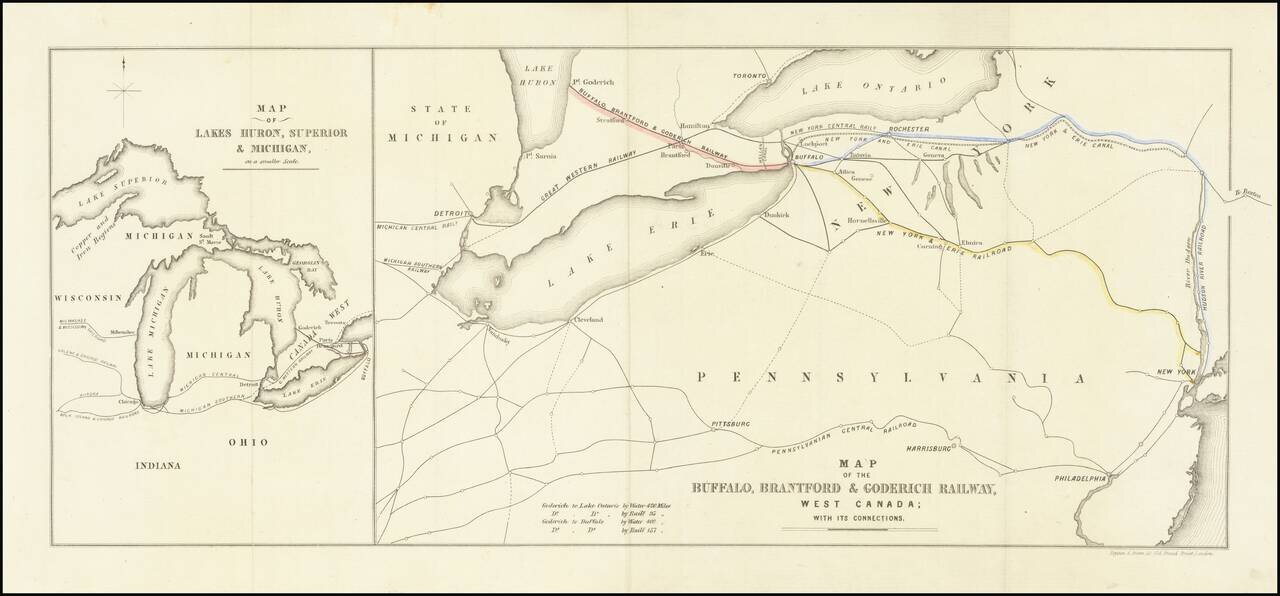
Interesting map of the Buffalo, Brantford and Goderich Railway, likely published either in its earliest incarnations in 1852 or at the time of its reorganization in 1856. The Buffalo, Brantford & Goderich Railway operated between 1852 and 1856,...

Detailed road map of the Great Lakes Region, constructed by Canada's Department of the Interior. Includes Provincial Routes, Federal Routes and State Routes.
![The Cities of Pittsburgh and Allegheny with Parts of Adjacent Boroughs [with] The City of Cincinnati Ohio.](/map/small/39410.jpg)
Two nice town maps on a single sheet, each with excellent detail and colored by ward. Early Pittsburgh maps are scarce. Decorative border. A terrific map, from JH Colton, one of the most prolific American mapmakers of the mid-19th century.
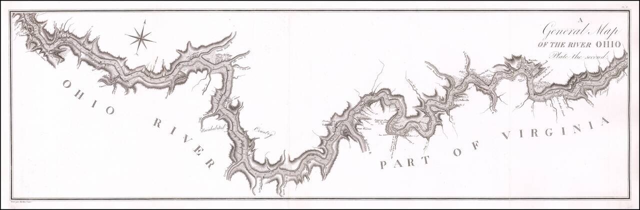
Antique Map of a Section of the Ohio River Prepared By A French Spy Important early map of the Ohio River from Maysville, Kentucky to just south of Wheeling, West Virginia, prepared by the French military officer and spy George Henri Victor Collot,...
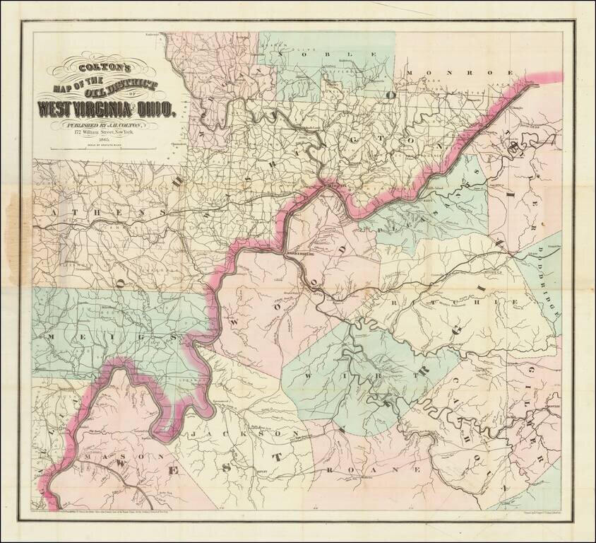
Scarce First State of Colton's Map of Some of the Earliest Oil Fields in the United States. Hand-colored lithographed map of the West Virginia oil region off the Little Kanawha River. Colton published the map in New York in 1865. The map shows a...
![[Early Ohio River Promotional Map] Plan Des Achats Des Compagnies de L'Ohio et du Scioto](/map/small/58635.jpg)
Rare Early Real Estate Speculation in the Ohio Valley (Manuscript Additions!) Rare first state of this important map for the early development of the Ohio Valley, promoting the lands of the Scioto Company. The present example is a rare early state,...
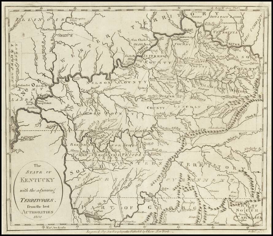
Early Map of Kentucky, Tennessee and Southern Ohio Important early map of Kentucky, Tennessee (then still Southwestern Territory) and the Ohio Valley, with marvelous early information. Kentucky includes about a dozen early counties, plus towns,...
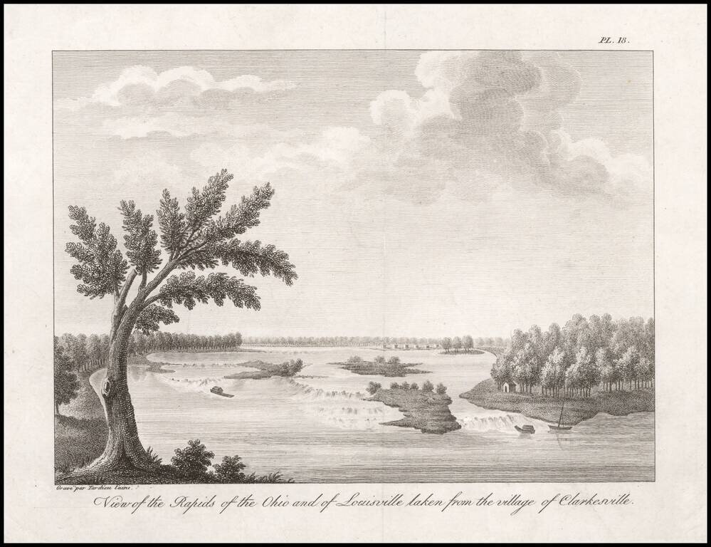
One of the Earliest Views of Louisville, Made Shortly After It Was Founded by Col. George Rogers Clark. An 18th century French Spy's View of the Rapids of the Ohio. Fine engraved view of the Rapids of the Ohio River, taken from "Clarkesville" (now...
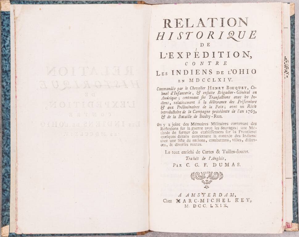
First Edition in French of Smith's An historical account of the expedition against the Ohio Indians, which was originally published in Philadelphia by William Bradford in 1765. The introduction described Bouquet's successful expedition of 1763, to...
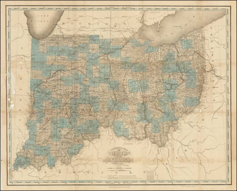
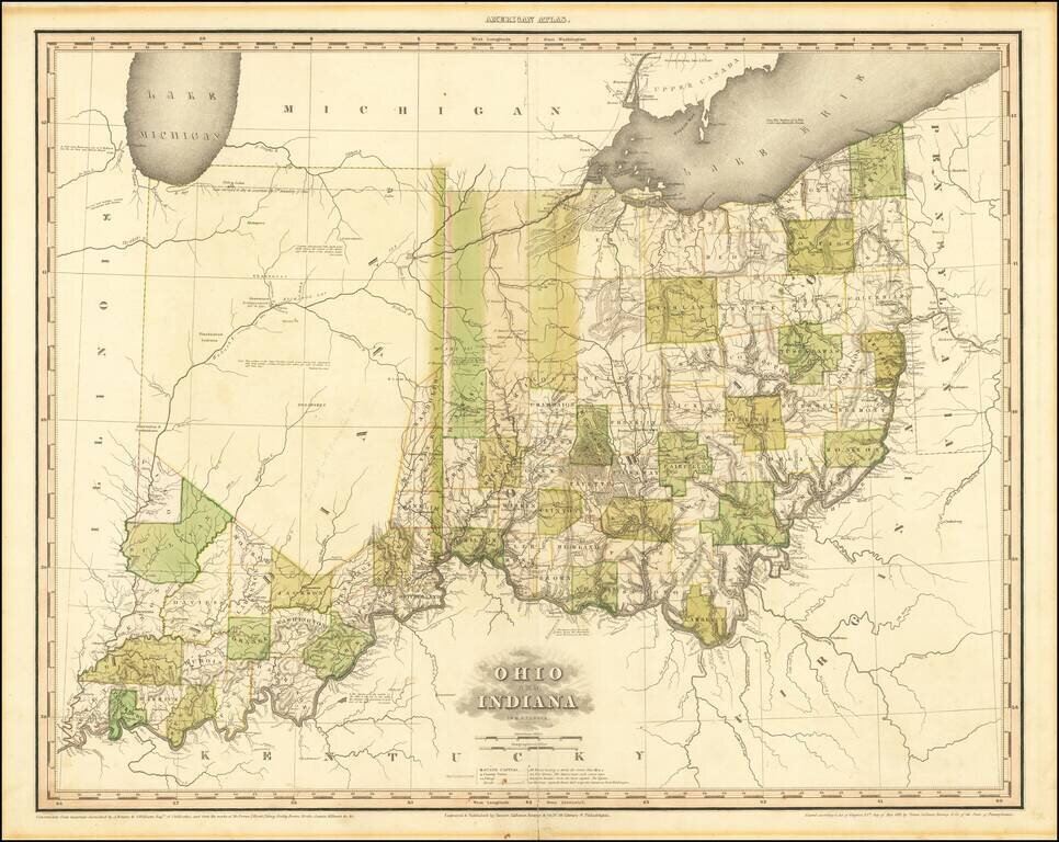
Unrecorded Final State. Extremely rare 10th state (and presumed final) state of one of the best 19th-century maps of Ohio and Indiana. The map was initially issued in 1819, though here that information has been obliterated from the imprint line in...
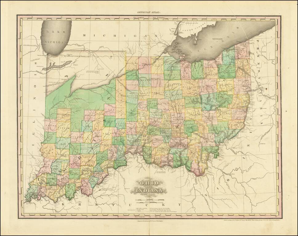
A nice example of this important early map of Indiana and Ohio, published by Henry Schenk Tanner. The present example is the 3rd state of the map, most notable for the addition of Randolph County and a massive Kankakee Pond, plus a new Indian Village...
A nice example of this important early map of Indiana and Ohio, published by Henry Schenk Tanner. The present example is the 1st state of the map, most notable for the addition of Randolph County and a massive Kankakee Pond, plus a new Indian Village...
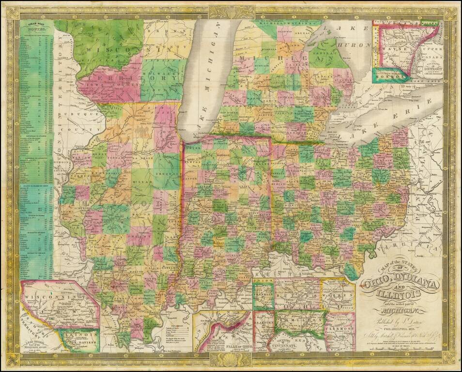
Excellent antique hand-colored engraved map of the eastern Midwest, covering Michigan, Ohio, Indiana, Illinois, and the southern half of Wisconsin. This is a rare later state of Finley's map of eastern Midwest, first issued in 1825, here in the 1835...
![[Eastern Sheet -- Ohio] Post Road Map of the States of Ohio and Indiana with Adjacent Parts of Pennsylvania Michigan Illinois Kentucky and West Virginia Showing Post Offices With The Intermediate Distances and Mail Routes In Operation On the !st of Febru](/map/small/44153.jpg)
Eastern Sheet (Ohio and parts of Kentucky, etc.) of W.L. Nicholson's Postal Map, published in 1885. Beginning with David Burr in the 1830s, the tradition of the American regional postal map became a centralized service provided from Washington, D.C....
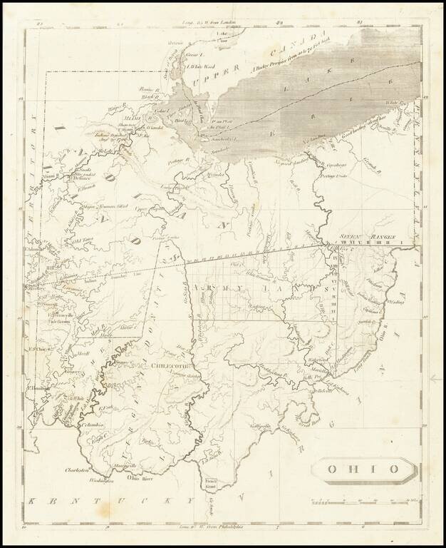
One of the First Printed Maps of Ohio -- Published Just Months After Ohio Statehood Important early map of Ohio from Arrowsmith & Lewis' New and Elegant General Atlas. The map appeared only months after Ohio became a state on March 1, 1803. The...