Map size in jpg-format: 41.0447MiB
Click to open in high resolution (open in new tab).
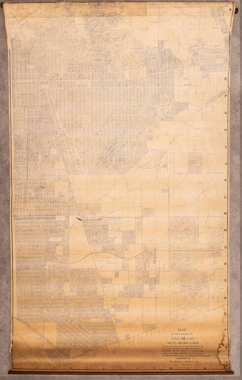
Very large wall map of a portion of San Diego, centered on City Heights and extending through the Mountain View and Southcrest neighborhoods to San Diego Bay in the lower-left corner of the map.
At the top edge of the map is Kensington and Kensington Heights.
The map provides an interesting look at these neighborhoods before they were carved up by the passage of the 5, 94, 15, and 805.
If you are a student, write to us in telegram: @antiquemaps and indicate what material you need and for what work you need a map in high detail. We are ready to provide material on special terms. For students only!
![(California-Mexico Border Survey) Datos de los trabajos astronómicos y topográficos. [bound with:] Variedades de la civilizacion, nueva epoca (Tomo I)](/map/small/70777.jpg)