
Rare old maps of the United States.
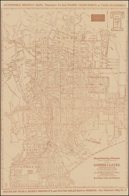
Scarce separately issued map of Pasadena, South Pasadena, Altadena and San Marino, published by Los Angeles map published Albert G. Thurston. The present example includes advertising from Godber & Gates, offering "A Complete List of All of...
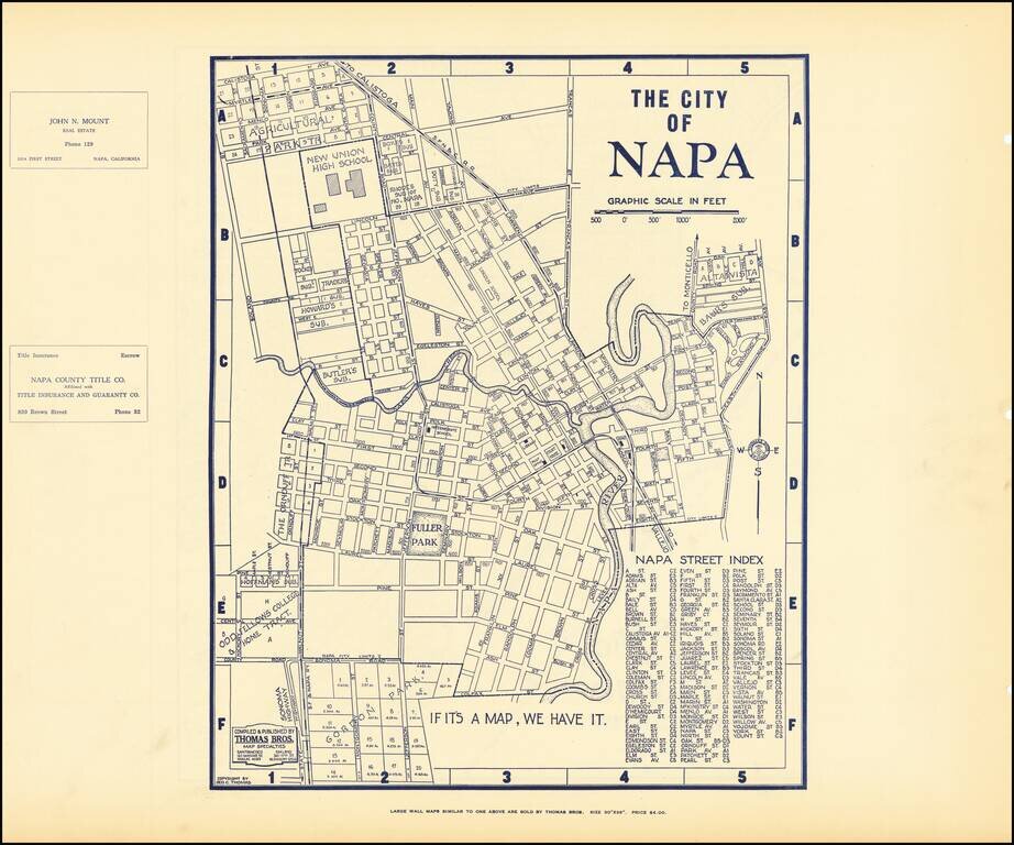
Early map of Napa, with a map of Vallejo on the verso. Nice plan of the area, including streets, major buildings, railroad lines, etc.
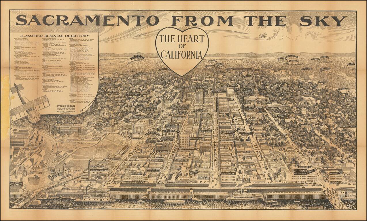
Rare Sacramento Birds-Eye View Rare aerial view of Sacramento, published in Sacramento, with a detailed map of the city on the verso. The view shows Sacramento from the west, looking toward the Sierra Nevada Mountains, with downtown Sacramento and...
![[Corona Del Mar]](/map/small/66927.jpg)
Rare promotional map of Corona Del Mar, promoting Hal Will Smith, Realtor / Fire Insurance. The map shows the City Boundary as of February 1924, with land ownership information dated as late as 1937, with one large oceanfront tract owned by Citizens...
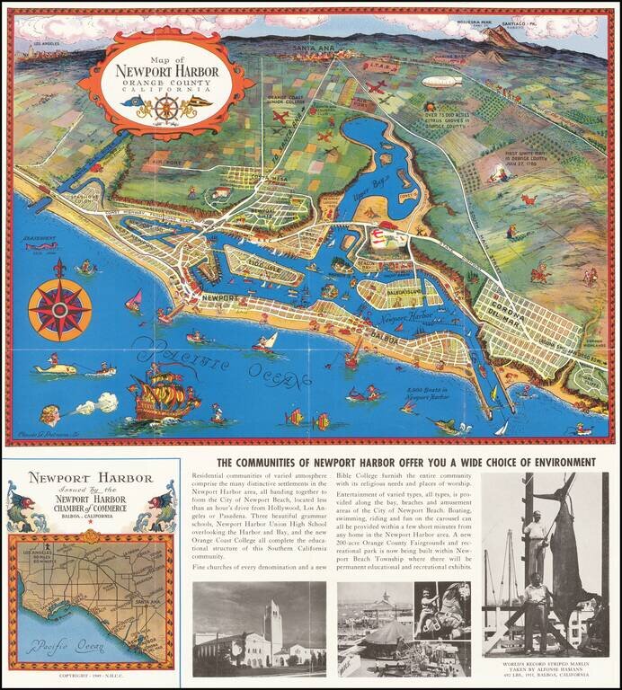
Decorative vintage pictorial promotional map of Newport Harbor and Newport Beach, California, issued by the Newport Harbor Chamber of Commerce. This is the second of Claude Putnam's maps of Newport Harbor, with a prior edition issued in 1939.
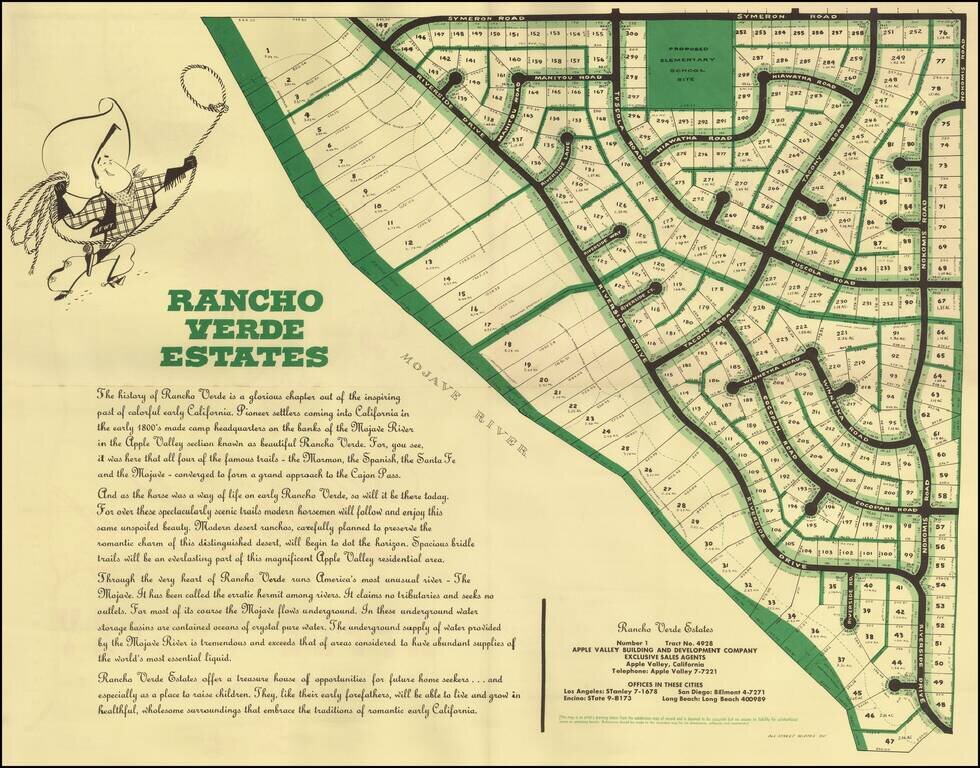
Detailed plan of Rancho Palos Verdes Estates, a planned community in Apple Valley, California. The area is now called Desert Knolls, on the north end of Mojave Narrows Regional Park. Apple Valley is in the High Desert region of San Bernardino County....
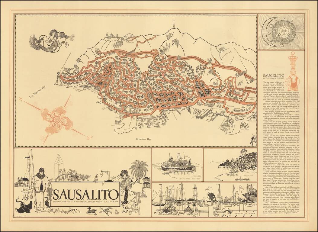
Decorative map of Sausalito, with interesting illustrations and a history of the town at the right side of the map.
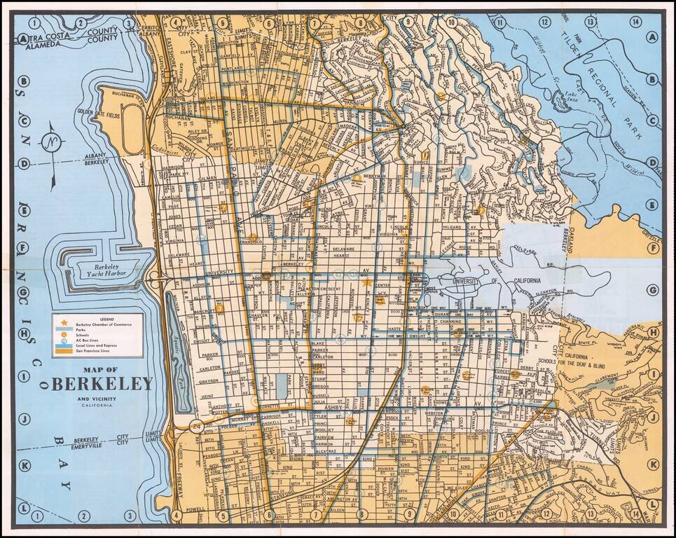
Detailed map of Berkeley, with emphasis on public transit and public works. The map locates the Chamber of Commerce, Parks, Schools, AC Bus Lines, Local and Express Bus Lines and San Francisco Bus Lines.
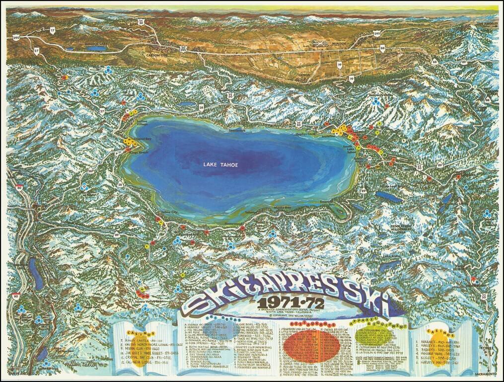
Attractive vintage pictorial bird's-eye view map, depicting Lake Tahoe as viewed from west to east. Truckee is shown at the far left; Kings Beach, Crystal Bay, Incline Village, Zephyr Cove, Stateline, South Lake Tahoe, Tahoe keys, Emerald Bay, Meeks...
![[Placerville, California]](/map/small/63008.jpg)
Lively pictorial advertising map for Placerville, California, issued in the mid-1970s. We dated the map based upon the Master Charge logo (1969-1979). The map provides a whimsical look at Placerville, in the foothills of the Sierra Mountains, with...
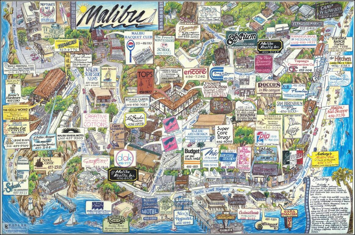
A great pictorial map of Malibu, the famed California beach community of the rich and famous. Taken from the south, the map shows the community in bright colors, with the ocean visible in the foreground. The map was produced through a model that asked...
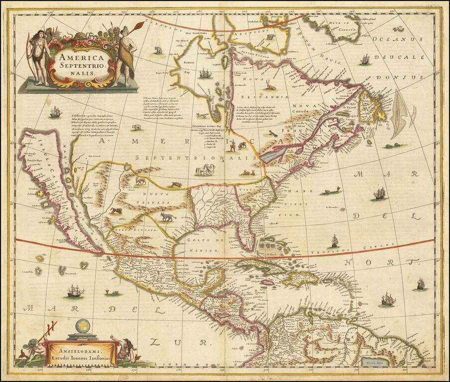
Hondius and Jansson’s Map of North America, A Map Central to the Myth of California as an Island Striking example of the first state of Henricus Hondius’ and Jan Jansson’s map of North America, called by Burden the single most influential map in...
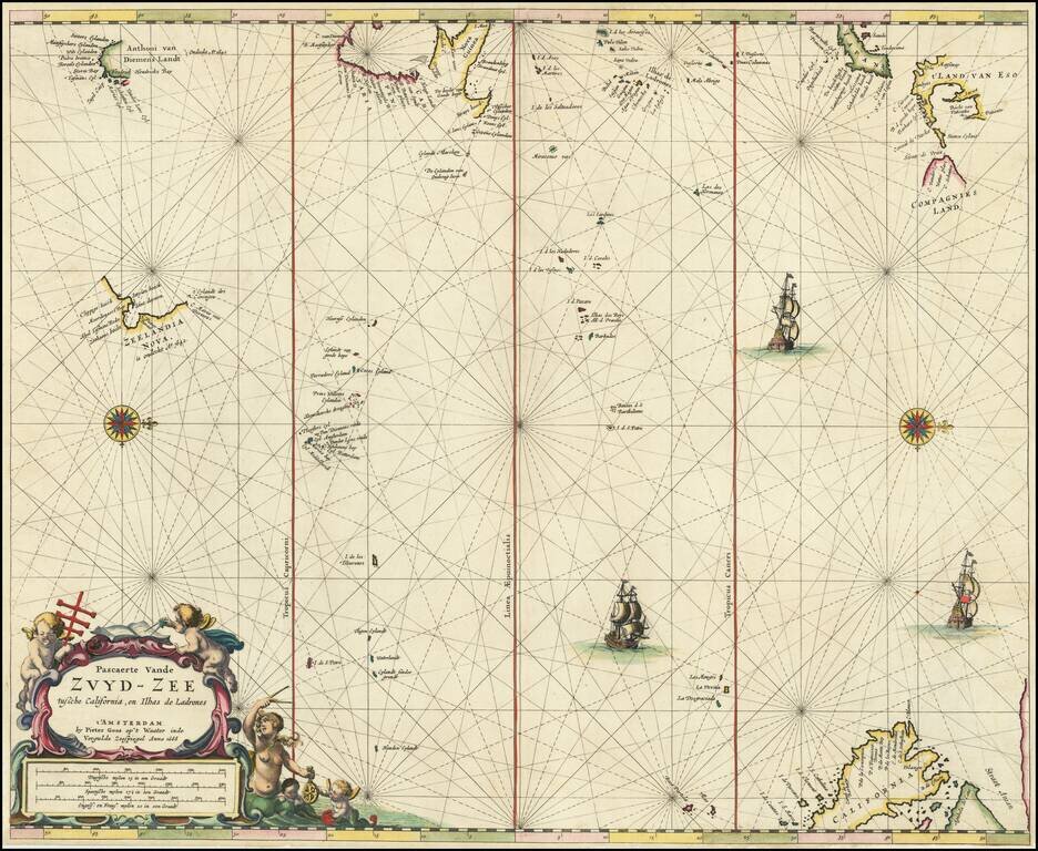
Rare Dutch Sea Chart of the Pacific Fine old color example of Pieter Goos' sea chart of the Pacific Ocean, extending from Australia, New Zealand and Japan to California. Oriented with west at the top, Goos's chart is among the earliest regional maps...

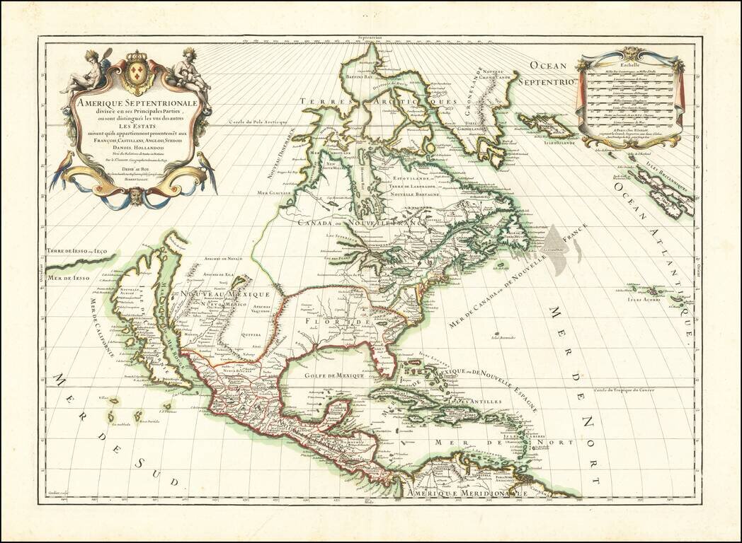
First edition of the Sanson-Marriette map of North America, first issued in 1669. Produced by Guillaume Sanson and Pierre Mariette, after the death of Guillaume's father Nicolas in 1667, this map is a reduced-size copy of Nicolas Sanson's 4-sheet wall...
![A Chart of the South Sea [1st English Map of the Pacific Ocean]](/map/small/47376.jpg)
Unrecorded state of John Seller's map of the Pacific Ocean, the first English map of the Pacific. John Seller's map of the Pacific Ocean is the first English map of the Pacific. First issued in 1675, it is a map of exceptional rarity and importance...
Striking map of North America, published in 1689 by Jaillot. A scarce map of California as an Island, which derives from Sanson's earlier maps of North America. The Great Lakes are shown as open ended. Florida and the Southeast have not yet been...