
Rare old maps of the United States.
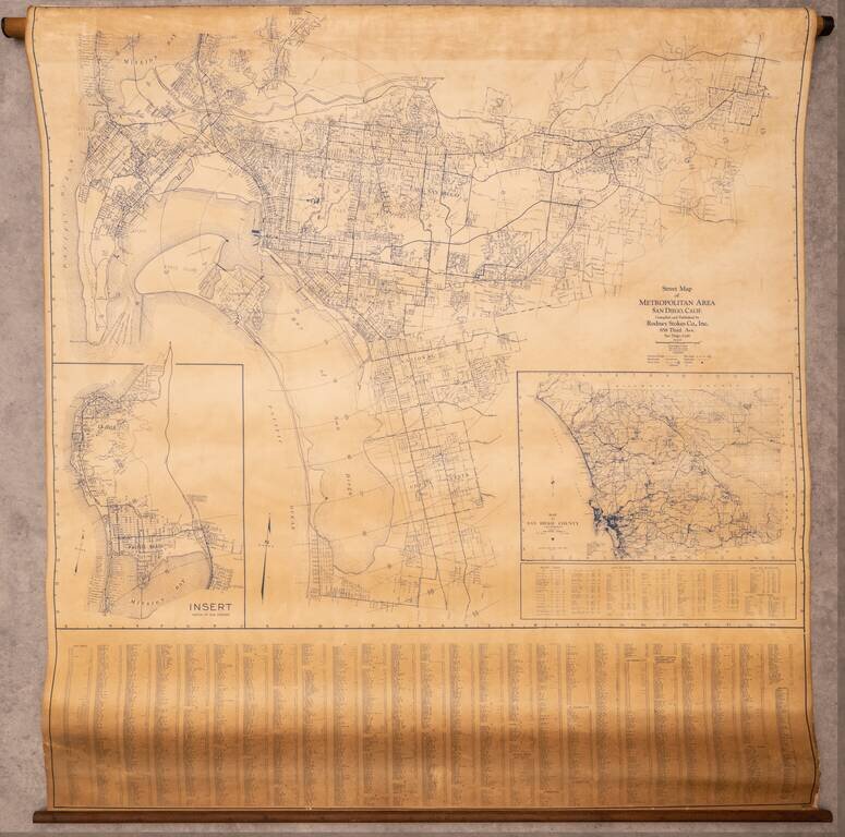
Large wall map of the San Diego Metropolitan Area, from Coronado to El Cajon, with an inset of Pacific Beach and La Jolla, and a further inset of the County of San Diego. This is a very large and detailed wall map of central San Diego, shown at 1:4000...
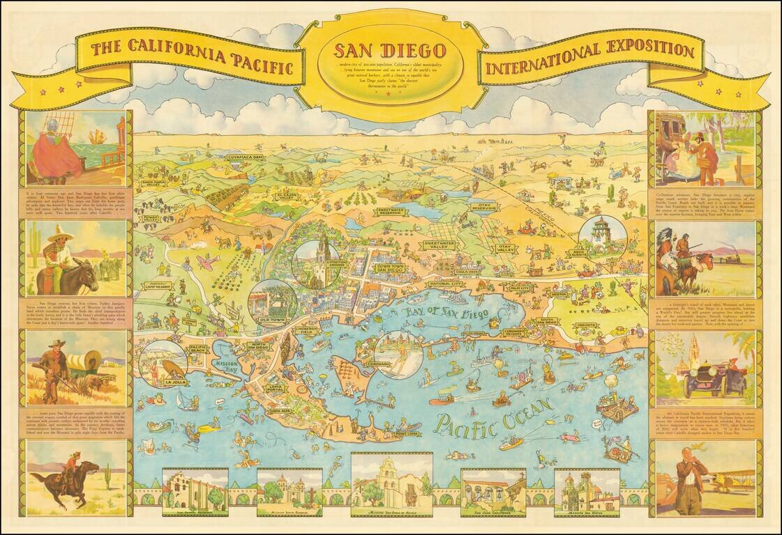
This is one of the great California caricature maps, showing San Diego on one side and Balboa Park on the verso. This edition was prepared by Shell Oil Company for the 1935 California Pacific International Exposition. The map was drawn by Don...
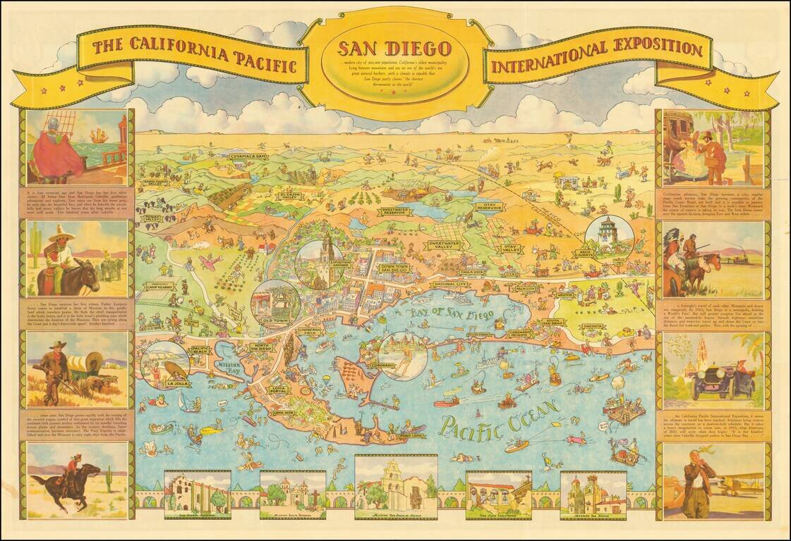
Decorative illustrated map of San Diego on one side and Balboa Park on the verso, prepared by Shell Oil Company for the 1935 California Pacific International Exposition. One of the great California caricature maps. The map was drawn by Don Bloodgood,...
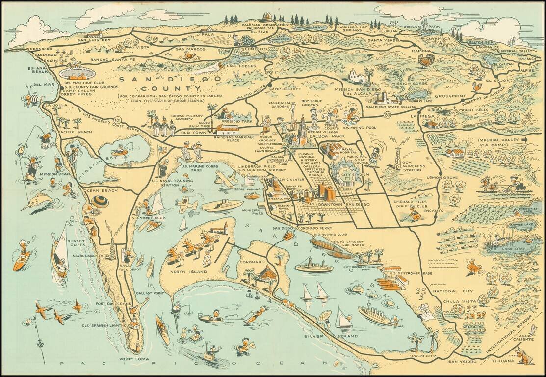
Whimsical map of San Diego County, showing a host of activities throughout, with a larger city street map. Among the more timely inclusions in the map are the Baseball field next to the County Administrative offices and Balboa Stadium, next to San...
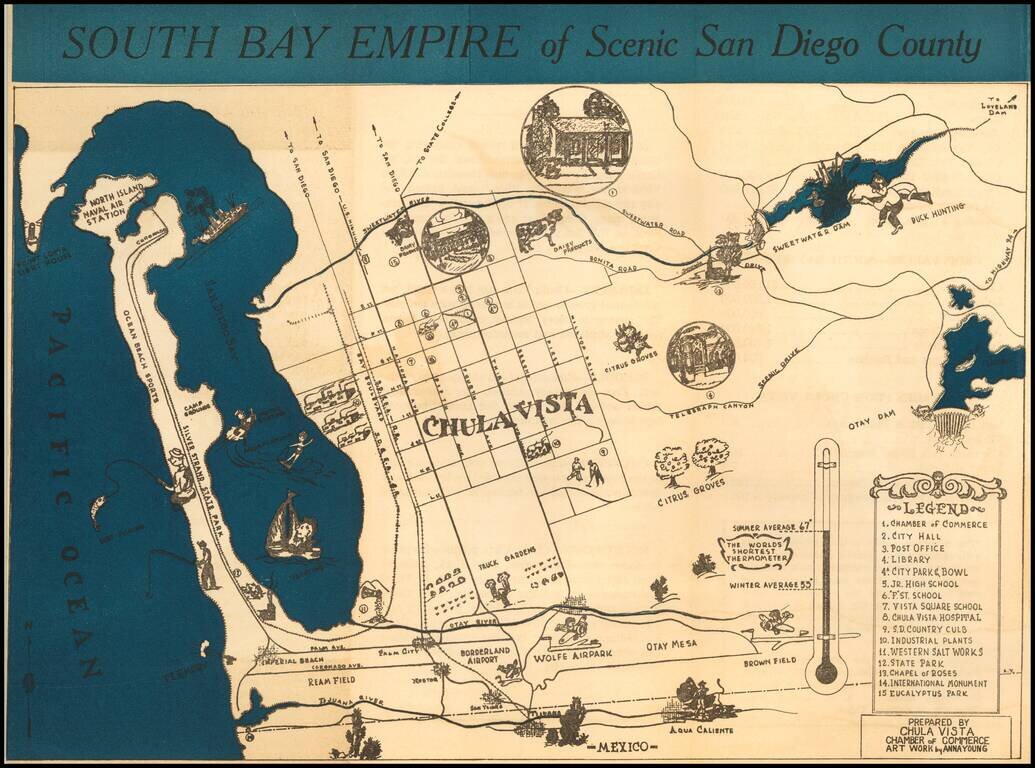
Rare promotional brochure map of San Diego's South Bay, drawn by Anna Young for the Chula Vista Chamber of Commerce. The map extends north to Point Loma and and the Sweetwater Dam area, centered on Chula Vista. Rarity The map is apparently very...
![[Restricted Military Map of San Diego] The City of San Diego Including The Cities of Chula Vista Coronado El Cajon La Mesa National City . . .](/map/small/69860.jpg)
Restricted Military Map of San Diego Restricted Armed Forces edition of this World War II era map of San Diego, published by the Automobile Club of Southern California. As noted below the map, the map was "issued for the exclusive use of the Armed...
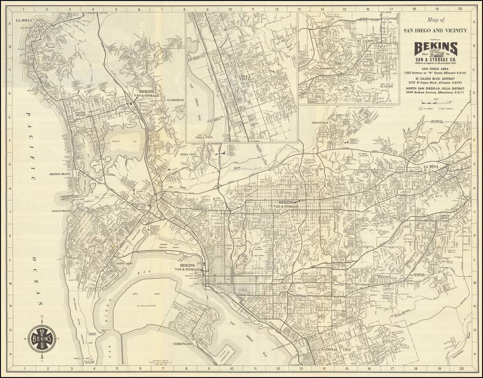
Detailed vintage map of San Diego, by the famous Bekins Van & Storage Co., published in 1958. The map shows Mission Bay before it was fully dredged and developed into the recreational area it is today. La Jolla has considerably more development...
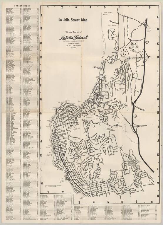
Early map of La Jolla, published by La Jolla Federal Savings. Early points of interest include: UC San Diego Revelle College Mt. Soledad Easter Cross Salk Institute Scripps Institute of Oceanography Spindrift Pitch & Putt (LJ Beach &...
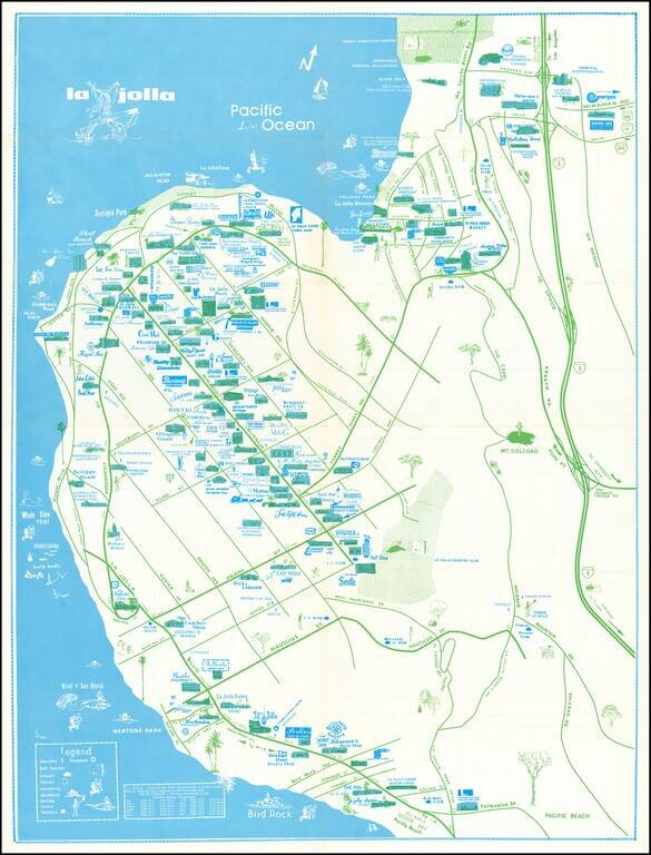
Rare separately issued map of La Jolla, California, published by the La Priscilla Publications of San Diego (Pacific Beach). The map locates dozens of businesses, with a legend noting Churches Golf Courses (including Torrey Pines) Schools...
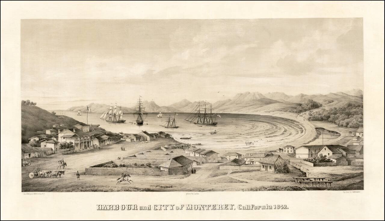
Monterey -- Mexican Capital of Alta California Nice example of one of the earliest bird's-eye views of California, published by Charles Gildemeister, and printed by D'Avignon in New York, for Thomas O. Larkin. The view depicts Monterey at the height...
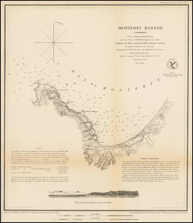
Nice example of this important early survey of Monterey Bay, published by the United States Coast Survey. Incudes a profile view of Pt. Pinos. Shows a Monterey town plan, Point Pinos, Pt. Anlon, Pt Almejor Mussell, the Lagoon, Fort, Ruins of the old...
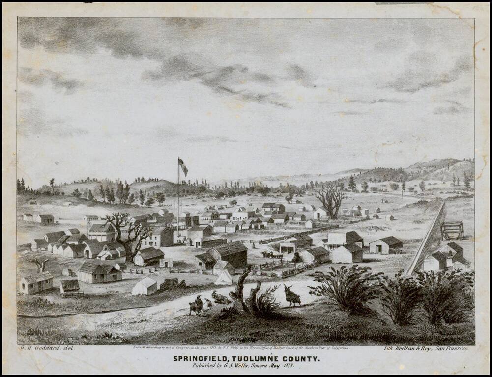
Early lettersheet birds eye view of the town of Springfield, Tuolumne County, California published in Sonora, California and engraved in stone by George H. Goddard, who would go on to become one of California's most important early surveyors. The view...
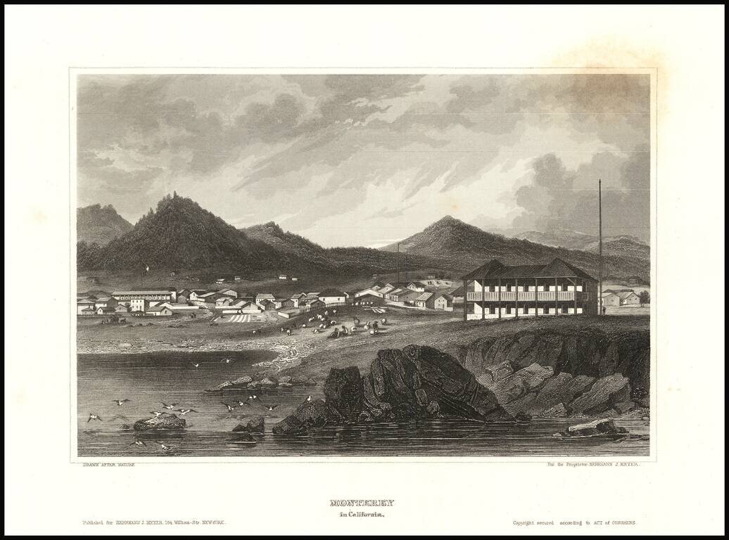
Detailed view of the town of Monterey, from Meyer's Universum. One of the view obtainable views of a city in Spanish California
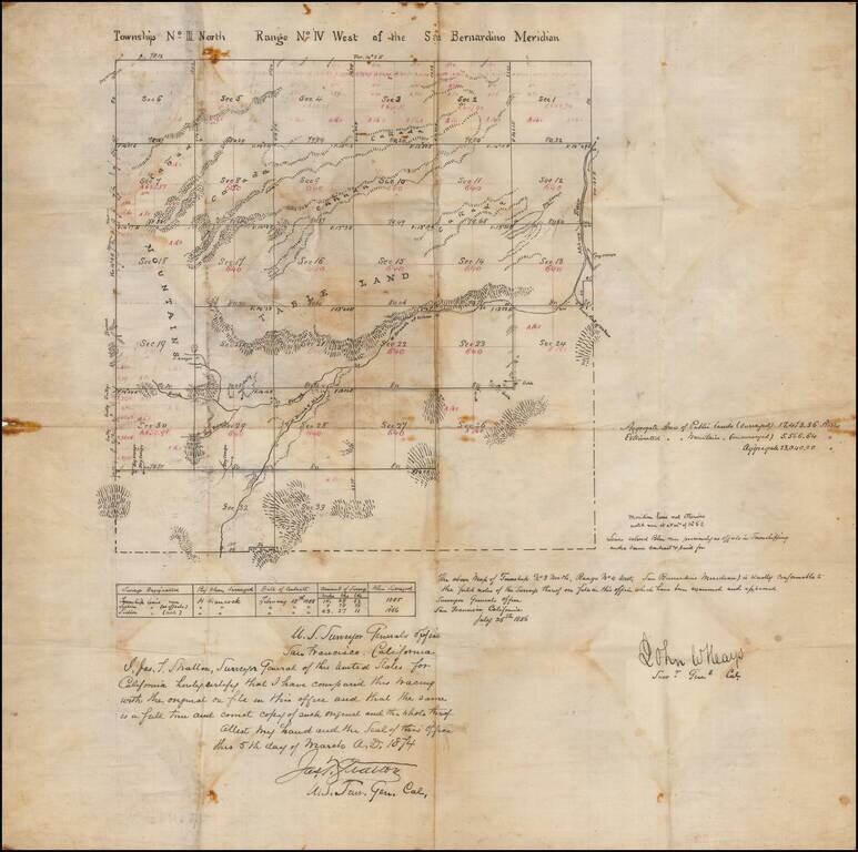
San Bernardino High Desert - Hesperia area manuscript map Manuscript copy of an original survey, signed by California Surveyor General John W. Hays. The present example was drawn by James T. Stratton, U.S. Surveyor General in California. The area...
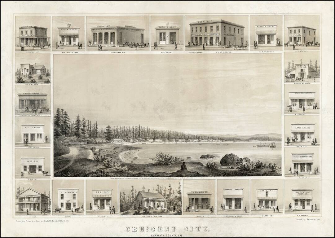
Decorative example of Kuchel & Dresel's view of Crescent City, published in San Francisco in 1857. Charles C. Kuchel & Emil Dresel were among the earliest western view makers. The pair published approximately 50 views between 1855 and 1859, of...
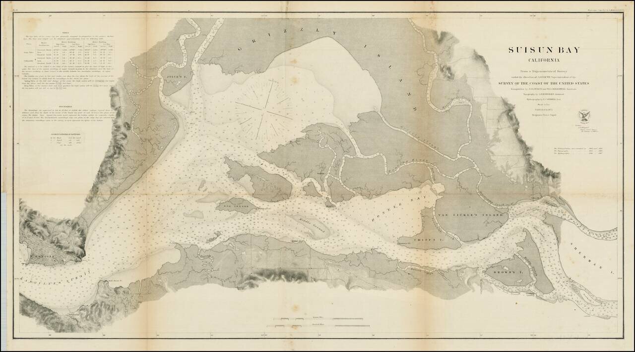
Detailed view of Suisun Bay, from Benicia to Sherman's Island and Brown's Island. Includes soundings, tides and other details. One of the earliest detailed surveys of the region.