
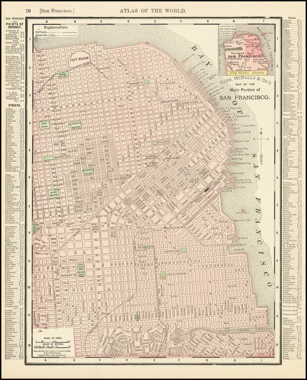
Rare old maps of the United States.
![[Untitled Map of Pittburg, California & Vicinity] Pittsburg Chamber of Commerce Trade Card](/map/small/19402.jpg)
An interesting trade card map, with promotional info for the Pittsburg Chamber of Commerce on the verso. See verso here: /gallery/enlarge/19402a
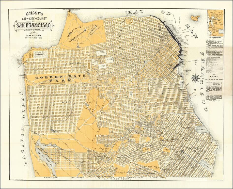
Nice example of this early edition of Faust's map of San Francisco, one of the most striking maps of the period, surrounded by promotional information for local merchants, etc. Faust's map provides a highly detailed look at San Francisco at the end of...
Detailed map of San Francisco, showing towns, wharfs, rail lines, street car lines, roads, buildings, etc. Includes a key with points of Interest, Streets, etc.
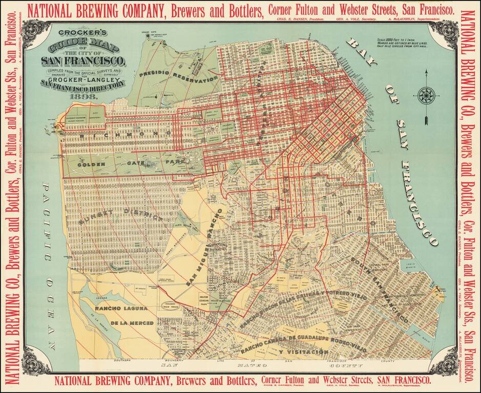
A Gorgeous Late 19th Century Map of San Francisco with Brewery Advertising Striking map of San Francisco, published by Crocker in 1898. The map provides a highly detailed look at the city, with marvelous contrasting color. The map is surrounded by...
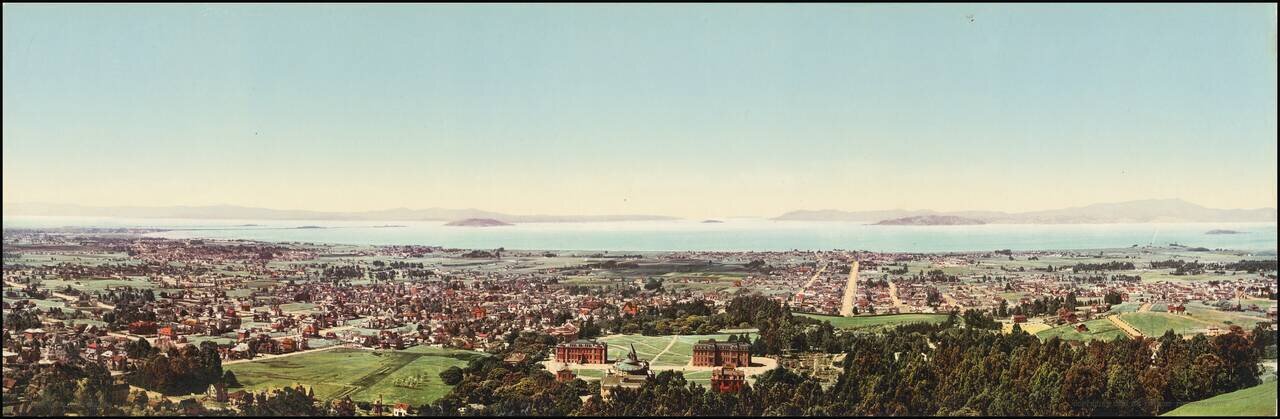
An Early Color Photographic View of UC Berkeley and the Bay Area. Attractive photochrome view of Berkeley, California, taken by one of the West's greatest photographers, William Henry Jackson. In the immediate foreground, the first buildings of the...
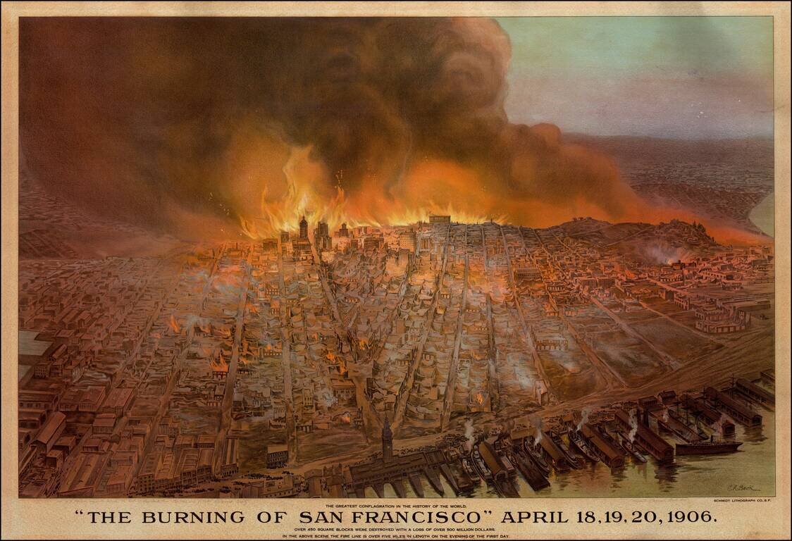
Striking Cityscape of San Francisco on Fire Detailed and dramatic view of San Francisco on fire after an earthquake in 1906. On the wharf, the lithographic print shows steam ships ready to depart the docks. A crowd is gathered nearby, presumably to...
![Map of City and County of San Francisco. H.A. Candrian, Copyright 1906 -- [Promotional Map for California Art Glass Works] [Map of Oakland, Alameda & Berkeley on verso]](/map/small/69224.jpg)
Striking map of San Francisco, published in 1906. The map includes advertising for California Art Glass Works and Hanson Co. Printing. Includes a fine large map of Oakland, Berkeley and Alameda on the verso.
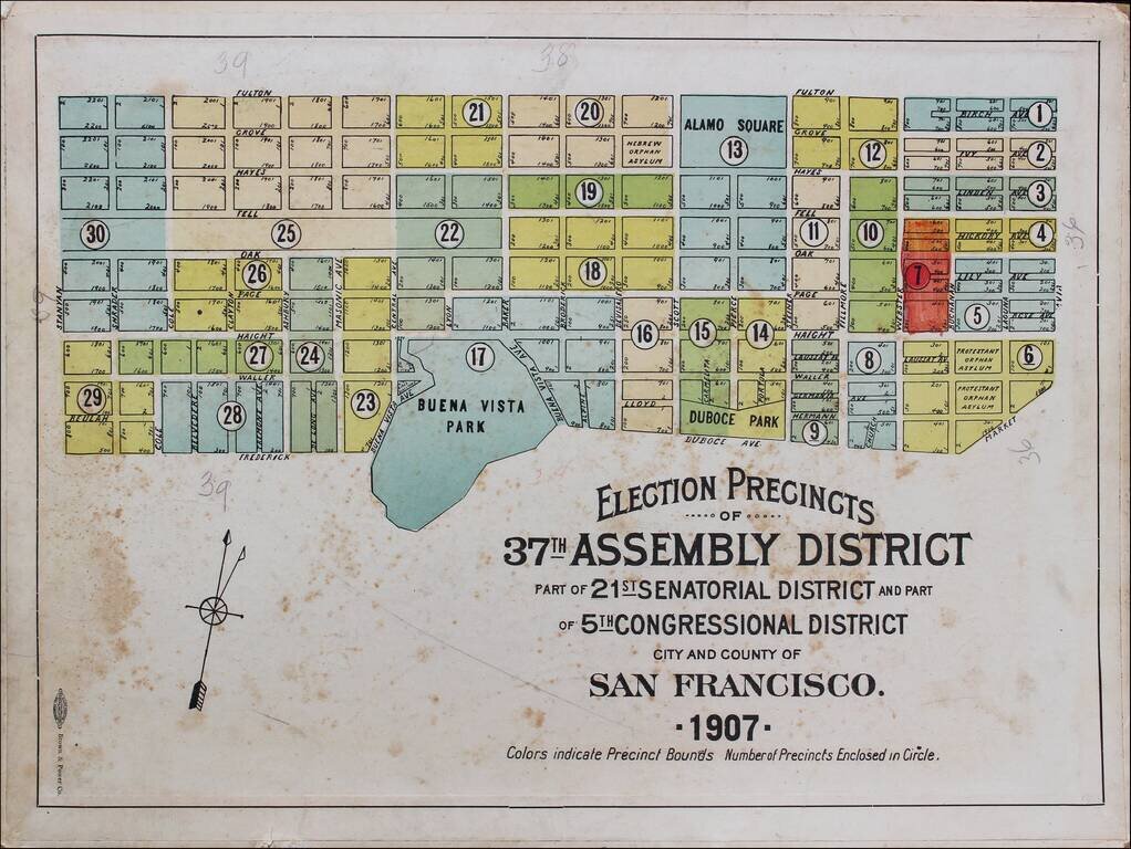
Rare Election Precinct Map for San Francisco, centered on Buena Vista Park. The map is bounded by Stanyan at the west, Fulton at the north, Octavia Street on the east and Frederick and Dubose Avenues in the south. Places shown include: Panhandle...
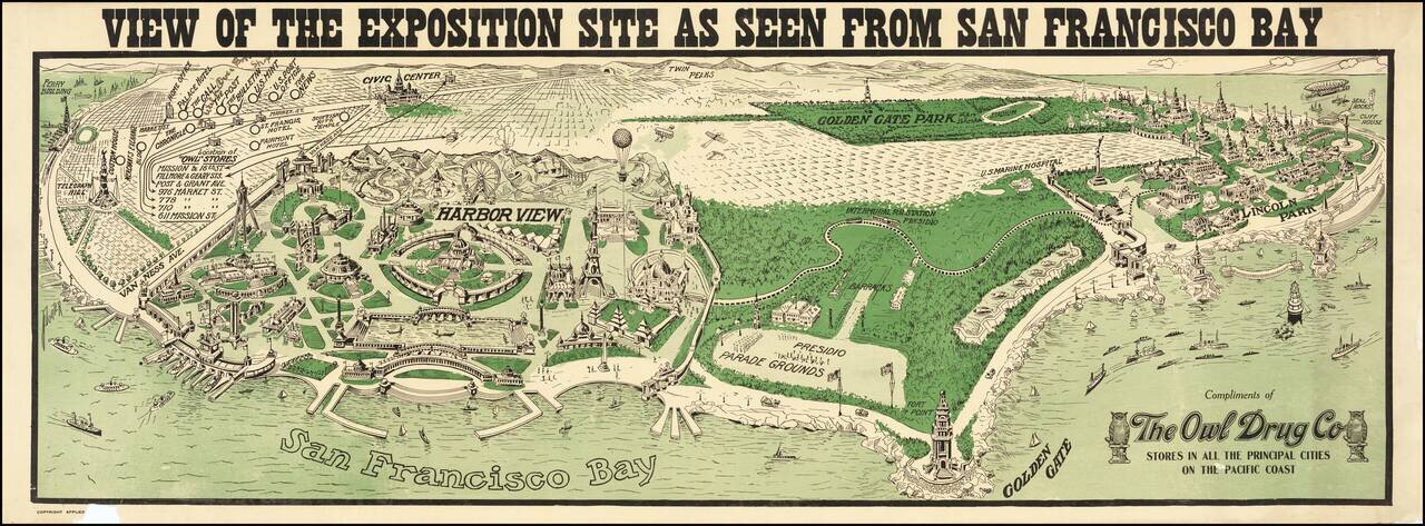
With Early Airplanes and Hot Air Balloon and Early Dirigible Rare panoramic view of the proposed site of the Panama Pacific International Exposition, published by The Owl Drug Company. The image provides an interesting Bird's-eye view of site of...
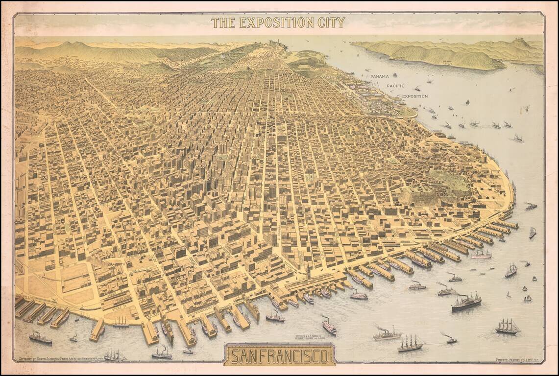
Important Early 20th Century View of San Francisco -- Antique Map Promoting the Site of the Future Panama Pacific Exposition Rare Birdseye View of San Francisco, "The Exposition City," copyrighted by North American Press Ass'n 1912 Hearst Bldg. S.F.,...
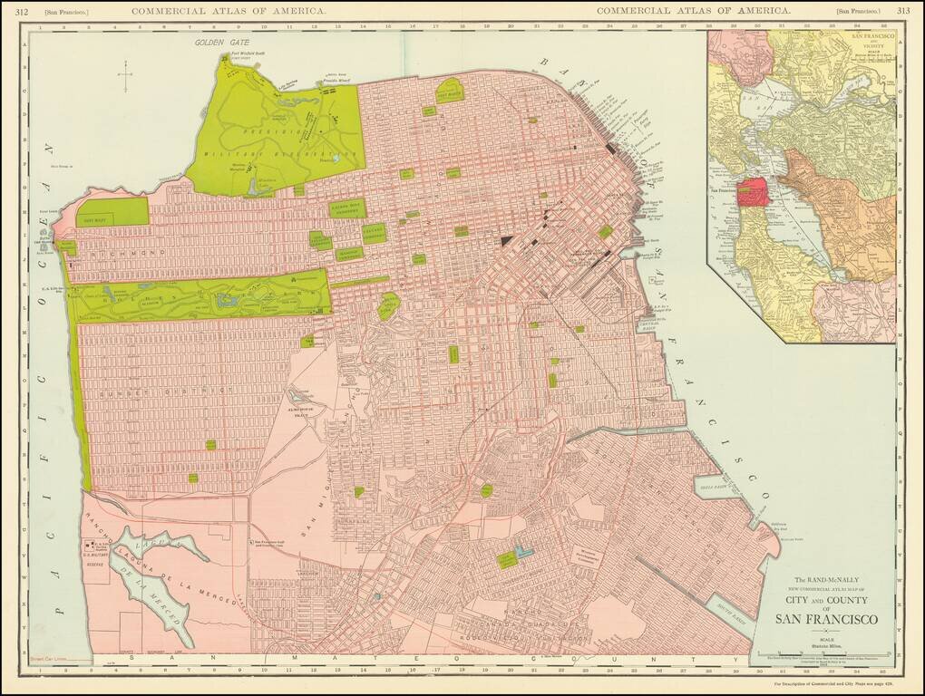
This is a great large-format, highly detailed map of San Francisco, showing towns, wharfs, rail lines, street car lines, roads, buildings, and more. The map includes a large inset of San Francisco Bay, attractively colored according to the county....
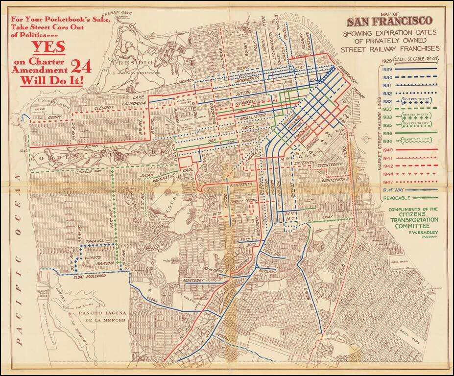
Rare political pamphlet map, promoting a campaign supporting the Yes on Charter Amendment 24, regarding the regulation and renewal of Private Street Railway in the city. The map shows the routes of privately-owned streetcar lines in San Francisco and...
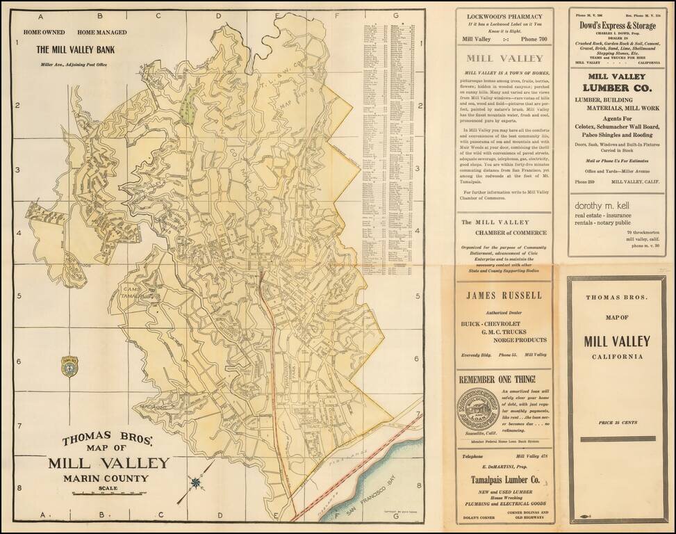
Scarce map of the Mill Valley, published by George C. Thomas. The map includes a detailed city plan, along with advertising.
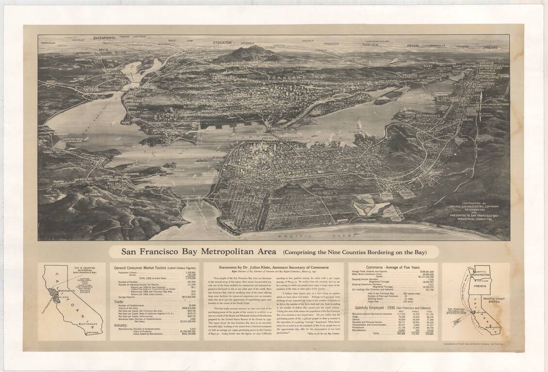
Fine birdseye view of the Bay Area, published by Pacific Gas & Electric Company. The view notes that it was presented to the San Francisco Bay Industrial Committee. In the section below the map is a Statement by Dr. Julius Klein, Assistant...
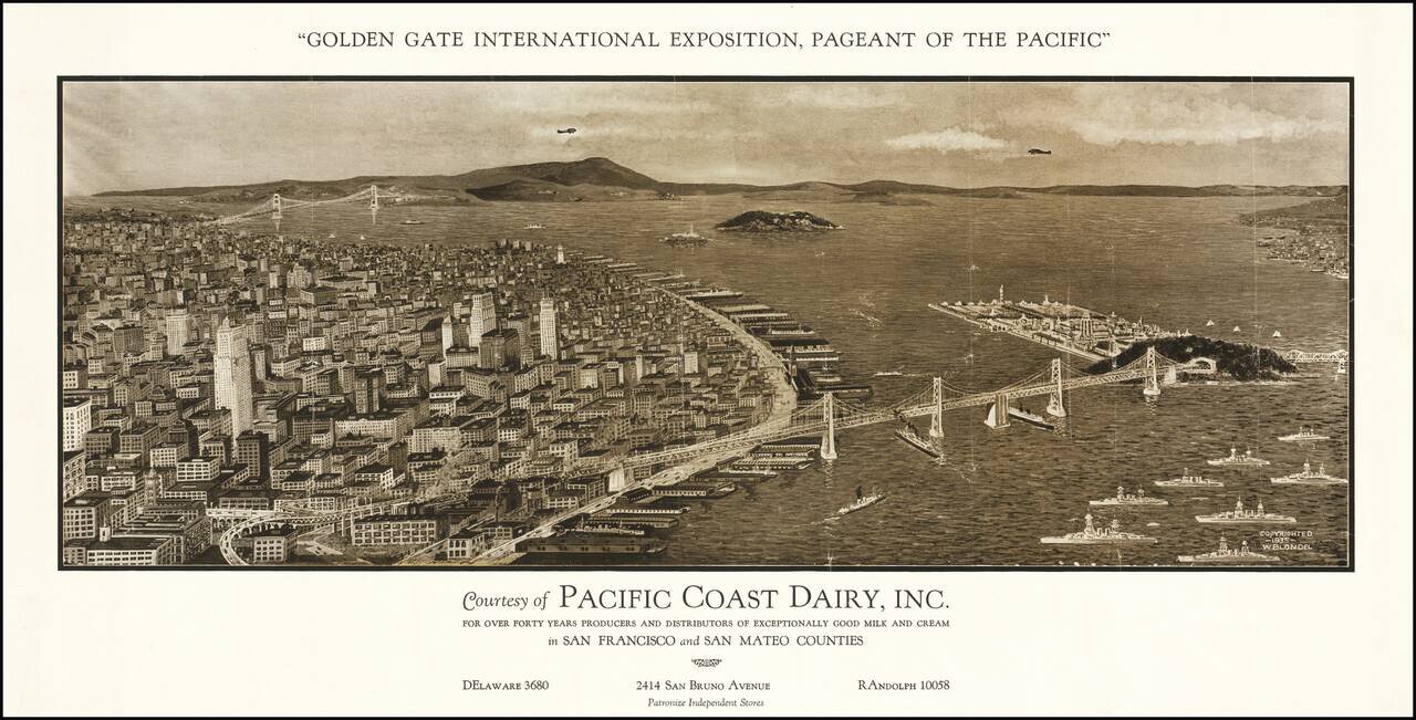
Rare early view of San Francisco, "Courtesy of Pacific Dairy, Inc." for the Golden Gate International Exposition. The map provides a remarkable view of San Francisco, with the Golden Gate Bridge in the distance, the San Francisco Bay Bridge in the...
![[Hand Drawn Map By The Father of Modern Space Art] A Plan For The East Bay Prepared by Chesley Bonestell for the Purpose of Creating Interest in the Solution of that Problem. 1945.](/map/small/68505.jpg)
Waterfront Improvement Plan of the East Bay Drawn By The Father of Modern Space Art Hand drawn map illustrating a shoreline improvement plan of the East Bay, centered Berkeley, drawn by renowned American space and science fiction illustrator Chesley...