Map size in jpg-format: 14.9813MiB
Click to open in high resolution (open in new tab).
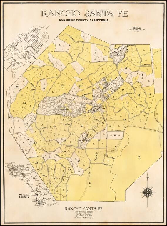
The First Plan of Rancho Santa Fe
Fine example of the original subdivision map for Rancho Santa Fe, California, published in January of 1929.
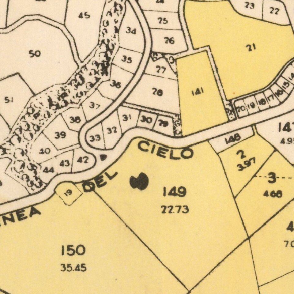
The map Includes lot and tract numbers, with acreage, street names,
At the center is the "Civic Center", which is reproduced in larger scale at the top left, showing Paso Delicias, El Tordo, La Flecha, La Morada, Avenida de Acaicias and La Granada. To the North of the Civic Center an area identified as Golf Course spreads out to the east and west along La Granada and Paseo Delicias, showing the location of the Rancho Santa Fe Golf Club, which would open in August of 1929.
The map extends north to the San Dieguito Reservoir and El Camino Del Norte, and south to the San Diegutio River, Via De La Valle and Las Planideras.
While unsigned, the address and phone number (VAndyke 0197), corresponds to the original promotional offices for Rancho Santa Fe advertised in the Los Angeles Times in the early 1930s.
Rancho Santa Fe
The history of Rancho Santa Fe dates to 1833, when Juan Osuna, Alcalde (Mayor) of San Diego obtained a grant for 8,825 acres of land then known a Rancho San Diegito. In 1906, the Atcheson, Topeka & Santa Fe Railroad acquired the majority of the land, with a plan to develop a tree farm to supply the railroad with railroad ties. The company planted the land with Eucalyptus trees, but the venture ultimately failed. As an alternative use, the Santa Fe Land Improvement Company was formed to develop a planned community of gentlemen's ranches in the style of the Spanish and Rancho eras.
In 1921, L.G. Sinnard was hired to managed the project. Sinnard and his staff spent the next five years plotting estate subdivisions and laying out and constructing some fifty miles of winding rural roadways. Also beginning in 1921, all purchasers of Ranch property were required to agree to design controls in the form of deed restrictions. In 1922, the company hired the architectural firm of Requa and Jackson to design the downtown Civic Center. Under the direction of Architect Lilian Rice, the Civic Center was designed as a mixed use, public/commercial/residential area and developed architecturally in the Spanish Revival style.
In 1926, the owners of the Ranch, the Santa Fe Company, hired Charles H. Cheney, a nationally renowned city planner and the author of the Palos Verdes Protective Covenant, generally considered the first planned community of its kind in America. Cheney modified the Palos Verdes document to reflect the larger estate-sized lots, the Hispanic design motif and the influence of citrus agriculture and horse keeping found in Rancho Santa Fe. Cheney's plan was put to the vote of the existing homeowners and adopted in 1928.
The map provides a highly detailed look at the earliest efforts to plan the community and the area between the railroad's lands along the coast. Prepared in January 1929, only months after residents approved Cheney's 54 pages covenant, the map is the earliest surviving map of the Ranch.
Rarity
OCLC locates only a single example (UCLA).
If you are a student, write to us in telegram: @antiquemaps and indicate what material you need and for what work you need a map in high detail. We are ready to provide material on special terms. For students only!
![(California-Mexico Border Survey) Datos de los trabajos astronómicos y topográficos. [bound with:] Variedades de la civilizacion, nueva epoca (Tomo I)](/map/small/70777.jpg)