
Rare old maps of the United States.
![L'Amerique Septentrionale [Unrecorded map showing California as an Island]](/map/small/70283.jpg)
Unrecorded map of North America, showing California as an island, with a very curious shape. A close study of the lower part of California suggests a knowledge of De L'Isle's 1700 map of North America, which was one of the first maps to show...
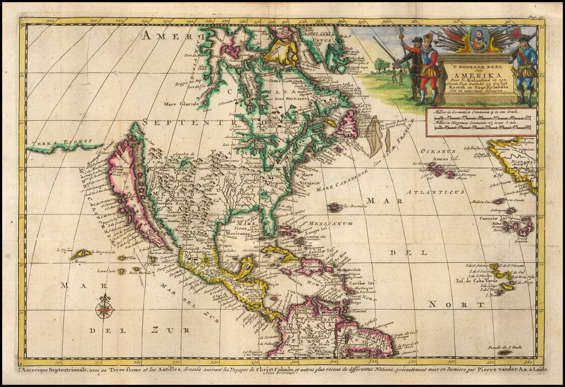
Decorative map of North America, which appeared in the Dutch translation of the Narrative of Columbus' first voyage to the New World. The map shows California as an Island, highly inaccurate Mississippi River and open Great Lakes, with no sign of the...
![A New Map of North America. According to the Newest Observations [California as an Island]](/map/small/70205.jpg)
Handsome example of Moll's miniature map of North America. California is shown as an Island. The map features a curious depiction of the Florida coastline. The Mississippi is west of its correct location, with a rudimentary illustration of its major...

Terrific map of the North Polar region, which shows the Northeast Passage, but no definite Northwest Passage. California is shown as an Island, along with the River systems of North America. Nice detail in the Polar regions, especially New Denmark and...
![[Yosemite / Half Dome Photo] Tasayac, The Half Dome 5000 ft.](/map/small/62639.jpg)
Carelton Watkins photo showing the Merced River in the foreground and Half Dome in the distance.
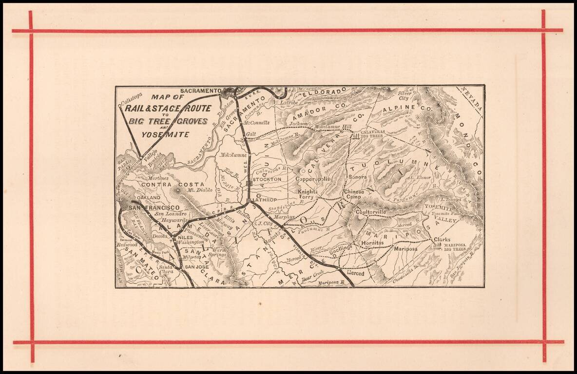
Rare early map of the routes to Yosemite and the Redwood Groves to the south, which would become Sequoia National Park. Versions of this map are known to have been published as early as 1872, in The Wonders of the Yosemite Valley, and of California...
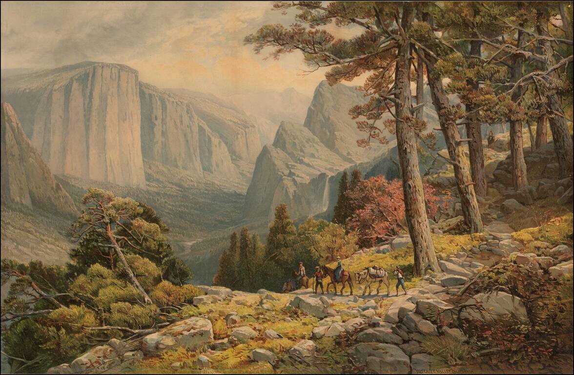
Fine large chromolithographic view of Yosemite Valley, looking from the Mariposa Trail in the Southwest corner of the valley toward El Capitan, the Three Brothers and Bridal Veil Falls. The image is drawn from a painting by Andrew Melrose.
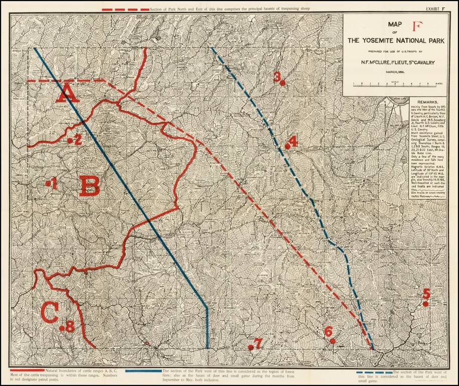
Highly detailed map of Yosemite National Park, prepared by N.F. McClure, during the period when the Park was controlled by the U.S. Army. Includes outlines in Red and Blue, showiing natural boundaries of cattle ranges, section of the park susceptible...
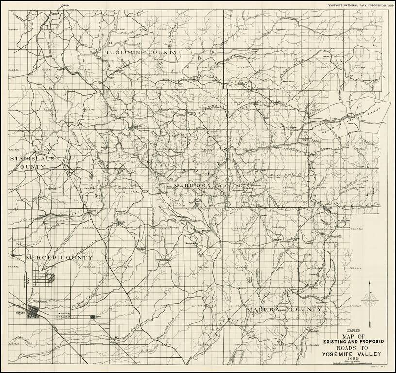
Fine example of the large format map of the entire Yosemite National Park and adjoining regions, which accompanied the Official Report of the Yosemite National Park Commissions. The subject map is the result of a ten year effort to increase public...
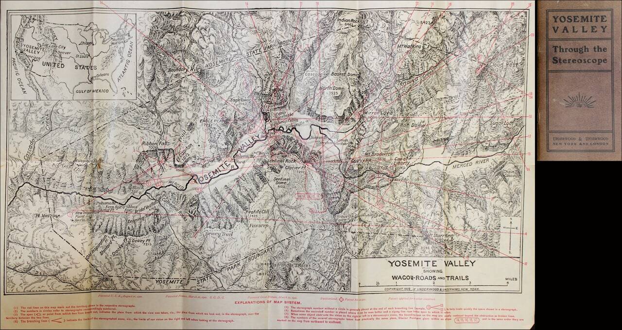
Detailed map of Yosemite Valley, including a key locating the direction of the Stereoviews sold to accompany the pamphlet.
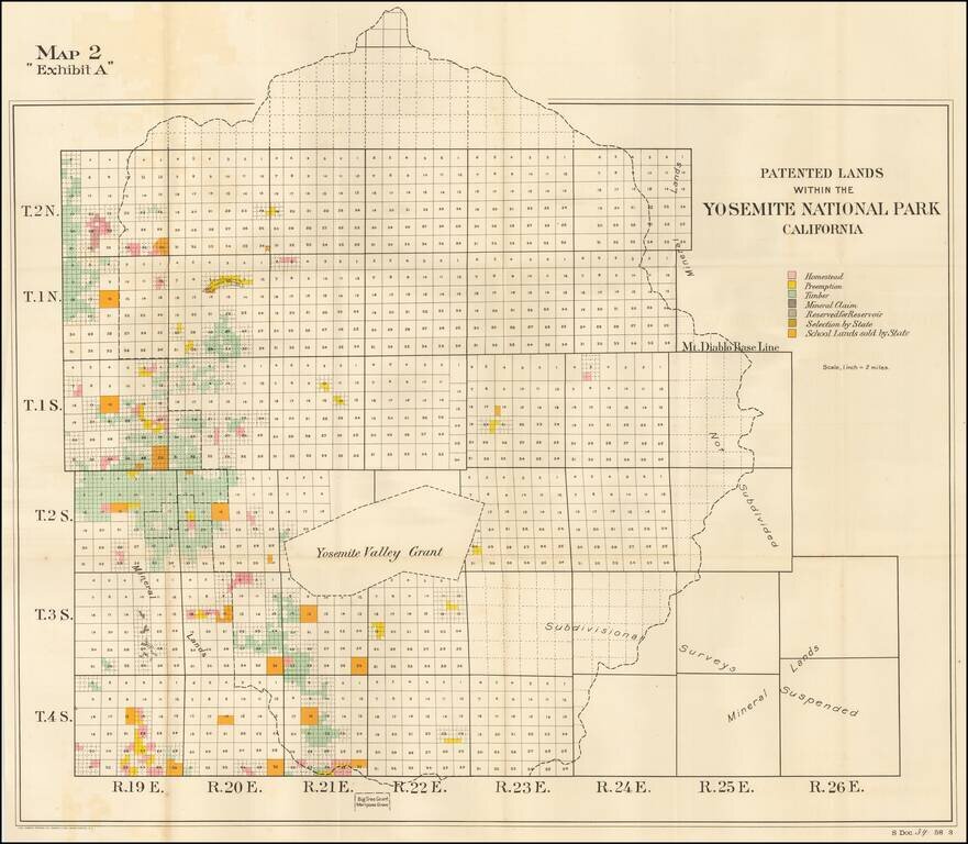
Detailed map of the Patented Lands within Yosemite Valley, published for the US Senate in 1904. Shows township and section lines, undivided lands, homesteads, preempted lands, timber holdings, mineral claims, lands reserved for reservoir use,...
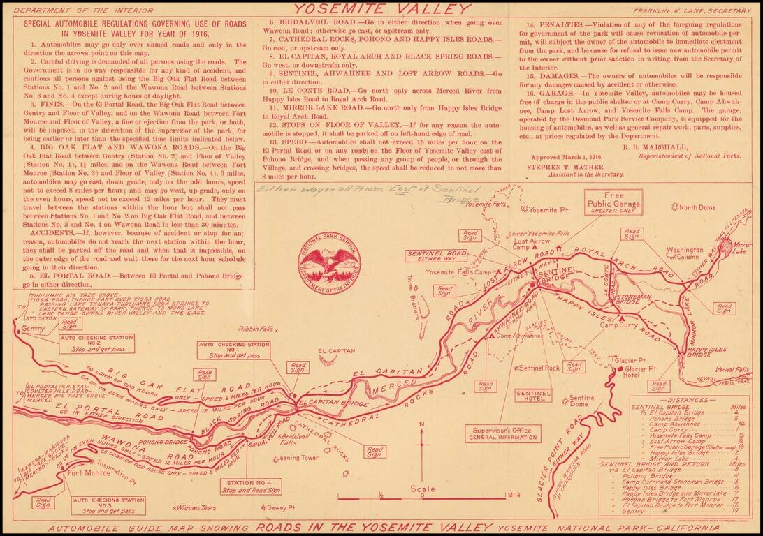
Rare early Automobile Guide map of Yosemite, printed (in red) by the Department of the Interior. Includes "Special Automobile Regulations Governing Use of Roads in Yosemite Valley For Year of 1916." Includes a list of distances and major landmarks....
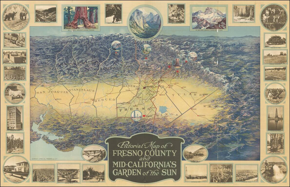
One of the great California pictorial maps from the Golden Age of American Pictorial mapmaking. The map stretches from San Francisco in the lower-left corner to San Emigdio Mountains at the right and the Sierra Nevadas in the background. The map thus...
![Map of Yosemite National Park Showing Routes of Yosemite Transportation System, High Sierra Camps and Pack Trip Country. [on sheet with:] Map of the Floor of Yosemite Valley Yosemite National Park, California](/map/small/66362.jpg)
Illustrated Stage and Railroad Routes To Yosemite Detailed topographical / pictorial map of Yosemite and Vicinity, published as a vistor's guide promotional map. The primary map illustrates the Y.T.S. Stage Service and Railroads servicing the valley...
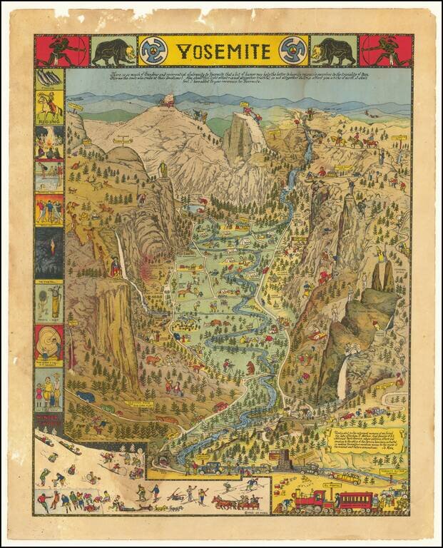
Decorative vintage pictorial map of Yosemite Valley drawn by artist Jo Mora in 1931 and later re-issued in 1941 and 1949. The map shows many humorous scenes and shows the activities common at the time in the Valley. Many landmarks are shown in an...
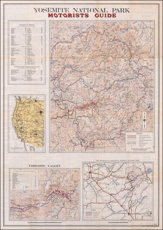
Including the Bear Feeding Platform! Large motorist guide map to Yosemite National Park, with smaller maps of Yosemite Valley, Routes to the park and a regional map. The primary maps locate Paved Roads (66 miles), Improved Roads (142 miles), Other...