Map size in jpg-format: 11.0615MiB
Click to open in high resolution (open in new tab).

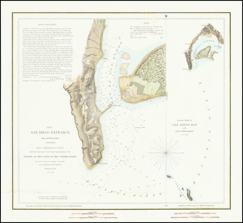
First American Map of the Bay of San Diego
Nice example of the first edition of the US Coast Survey's first mapping of San Diego Bay.
This first edition can be distinguished from the 2nd edition by the addition of the official seal of the US Coast Survey in the left of the map on the 2nd edition.
The plan of the harbor covers the area from Point Loma and La Playa in the west to Shelter Island, with extensive soundings taken. Point Loma, Ballast Point, La Playa, an Observatory, ship wreck and various buoys are noted. Larger inset diagram shows the entire bay. Extensive sailing notes in the upper left corner. One of the earliest obtainable maps of San Diego.
If you are a student, write to us in telegram: @antiquemaps and indicate what material you need and for what work you need a map in high detail. We are ready to provide material on special terms. For students only!

![(California-Mexico Border Survey) Datos de los trabajos astronómicos y topográficos. [bound with:] Variedades de la civilizacion, nueva epoca (Tomo I)](/map/small/70777.jpg)