
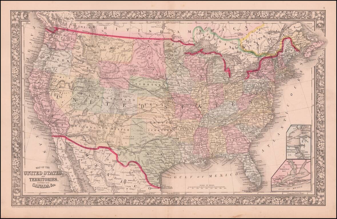
An Early Appearance of Wyoming Territory Rare intermediate state of Mitchell's map of the United States, the first map to include the territory of Wyoming, 3 years before it's official creation, based upon a failed 1865 congressional act. The map...

Including Manuscript Additions of the Overland Route To California and Other Important Points. Nice example of Mitchell's seminal map of Texas, Oregon, Upper California, Missouri Territory and a massive Indian Territory (covering most of Kansas and...
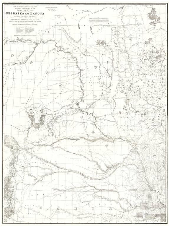
1875 Edition of Warren's Pivotal Map of the American Plains -- Early Reference To the Colorado / Kansas Gold Regions 1875 edition of Gouverneur Kemble Warren's large format map of Kansas, Nebraska, Dakota and part Colorado and Wyoming, based upon...
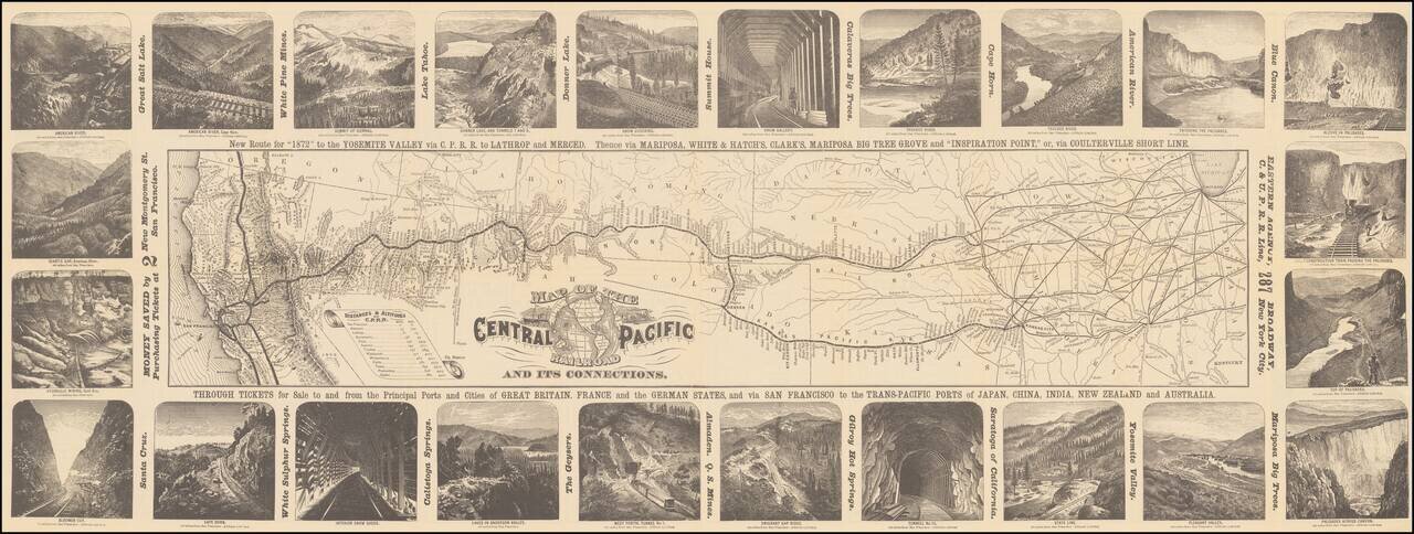
Decorative map of the route of the Central Pacific from the midwest to San Francisco, illustrated with 24 images of the west, primarily of California and Nevada. Decorative and highly detailed map, with vignettes of major points of interest in the...
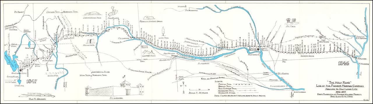
Rare historical / pictorial map of the Mormon Route from Navoo to Salt Lake, drawn by Robert A. Hanson. The map was likely published by the Western Cover Society, a California based society which published the Western Express. Hanson's maps were...
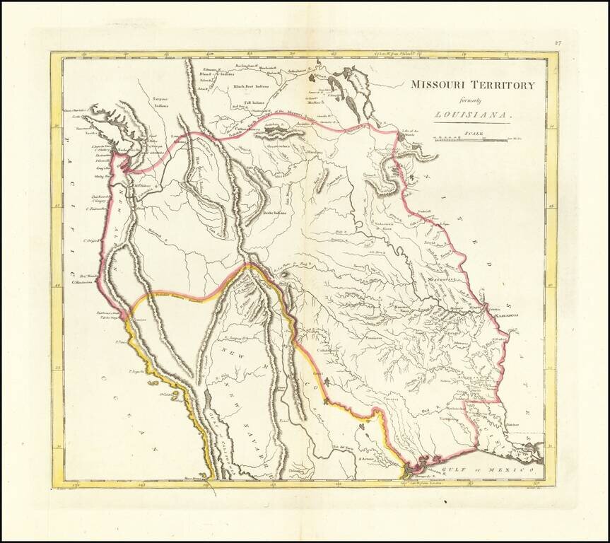
The First American Atlas Map of the Transmississippi West -- Based Upon Lewis & Clark's Reports Nice example of Mathew Carey's highly important map of Missouri Territory. Published shortly after the return of Lewis & Clark, Mathew Carey's...
![[Western Territory]](/map/small/68666.jpg)
Antique Map of the Plains and Indian Territory, Extending the Rocky Mountains Rare and important map from the 1835 Dodge-Kingsbury expedition (only 500 copies printed). The map identifies place names as far west as Santa Fe New Mexico, Pike's Peak...
![Territory of Nebraska [includes parts of Montana, Wyoming, Colorado and Dakota]](/map/small/66957.jpg)
Rare map of the Territory of Nebraska, from Rogers & Johnston's Atlas of the United States. Rogers & Johnston's map is the only commercial atlas map to show Nebraska Territory on a single map. The map was derived from the monumental and...
![Map showing the scene of General Hancock's operations in the Indian Country, the Forts, Military Stations, Pacific Railroads, etc. [Harper's Weekly. June 15,1867]](/map/small/70224.jpg)
Fine map of the Western United States, published in Harper's Weekly The map focuses on General Hancock's military operations against the Native Americans in Indian Territory. The map highlights the the forts, military stations, and railroads in the...
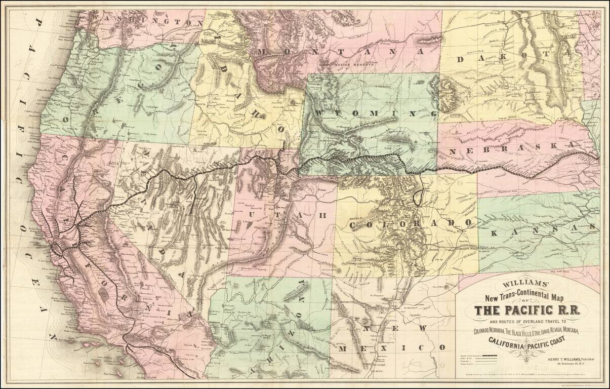
Rare first edition of this striking large format map of the West, published by Henry T. Williams, with handwritten notes, including a note relating to the notorious stagecoach robber, Black Bart, who operated in northern California and southern Oregon...
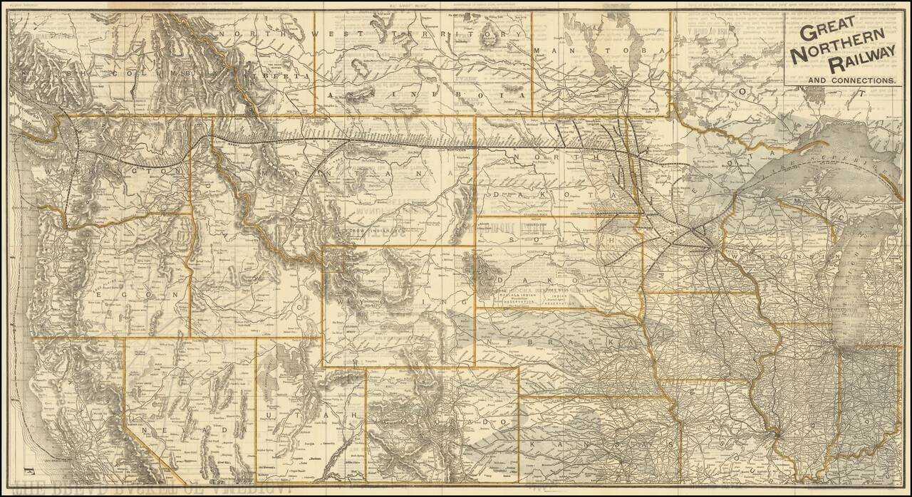
The Bread Basket of America! -- You Are Not Going To the Frontier! Fine large promotional map for the Great Northern Railway, promoting the Government lands available in the Red River Valley. The map shows the railroad lines of the Great Northern,...
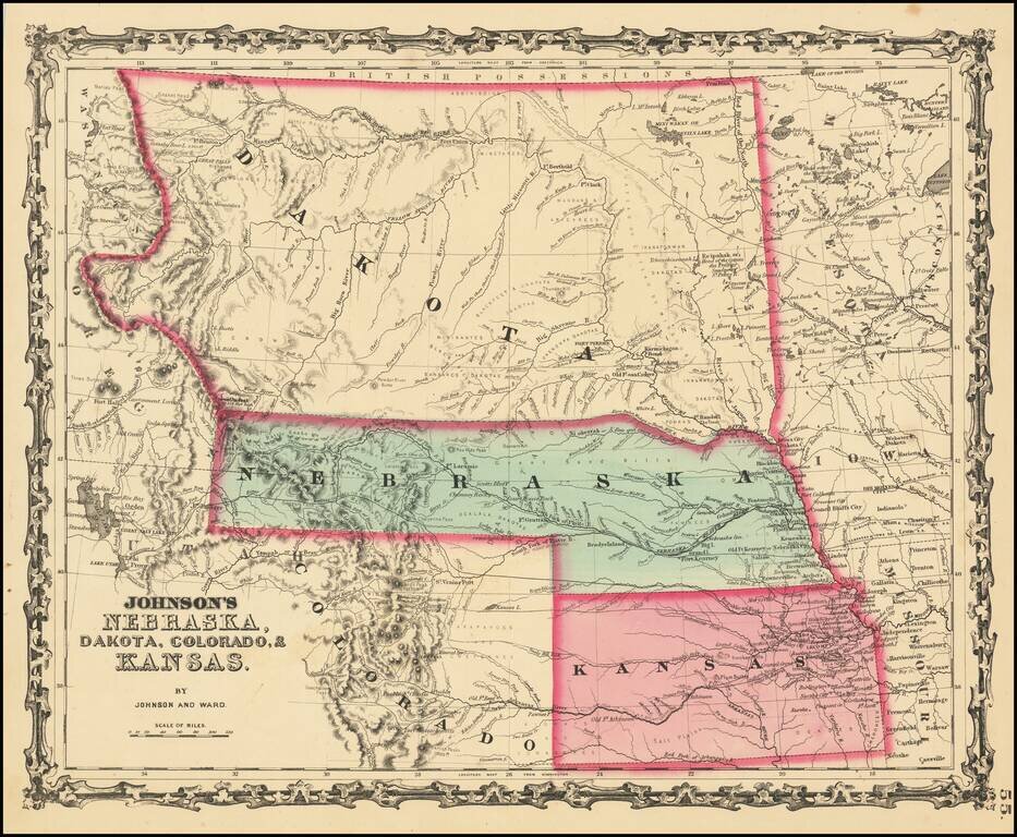
Massive Dakota Territory -- Pre-dating Wyoming and Montana. This is the third map in the series of Johnson's maps of this region and the first to include Colorado. Kansas gives way to Colorado, Nebraska is truncated by Dakota, but still extends to...
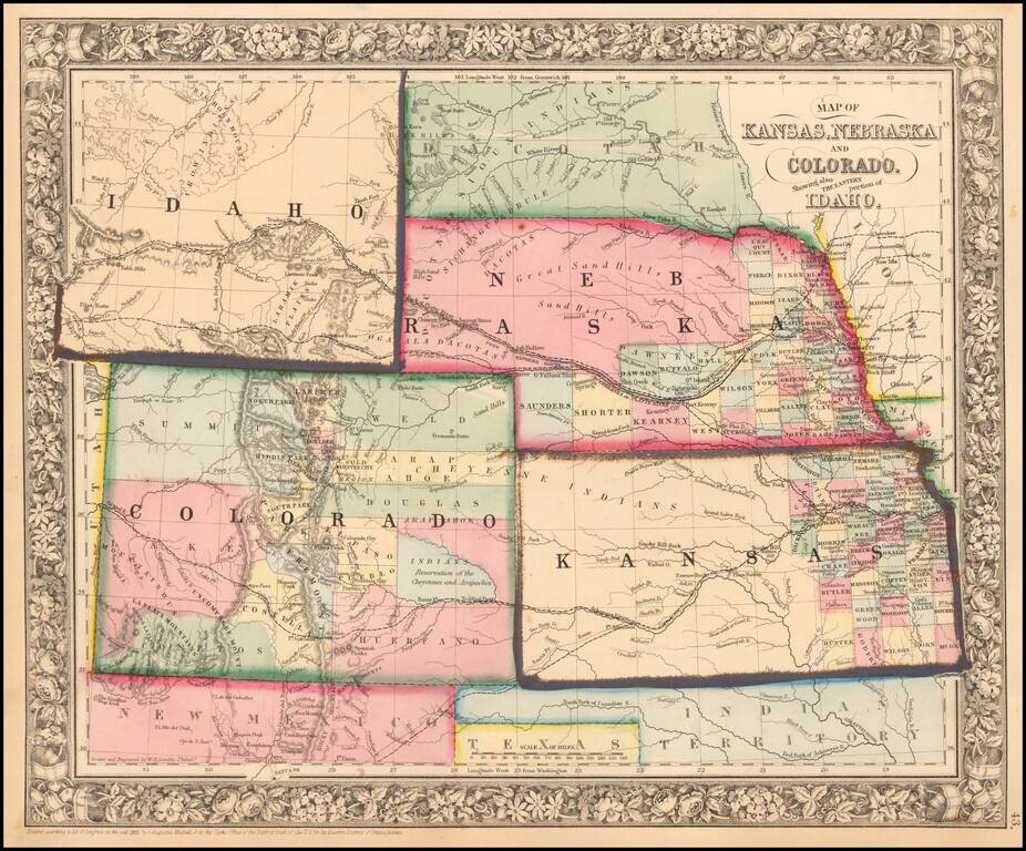
Excellent early map of the region, including an early appearance of Idaho Territory, one of the earliest appearances of this Territory (formed March 1863), on a printed map. Kansas counties cover only the eastern third of the state. Nebraska counties...
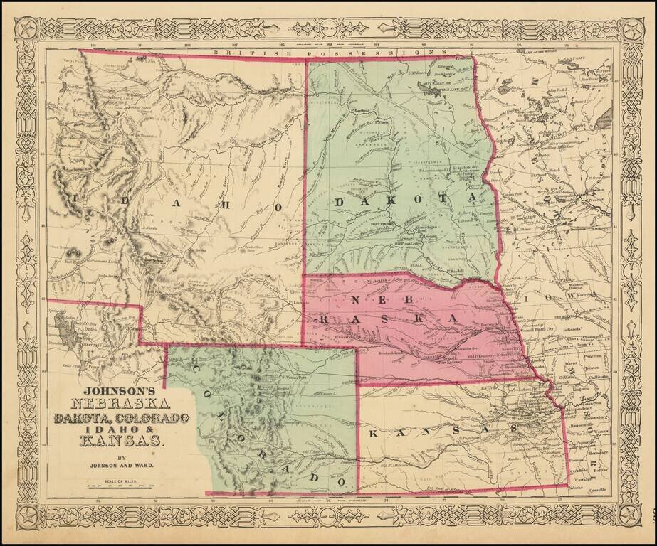
The Earliest Appearance of Idaho Territory--Including The Future Montana & Wyoming Territories Third in series of Johnson maps showing evolution of the mapping of these western territories. The most notable feature of the map is the massive...
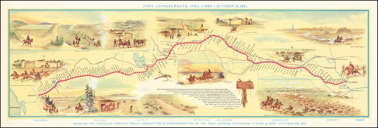
Fine pictorial map of the Pony Express Route, issued by the American Pioneer Trails Assocation in to commemorate the Centennial of the Pony Express. As noted by David Rumsey: Shows route of Pony Express with names and location of relay stations....
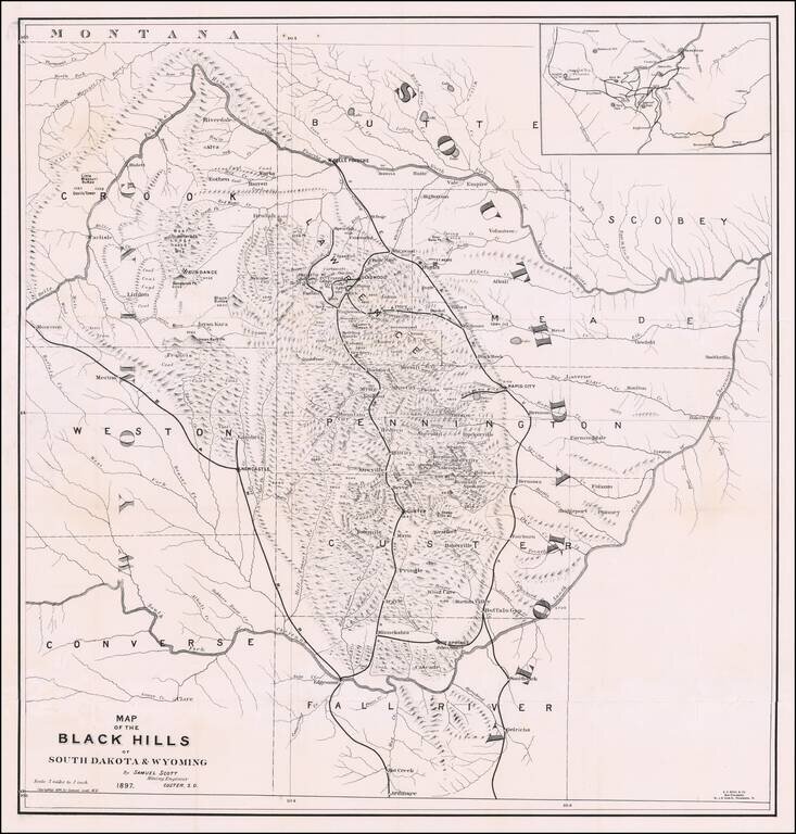
The First Book on Descriptive Mineralogy of the Black Hills with An Important Map Detailed map of the Black Hills region of western South Dakota and eastern Wyoming, between the North Fork and the South Fork of the Cheyenne River, published by Samuel...