
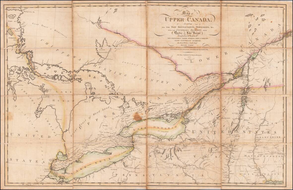
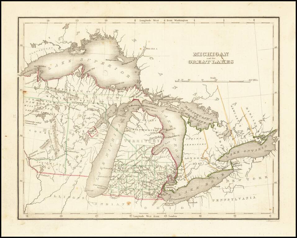
An Early Upper Canada Rarity - Sent To Thomas Jefferson During the War of 1812 Extremely rare separately published map of Upper Canada, Lake Huron, Lake Erie, Lake Ontario and contiguous parts of New York, Michigan, Vermont and Pennsylvania, published...

Detailed road map of the Great Lakes Region, constructed by Canada's Department of the Interior. Includes Provincial Routes, Federal Routes and State Routes.
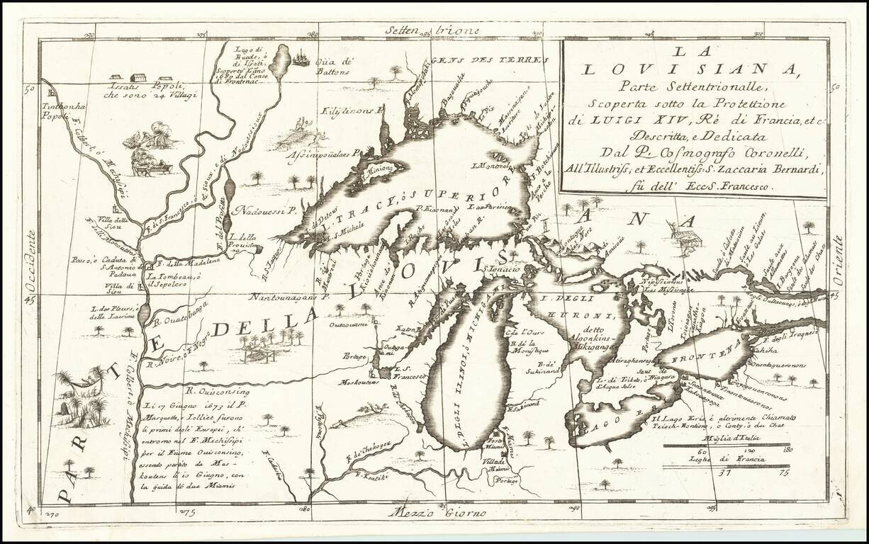
Important 17th Century Map of the Great Lakes and Upper Mississippi River Nice example of Coronelli's highly important map of the Great Lakes and Upper Mississippi region. Coronelli's map is widely regarded as one of the most important maps of the...
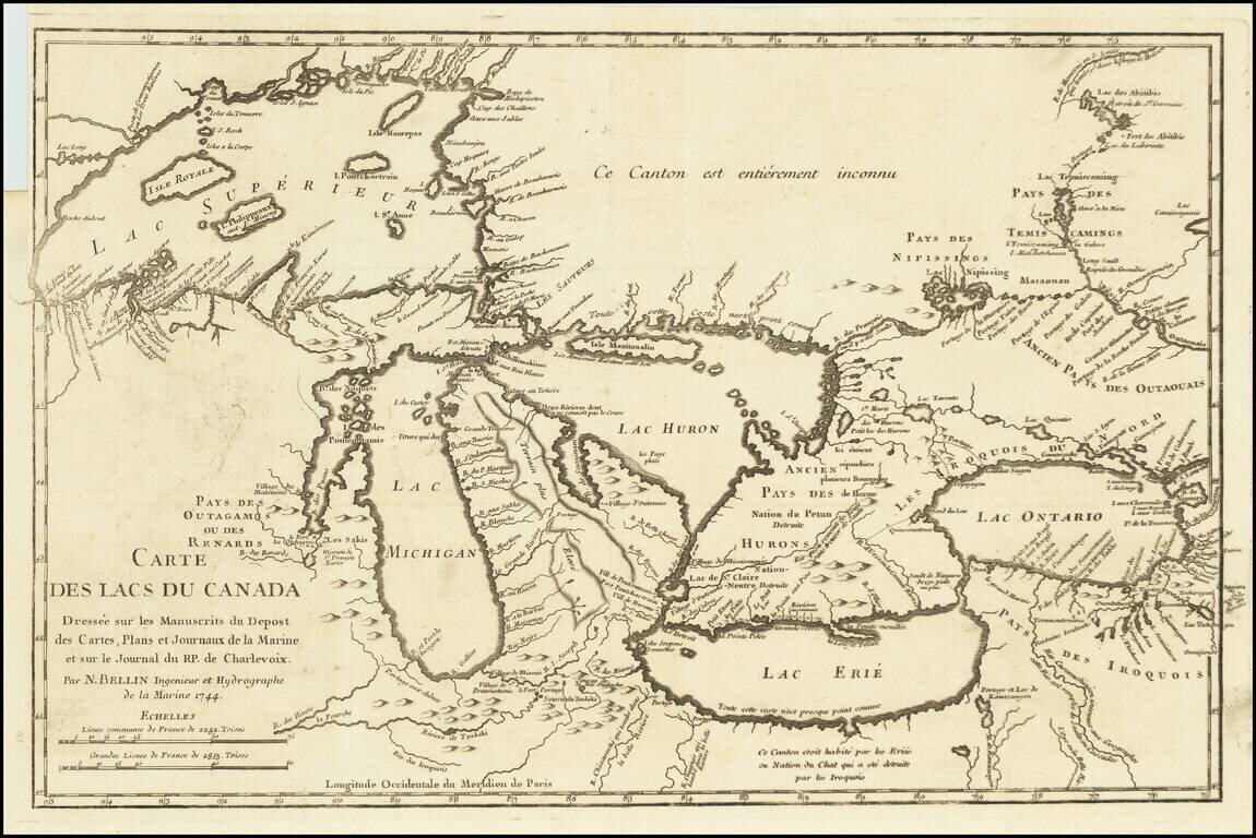
Fine example of Bellin's Landmark map of the Great Lakes region, published in 1744 Bellin's seminal early map of the Great Lakes represented a milestone in the progress of the mapping of the region. It is also one of the earliest appearances of...
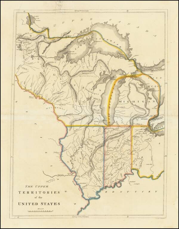
An Early American Map of the Old Northwest Nice example of the rare 1814 edition of Mathew Carey's map of the old Northwest. The map reflects a very early appearance of Michigan Territory (organized 1805), which had not yet appeared separately on any...
Nice example of this early map of Michigan Territory and adjoining regions (including what would become Wisconsin), published by S.A. Bradford. Michigan proper is shown with counties in the southern half, the north being Ottawa and Michilmackinac...
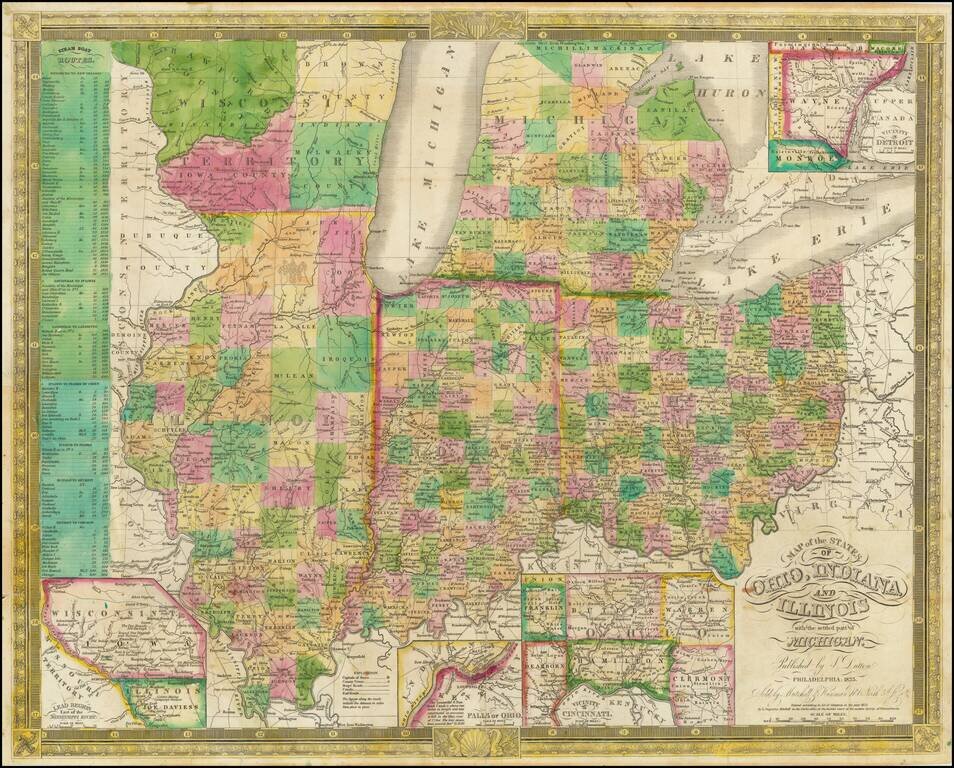
Excellent antique hand-colored engraved map of the eastern Midwest, covering Michigan, Ohio, Indiana, Illinois, and the southern half of Wisconsin. This is a rare later state of Finley's map of eastern Midwest, first issued in 1825, here in the 1835...
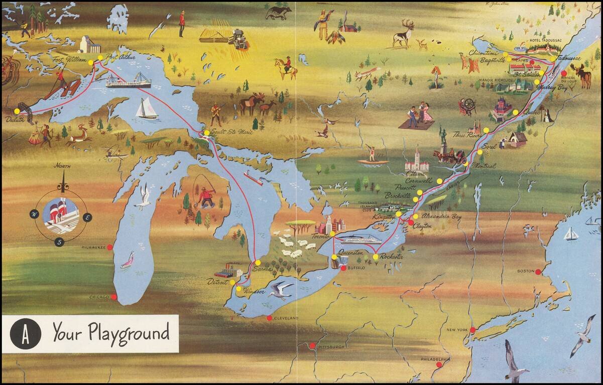
Interesting pictorial map, advertising for Canada Steamship Lines. The route shown goes from Duluth, Fort William and Port Arthur to Sault Ste Marie, Darnia, Detroit and Windsor, with a second route from Buffalo and Toronto to the mouth of the St....
![[First map of Michigan Territory published in Europe] Carte Geographique, Statistique et Historique De Michigan](/map/small/61757.jpg)
Highly important early map of Michigan Territory, being the first separate map of Michigan Territory published outside of the United States. Virtually no settlements in the interior and the upper peninsula, with most of the towns concentrated on the...
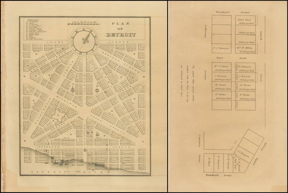
Rare early plan of Detroit from the first edition of the American State Papers. A highly desirable early plan of Detroit. With the additional leaf showing plots off of Larned Street and Bates Street.
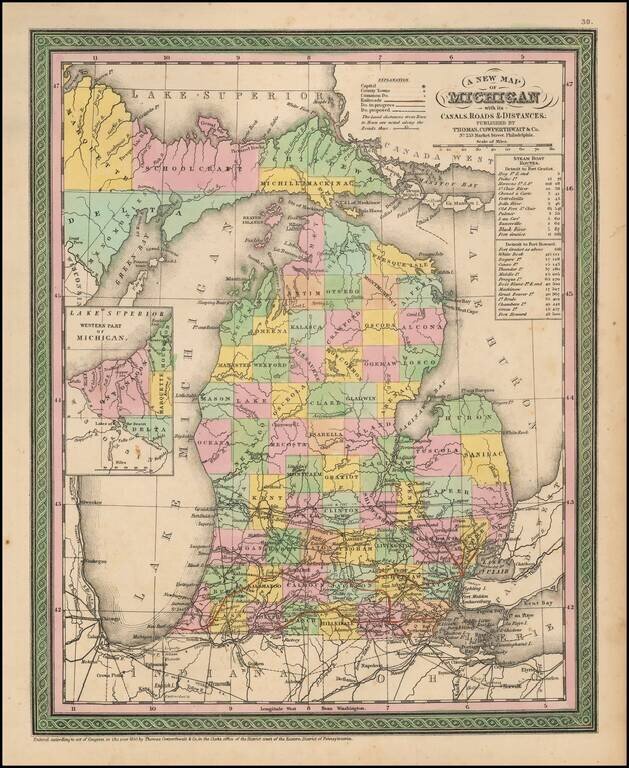
![[Michigan Territory] A New Map of Michigan with its Canals, Roads & Distances by H.S. Tanner](/map/small/68804.jpg)
Michigan 4 Years After Statehood Scarce early example of Tanner's map of Michigan Territory, with interesting early/primitive counties, Indian Lands, etc. Some of the northern counties are not yet completely formed.
Marvelous and highly detailed map from Morse's important Atlas of North America, the first cerographic atlas. Shows towns, roads, rivers, townships, etc. Morse & Breese's North American Atlas was a landmark in American Cartography, being the first...
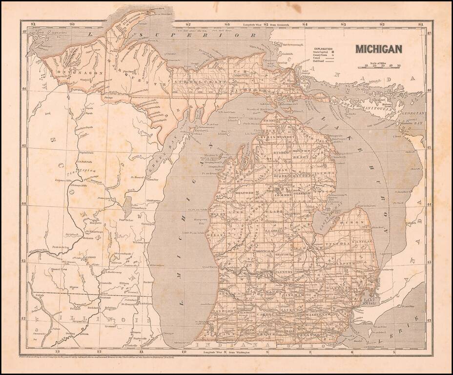
Detailed and interesting map of Michigan, hand colored by county and showing towns, rivers, bays, lakes, railroads, roads, distances, etc. Tables of Steam Boat routes and distances. A nice example of this increasingly difficult map to obtain, from an...
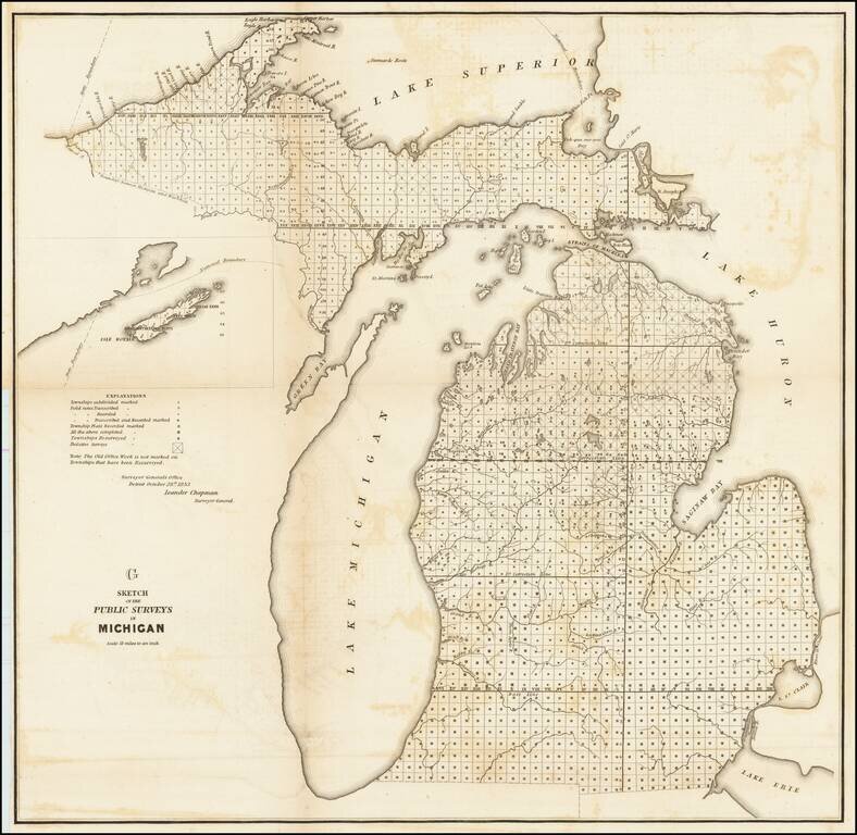
Lithographed map of the progress of the government surveys in Michigan up to 1853. The map has the statement of authority of Leander Chapman, Surveyor General of the Detroit Office, October 28th 1853. This state of the map includes the inset of Isle...
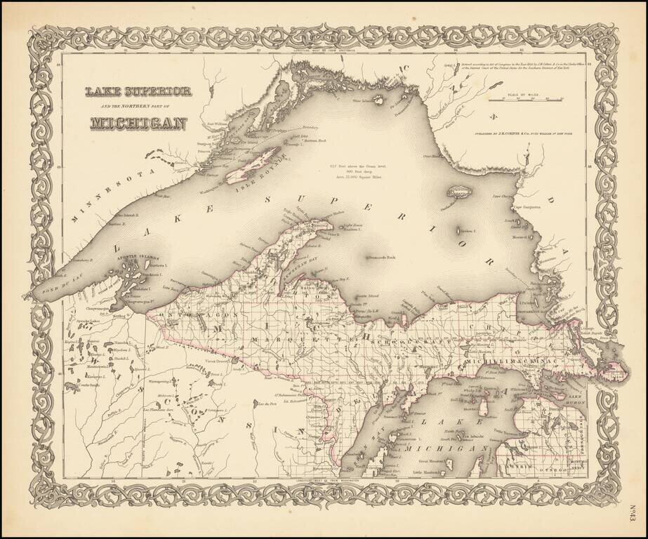
Rare outline color example (first state) of Colton's map of Lake Superior and the Upper Peninsula. Detailed map of the region, showing towns, townships, rivers, lakes, etc. Still no railroad service. JH Colton was one of the pre-eminent American map...
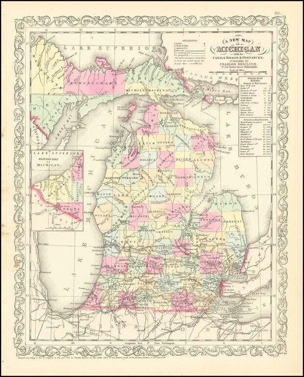
Scarce Charles Desliver map of Michigan, hand colored by county and showing towns, rivers, bays, lakes, railroads, roads, distances, etc. Tables of Steam Boat routes and distances. A number of Michigan Counties still not yet formed. Railroads are...