Map size in jpg-format: 1.96511MiB
Click to open in high resolution (open in new tab).
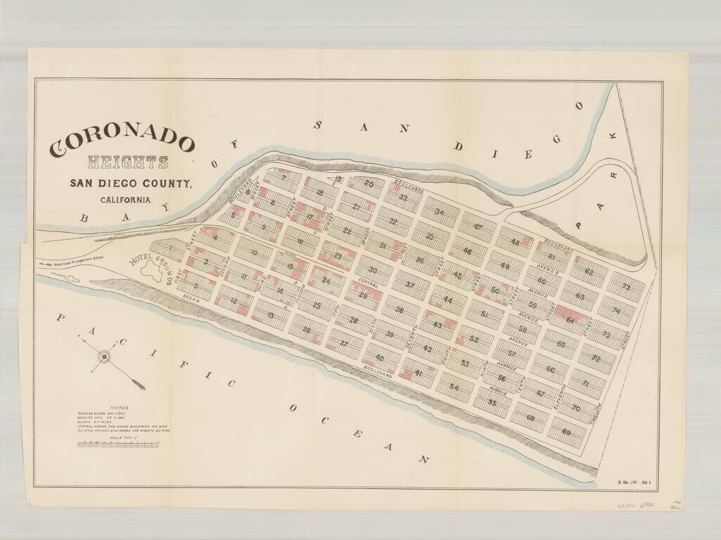
Rare plan of the north end of Imperial Beach, which at the time was planned as a community to be called Coronado Heights, just south of Coronado and the Strand.
Located immediately south of the Strand, Coronado Heights would ultimately become a part of Imperial Beach.
If you are a student, write to us in telegram: @antiquemaps and indicate what material you need and for what work you need a map in high detail. We are ready to provide material on special terms. For students only!
![(California-Mexico Border Survey) Datos de los trabajos astronómicos y topográficos. [bound with:] Variedades de la civilizacion, nueva epoca (Tomo I)](/map/small/70777.jpg)