logo

1872. Originalkarte zum Nachweis der Schiffbarkeit des Sibirischen Eismeers uin Mowaja Semlja in den Monaten Juni bis September und Oktober . . .

  • Originalkarte zum Nachweis der Schiffbarkeit des Sibirischen Eismeers uin Mowaja Semlja in den Monaten Juni bis September und Oktober . . .

Originalkarte zum Nachweis der Schiffbarkeit des Sibirischen Eismeers uin Mowaja Semlja in den Monaten Juni bis September und Oktober . . . information:

Year of creation: 
Resolution size (pixels): 
 4107x3259 px
Disk Size: 
 2.53977MiB
Number of pages: 
 1
Place: 
 Gotha

Print information. Print size (Width x height in inches):
Printing at 72 dpi 
  57.04 х 45.26
Printing at 150 dpi 
 27.38 х 21.73
Printing at 300 dpi 
 13.69 х 10.86

An example of detailing the file of this map of in a printable high-resolution:

Click to open in high resolution (open in new tab).
Attention! this is just the central piece (central area 960x960 px) of the map file!
This is an example, so that you can see and study the level of detail of a given map. The entire Map will be fully available after payment!

Originalkarte zum Nachweis der Schiffbarkeit des Sibirischen Eismeers uin Mowaja Semlja in den Monaten Juni bis September und Oktober . . .

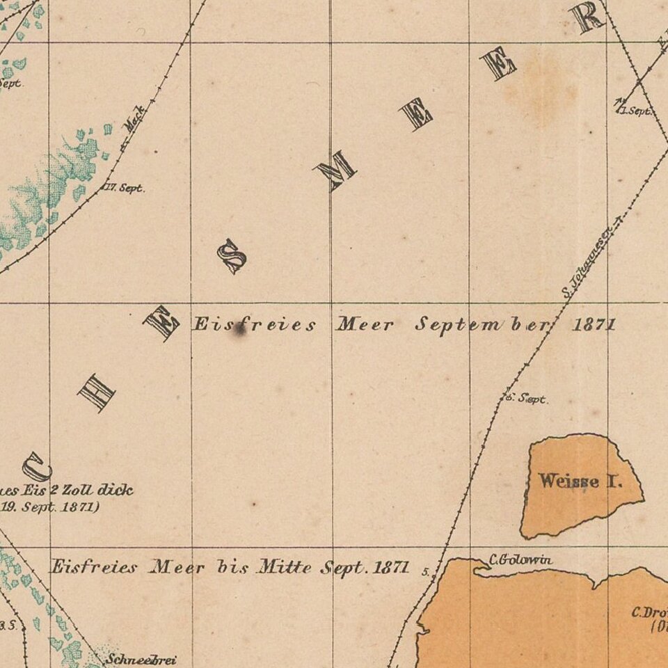
Detailed map of the Nova Zemla region, focusing on the polar voyages in the region in the 1870s.

The following explorer routes are noted:

  • Johannsen 1869
  • Johannsen 1870
  • F.C. Mack 1871
  • Johannsen 1871
  • Tobiesen 1871
  • Isacksen 1871
  • Dorma 1871
  • Rosenthal 1871
  • Payer & Weyprecht 1871

Special conditions for students!

If you are a student, write to us in telegram: @antiquemaps and indicate what material you need and for what work you need a map in high detail. We are ready to provide material on special terms. For students only!

Item information:

Year of creation:
Size:
4107x3259 px
Disk:
2.53977MiB
Number of pages:
1
Place:
Gotha
Author:
Augustus Herman Petermann.
$14.99

Related item