Map size in jpg-format: 48.7978MiB
Click to open in high resolution (open in new tab).

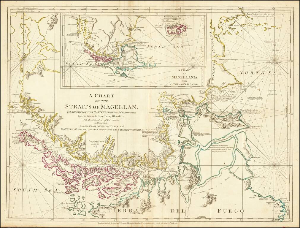
Nice example of this detailed map of the Straits of Magellan on continuous regions, prepared from the recently completed map of Juan de La Cruz Cano & Olmedilla and Hiolito Ricarte.
Cruz Cano's eight-sheet map of South America, much like the Mitchell map, was sponsored by Spain as a means of mapping the then known continent of Spain's colonial power. It is believed that the plates for the map were subsequently destroyed, making it a legendary rarity.
This map appears mostly in Thomas Jeffery's American Atlas.
If you are a student, write to us in telegram: @antiquemaps and indicate what material you need and for what work you need a map in high detail. We are ready to provide material on special terms. For students only!
![[Eastern Hemisphere Globe Gores] (Nova et integra universi Orbis descriptio)](/map/small/54480.jpg)

