Map size in jpg-format: 31.1731MiB
Click to open in high resolution (open in new tab).
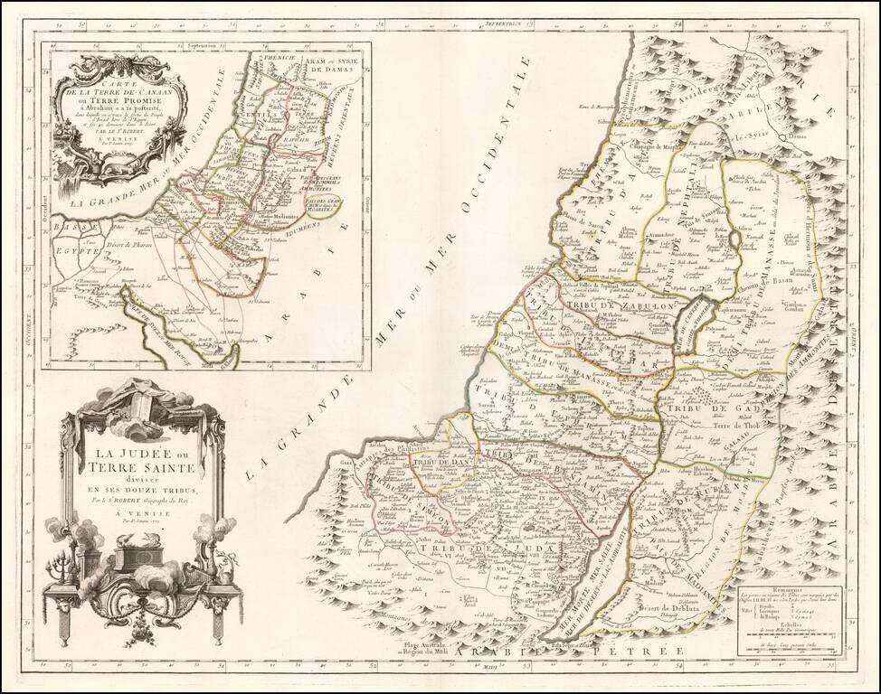
Fine large format map of the Holy Land, published in Venice, in 1779, by Santini and engraved by Remondini.
The map presents a fine detailed depiction of Judea or the Holy Land, divided into the regions controlled by the 12 Tribes of Israel.
A large inset in the upper left corner illustrates the Wanderings of the children of Abraham in search of Canaan or the Promised Land.
Elegant large cartouche, with allegorical representations of the two tablets of the law which Moses brought down from the mountain, along with various other old testament symbols.
Paolo Santini (1729-1793) was an Venetian engraver known especially for his religious prints and fine cartographic engravings. He published in Venice and may have a been a member of the clergy. In his maps, he largely adopted and adapted the work of his French counterparts, especially the brothers de Vaugondy.
If you are a student, write to us in telegram: @antiquemaps and indicate what material you need and for what work you need a map in high detail. We are ready to provide material on special terms. For students only!


![[Early Montanus World Map in Volume Eight of the Plantin Polyglot Bible]](/map/small/53766.jpg)