Map size in jpg-format: 98.5532MiB
Click to open in high resolution (open in new tab).

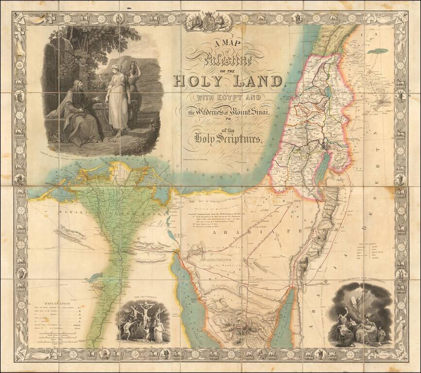
Rare separately pubilshed map of the Holy Land, engraved by J & C Walker for Peter Graham.
The map shows a number of important early routes, including:
An ancient canal between the Salt Marshes of the Red Sea and the Gulf of Suez is shown along with a note "Vestiges of Suez Canal", a reference to Napoleon's attempt to construct the Suez Canal, as well as a proposed railroad from Cairo to the north point of the Suez Canal.
The map includes three large engraved vignette illustrations by W. Hamilton R.A.:
The map extends from to the Nile delta, Arabian peninsula and Palestine.
If you are a student, write to us in telegram: @antiquemaps and indicate what material you need and for what work you need a map in high detail. We are ready to provide material on special terms. For students only!


![[Early Montanus World Map in Volume Eight of the Plantin Polyglot Bible]](/map/small/53766.jpg)