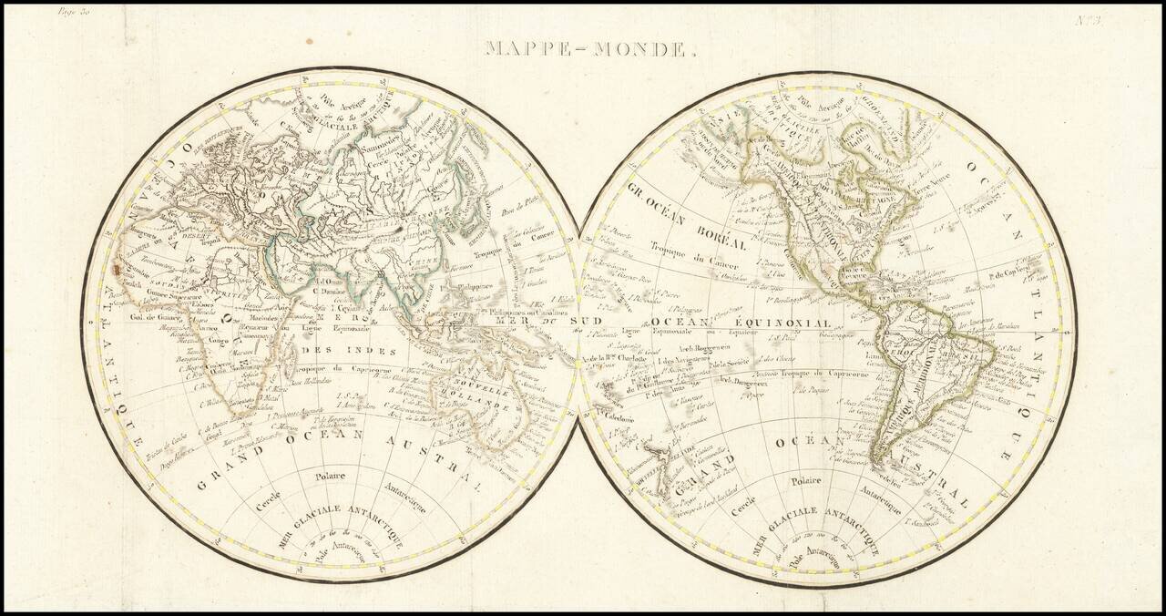
Double hemisphere map of the world, issued early in the 19th Century. We date the map based upon the configuration of the Rocky Mountains, which is in the style of Alexander von Humboldt and the presence of the Bass Strait, between Tasmania and the...
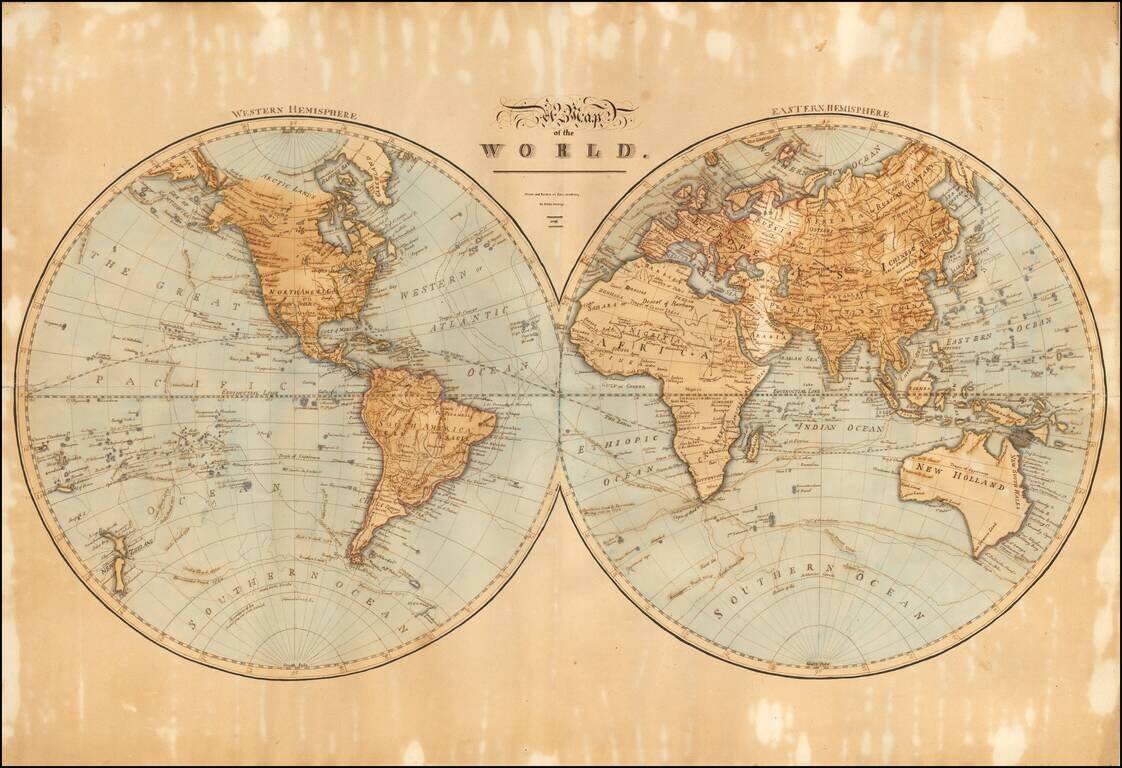
A Large Skillfully Drawn Schoolgirl Map of the World Finely executed hand drawn map of the world by Phebe Phillips of the Lynn Academy. The detail and size of this world map are quite exceptional. Lynn Academy The Lynn Academy occupied a building...
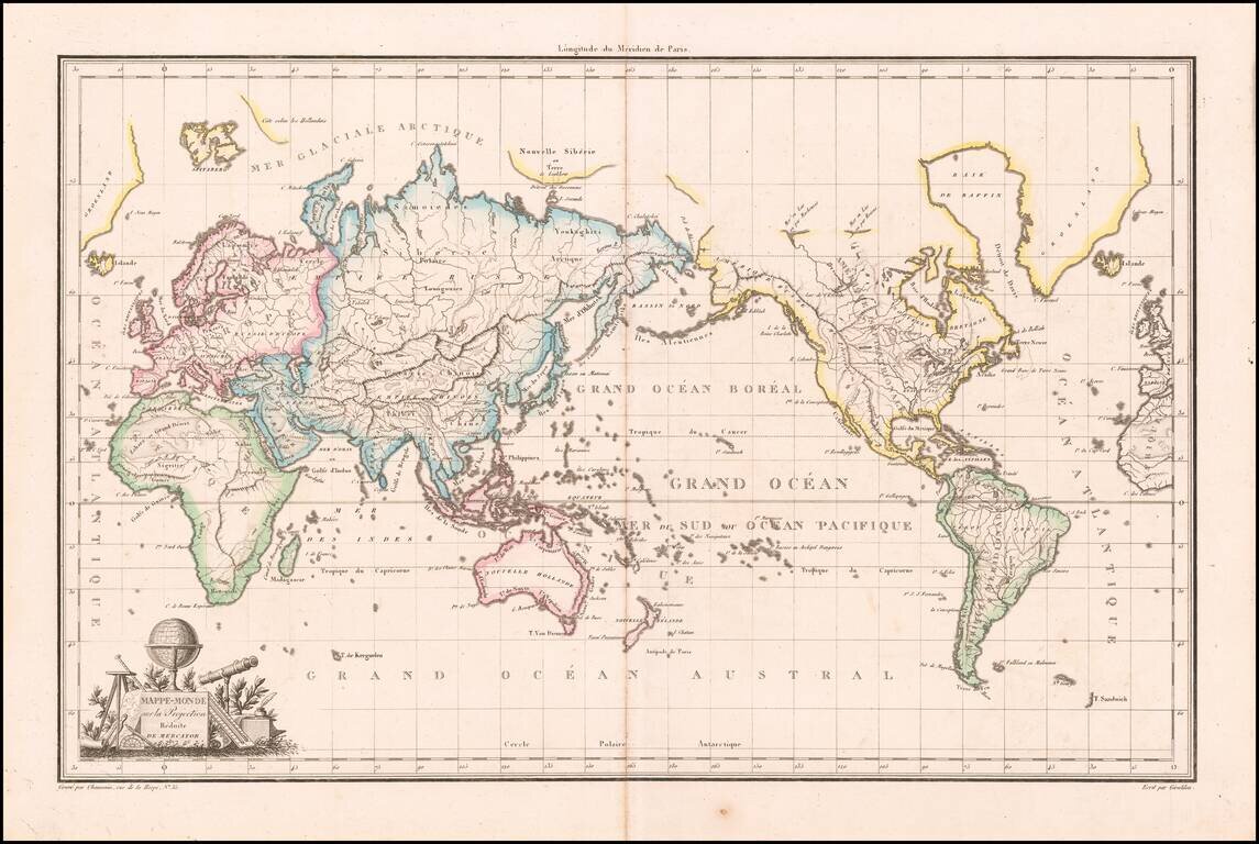
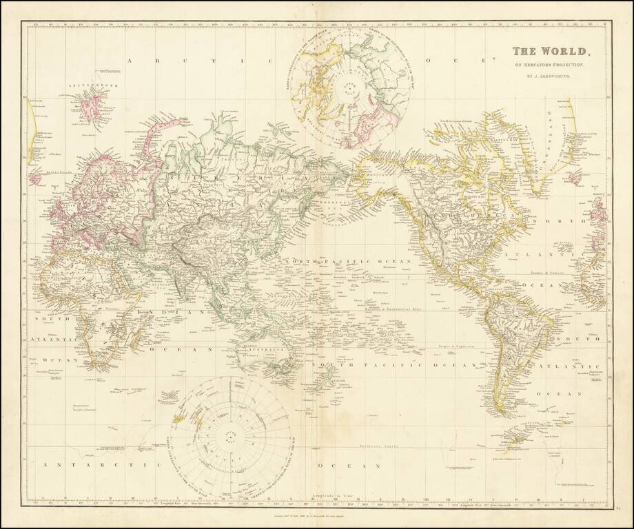
Antique Map of the World on Mercator's Projection Highly detailed large format map of the World, centered on Australia, with the Americas in the east. Antarctica is just beginning to take shape south of Tierra del Fuego, with the naming of Terre de...
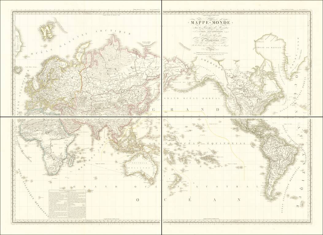
Impressive four-sheet wall map of the world, published by Brué in Paris in 1816. The map depicts the Pacific at its center. This approach became popular in the late 18th and early 19th century as the great Pacific explorations filtered into the...
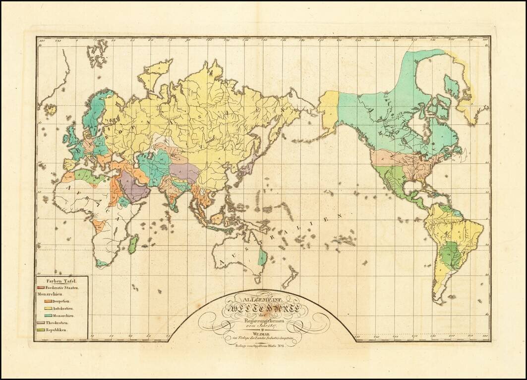
A World Map of Despots, Theocrats, Monarchs and Autocrats, etc. Rare map of the world, illustrating the the different governments of the world in 1817. The key locates 6 typles of Government: Federated States Monarchies - Despots Monarchies -...
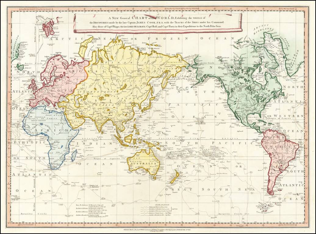
Rare 1824 edition of this rare separately issued map of the World on Mercator's Projection showing the tracks of all three of Cook's voyages as well as the Arctic expedition of Captain Phipps, Ross and Parry, published in the early 19th Century This...
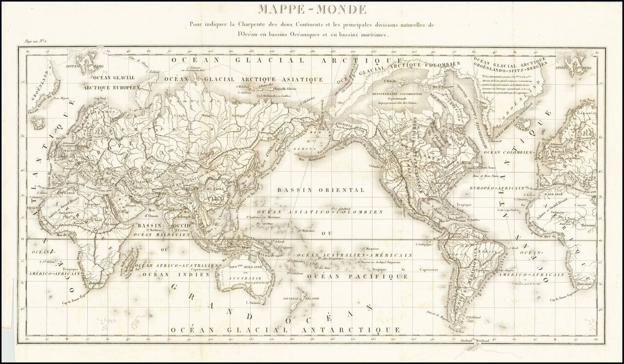
Fine General Hydrographical World Map Striking world map showing the world’s maritime basins. It was part of a geographic system meant to teach an overview of the world’s hydrography. The map was featured in Mémorial topographique et militaire...
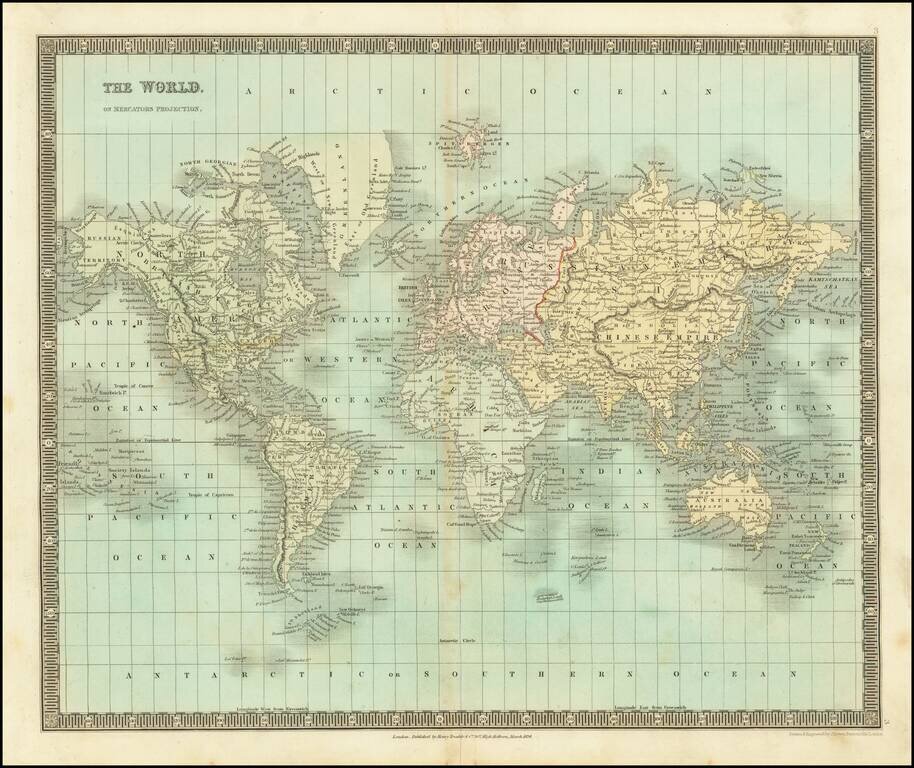
Detailed engraved map of the world issued by Henry Teesdale in London in 1834. On the west coast of North America, we have Old and New California, New Cornwall, New Norfolk, and Russian America (Alaska). The Canadian Arctic is still poorly...
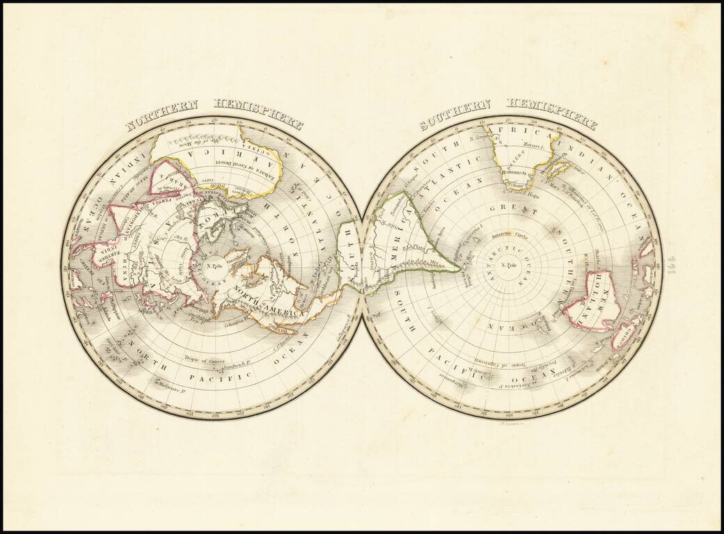
Interesting early American twin-hemispheric map on a polar projection, published in Boston. Still no part of the Antarctic landmass shown.
![[Tracking Noah's Descendants] The Countries of The Ancient World Exhibiting The Probable Settlement of the Descendants of Noah . . .](/map/small/68690.jpg)
This is an interesting map of the ancient world showing the spread of Noah's descendants. Known in biblical scholarship as the Generations of Noah, the sons of Noah were supposed to have spread out to different corners of the world to repopulate the...
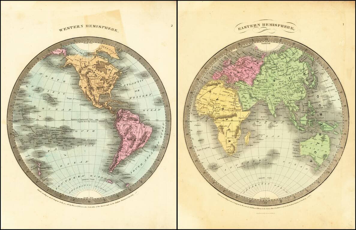
Detailed pair of hemispheric maps of the World, from Burr's Atlas Universal. Shows an oddly configured Australia and Alaska, as well as conjectural knowledge of the Northwest Passage, about 25 years before its discovery.
![[Map of the Five Parts of the World Accroding to Mercator's Projection] Карта Пяти Частей Свѣта по Проекціи Меркатора](/map/small/66676.jpg)
Detailed and very rare Russian-language the World, published in Saint Petersburg in 1836. Labels Alaska as Russian Possessions, etc. Rarity The map is very scarce. We have been unable to find any other examples in sales databases, libraries and...
![[Image of the Globe] Изображеніе Земнаго Шара](/map/small/66770.jpg)
Detailed and very rare Russian-language map of the World, published in Saint Petersburg in 1836. The map is projected with the Pacific ocean at the center. Antarctica, which shows the first hints of discovery is labeled "Southern Ice Sheet Ocean"....
![[From the Library of Captain Louis Freycinet] Carte Hydrographique Des Partes Connues De La Terre Dressee sur la Projection de Mercator, Poar C.LO. Gressier , Ingenieur Hydrographe de la Marine . . . 1835 (with extensive manuscript annotations)](/map/small/58604.jpg)
Annotated Sea Chart of the World Presented To The Explorer Louis Freycinet In Support of A Report to the French Academy of Sciences on The Prevailing Winds At Sea. Finely-detailed, sea chart of the world with extensive manuscript annotations,...
Detailed World Map Showing the Latest Polar Discoveries Scarce, fine world map with polar insets by the notable mapmaker John Arrowsmith. The map shows the latest polar discoveries by Scoresby, Parry, Franklin’s overland expeditions, and Kemp, among...
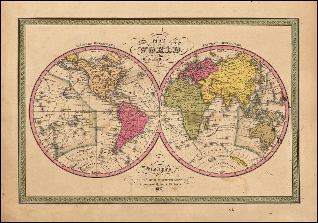
Attractive double hemisphere map of the world with decorative borders. Attractive example with wide margins. The Antarctic regions are just now being discovered. Includes the routes of Captain Cook, Captain Gore and the United States Exploring Expedition.