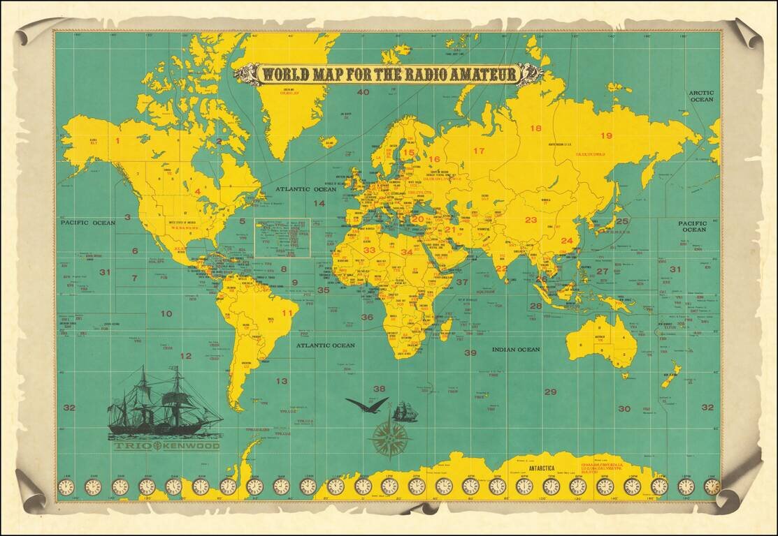
This is a map of the world produced for amateur radio operators, made by the Japanese Trio Kenwood (now Kenwood) Corporation. The map shows political boundaries, time zones, intriguing transportation devices, and, of course, useful information for...
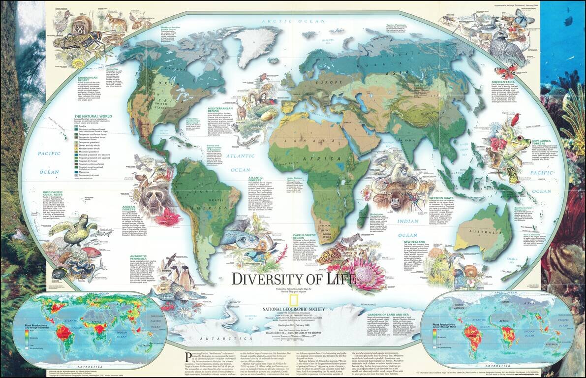
Fascinating pictorial map that portrays the many unique aspects of life on earth. Map itself portrays the world divided into biomes. Insets detail the differences in summer and winter primary productivity between the hemispheres. Includes drawings of...
![[Early Fascimile of the Disputed Christopher Columbus Portolan Chart]](/map/small/66571.jpg)
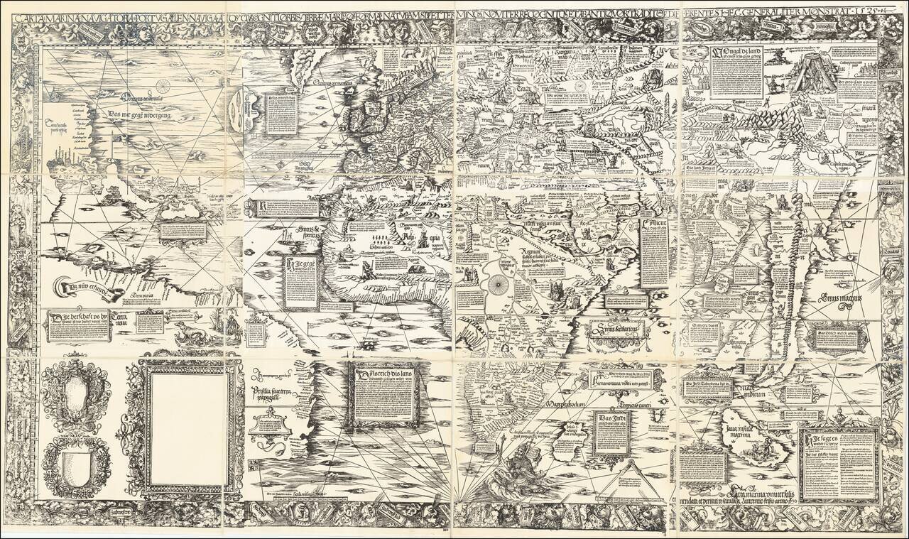
Early Photographic Facsimile of a 15th Century Portolan Chart Attributed By One Scholar To Christopher Columbus. From the Collection of Famous Map Scholar Edward Luther Stevenson. An impressive early facsimile of the "Columbus Mappa Mundi", which...
![[Early Photographic Facsimile] Kunstmann II (Four-Finger Map)](/map/small/66513.jpg)
Early Facsimile of the Kuntsmann II Portolan from the Collection of Edward Luther Stevenson. Fascinating early facsimile of the Kunstmann II map, one of the earliest maps of any kind to show the new world. The map is sometimes attributed to Amerigo...
![[Early Photographic Facsimile of the Contarini-Roselli World Map]](/map/small/66460.jpg)
Early Photographic Facsimile of One of the Rarest Early World Maps. Early photographic reproduction of the of Contarini-Rosselli world map from the collection of early map scholar Edward Luther Stevenson. Shirley (24) says of the map: Since the...
![[Early Photographic Facsimile of Kunstmann III]](/map/small/66577.jpg)
Photographic Facsimile of a Now-Lost Map of the New World, From the Collection of Edward Luther Stevenson. An early photographic facsimile of the famed, and now-lost, Kunstmann III map of the New World. Kunstmann III (Cod. 31-2) was one of at least...
![[Early Photographic Facsimile of the Egerton Portolan of circa 1510]](/map/small/65127.jpg)
"It appears to be not only the oldest known portolan atlas on whose charts any part of the New World is laid down, but the oldest known atlas in which the coast regions of a very large part of the entire world are represented with a fair approach to...
![[Early Photographic Facsimile of the 1523 Turin Map]](/map/small/67275.jpg)
Detailed Photographic Facsimile of "undoubtedly the most important record of the Magellan expedition." MyOldMaps gives the following summary of this very important early world map: This large map is attributed to Giovanni [Juan] Vespucci, born in...
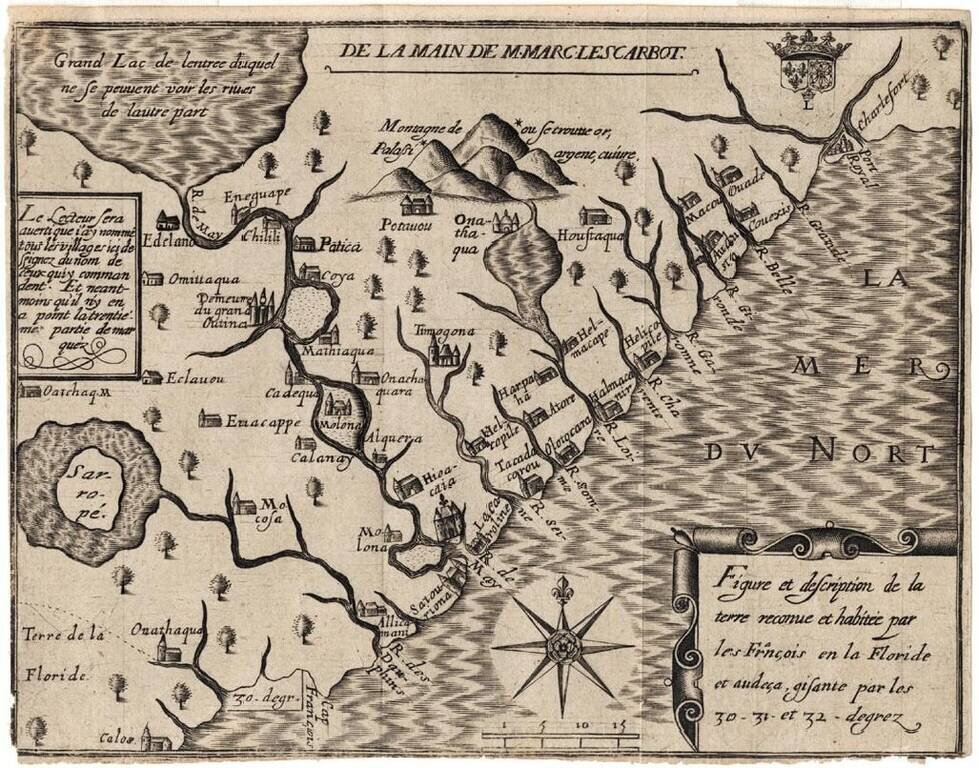
This facsimile reproduction of Lorenz Fries' 1530 Carta marina, published in Munich in 1926, is the only know large-scale facsimile of that important world map. Fries began work on a re-issue of Martin Waldseemuller's famous 1516 wall map (likewise...
![[Early Facsimile] Esta Carta General en Plano Hizo Sancho Gutierrez Cosmographo de Su. S.C.C. Magt Del Īperador Y Rei Nuestro Señor [dō Carlos] Quinto Deste Nōbre. En la Qual Esta Todo Lo Hasta Oy Descubrierto. Imitando Alto Tomeo en Parte Y Alos Modernos](/map/small/66534.jpg)
Early photographic facsimile of the Western Hemisphere of the famed 1551 Sancho Gutierrez planisphere. Sancho Gutiérrez is the author, in 1551, of a world map addressed to Carlos Quinto and based on the Padrón Real. It includes many details of the...
![[Armenian Map of the World] HAMATARAC ASXARHAC 'OYC'](/map/small/66461.jpg)
Early Photographic Facsimile of a Very Scarce Armenian-Language World Map. Hand-colored photographic facsimile of the Schoonebeck (or Schoonebeek) Armenian-language map of the world. Shirley (575) says of the map: ONE OF THE more unusual world maps...
![[The Carlo Naya Facsimile of the Fra Mauro Mappa Mundi]](/map/small/64812.jpg)
Life-Size 1873 Photograph of the Fra Mauro Map of the World. Seven-foot by seven-foot hand-colored photograph of the ca. 1450 Fra Mauro Mappamundi, the greatest medieval map of the world, published by Carlo Naya in Venice in 1873. This life-size...
![[The Carlo Naya Facsimile of the Fra Mauro Mappa Mundi]](/map/small/64813.jpg)
Life-Size 1873 Photograph of the Fra Mauro Map of the World. Seven-foot by seven-foot photograph of the ca. 1450 Fra Mauro Mappamundi, the greatest medieval map of the world, published by Carlo Naya in Venice in 1873. This life-size photograph of the...
![[The Carlo Naya Facsimile of the Fra Mauro Mappa Mundi]](/map/small/64919.jpg)
Life-Size 1873 Photograph of the Fra Mauro Map of the World. Seven-foot by seven-foot hand-colored photograph of the ca. 1450 Fra Mauro Mappamundi, the greatest medieval map of the world, published by Carlo Naya in Venice in 1873. This life-size...

Using the Stars to Understand Latitude—A Rare Instructional Star Chart Rare, commercially-published star chart, made for teaching constellations and the path of the sun through the celestial sphere, the ecliptic, to students of astronomy. Once these...