Map size in jpg-format: 19.3737MiB
Click to open in high resolution (open in new tab).
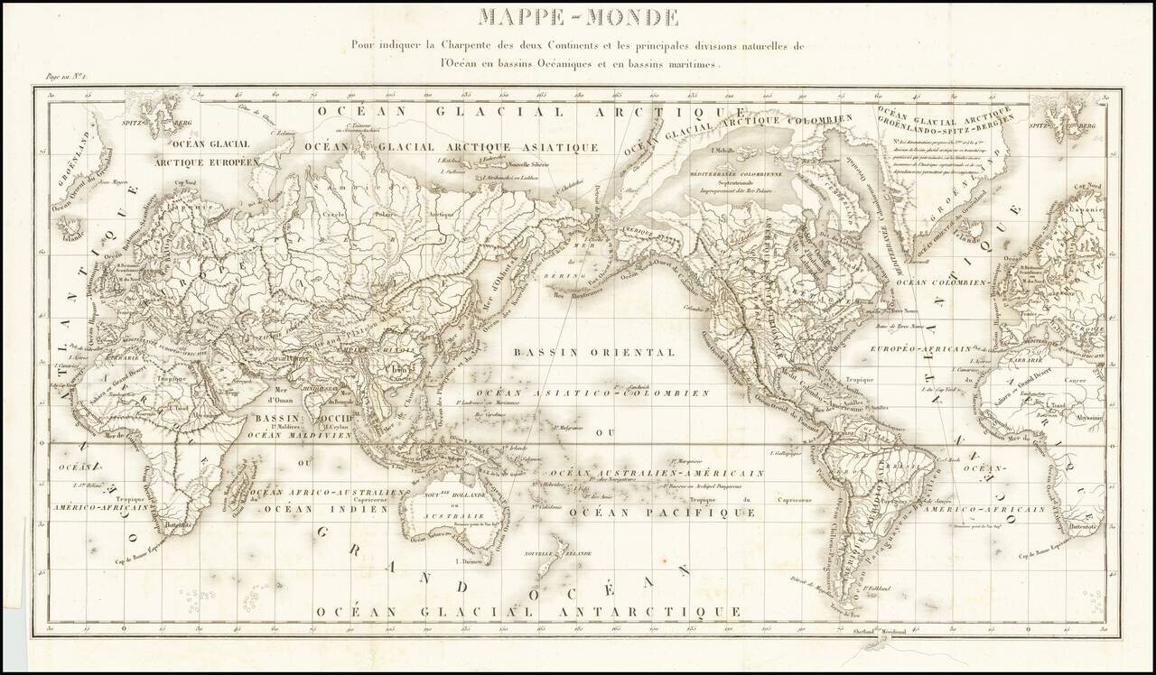
Fine General Hydrographical World Map
Striking world map showing the world’s maritime basins. It was part of a geographic system meant to teach an overview of the world’s hydrography.
The map was featured in Mémorial topographique et militaire rédigé au dépôt general de la guerre, imprimé par ordre du minister. Tome VIII. Année 1825 (Paris: Guiraudet, rue St. Honoré, 1826).
As the title indicates, the author of the treatise in which the map appeared, an army officer named Denaix, considers the world as made up of two main continents: Europe-Africa-Asia and the Americas. Further lands are suggested with outlines of a southern continent breaking the frame at bottom, and the northern extent of glaciers drawn in the Arctic.
The landmasses are heavily lined with mountain ranges and riverine networks. Ringing the terrestrial detail are labels explaining the various maritime basins nearby.
This is certainly not the first attempt to describe the world’s hydrology and hydrography. Philippe Buache developed theories about interconnected submarine mountain ranges and watersheds in the eighteenth century. This map coincides with the early development of tidology, anemology, and oceanography, all of which matured in the nineteenth century.
If you are a student, write to us in telegram: @antiquemaps and indicate what material you need and for what work you need a map in high detail. We are ready to provide material on special terms. For students only!


