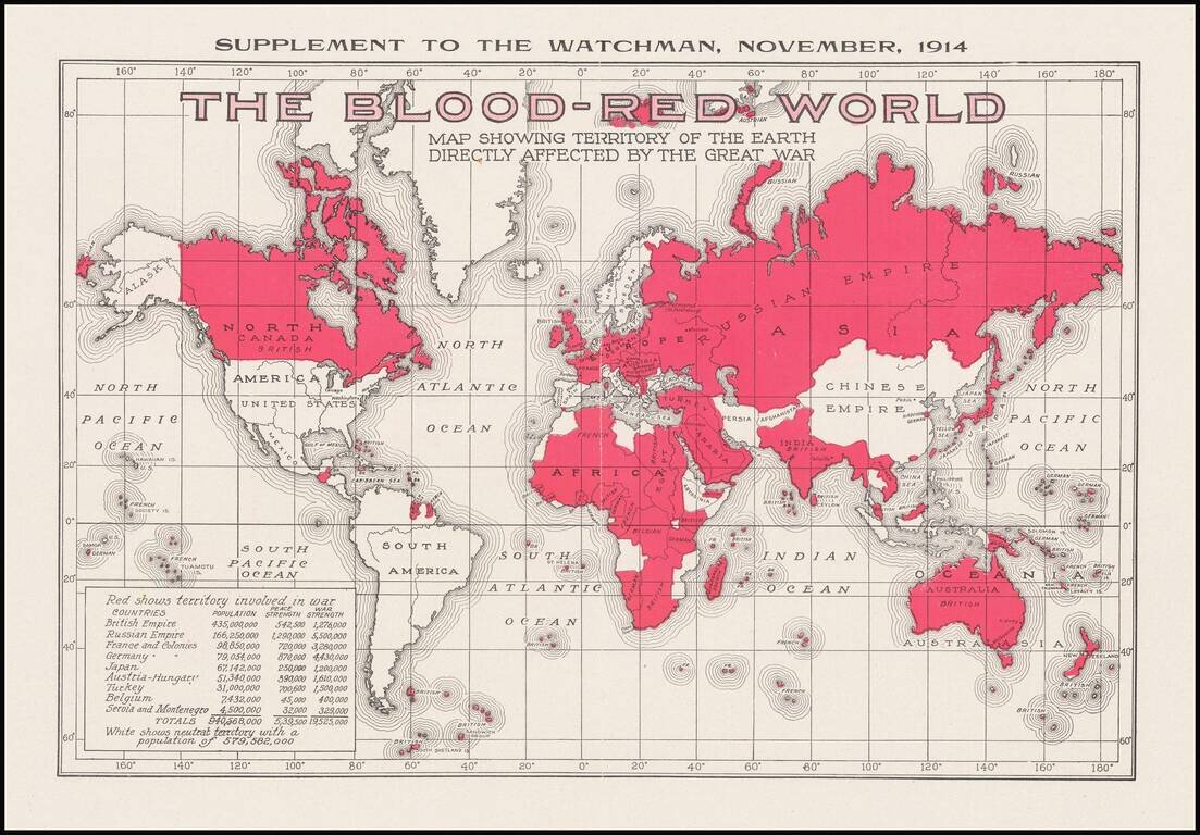
Interesting, small map issued as a supplement to the magazine The Watchmen magazine, which was published by the Southern Publishing Association of Nashville, Tenn. The map shows that 940,568,000 people were somehow affected by the war through living...
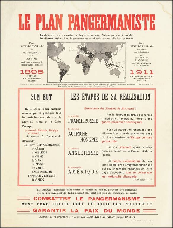
Fantastic anti-German polemic broadside map, issued in France during World War I, published by Adrien Maréchal. The map focuses on the so-called "Pan-Germanic Plan" of world domination. It rallies the French against the ever-expanding influence of...
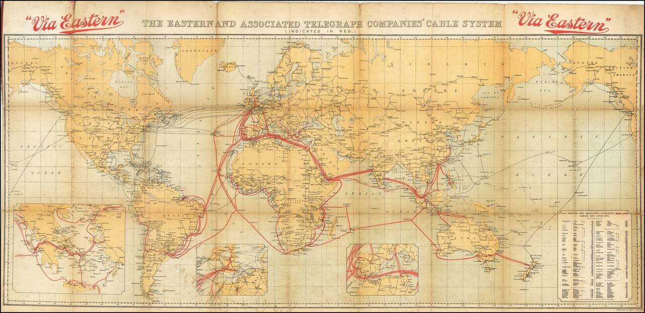
Tracing the Expansion of the Global Telecommunications Network. Fascinating color-lithographed map, showing the coverage of the extensive submarine cable network of the Eastern and Associated Telegraphy Companies in 1926. That company can trace its...
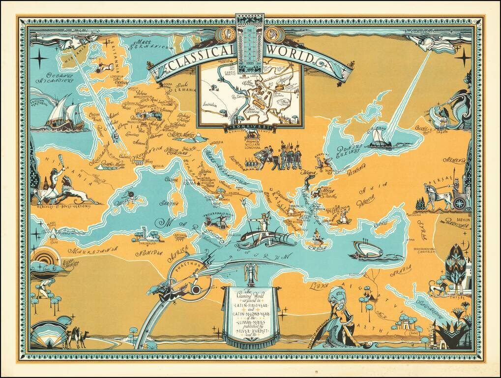
Rare pictorial map centered on the Mediterranean Sea, showing the world at the time of the Roman Empire, with place names in Latin. The map was produced for educational purposes to accompany a series of Latin textbooks published by Silver Burdett...
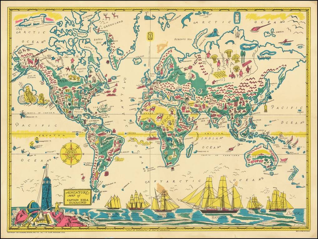
Rare Pictorial World Map, prepared as a promotional premium to promote the Captain Ezra Diamond Radio Show. Captain Ezra Diamond was the fictional spokesperson for the Diamond Salt Company began in the early 1930s. The company itself began some 50...
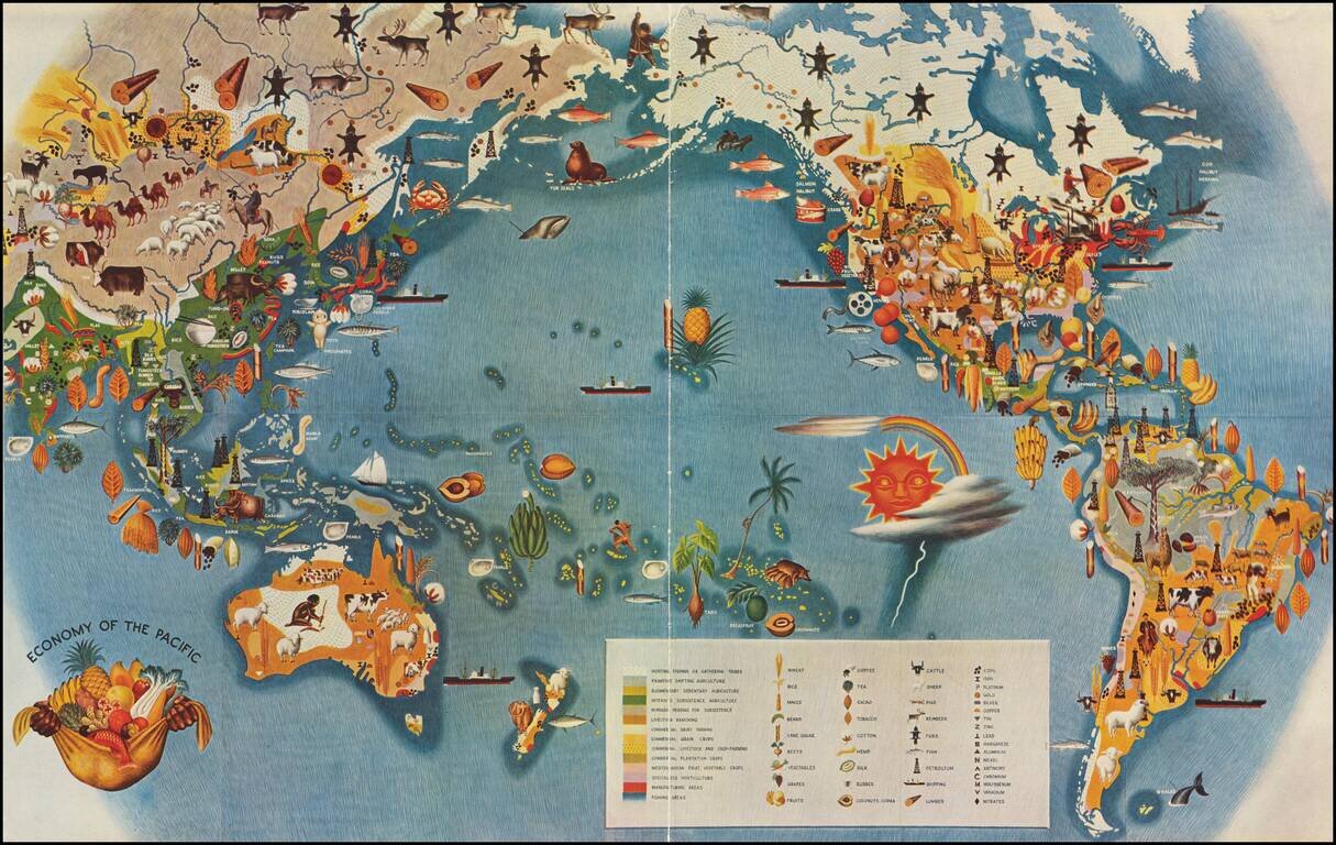
Smaller version of Miguel Covarrubias's iconic map from his Pageant of the Pacific series. This well regarded stylized map by the Mexican painter, illustrator, filmmaker and anthropologist Miguel Covarrubias, often called Mexico's Renaissance Man....
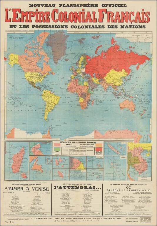
Interesting broadside map of European colonial possessions around the world. The map was published in Paris, circa 1935, as a map of the French colonial empire, but it shows all shows the colonial possessions of Great Britain, Italy, and lists the...
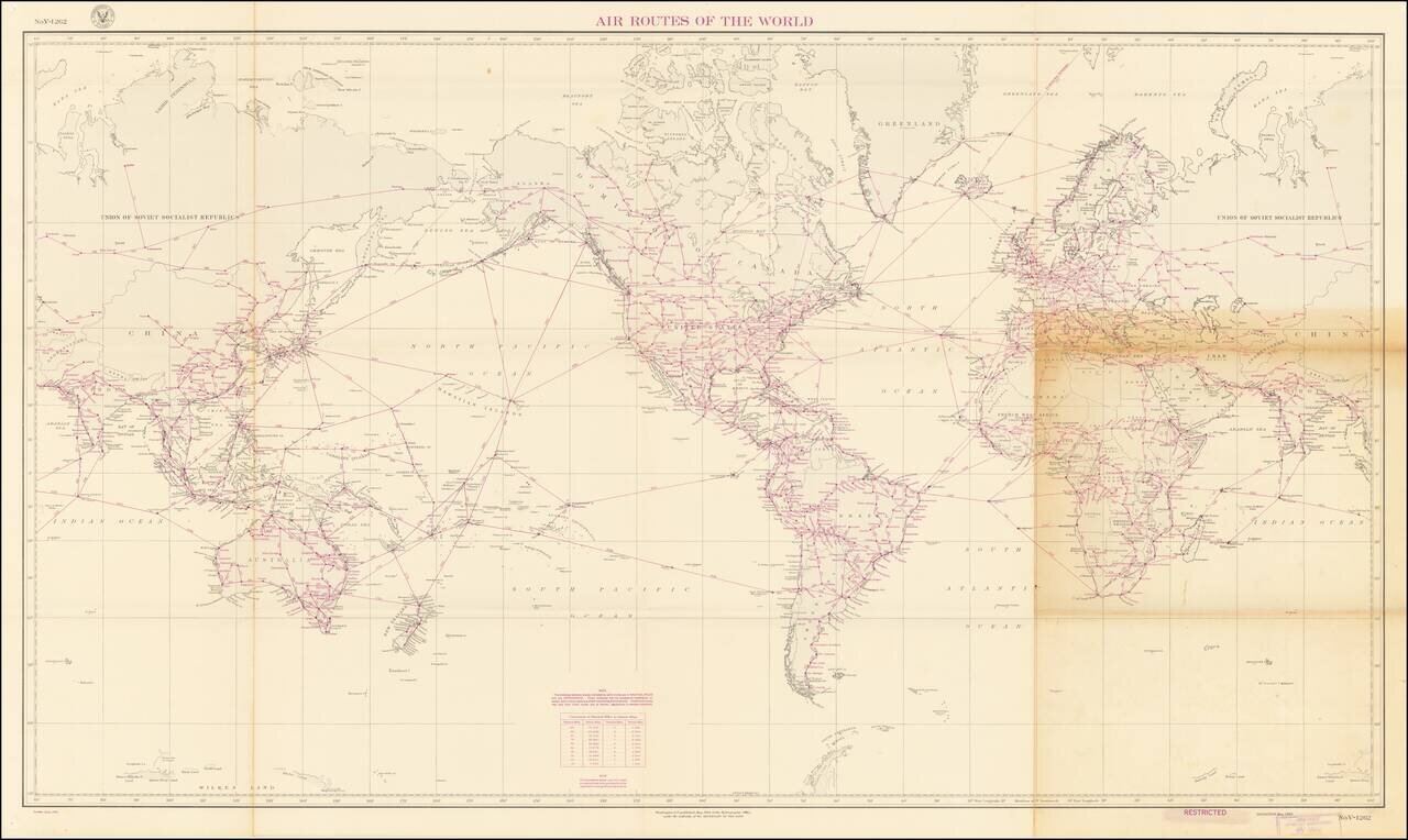
Detailed vintage map of world air routes, with distances, including established and projected routes. The chart was published by the Hydrographic Office, under the authority of the Secretary of the Navy, in May of 1939. The map calls itself the first...
![[World] Air France -- Nova et Vetera Sur La Vieille Terre Des Chemins Nouveaux](/map/small/67467.jpg)
Rare Early Air France Map Decorative Air France Map Poster by Lucien Bouche. Presents a lively pictorial map of the World, with Air France routes extending to Buenos Aires and Santiago, New York, Cairo, Beyruth (Beirut), Calcutta, Saigon, and Hong...
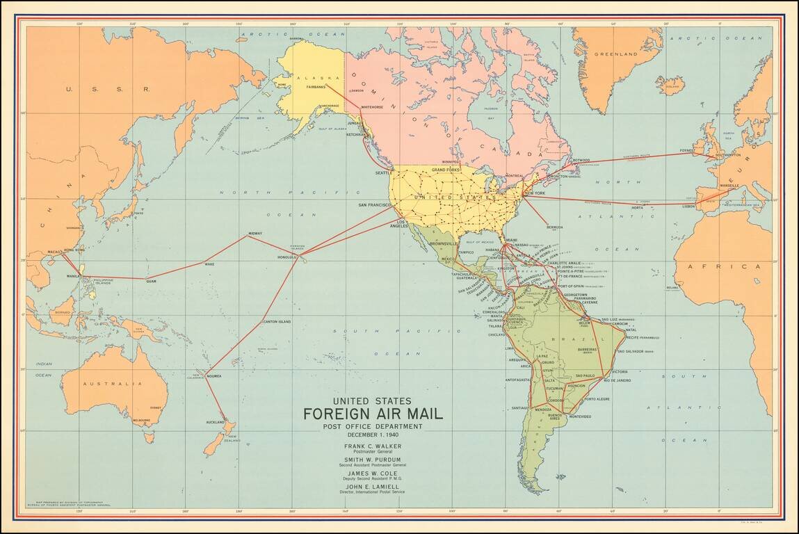
America's Foreign Air Mail Routes in the Year Before it Entered World War II. Attractive vintage map of the foreign routes of the US airmail service relevant to the United States, in December of 1940. At the time of creation, there were only a few...
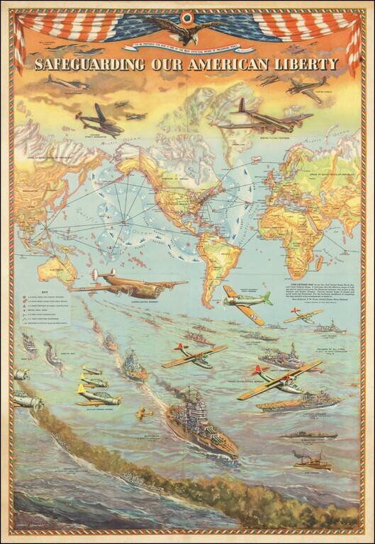
Provocative pictorial map depicting the United States Naval, Air and Coast Defense Bases. The map was created by Lambert Guenther to glorify the power and international reach of the United States military. The protective boundary of the air and sea...
![[Musselini Celebrates Pearl Harbor] Grande Carta Del Pacifico](/map/small/64895.jpg)
Musselini Celebrates The Japanese Attack on Pearl Harbor -- Provoked by A Democratic Despot Issued 4 days after the Japanese attack on Pearl Harbor, this message from Musselini, celebrates the attack and speaking in fiery nationalistic rhetoric in...
![[WWII Propaganda Map] Newsmap -- Monday, September 14, 1942](/map/small/66662.jpg)
American Occupation of Galapagos -- Nazis Closing on Stalingrad -- 234 US Vessels Launched Labor Day (1942) Fine large format WWII "Newsmap", providing up to date coverage of World War II to the American public. The base map is surrounded by news...
![[WWII Propaganda Map] Newsmap -- Monday, October 26, 1942](/map/small/66710.jpg)
More Than 530 Enemy Subs Reported Sunk or Damaged Fine large format WWII "Newsmap", providing up to date coverage of World War II to the American public. The base map is surrounded by news style articles, images, photographs and other information...
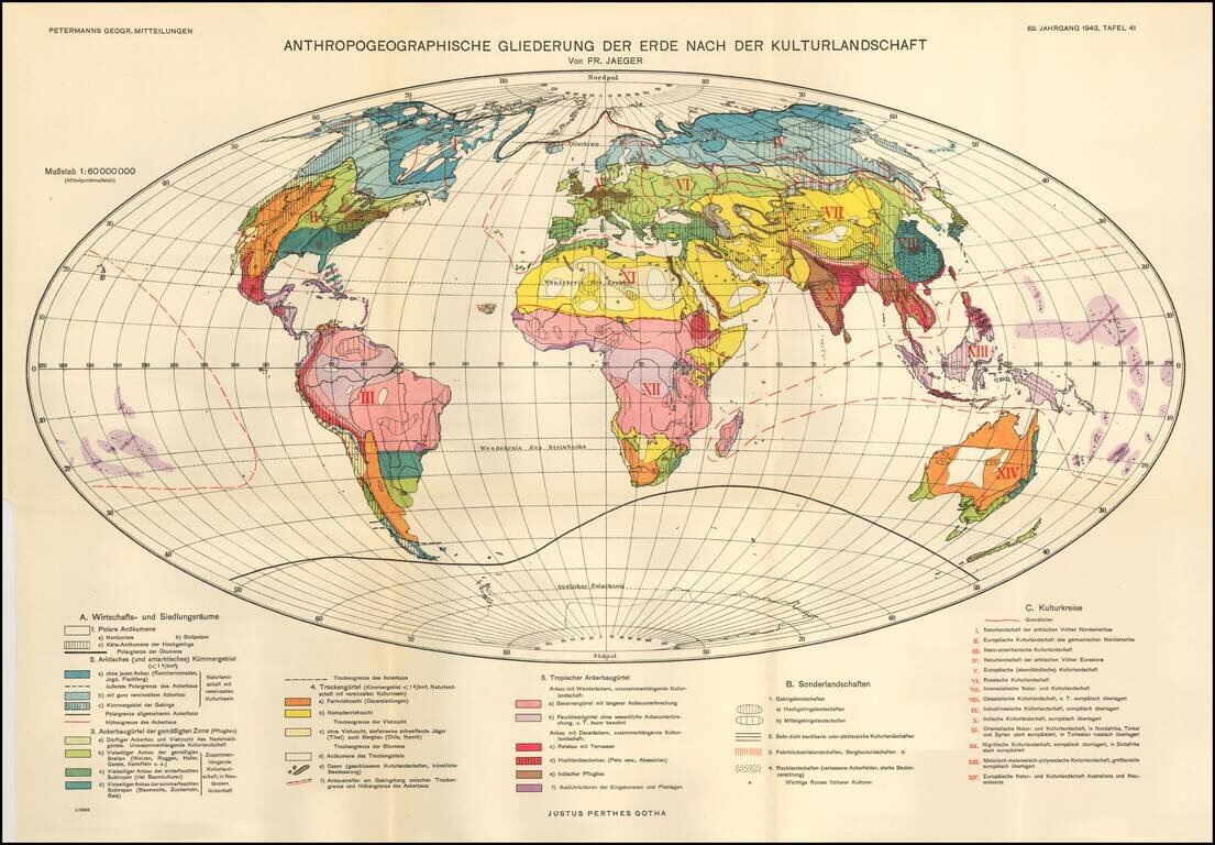
Fritz Jaeger's Anthropogeographic Outline of the Earth After the Cultural Landscape. The world is illustrated in 3 major groups: Economic and Sectarian Special Landscapes -- Regions conducive to manufacturing, mining, etc. Cultural Landscapes
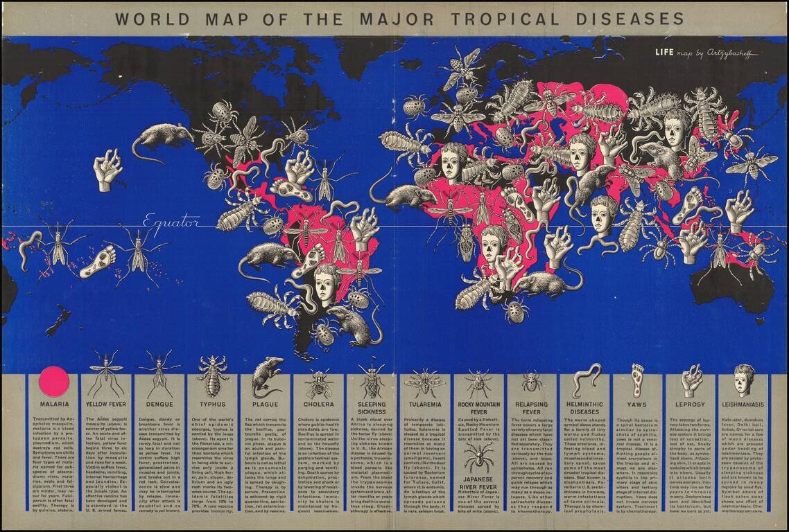
Tropical Disease Pictorial Map. A world map by a well-known artist of the time (Boris Artsybasheff) illustrating an article on tropical diseases. The use of ominous pictorial symbols for 15 diseases, combined with the size and location of the symbols...