![Map of the World on Mercator's Projection Published By T & E. H. Ensign. . . . 1846 [Flag of Republic of Texas]](/map/small/68426.jpg)
Flag of the Republic of Texas! Striking map of the World on Mercator's Projection, published by Ensign in New York. The map is ringed with flags of the World, including the flag of the Republic of Texas, American Jack and American Commodore. The...
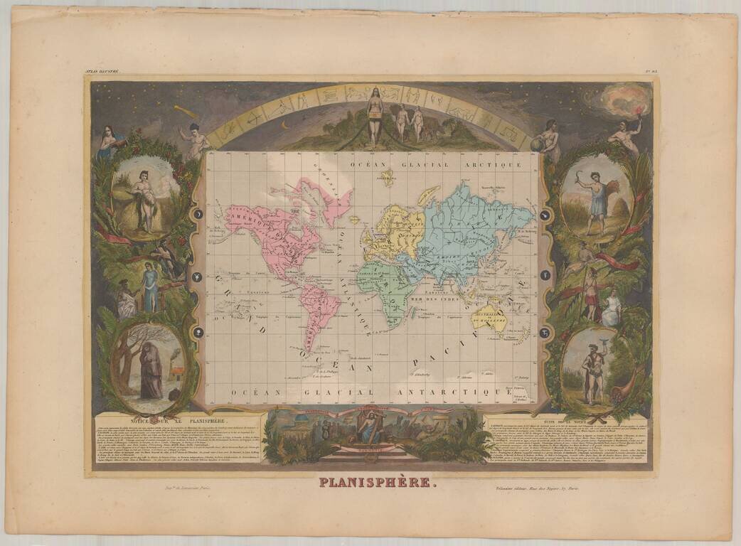
Decorative map of the world on Mercator's Projection, surrounded on all sides by decorative vignettes. This decorative map was engraved by Raimond Bonheur, father of the famous French artist Rosa Bonheur. Shows the World on Mercator's projection with...
![[World] Die ostliche und westliche Halbkugel Der Erde. Mit vielen Abbildungen aus der mathematischen und physicen Geographie -- Entworfen und gezeichnet fur den Schulgebrauch von G. A. St. Dewald, lithogaphirt von E. Winckelmann. (Zwei Chartern, jede 12](/map/small/63095.jpg)
Finely executed world map on a grand scale, prepared for use in schools. The surrounding borders are filled with illustrations from mathematical and physical geography Lithographed by E. Winckelmann. Rarity The map is very rare. OCLC locates 1...
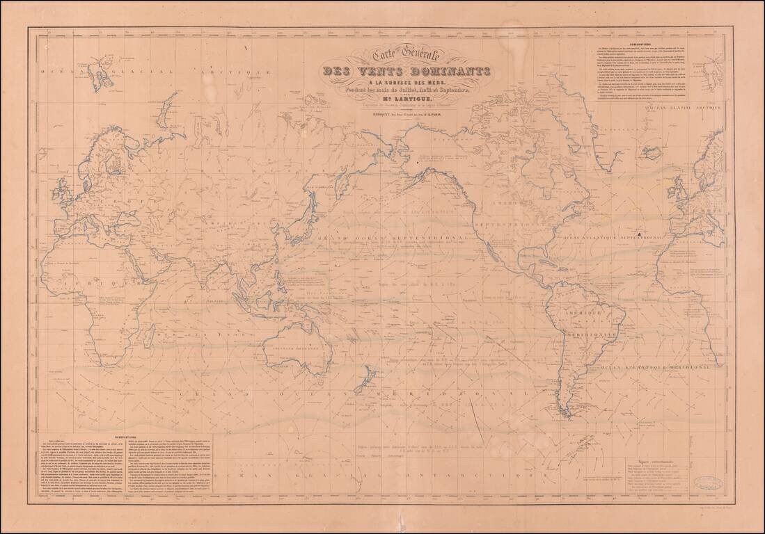
Extremely Rare Map of the World Showing Theory of the Winds Very rare map of the world showing the system of wind currents developed by French naval officer Joseph Lartigue. One of only two known examples and the only one in private hands, this world...
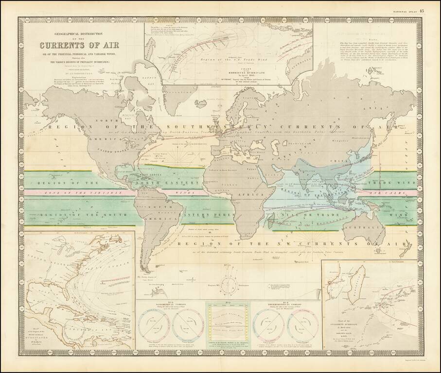
Fascinating map of the world, focused on hurricanes, air currents and other details. At the lower left is a model illustrating Hurricanes in the West Indian regions. At the top center is a model of the Rodriguez Hurricane of April 1843, the lower...
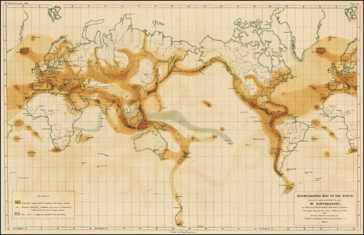
The First Seismographic World Map by The Father of Modern Seismography Rare example of the first-ever seismographic map of the world, published to illustrate the work of Robert Mallet and his son, John. The map bears the imprint of "G Falkner, Lith.,...
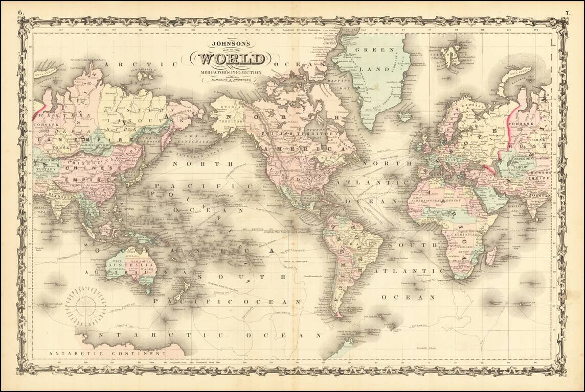
Detailed map of the world, hand colored by counties and showing a number of major explorers and shipping routes throughout the world. Still an incomplete knowledge of the Antarctic. A wonderful decorative map.
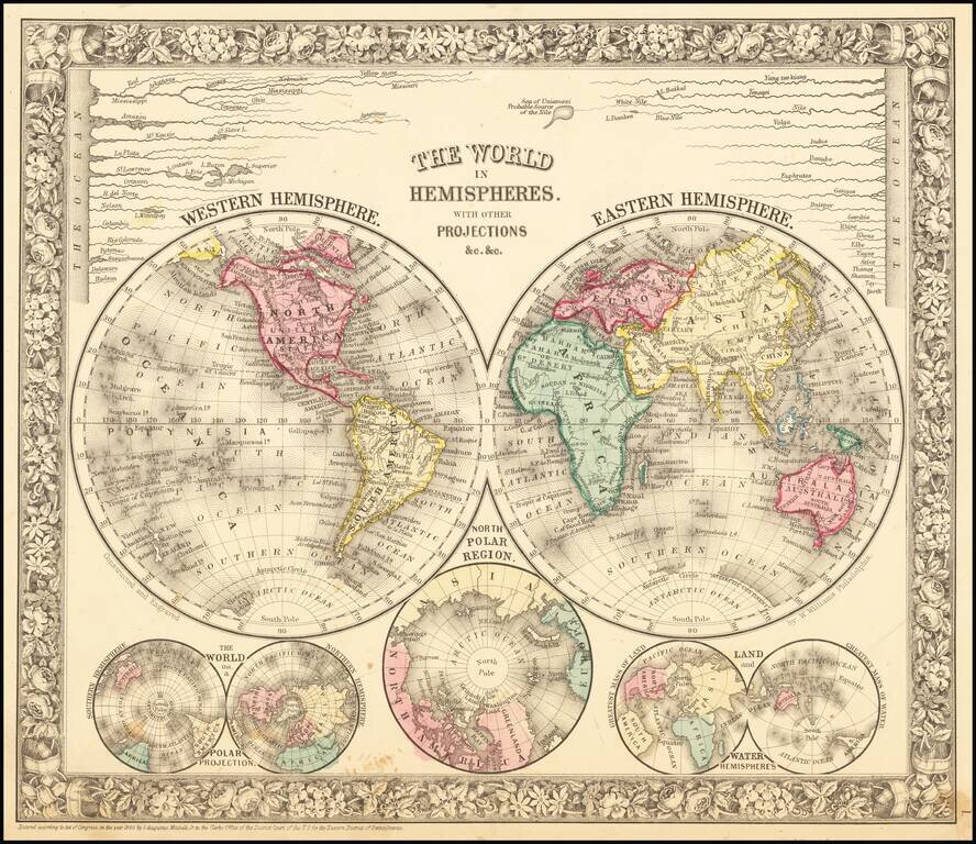
Decorative double hemisphere map of the world, with a number of other smaller hemispheric projections and projections of the world's rivers from this famous American Atlas. SA Mitchell Jr. acquired his father's former business from DeSilver in 1860...
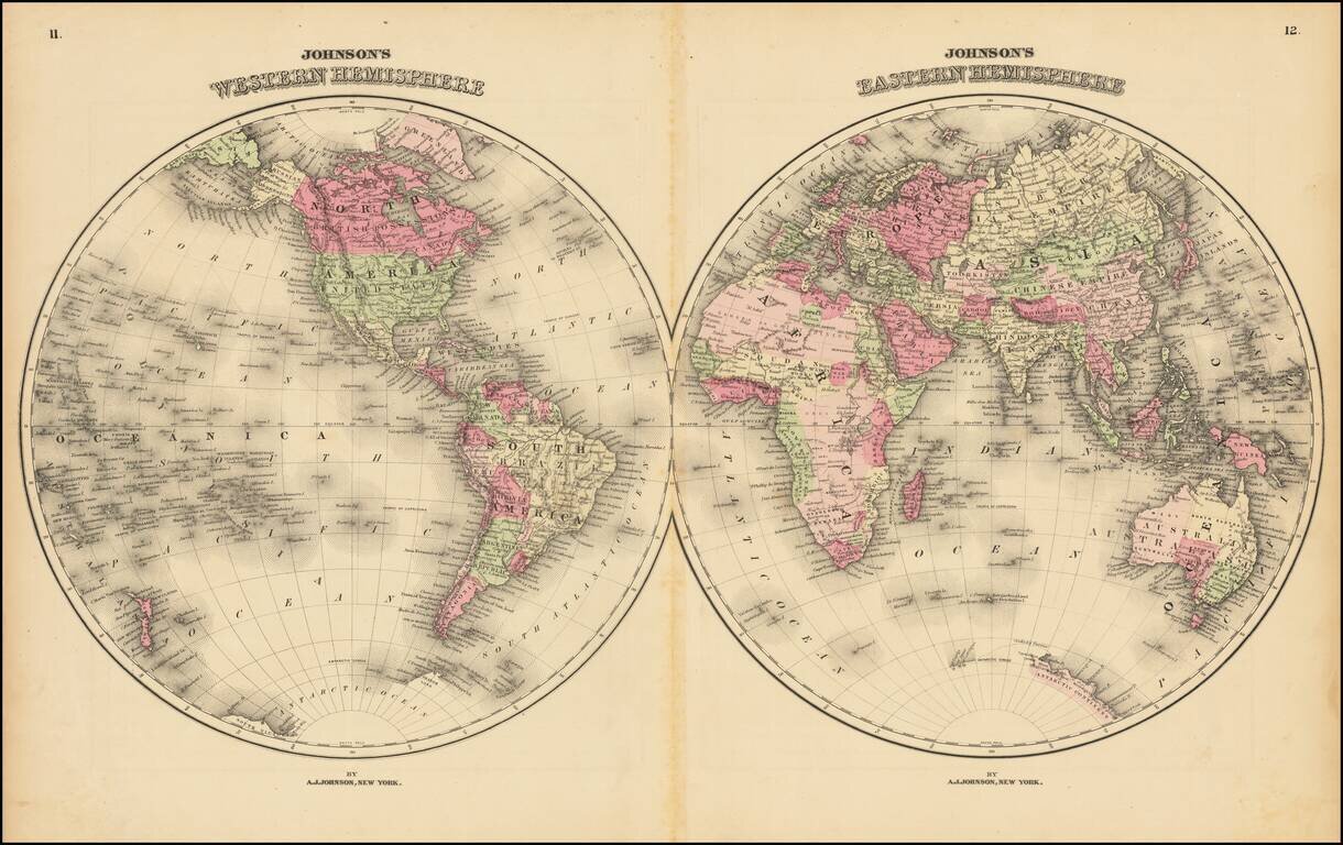
Large and detailed double hemisphere map of the World, in nice wash colors. Shows early (but still quite limited) knowledge of the Antarctic Coastline and the NW Passage. From one of the major American map publishers, during the second half of the...
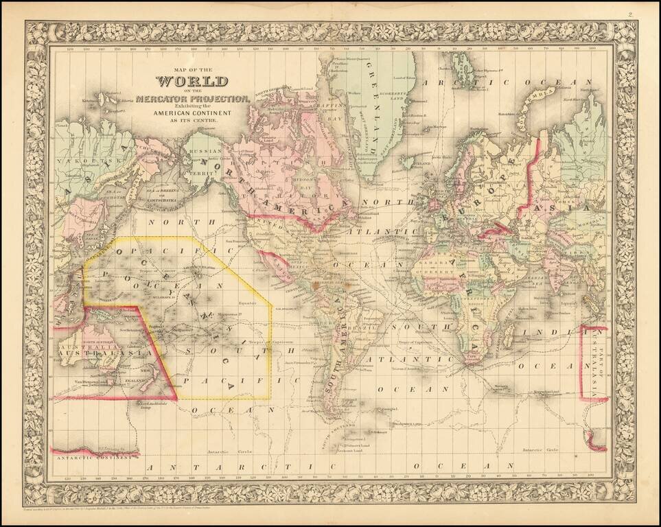
Decorative mid 19th Century map of the world, with an interesting twist, in that the Americas are at the center of the map. Shows the tracks of the various 18th & 19th Century explorers, including Cook, Gore, US Ex Ex, Ross, and Clarke.

Scarce Spanish map of the world by Jose Pilar Morales. The map shows the world on a homolographic projection, an equal-area projection in which the proportion between regions of unequal area is correctly shown. The map is set in Spanish text which...
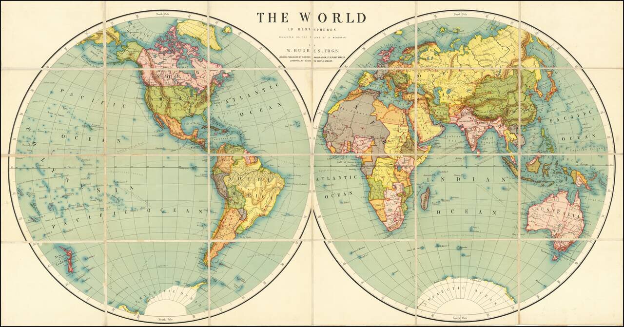
Fine large world map, illustrating the world in two hemispheres at the end of the 19th Century.
![[Wall Map of the World] Mappemonde Dressee et Grave Specialement pour Le Petit Journal D’apres les Documents le Plus Regents . . .](/map/small/70573rd.jpg)
Decorative Wall Map of the World, Illustrating the Manner of Dress of All The Peoples of the World Fine double hemisphere world map, drawn by Menetrier, and engraved and printed by E. Charaire in Paris. The map is a fine example of a World Map as an...
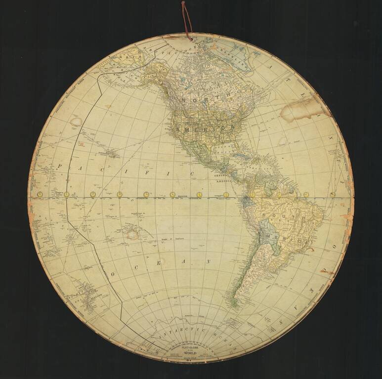
A Two-Sided Flat Earth Globe? Fascinating "Flat-Globe" of the World, published in New York by the International Globe Company. Includes a note that it was edited by Robert Peary, the American explorer and United States Navy officer who made several...
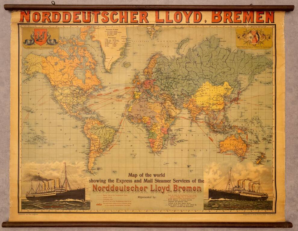
Fine promotional wall map of the world, promoting the Norddeutscher Lloyd line of Bremen. The map focuses on the routes of the Norddeutchser Lloyd Line, an important global steamship line in the 19th and 20th centuries. The routes of the line are...
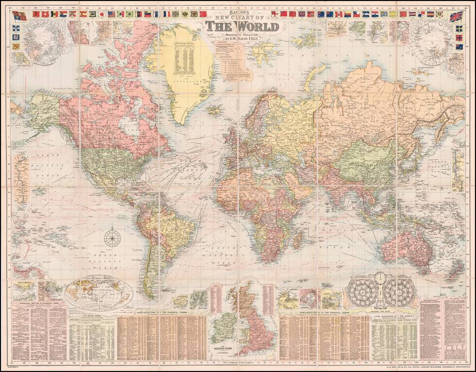
A Grand Map of the World At The Height of the British Empire Decorative large format map of the world, showing the British Empire, at its height. Around the map are inset details: with plans of towns including Hong Kong, Singapore, Sydney and New...