logo

1815. Mappe-Monde

  • Mappe-Monde

Map size in jpg-format: 8.56335MiB

Download "Mappe-Monde", in high resolution.

Mappe-Monde information:

Year of creation: 
Resolution size (pixels): 
 8670x4577 px
Disk Size: 
 8.56335MiB
Number of pages: 
 1
Place: 
 n.p.
Author: 

Print information. Print size (Width x height in inches):
Printing at 72 dpi 
  120.42 х 63.57
Printing at 150 dpi 
 57.8 х 30.51
Printing at 300 dpi 
 28.9 х 15.26

An example of detailing the file of this map of in a printable high-resolution:

Click to open in high resolution (open in new tab).
Attention! this is just the central piece (central area 960x960 px) of the map file!
This is an example, so that you can see and study the level of detail of a given map. The entire Map will be fully available after payment!

Mappe-Monde

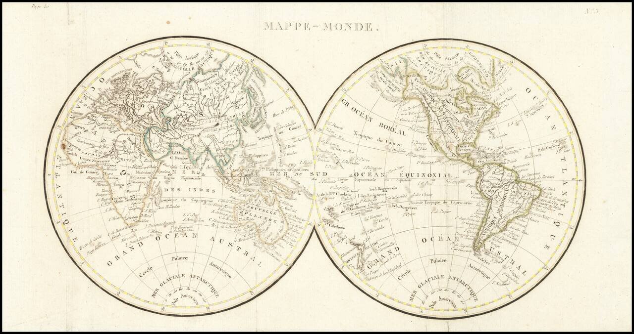
Double hemisphere map of the world, issued early in the 19th Century.

We date the map based upon the configuration of the Rocky Mountains, which is in the style of Alexander von Humboldt and the presence of the Bass Strait, between Tasmania and the mainland of Australia.


Special conditions for students!

If you are a student, write to us in telegram: @antiquemaps and indicate what material you need and for what work you need a map in high detail. We are ready to provide material on special terms. For students only!

Item information:

Year of creation:
Size:
8670x4577 px
Disk:
8.56335MiB
Number of pages:
1
Place:
n.p.
Author:
Anonymous.
$14.99

Related item