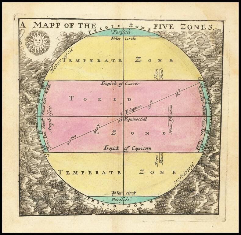
A little gem of map, being John Seller's representation of the ancient concept of zones of the earth, published in his miniature Atlas Terrestris, circa 1700. The map is a great example of the characteristic Seller engraving style, with the sun and...
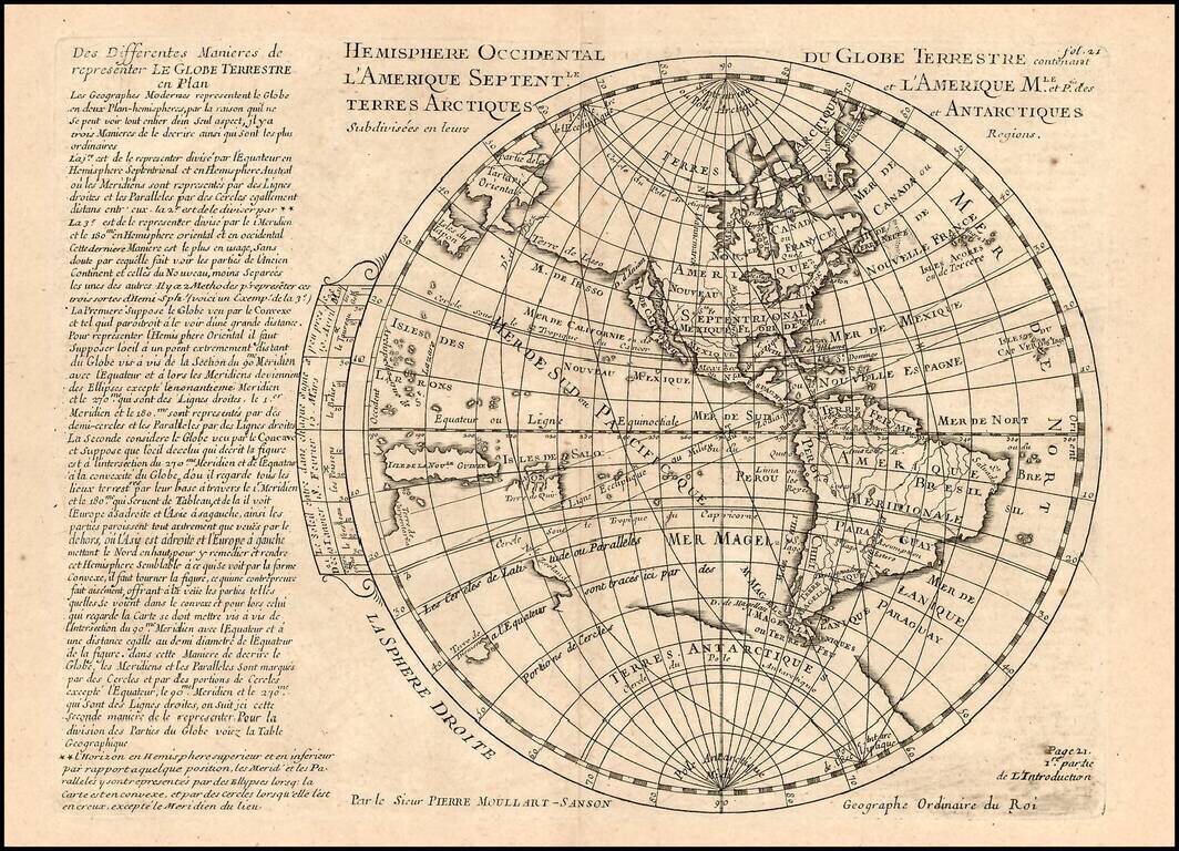
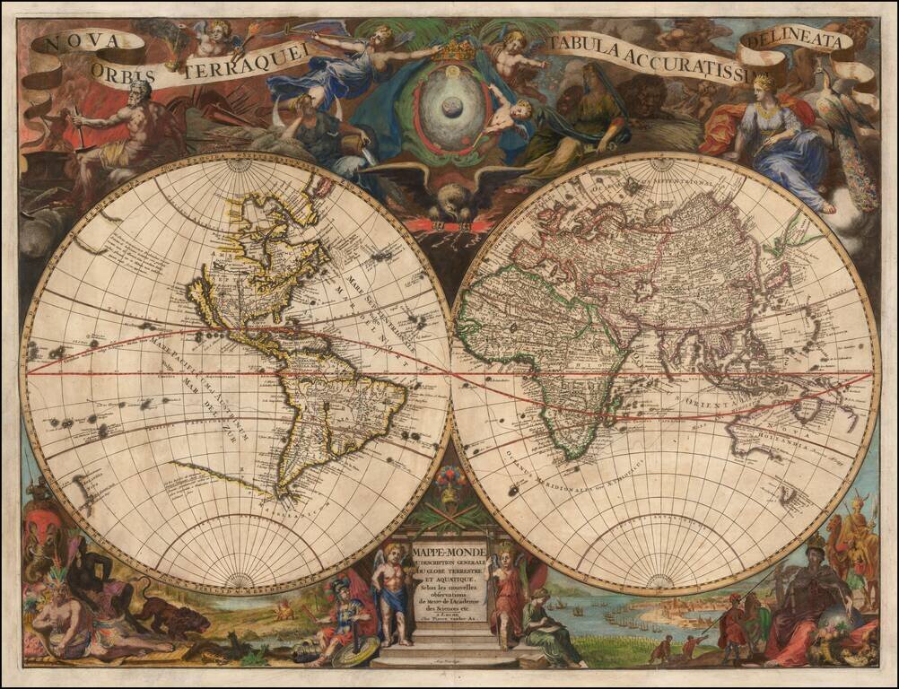
Rare map of the Western Hemisphere, from a very rare work by Pierre Moullart Sanson, the grandson of Nicolas Sanson the Elder. The map is part of a series of maps intended to depict the various ways of depicting the Globe.
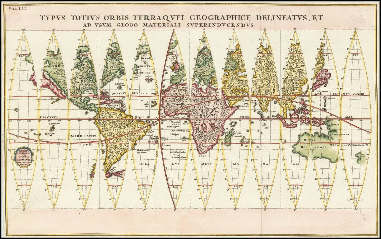
Dynamic Set of Globe Gores Showing California as an Island Fine example of Heinrich Scherer’s globe gores, included in his eight-volume atlas of 1703. The world map includes California as an island and a hypothetical depiction of Australia. The...
![[Proietio Optica Hemisphaerii Polaris Arctici]](/map/small/59287.jpg)
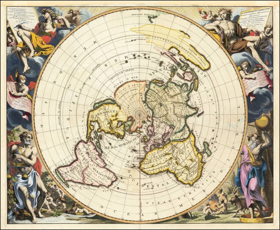
Unusual World map on a North Polar projection, with a highly enlarged depiction of Greenland and Iceland and celestial model in the upper right. The map shows California as an Island and a potential NW Passage and also a possible continuous landmass...
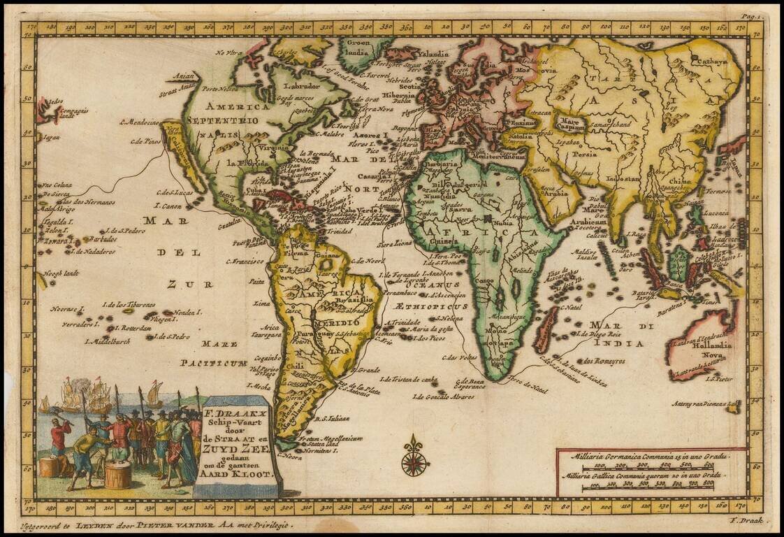
Striking world map illustrating Sir Francis Drake's circumnavigation of the globe. The map shows Drake's route from London through the Straits of Magellan, up to the northern part of the Island of California, across through the Ladrones and the...
![[Title Page] Atlas Novus Terrarum Orbis Imperia Regna et Status exactis Tabulis Geographice demonstrans . . .](/map/small/54916.jpg)
Highly decorative title page, from Homann's Atlas Novus. Includes an allegorical image of Atlas holding the World aloft, along with images of Triton, Mercury and a number of other gods, overlooking a projection of the Globe showing Africa and Europe....
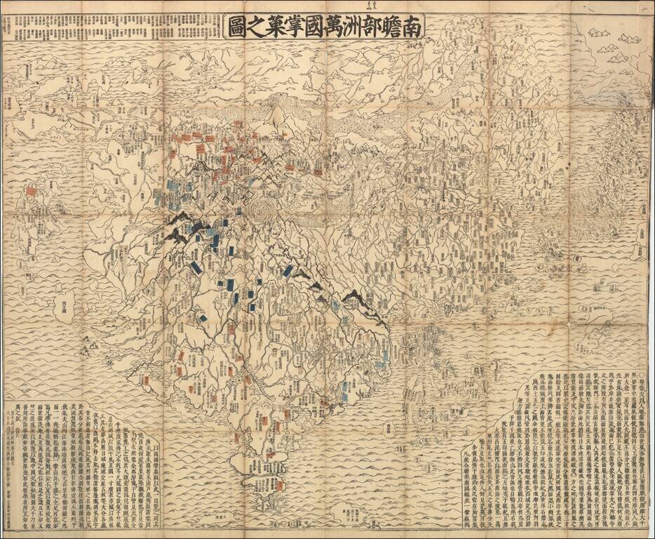
A Buddhist Worldview -- From the Original Sanskrit Nice example of Rokashi's world map, with the addition of small strips of paper translating placenames from the original Chinese/Sanskrit transliteration to a more modern Japanese version of the same...
Dramatic double hemisphere map of the World, published in Ledien by Pieter Van Der Aa. The map includes an unnamed set sailing tracts. California is shown as an island. The Mississippi River and Great Lakes are based upon early 18th Century French...
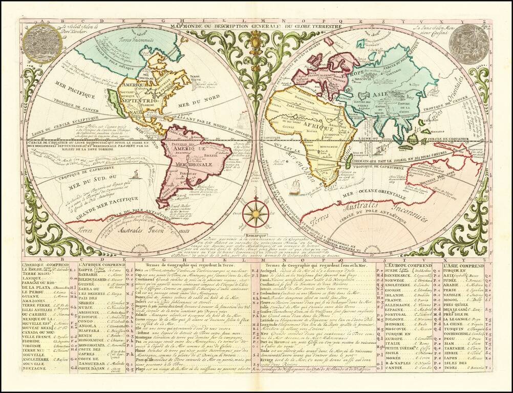
Fine example of Vander Aa's map of the World, utilizing Casini's important north polar projection. The map is a close copy of the extremely rare Cassini-Nolin map issued in 1696 which was one of the most carefully prepared and scientifically accurate...
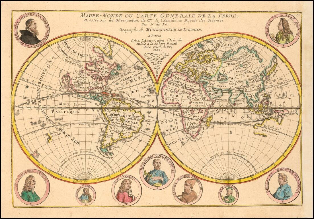
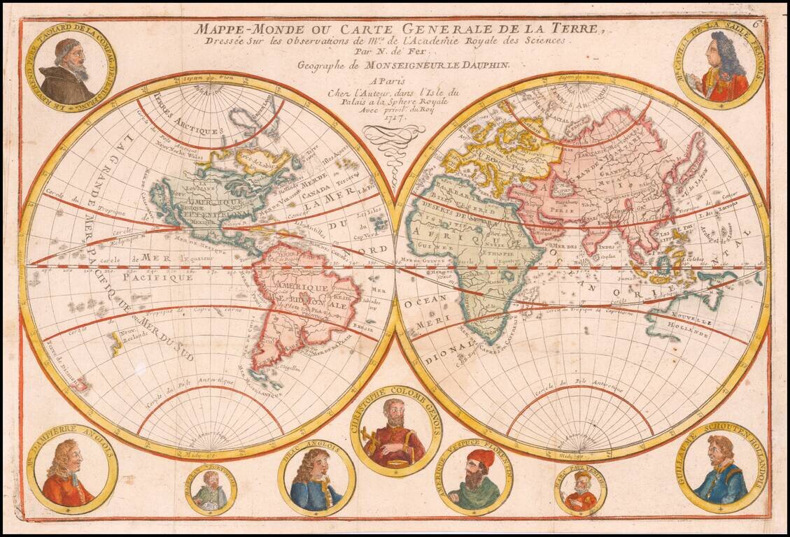
With Portraits of the Great Explorers Decorative map of the World depicting both the Western and Eastern Hemispheres. In the west, the map shows California as an Island, the Northwest Passage, an interesting misprojection of the Great Lakes, and the...
Decorative double hemisphere map of the World, published by one of Paris's leading mapmakers, Nicolas De Fer in 1700. In the west, the map shows California as an Island, the Northwest Passage, an interesting misprojection of the Great Lakes, and the...
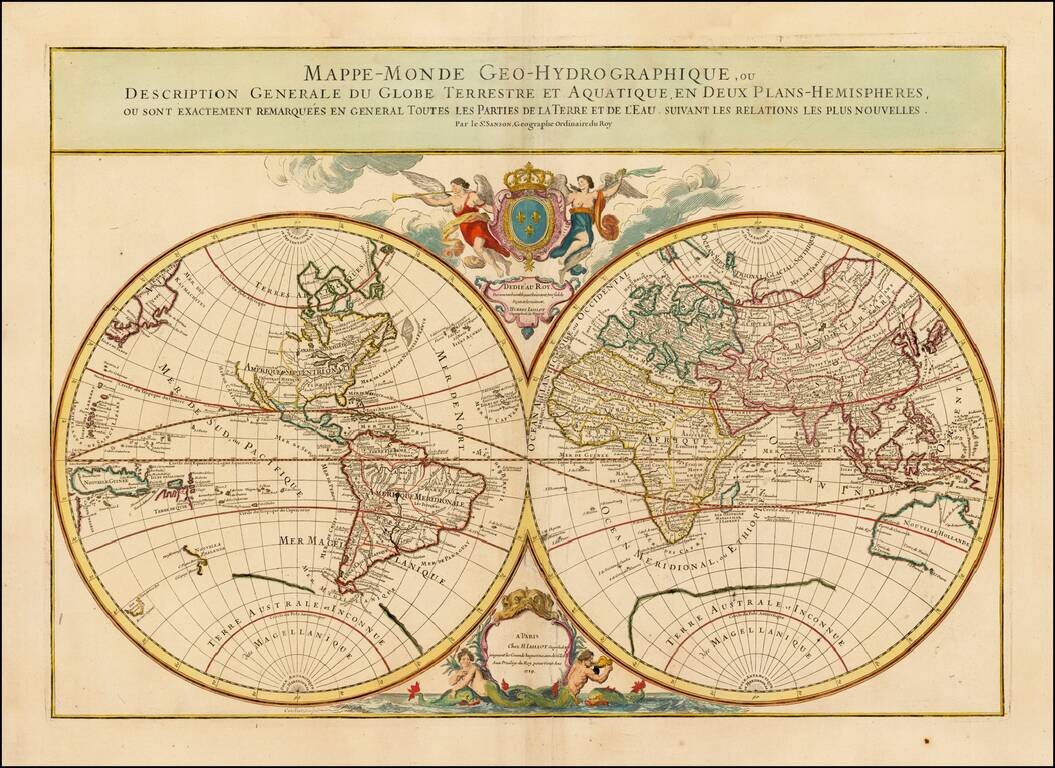
Fine Double-Hemisphere World Map—Jaillot’s Final World Map Fine example of Hubert Jaillot's final double hemisphere map of the world, first published in 1695. This is the later state of the map; the primary difference between this and the early...
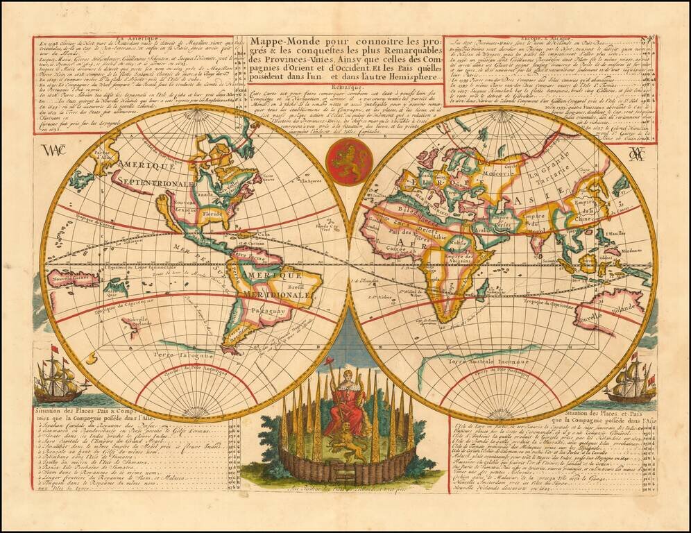
Decorative double hemisphere map of the World, intended to illustrate the successes of the Dutch East India and Dutch West India Companies throughout the world. Shows an incomplete Australia and New Zealand, along with California as an Island and a...
An Unusual Treatment of Australia and the Unknown Southern Continent Decorative world map, showing California as an island, the tracks of several explorers around the world and Celestial images of the sun Kircher and the moon by Cassini. The map...
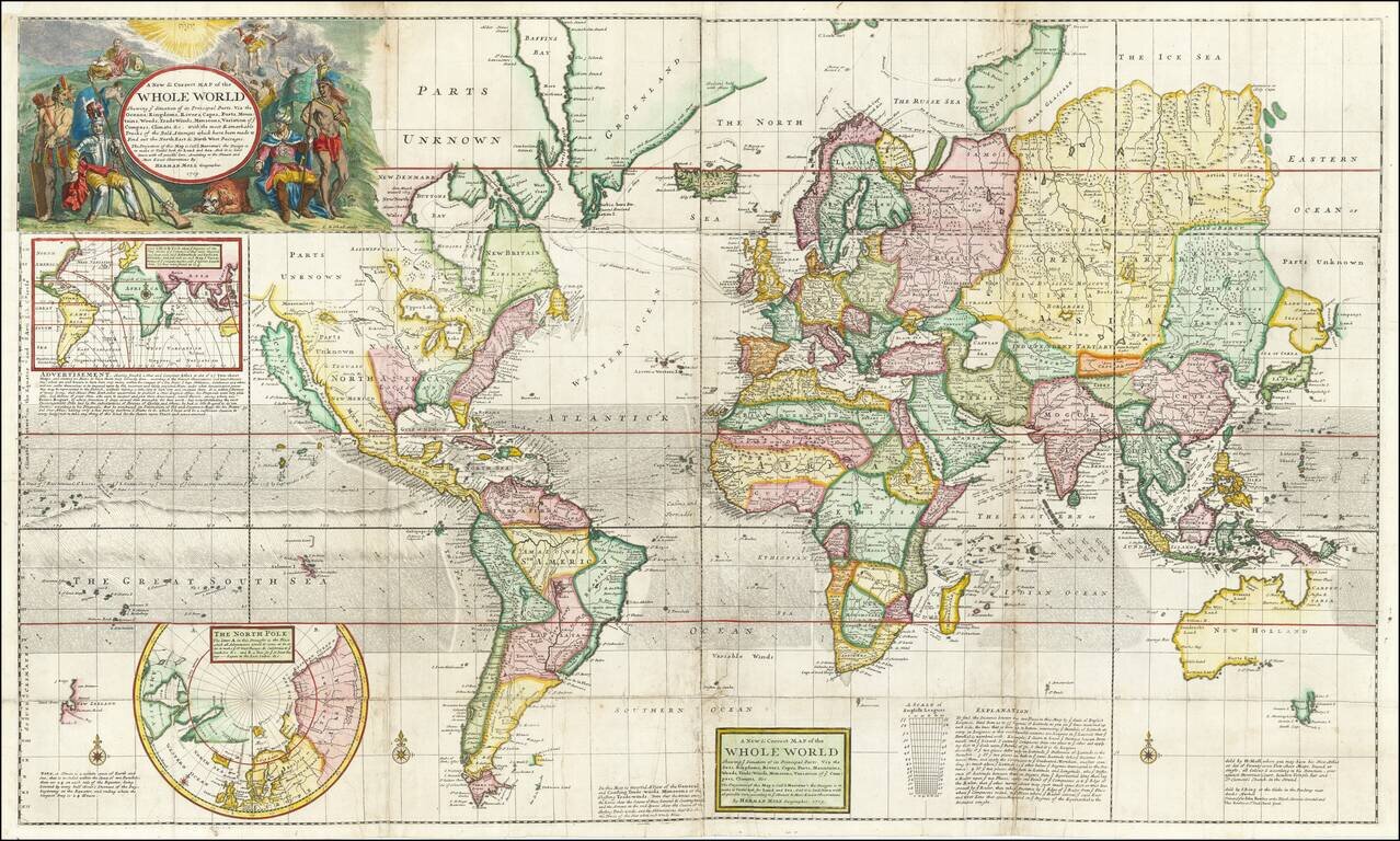
Early 18th Century English Wall Map of the World Striking example of Herman Moll's extraordinary 4-sheet map of the World on Mercator's projection, showing the routes of the explorers who had sailed in search of the Northwest and Northeast Passages....

Fine set of three scientific instruments, engraved for Johann Baptiste Homann in Nuremberg. Included are decorative illustrations of a celestial globe, terrestrial globe and armillary sphere, with an explanation in Latin.