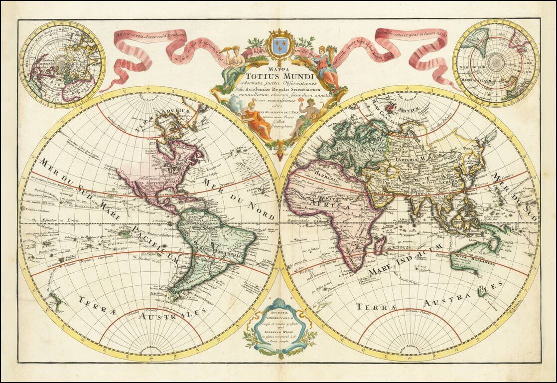
Rare double hemisphere map of the World by Jeremias Wolff in Augsburg. The map is very similar to a double hemisphere map by Lotter, however it is rarer. Wolff was an important Augsburg publisher at the end of the 17th and beginning of the 18th...
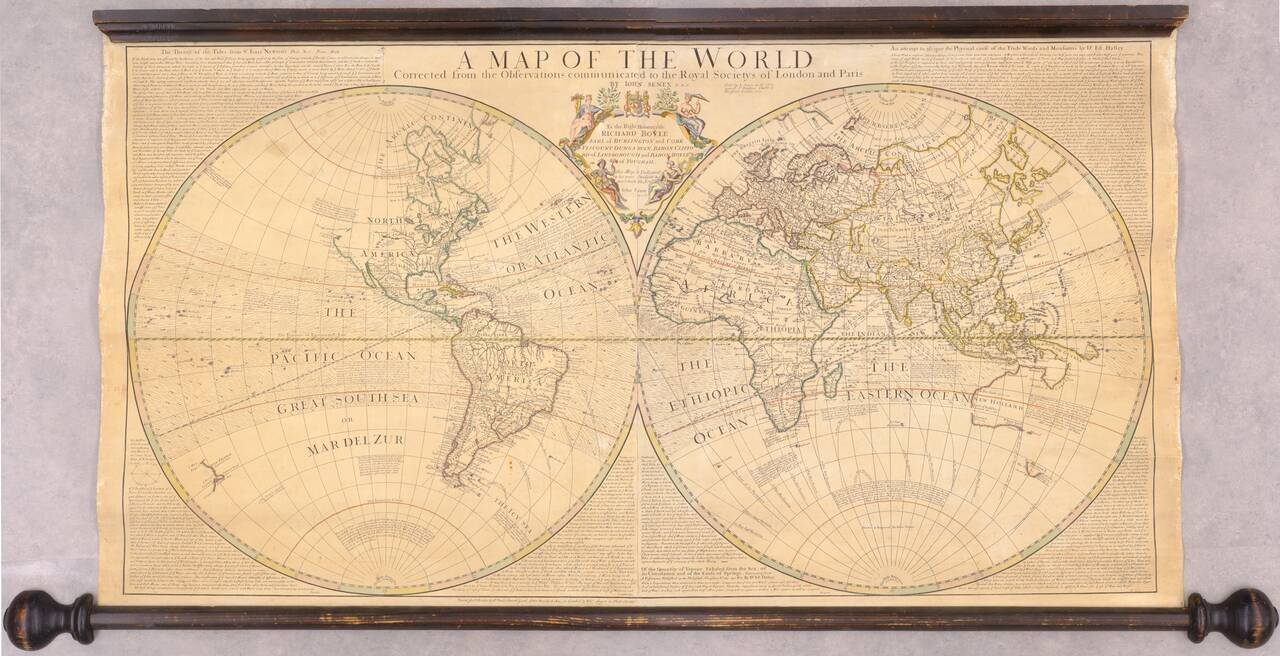
Fine double hemisphere map of the World, published by John Senex in London. A beautiful large scale map of the world, surrounded by text from some of the leading scientists of the day. Top left: "The Theory of the Tides from Sr. Isaac Newton's...
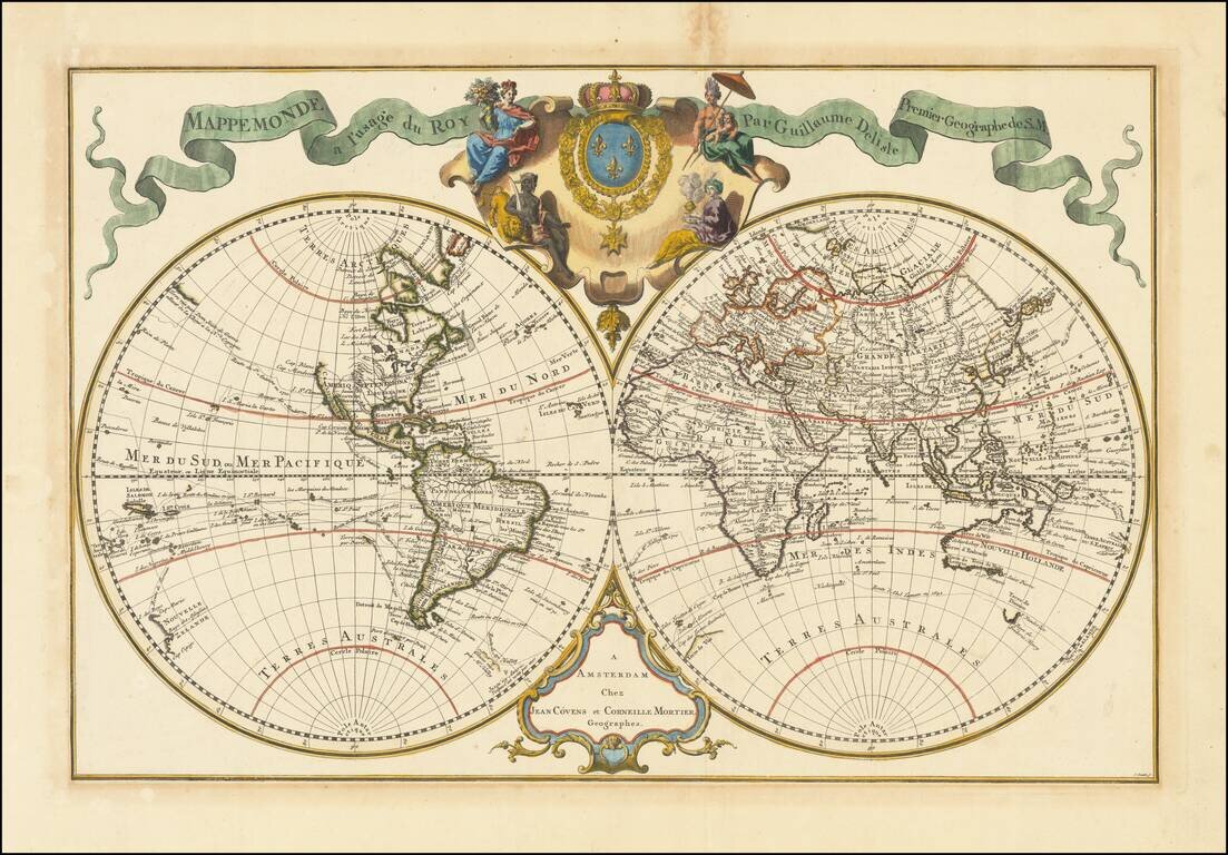
Nice Example of Covens & Mortimer's De L'Isle World Map Showcasing European Exploration This is an example of a first edition of Covens' and Mortiers' decorative double hemisphere map of the world by De L'Isle. It shows the extent of oceanic...
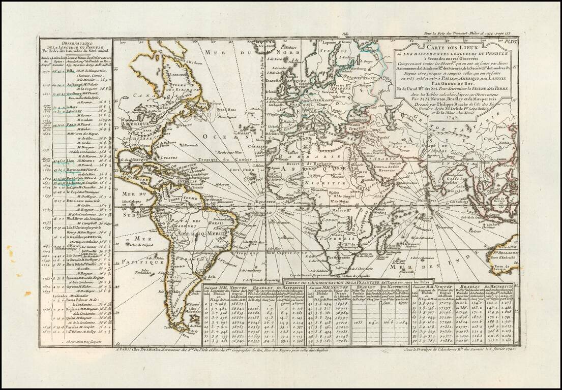
Comparing the Observations of Newton, Bradley and Maupetius Rare map centered on Europe, without the western part of North America or the Pacific. The map includes tables showing variations in longitude and latitude, as calculated by Newton, Bradley...
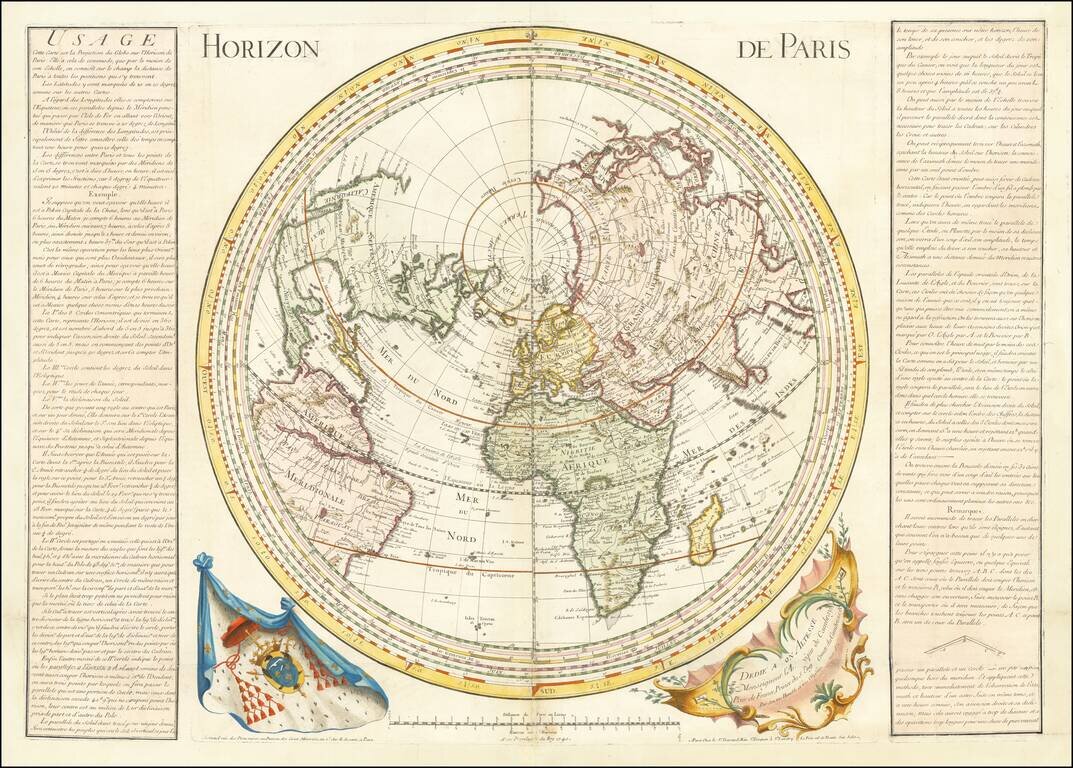
Unusual, Separately-Issued World Map on the Horizon of Paris First published in Paris in 1739, this map shows the world projected around the meridian of Paris, one of several competing prime meridians in the eighteenth century. In the bottom right...
![[World]](/map/small/70616.jpg)
Improving Upon A Classic Dutch Double Hemisphere World Map Striking double hemisphere Dutch bible map published by the Keur family. The map is embellished with female allegorical figures representing America, Asia, Europe and Africa, based on early...
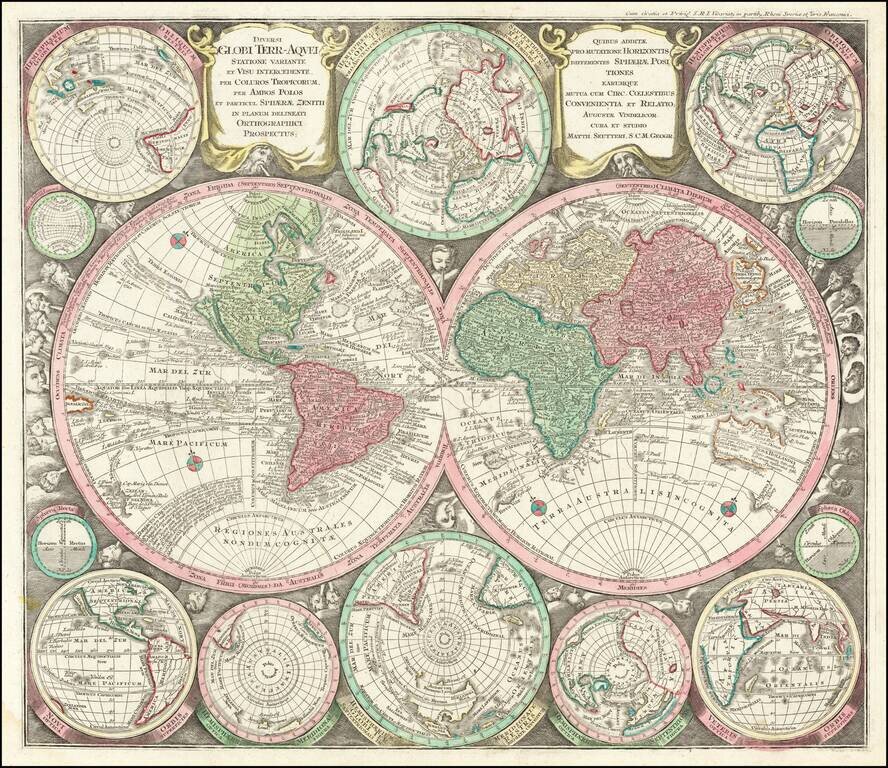
Fine Double-Hemisphere World Map, Combining the Latest Scientific Theories and Older Decorative Details Striking double-hemisphere world map combining scientific diagrams with decorative imagery. Based on Carel Allard’s influential map of 1696, it...
Rare Leipzig Bellin’s World Map Showing Both the Latest Discoveries and Lingering Geographic Questions Rare Leipzig edition of J.N. Bellin's influential mid-eighteenth-century map of the world, first published in Paris in 1748. The map shows...
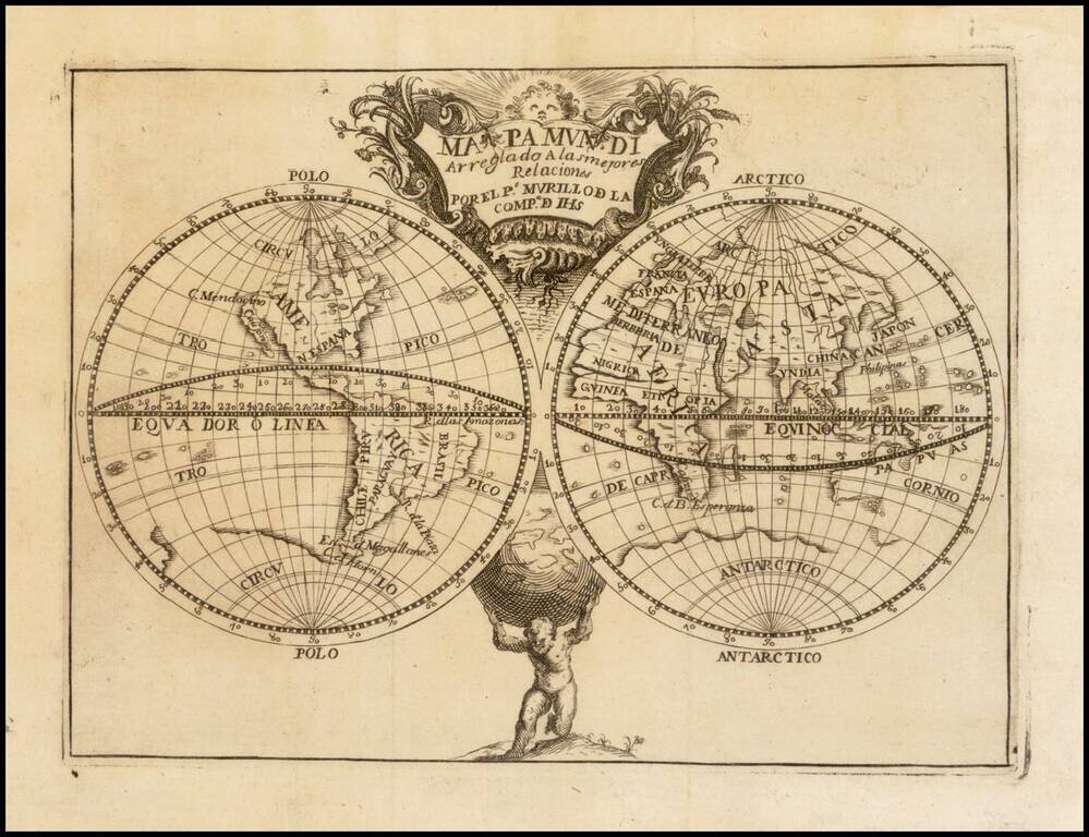
A Map of the World Naming the Philippines, by Murillo Velarde, the Greatest Mapmaker in Philippines History. Engraved map of the world by Murillo Velarde, issued as the world map in his magnum opus on historical geography: Geographia Historica......
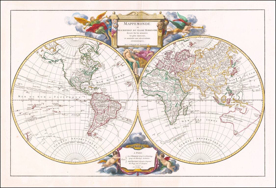
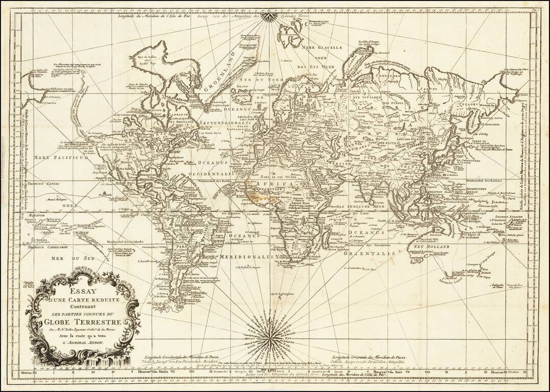
Striking Double Hemisphere Map of the World Showing the Latest Discoveries in the 1740s Fine large double hemisphere map of the world by renowned French mapmaker Gilles Robert de Vaugondy in 1752, first published in 1752. It shows the Anson...
![Planisphere Physique ou l'on voit du Pole Septentrional ce que l'on connoit de Terres et de Mers Avec les Grandges Chaines de Montagnes . . . [Bay or Sea of the West]](/map/small/70578.jpg)
Scarce Buache Map of the World's Watersheds, One of the First Thematic Maps Fine example of Buache's watershed map of the world, on a North Polar projection. The map shows how mountain chains affect the flow of water into the various oceans. The map...
![Hemisphere Occidental ou du Nouveau Monde . . . [and] Hemisphere Oriental ou de L'Ancien Monde . . . MDCCLXI](/map/small/64273.jpg)
First State of An Important Enlightenment Era Mapping of the World Marvelous pair of large scale maps of the Eastern and Western Hemisphere, showing the known World on the eve of the first Voyage of Captain James Cook. The map is a fine example of...
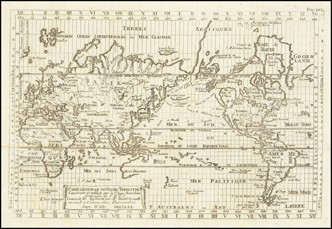
Reduced Venetian engraved copy of Isaac Brouckner's famous sea atlas of 1749, the first Prussian "Sea Atlas", published by Remondini in 1761. Our example of the original Isaac Brouckner 12-sheet wall map can be seen here:...
Finely engraved map of the World, from Jacques Nicolas Bellin's Le Petit Atlas Maritime Recueti de Cartes et Plans des Quatre Parties du Monde en Cinq Volumes, first published in Paris in 1764. The map shows Australia and New Zealand on the eve of...

Interesting map of the Eastern Hemisphere showing explorers' routes with dates, an early projection of Australia, with Van Diemen's Land attached and speculative coastlines along most of the Southern and Eastern Coasts. A fine map from Brion De La...
![Globe Terrestre [and] Globe Celeste](/map/small/62556.jpg)
Attractive pair of engraved globes, illustrating the Terrestrial World and Celestial World. The Terrestrial Globe is oriented to show the Eastern Hemisphere, including a wild mid-18th Century illustration of Australia. The Celestial Globe is oriented...