Map size in jpg-format: 197.052MiB
Click to open in high resolution (open in new tab).
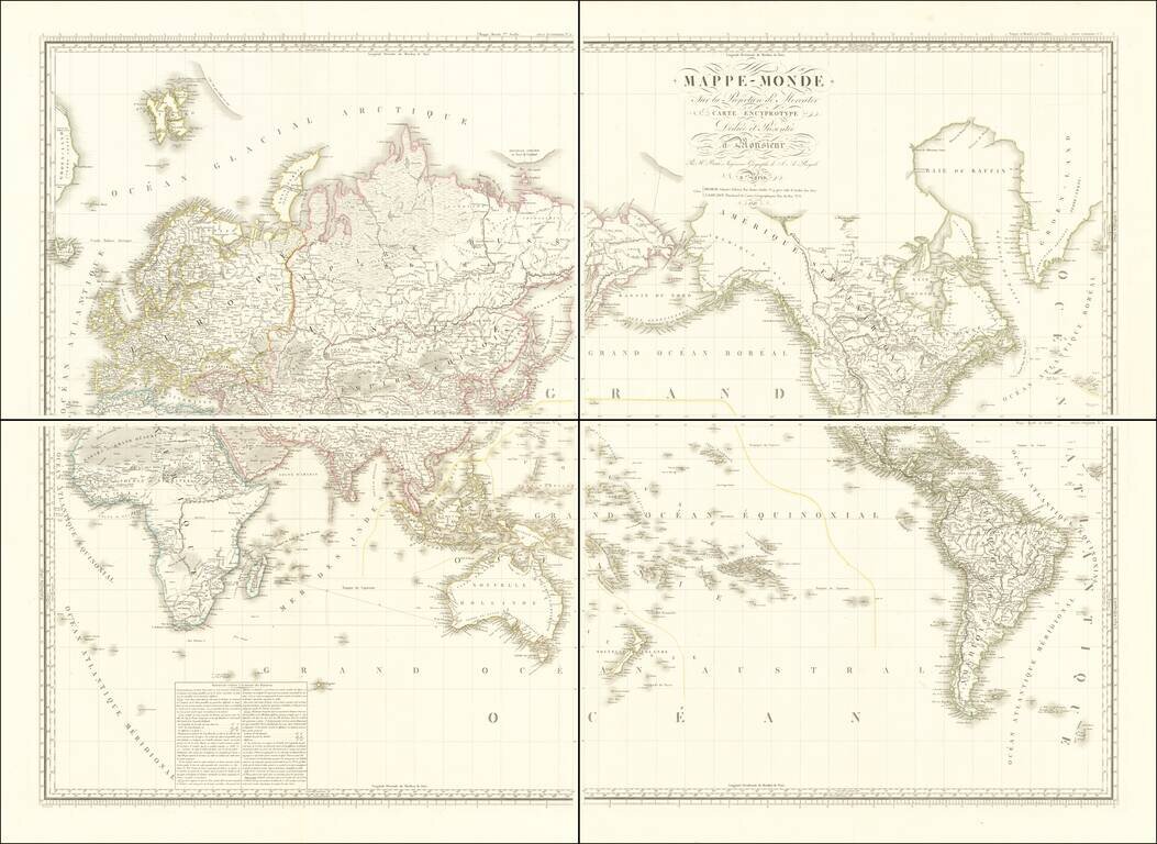
Impressive four-sheet wall map of the world, published by Brué in Paris in 1816.
The map depicts the Pacific at its center. This approach became popular in the late 18th and early 19th century as the great Pacific explorations filtered into the public consciousness.
In North America, the map includes an early rendition of Lewis & Clark's mapping of the Transmississippi West.
In Africa, the mapping reflects a growing European appreciation of their lack of knowledge about the interior of the continent.
The map appeared in Brué's Atlas Encyprotype, which included a series of four-sheet wall maps along with single sheet reductions of those larger maps.
Andre Hubert Brué was a French geographer and cartographer. Born in Paris, he served in the French Navy, joining the Baudin expedition to the Pacific (1800-1804). After his sea service, Brué applied his navigation and charting skills to creating finely-crafted maps, which were renowned for their crisp engraving and accuracy. He drew directly on the copper of the plate, creating what he called encyprotypes. He is best known for the Atlas universal de géographie physique, politique, ancienne et moderne.
If you are a student, write to us in telegram: @antiquemaps and indicate what material you need and for what work you need a map in high detail. We are ready to provide material on special terms. For students only!


