logo

1816. (Hand Drawn World Map) A Map of the World. Drawn and Painted at Lynn Academy. By Phebe Phillips 1816

  • (Hand Drawn World Map)  A Map of the World. Drawn and Painted at Lynn Academy.  By Phebe Phillips 1816

(Hand Drawn World Map) A Map of the World. Drawn and Painted at Lynn Academy. By Phebe Phillips 1816 information:

Year of creation: 
Resolution size (pixels): 
 17559x12019 px
Disk Size: 
 32.4184MiB
Number of pages: 
 1
Place: 
 Lynn, MA
Author: 

Print information. Print size (Width x height in inches):
Printing at 72 dpi 
  243.88 х 166.93
Printing at 150 dpi 
 117.06 х 80.13
Printing at 300 dpi 
 58.53 х 40.06

An example of detailing the file of this map of in a printable high-resolution:

Click to open in high resolution (open in new tab).
Attention! this is just the central piece (central area 960x960 px) of the map file!
This is an example, so that you can see and study the level of detail of a given map. The entire Map will be fully available after payment!

(Hand Drawn World Map)  A Map of the World. Drawn and Painted at Lynn Academy.  By Phebe Phillips 1816

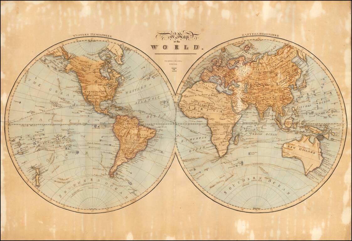
A Large Skillfully Drawn Schoolgirl Map of the World

Finely executed hand drawn map of the world by Phebe Phillips of the Lynn Academy.

The detail and size of this world map are quite exceptional.

Lynn Academy

The Lynn Academy occupied a building erected for the purpose on the site now known as 170 South Common Street, and was opened April 5, 1805. William Ballard served as its first preceptor.


Special conditions for students!

If you are a student, write to us in telegram: @antiquemaps and indicate what material you need and for what work you need a map in high detail. We are ready to provide material on special terms. For students only!

Item information:

Year of creation:
Size:
17559x12019 px
Disk:
32.4184MiB
Number of pages:
1
Place:
Lynn, MA
Author:
Phebe Phillips.
$14.99

Related item