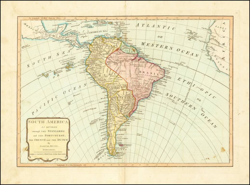
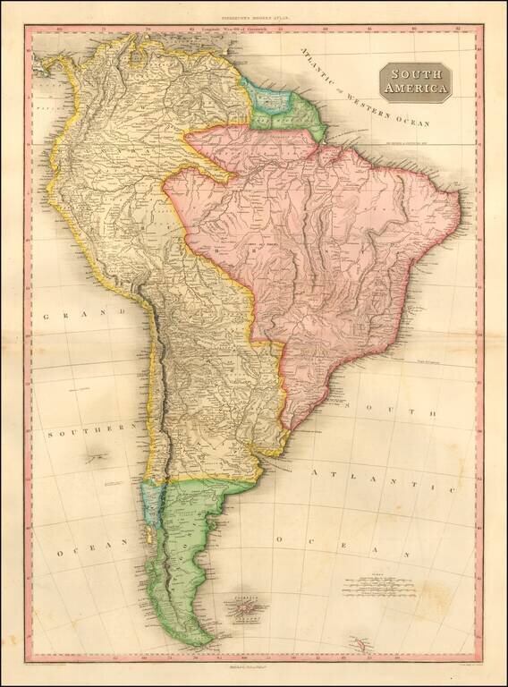
From Dunn's New Atlas or Mundane System of Geography, published by Laurie & Whittle. The map shows South America on the eve of several decades of Revolution and Independence from Spain and Portugal.
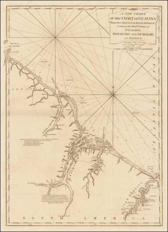
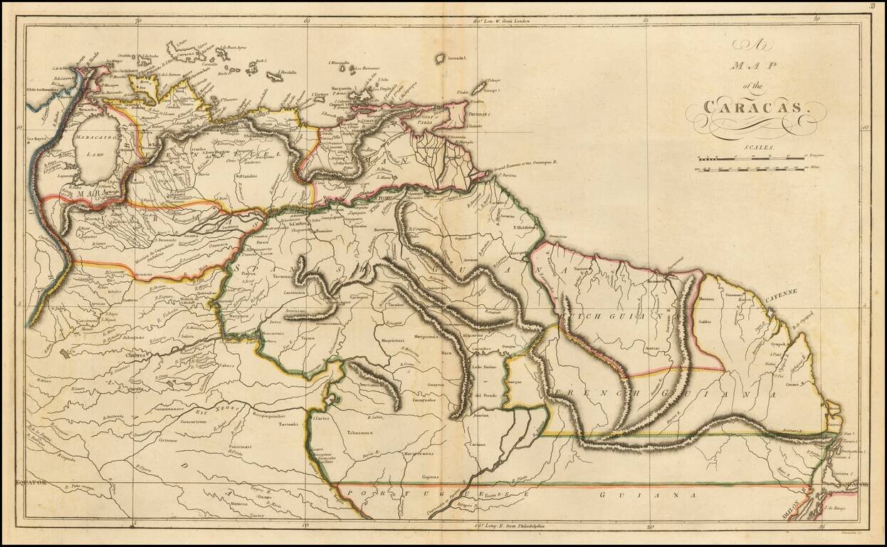
Significantly revised and updated version of Laurie & Whittle's chart of the Dutch Colony of Guayana, from Jeffery's West India Atlas. The present chart has been significatnly updated from earlier editions.
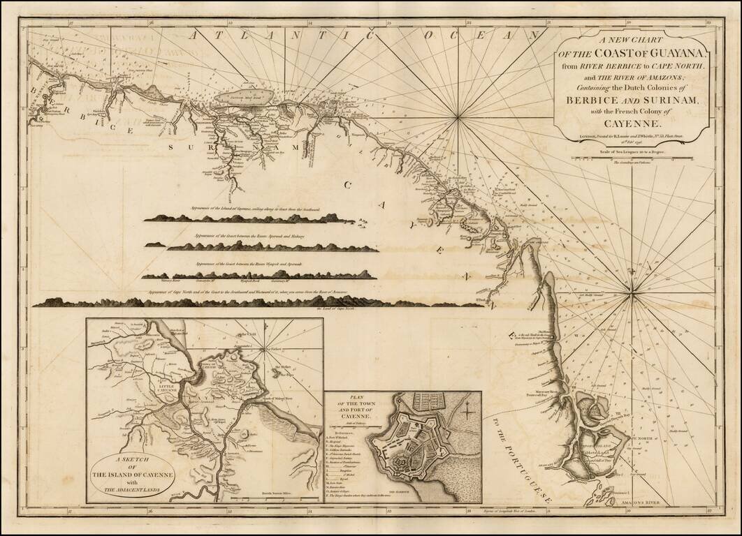
Significantly revised and updated version Laurie & Whittle's chart of the Dutch and French Colonies in Guayana, from Jeffery's West India Atlas.
![[Unrecorded First State] Columbia Prima or South America, in which has been Attempted to Delineate the Extent of our Knowledge ... Extracted Chiefly from ... Manuscript Maps of ... Pinto ... Rocha ... Ferreira ... Sobreviela ... by ... Louis Stanislas D'](/map/small/52063.jpg)
Unrecorded First State of The Best English Map of South America of The Early 19th Century -- Prince Augustus Frederick, Duke of Sussex Copy Exceptional map of South America, at the outset of its Century of Independence, without question the finest...
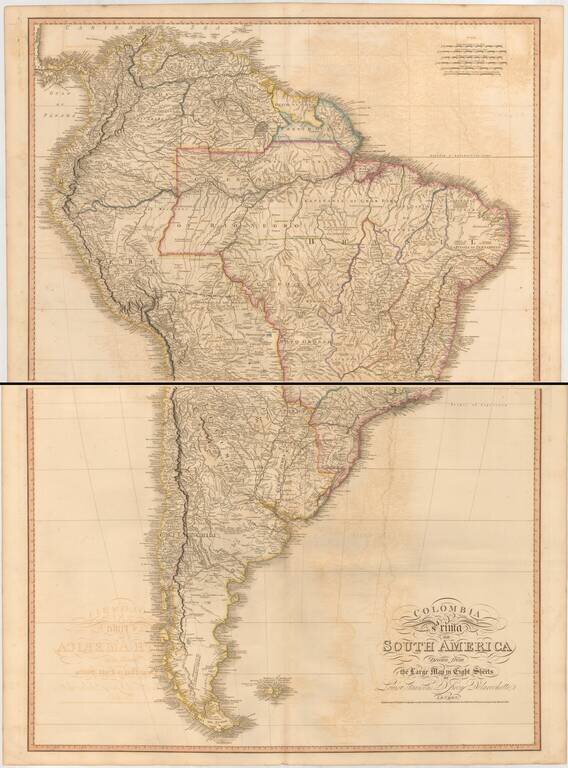
John Cary's 1807 two-sheet English language map of South America. Shows towns, rivers, mountains, lakes, islands, etc. The Amazon region is still relatively unknown.
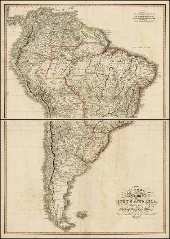
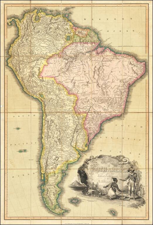
Exceptional map of South America, at the outset of its Century of Independence. The map is a fine large format two sheet version of one of the great maps of South America, drawn from Faden's 8 sheet map of South America, issued in 1807. One of the...
Two sheet edition of this exceptional map of South America, at the outset of its Century of Independence, without question the finest large format commercially published map of South America published in the early 19th Century. The map is based upon...
Detailed early map of the coast of Venezuela and contiguous islands (Curacao, Bonaire, Aruba, Tortuga, Trinidad, Tobago, etc.) The map was issued 3 years after 7 of the 10 provinces of the Captaincy General of Venezuela declared its indendence from...
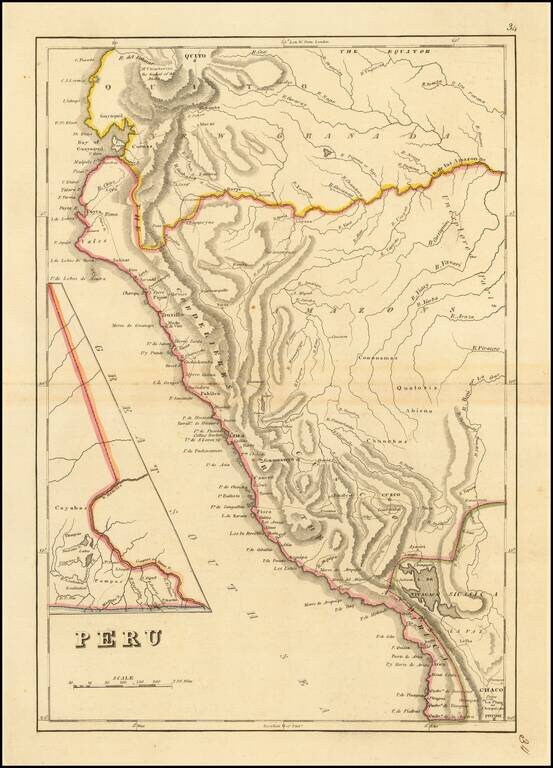
Peru at the Dawn of Its Indpendence Movement Detailed map of Peru, from a scarce late edition of Mathew Carey's General Atlas, the first atlas published in America. In 1808, Napoleon invaded the Iberian Peninsula and took the king, Ferdinand VII,...
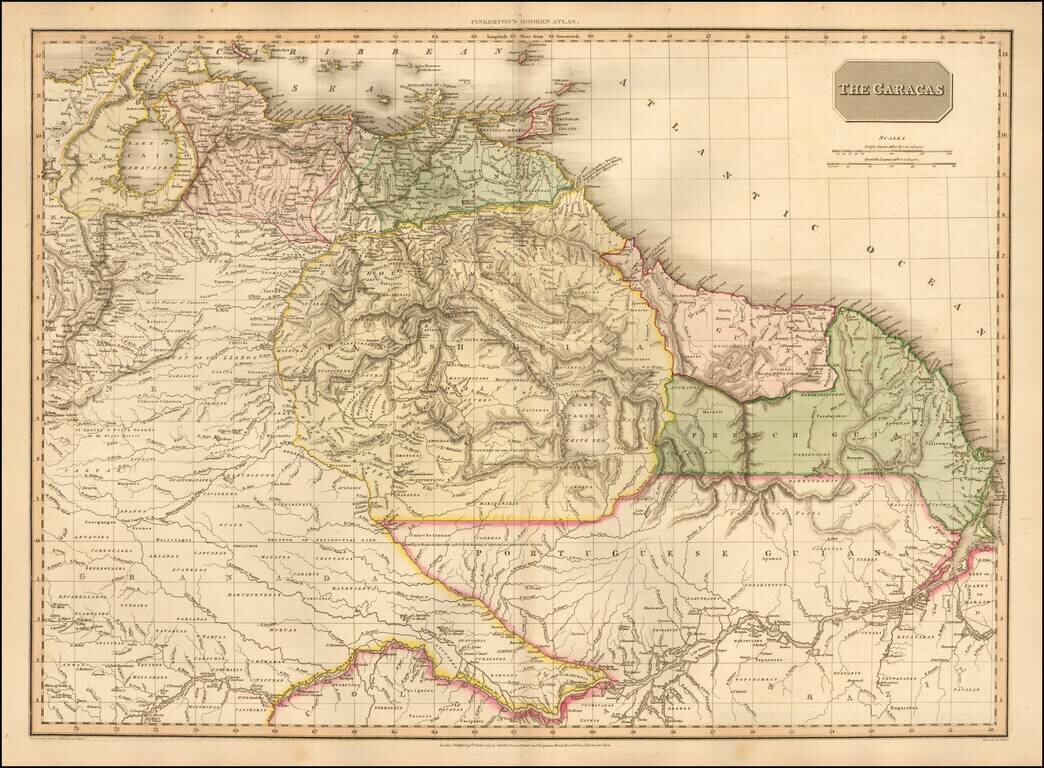
One of the Earliest Maps To Show An Independent Venezuela Highly detailed map of Venezuela, Columbia and part of Brazil, extending south to cover most of the Amazon and its tributaries, during this fascinating revolutionary period in South...
Striking and highly detailed map of South America, at the beginning of the major period of political upheaval on the Continent. The map was produced immediately after Alexander Von Humboldt's visit, which spawned so much interest in the exploration...
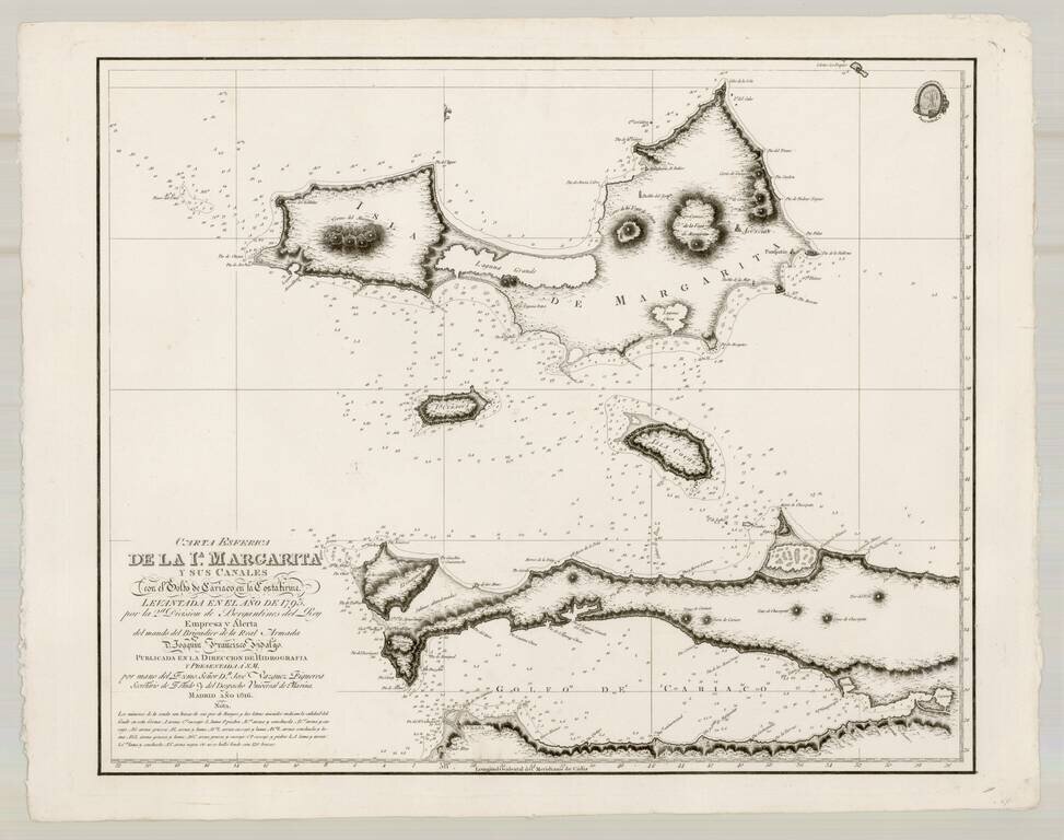
Fine map of Margarita Island and the Gulf of Cariaco, as surveyed by the Spanish at the end of the 17th Century. The present chart represents the southeastern most expeditionary work of Brigadier Joaquin Franciso Fidalgo, at the end of the 18th...
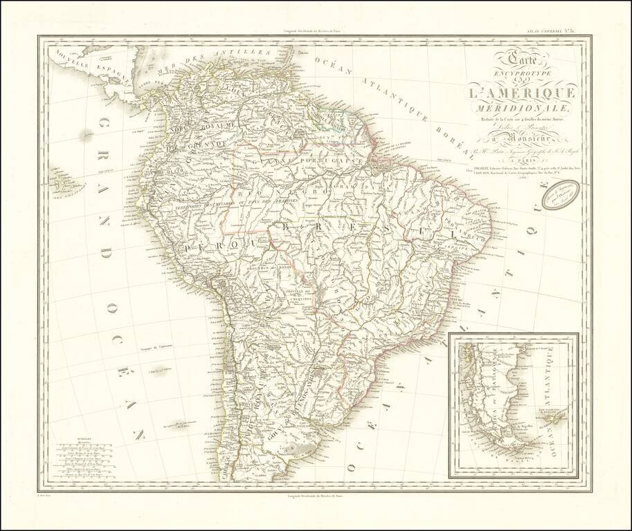
![Carte Encyprotype, de l' Amérique Meridionale . . . 1816 [Wall Map]](/map/small/69010.jpg)
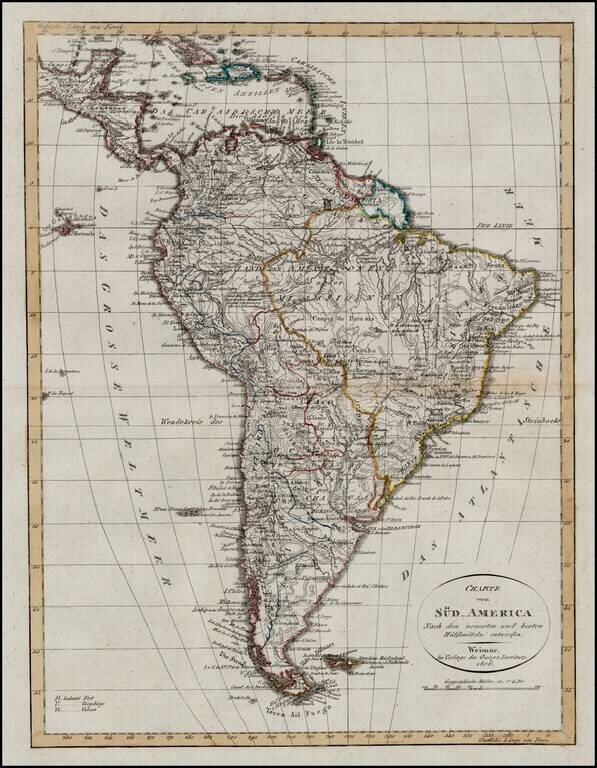
Beautiful engraved and highly detailed four-sheet wall map of South America at the beginning of its Century of Revolution. The map reflects the extent of European knowledge and explorations into the interior of the continent, which was advanced, but...
Scarce map of South America at the outset of its Century of Revolution. Highly detailed map wih extensive annotations throughout and a fine depiction of the Rivers and Mountains in the interior regions.
Highly detailed map of South America at the beginning of its Century of Revolution. The map reflects the extent of European knowledge and explorations into the interior of the continent, which was advanced, but still far from complete.
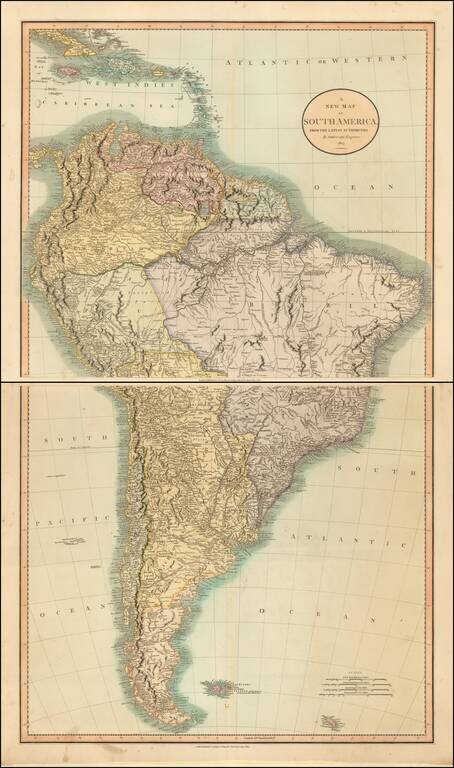
Fine large format map of South America, published in London by William Darton, Junior. The is finely colored and includes road systems, topographical details, historical annotations and other notes. The map includes an evocative cartouche, showing a...