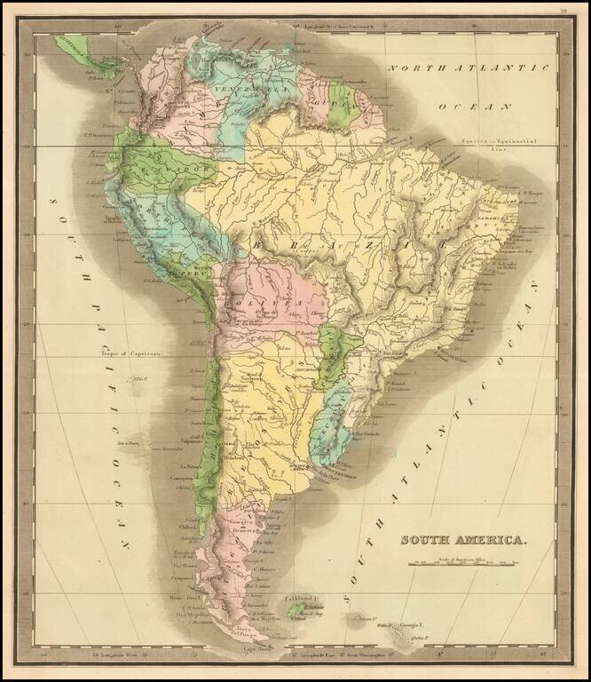
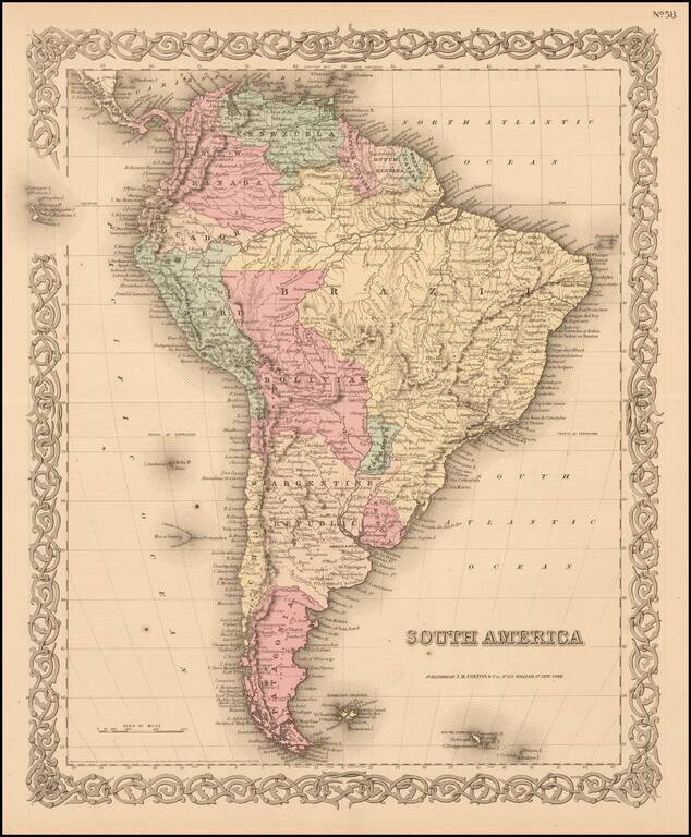
Elegantly colored map of South America, from one of the most interesting early 19th century American map publishers. South America is depicted at the end of its Revolutionary Period, with the Spanish presence now ended. The territorial divisions...
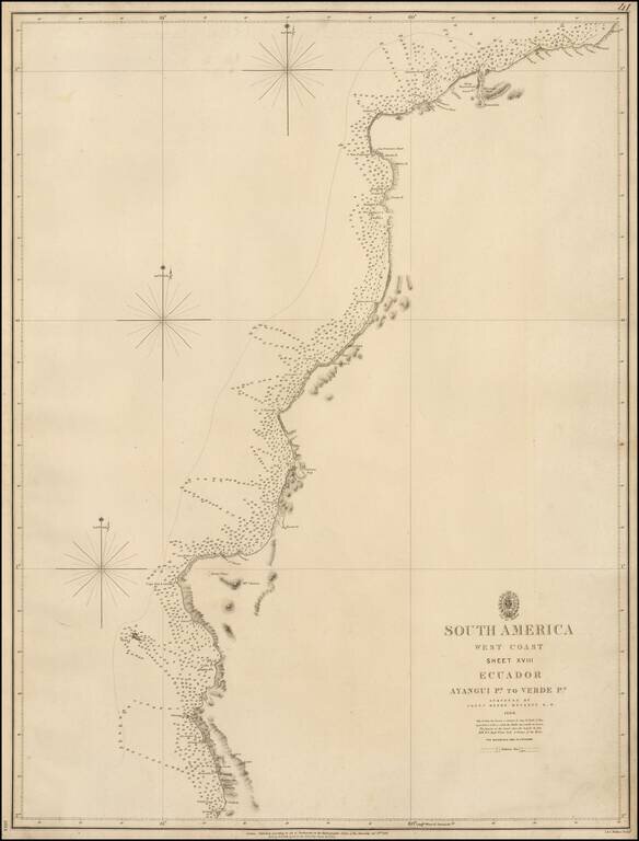
Rare coastal chart of the northern part of the Coast of Ecuador, published by the British Admiralty. The map extends from the Valdivia Region in the south to just north of Esmeraldas. Henry Kellett Henry Kellett (1806-1875), joined the Royal Navy in...
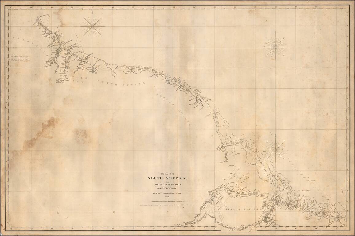
Rare separately published American Sea chart of the Northeastern coastline of South America, drawn by Charles Copley and published by Blunt. The map extends from the Orinoco River, Essequibo River and Demarara River in Venezula to Ilha Marajo, Belem...
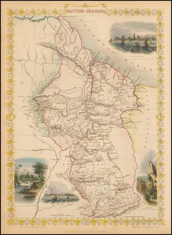
Decorative and detailed map of the Britsh Guayana, showing mountains, rivers, towns, islands, etc. Vignettes of Christmas Cataract on the River Berbice, New Amsterdam, Ataraipu and Georgetown. Engraved for R. Montgomery Martin's Illustrated Atlas....
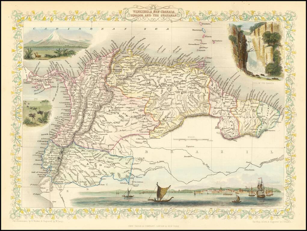
Striking full color example of this marvelous map of the Northeastern part of South America. Showing vignettes of Paramaribo, Chimborazo, the Falls of Bagota and animals of that time. Engraved for R. Montgomery Martin's Illustrated Atlas. Tallis was...
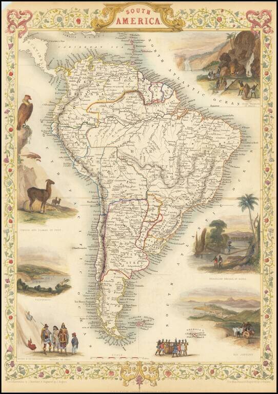
Gorgeous full-color example of Tallis' map of South America, with vignettes showing the cities of Rio Janeiro and colorful vignettes of Gold Washing in Brazil, Natives of Chili, Condor and Llamas of Peru. Beautiful decorative border. Engraved for R....
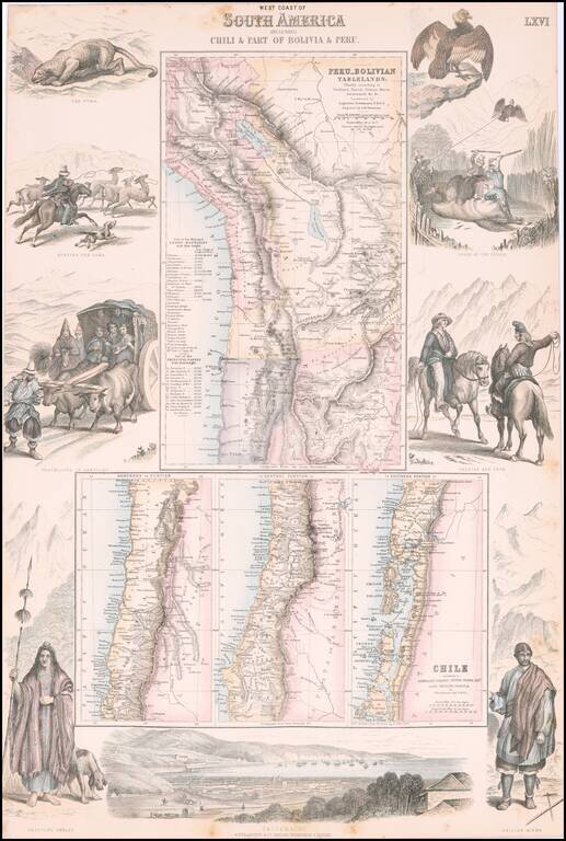
Decorative regional map of South America, which consists of 4 maps (the upper map showing Peru and the Bolivian Table Lands and the lower 3 maps showing Chile, each in excellent detail). Includes a birdseye view of Valparaiso at the bottom and...
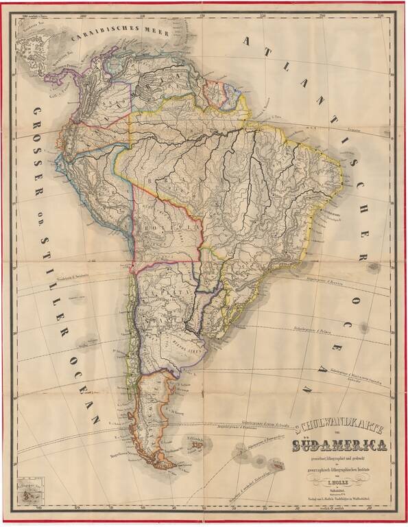
Very rare (unrecorded) wall map of South America, published by Leinhert Holle in Wolfenbuttel. The Geographisch-lithographisches Institut was an active publisher of maps in the mid-19th Century and thereafter. During a brief burst of activity in the...
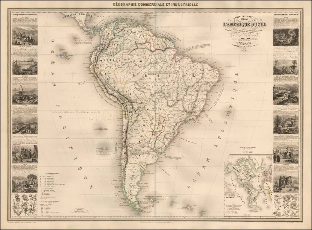
Scarce decorative map of South America, published in Paris by Vuillemin. The map includes 14 decorative side panel vignettes showing indigenous scenes in America, flora and fauna. The map provides a fine large format depiction of South America in the...
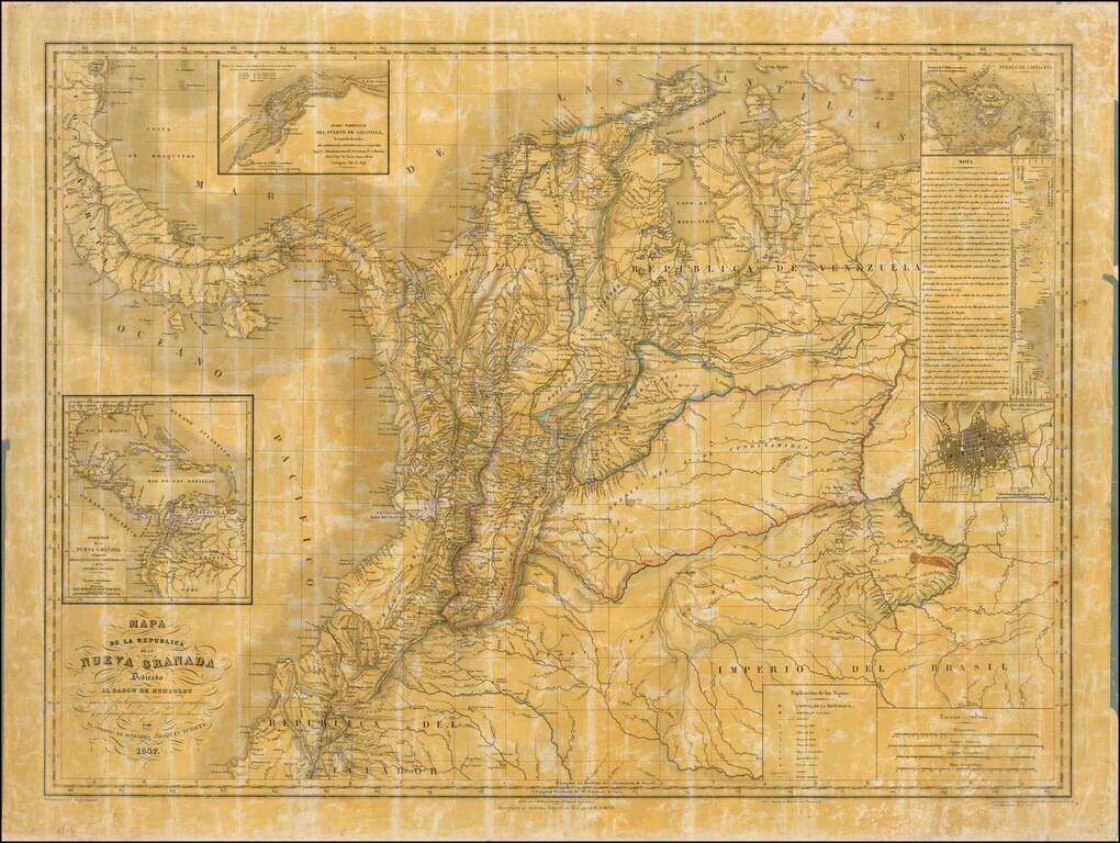
Quite Possibly The Only Official Map of the Confederation Granadine -- Originally Created By One Colombia's Most Important Historians and Scholars Second state of this rare wall map of the Republic of New Granada dedicated to the Baron de Humboldt,...
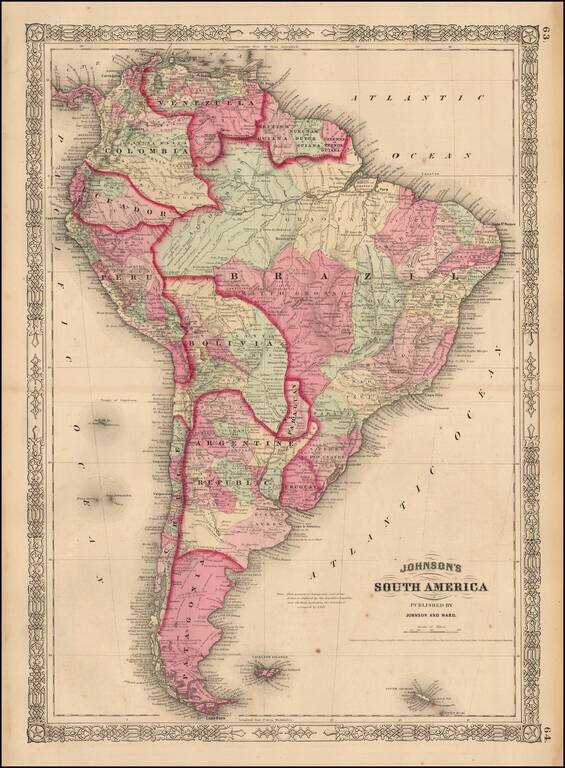
Detailed map of the region, colored by country and showing towns, rivers, province names and mountains. Surrounded by decorative border.
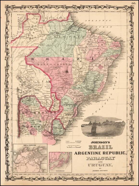
Attractive regional map, colored by provinces and showing towns, mountains, rivers, bays, etc. Large vignette of the harbor of Rio De Janeiro and insets of Rio and Pernambuco.
Attractive map of South America, colored by country or state. Extends south to the South Shetland Islands and north to the Gulf of Mexico. Includes notes of numerous 18th century voygages, including Columbus, inset of Cape Horn and other interesting...
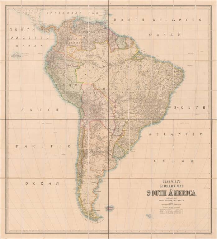
Early State of Edward Stanford's Wall Map of South America Nice example of Edward Stanford's large format library map of South America. In the early 1850s Edward Stanford commissioned Alexander Keith Johnston to prepare a set of large wall maps of...
![Patagonia [with] South Orkney [with] Falkland Islands [with] South Georgia Island](/map/small/56763.jpg)
Interesting map of Patagonia, with several insets of islands in the region, each of which is rarely given this much detail in a map.
![Amerique du Nord [Manuscript Map with Decorative Hand Drawn Vignette]](/map/small/23250.jpg)
Decorative hand drawn map of North America, with a striking vignette of a two parrots. Includes excellent detail for a map of this type. The number of place names is quite extraordinary, with a number states, ciities and Indian Tribes noted.