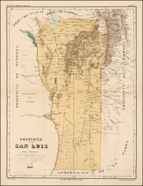
Fine map of the Provincia de San Luis in Argentina, published in the rare Atlas de la Republica Argentina. The map locates towns, roads, railroads, railroads under construction, etc.


Presented to Farabee's Wife An interesting archive of maps drawn to illustrate William Farabee's first expedition to South America, to visit the indigenous peoples of Eastern Peru. Along with the maps enumerated below, the archive includes a book...
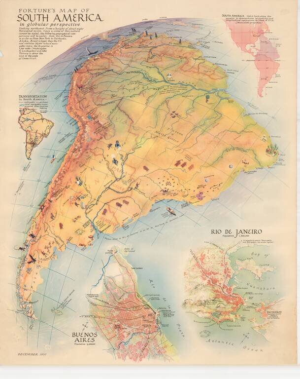
Scarce map of South America, published by Fortune Magazine. The map includes vignettes, showing natural resources, recreational activities and other vignettes highlighting the features of the various regions. Includes a second map showing a detailed...
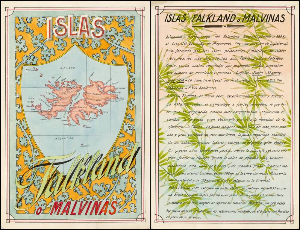
Award winning pair of manuscript cards, prepared by Antonio Raggio for the 11th Congreso de la Union Postal Universal (World Postal Congress) Exposition Filatelica Internacional, held in Buenos Aires, Argentina, in 1939. The map shows a finely...
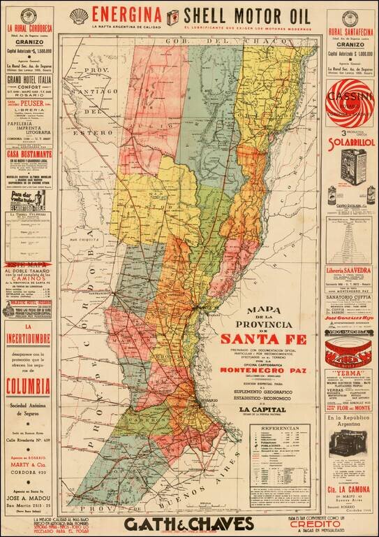
Fascinating map of the Province of Santa Fe, Argentina, centered on the capital city of Rosario. Surrounded by advertising.
Nice example of this important early map of the Straits of Magellan, predating the discovery of the Straits of Le Maire. Mercator's map is the earliest map of the Straits of Magellan to appear in a commercial atlas. It is also a rare example of a...

Striking map of the Straits of Magellan, with a large decorative compass rose. The map appeared in an early edition of the Mercator Hondius Atlas Minor.

Fine map illustrating the discovery of the Straits of Le Maire, as discovered in January 1616 by Le Maire and Schouten. This is De Bry's edition of the first printed map to detail the strait, showing the Magellan Strait and, further south, the route...
Rare early map of the area around the Straits of Magellan.
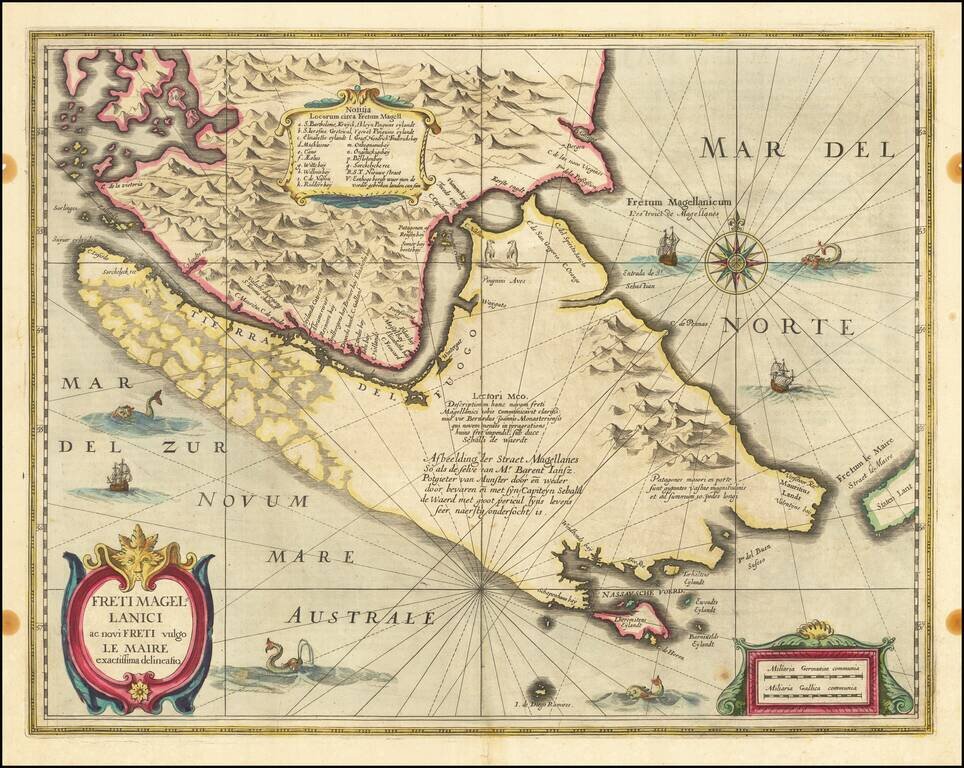
The Land of Giant Patagonians! Fine example of Willem Blaeu's map of the Straits of Magellan, Le Maire Strait, Fire Lands and the southern tip of Patagonia. The map is one of the earliest obtainable atlas maps of the Straits, preceded only by a map...
Nice example of the English edition of Hondius' map of the Straits of Magellan, Le Mair Strait, Fire Lands and the southern tip of Patagonia. The coastlines of Tierra del Fuego are incomplete. Fully engraved to show the mountainous terrain with no...

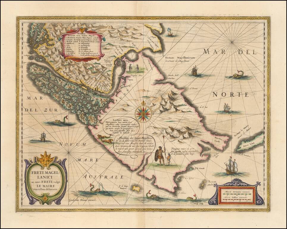
Blaeu’s Influential Map of Tierra del Fuego Showing the Important Strait of Le Maire Fine example of Willem Janszoon Blaeu's map of the Straits of Magellan and Tierra del Fuego (Magellanica)—the gateway to the Pacific during the seventeenth and...
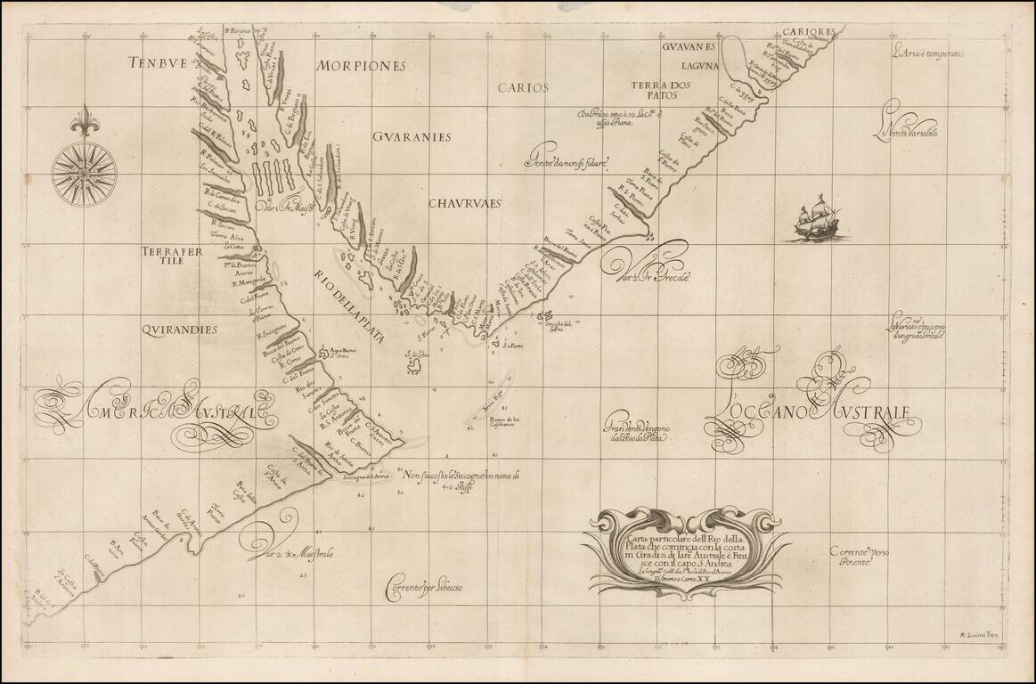
The earliest obtainable Sea Chart of the Mouth of the Rio de la Plata (River Plate). Fine example of the first state of Robert Dudley's chart of the mouth of the Rio de la Plata, extending north to Uruguay, the earliest obtainable chart of the...

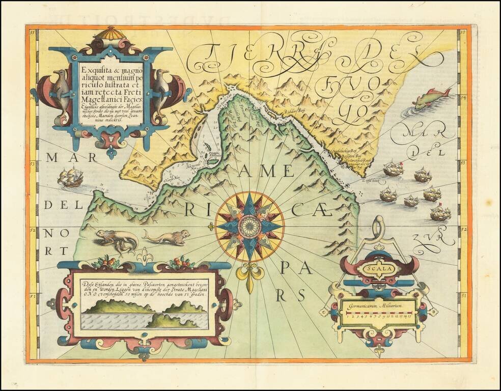
The Most Decorative Image of the Strait of Magellan from the Golden Age Fine example of the first state of Jansson's sea chart of the Southern tip of South America, illustrating Magellan's Strait and the recent discoveries of Jacques Le Maire. The...
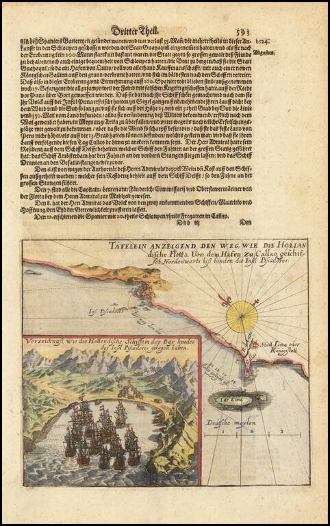
Rare early map of the area around Lima in Peru, with a large inset map of Insula de Pescadores.