Map size in jpg-format: 17.3919MiB
Click to open in high resolution (open in new tab).
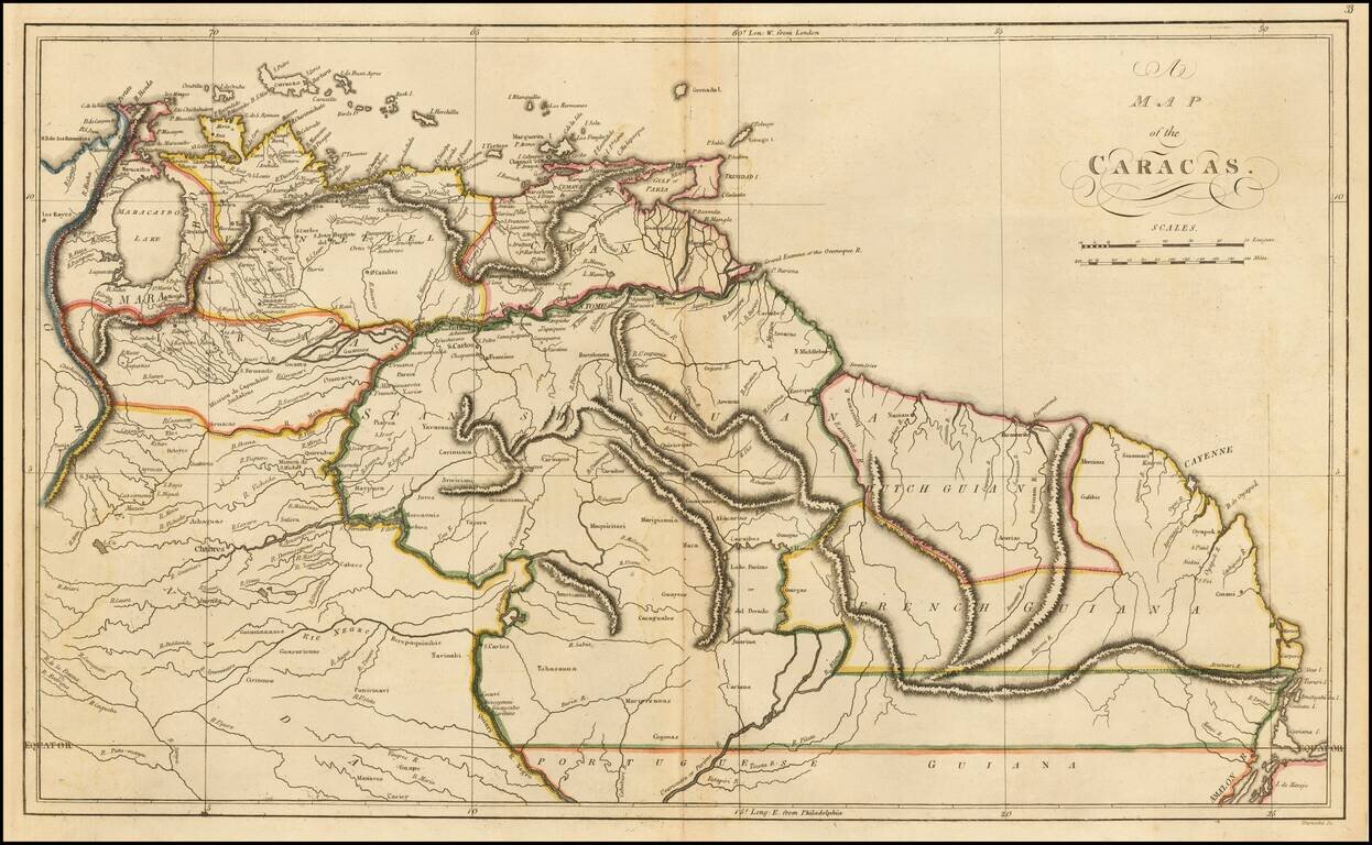
Detailed early map of the coast of Venezuela and contiguous islands (Curacao, Bonaire, Aruba, Tortuga, Trinidad, Tobago, etc.)
The map was issued 3 years after 7 of the 10 provinces of the Captaincy General of Venezuela declared its indendence from Spain on July 5, 1811.
More specifically, the map was issued shortly after the campaign of 1813 established the so-called Second Republic, following the retaking of Caracas by an army led by Simon Bolivar on Agust 6, 1813.
If you are a student, write to us in telegram: @antiquemaps and indicate what material you need and for what work you need a map in high detail. We are ready to provide material on special terms. For students only!


![[Signed Political Satire Artwork] Vietnam ... Vietnam ... Vietnam ...](/map/small/68726.jpg)