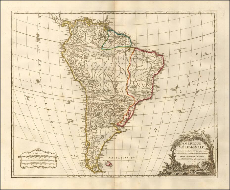
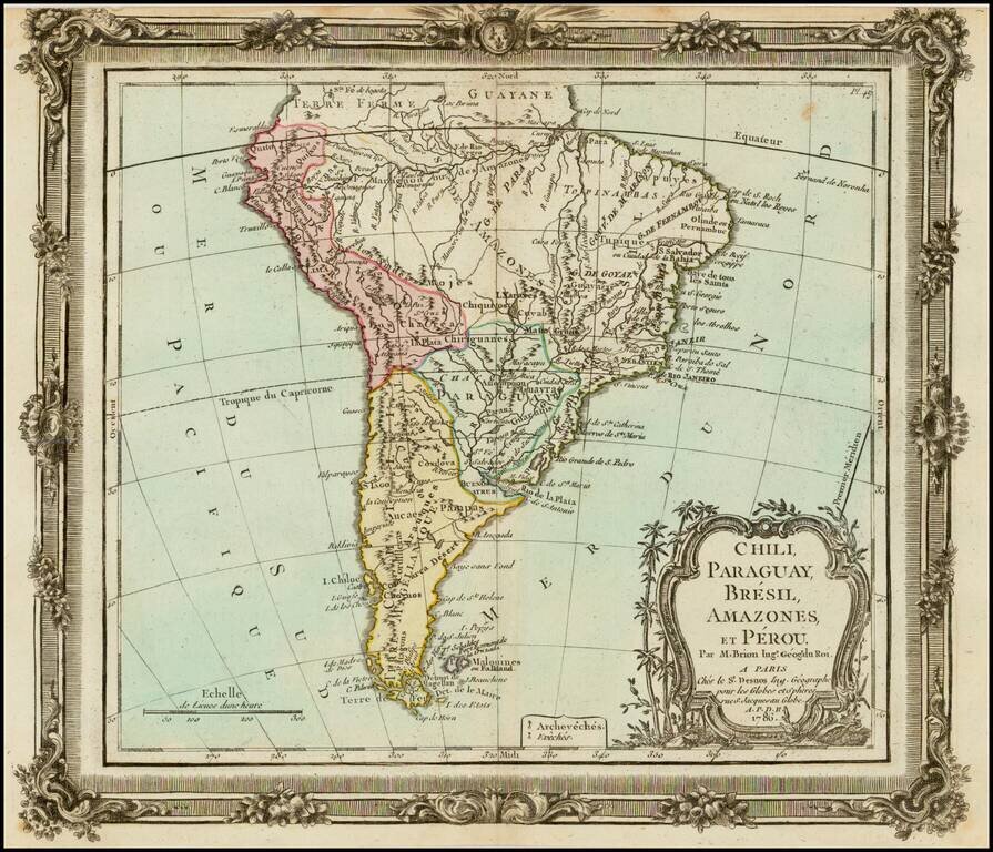
Detailed map of South America, published by one of Europe's leading map publishers of the second half of the 18th Century. The map illustrates South America at the height of its Colonial period and at a time when the interior of the Continent was...
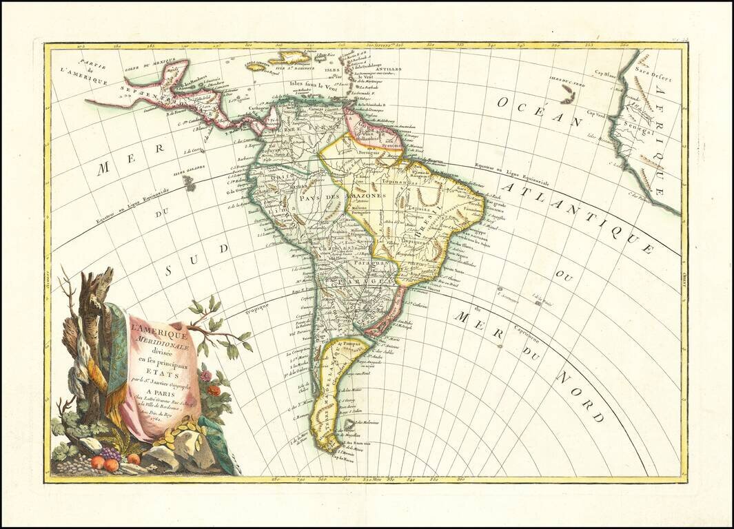
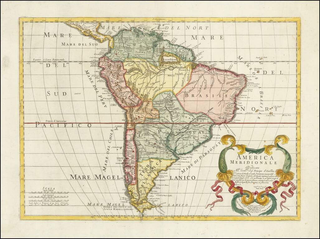
Decorative map of South America, published in Paris by Jean Janvier. A classic example of the French unwillingness to enhance maps with speculative cartography. Large decorative cartouche.
Detailed and well engraved sea chart of French Guiana and the island of Cayenne. The map was pubilshed in 1763 by Bellin (1703-72), a prolific cartographer assigned the Ministry of the French Navy. The chart shows soundings, anchorage's, channels,...
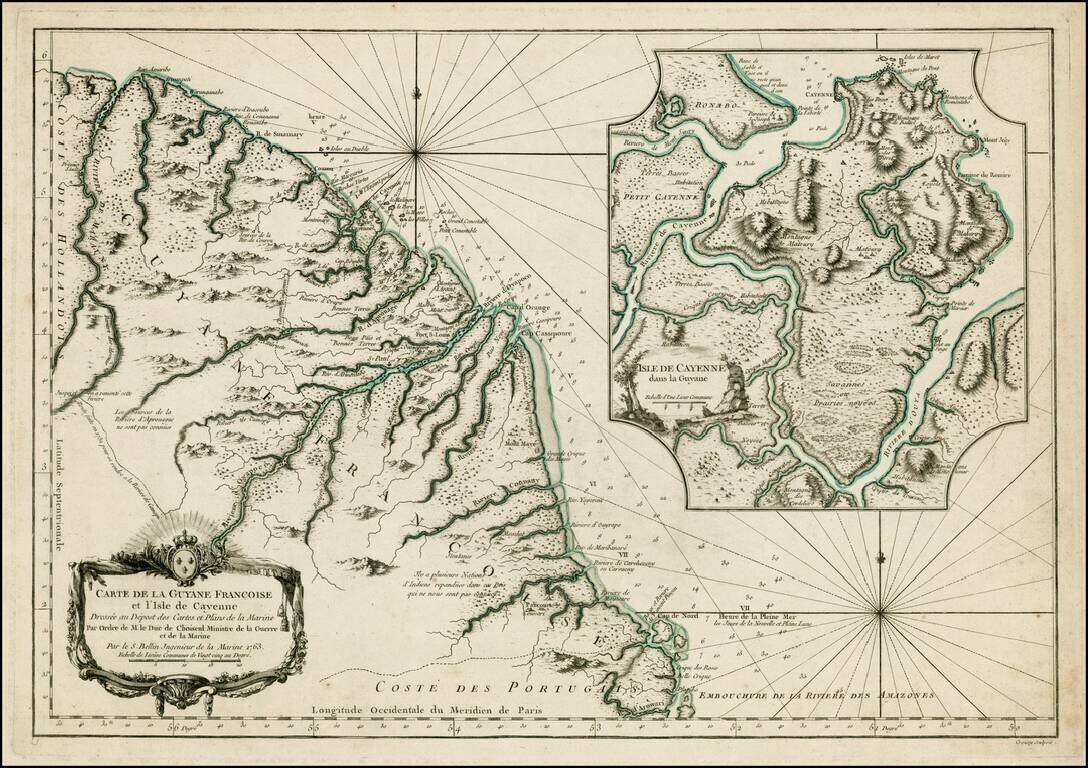
Detailed and well engraved sea chart of French Guiana and the island of Cayenne. The map was pubilshed in 1753 by Bellin (1703-72), a prolific cartographer assigned the Ministry of the French Navy. The chart shows soundings, anchorages, channels,...
A striking map of most of South America, colored by countries. Shows a still primitive mapping of most of the interior of the continent. Deluxe edition, with decorative printed borders.
Striking Italian Map of South America Rare 1766 edition of Paolo Petrini's South America, first published in Naples, ca. 1700. This map, based on the work of Nicolas Sanson, shows the entirety of the continent, from Terra Ferma to Tierra del Fuego....
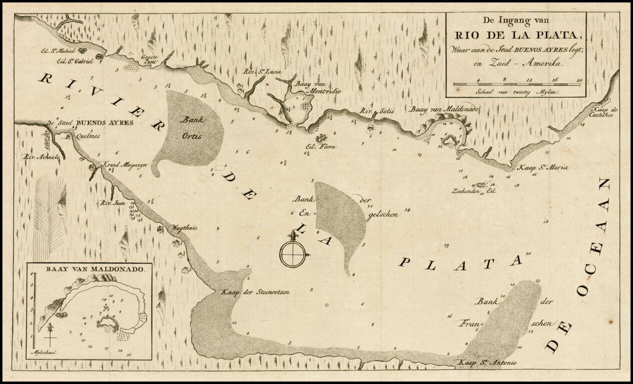
Detailed plan of of the mouth of the Rio de la Plata, including cities, soundings and other details. Inset of the Bay of Maldonado. From Tirion's Hedendaagsch Historie of Tegenwordige Staat van Amerika.
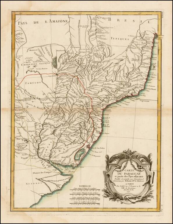
A detailed and attractive regional map of Brazil and Paraguay with a decorative cartouche. Rigobert Bonne served as the map maker to the King of France.
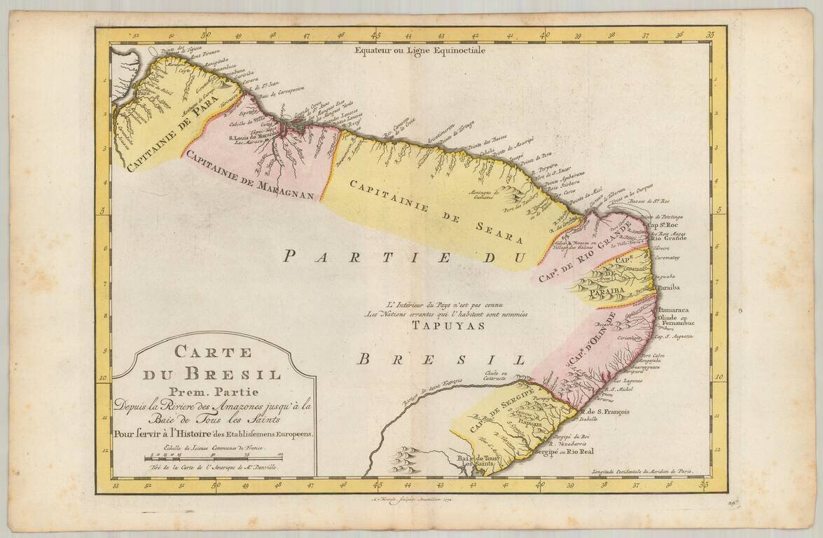
Detailed regional map of the coast of Brazil, from Maracana to Baye de Tous les Saints. Covers Capitanie De Maragnan, Seara, Rio Grande, Paraiba, D'Olinde and Sergipe. Includes a decorative title cartouche. Based upon an earlier map by Nicholas Bellin.
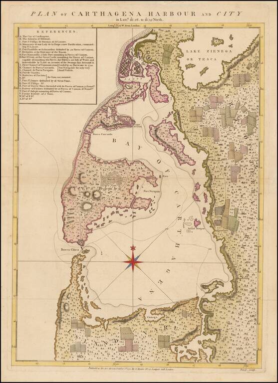
One of the Rarest Maps of Cartagena Rare plan of Cartagena and environs, engraved by Bayly and published in Speer's The West-India Pilot, sold by Samuel Hooper. The map includes a detailed key locating approximately 23 points of interest, including...
Striking 18th Century map of the northern portion of South America, including, Columbia, Venezuela, Ecuador, Guyana and the northen part of Brazil, on the eve of their independence from Spain. The map is divded into Spanish intendencies, with the...

A Rare Separately Published Example From A Storied English Country Mansion. Striking two-sheet, engraved map of South America below the Rio de La Plata, produced by Thomas Kitchin in London in 1772. Attractively-engraved by Kitchin, the map features...
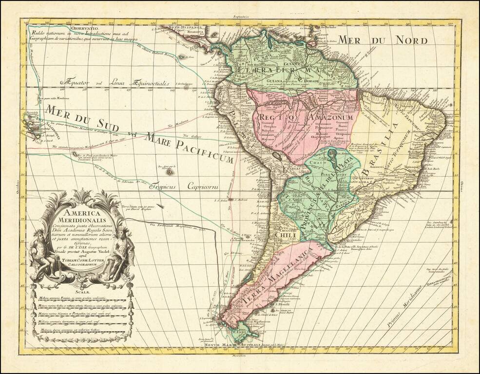
Decorative map of South America, by Conrad Lotter. The map shows the routes of Magellan (1520), Drake (1577), le Maire & Schouten (1616), and Sarmineto (1570). Various other dated discoveries are noted throughout. Interesting river systems and...
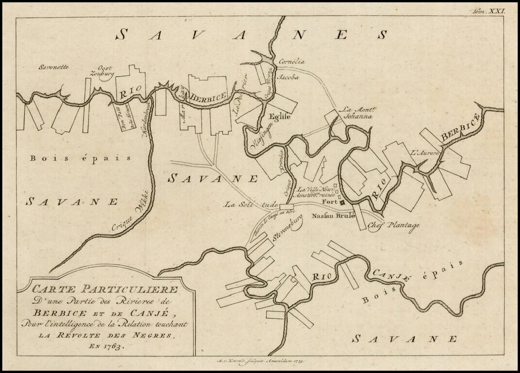
Scarce plan of Berbice, Surinam, illustrating the town at the time of the Slave Revolt of 1763. The Berbice Slave Revolt began in February 1763 and lasted into 1764. The uprising began on Plantation Magdalenenberg on the Canje River in Berbice. The...
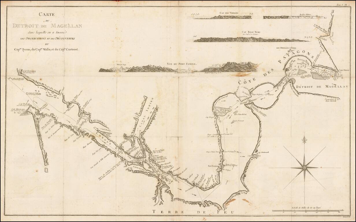
Rare chart of the Straits of Magellan from the Relation des Voyages Entrepris par Ordre de sa Majeste Britannique, the French edition of the official account of the first voyage of James Cook. The chart details the Straits of Magellan and the truly...
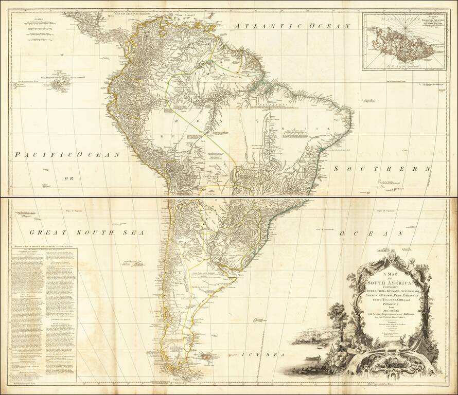
Detailed 4-sheet map of South America, based upon and earlier French map by D'Anville. Includes a large inset map of the Falklands. South America is shown during the Bourbon Englightenment period, when Spain was finally beginning to share more...