Map size in jpg-format: 11.9397MiB
Click to open in high resolution (open in new tab).
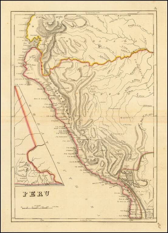
Peru at the Dawn of Its Indpendence Movement
Detailed map of Peru, from a scarce late edition of Mathew Carey's General Atlas, the first atlas published in America.
In 1808, Napoleon invaded the Iberian Peninsula and took the king, Ferdinand VII, hostage. Later in 1812, the Cadíz Cortes, the national legislative assembly of Spain, promulgated a liberal Constitution of Cadiz. These events inspired emancipating ideas between the Spanish Criollo people throughout the Spanish America. In Perú, The Creole rebellion of Huánuco arose in 1812 and the rebellion of Cuzco arose between 1814 and 1816.
Despite these rebellions, the Criollo oligarchy in Perú remained mostly Spanish loyalist, which accounts for the fact that the Viceroyalty of Peru became the last redoubt of the Spanish dominion in South America.Peru's movement toward independence was launched by an uprising of Spanish-American landowners and their forces, led by José de San Martín of Argentina and Simón Bolívar of Venezuela. San Martín, who had displaced the royalists of Chile after the Battle of Chacabuco, and who had disembarked in Paracas in 1819, led the military campaign of 4,200 soldiers. The expedition which included warships was organized and financed by Chile which sailed from Valparaíso in August 1820. San Martin proclaimed the independence of Peru in Lima on July 28, 1821, with the words "... From this moment on, Peru is free and independent, by the general will of the people and the justice of its cause that God defends. Long live the homeland! Long live freedom! Long live our independence!".
Still, the situation remained changing and emancipation was only completed by December 1824, when General Antonio José de Sucre defeated Spanish troops at the Battle of Ayacucho. The victory brought about political independence, but there remained indigenous and mestizo supporters of the monarchy and in Huanta Province, they rebelled 1825-28 in violence sometimes called the war of the punas or the Huanta Rebellion.
If you are a student, write to us in telegram: @antiquemaps and indicate what material you need and for what work you need a map in high detail. We are ready to provide material on special terms. For students only!


![[Signed Political Satire Artwork] Vietnam ... Vietnam ... Vietnam ...](/map/small/68726.jpg)