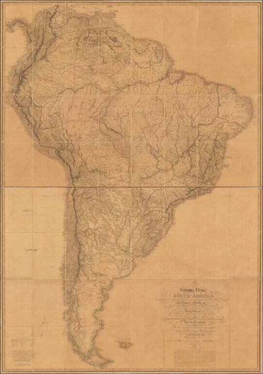
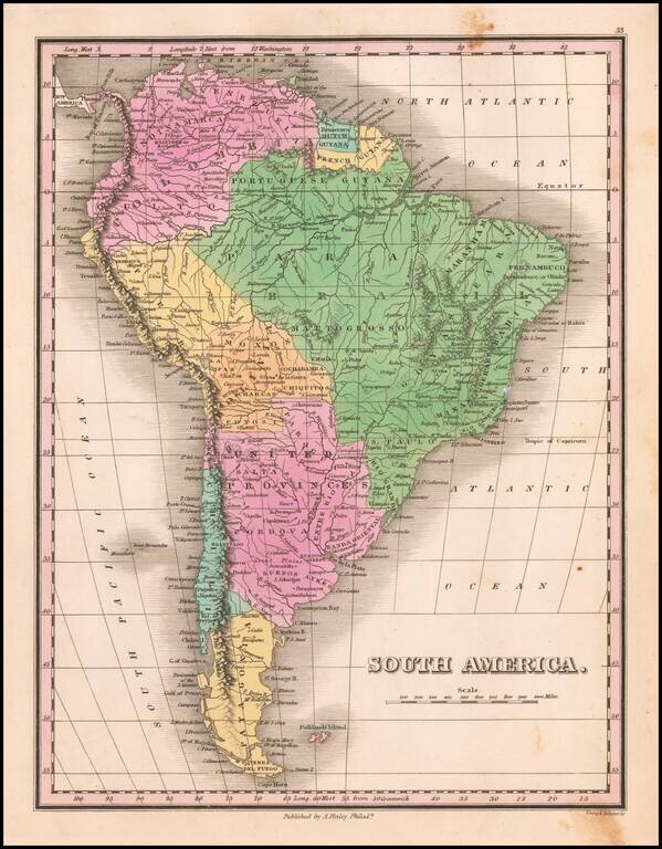
Rare Third State of The Best English Map of South America of The Early 19th Century Exceptional map of South America, at the outset of its Century of Independence, without question the finest large format commercially published map of South America...
Nice example of Fielding Lucas's 1823 engraved map of South America. Fielding Lucas' fine work distinguished him as the best publisher of the era. His maps are printed on a higher quality paper than contemporary maps by Carey & Lea and demonstrate...
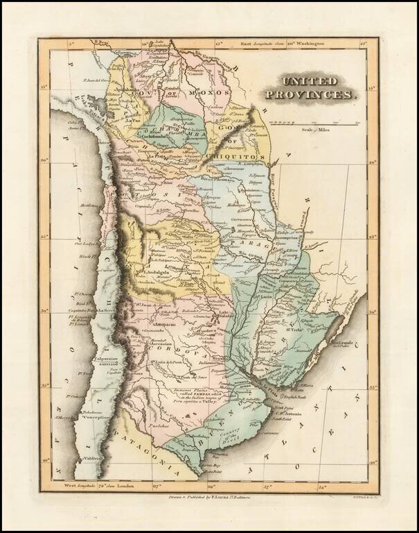
Interesting map of the United Provinces of the Rio de la Plata (later Argentina), on the eve of its independence. The United Provinces of the Río de la Plata and also earlier known as the United Provinces of South America was a union of provinces in...
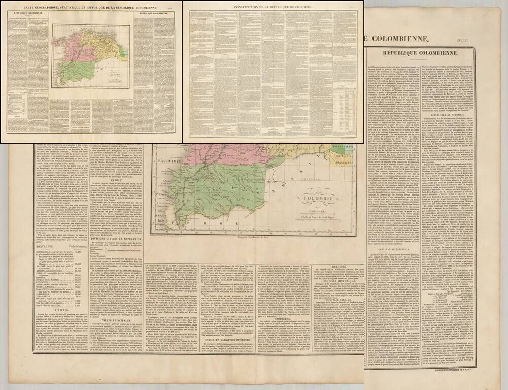
Fine map of Colombia, shortly after its indendendence, which includes an early printing of the Constitution of the Republic on a separate sheet. From 1796 to 1806, Colombia was constantly in conflict over the nature of its government. Constant...
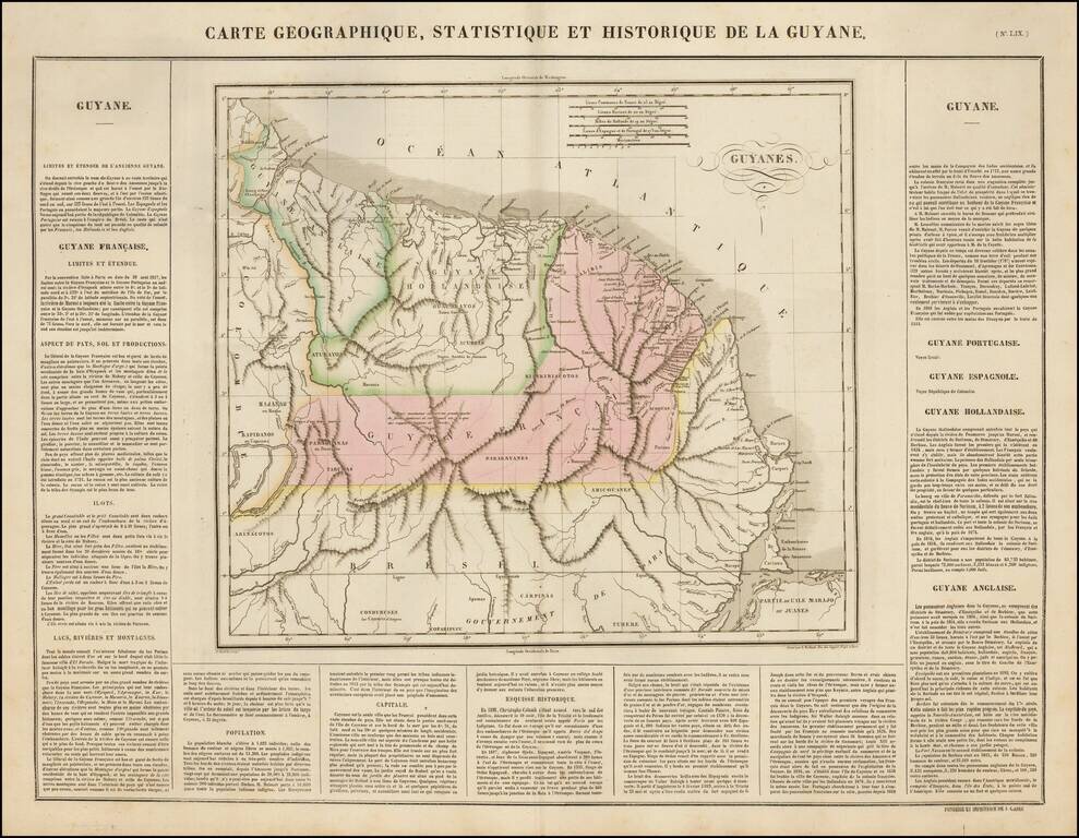
Nice example of the Buchon's map of Guyane, published in Paris in 1825. The map delineates English Guyana (Guyana), Dutch Guyana (Suriname) and French Guyana. The map is exceptionally detailed, with forts, towns, villages, mountains, rivers, etc....
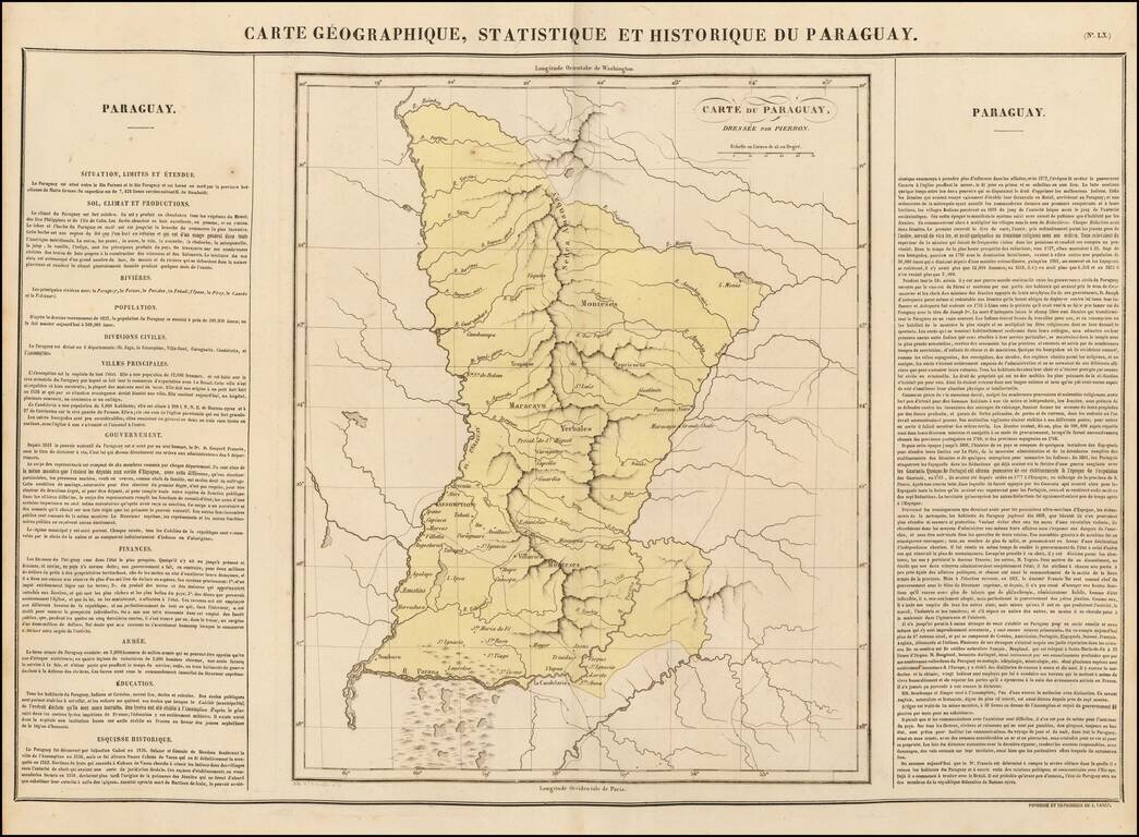
Nice example of the Buchon's map of Paraguay, published in Paris in 1825. The map is divided by regions. The map is exceptionally detailed, with Forts, Towns, Villages, Mountains, Rivers, etc. Overall plate size is 24 x 17 inches, surrounded by text...
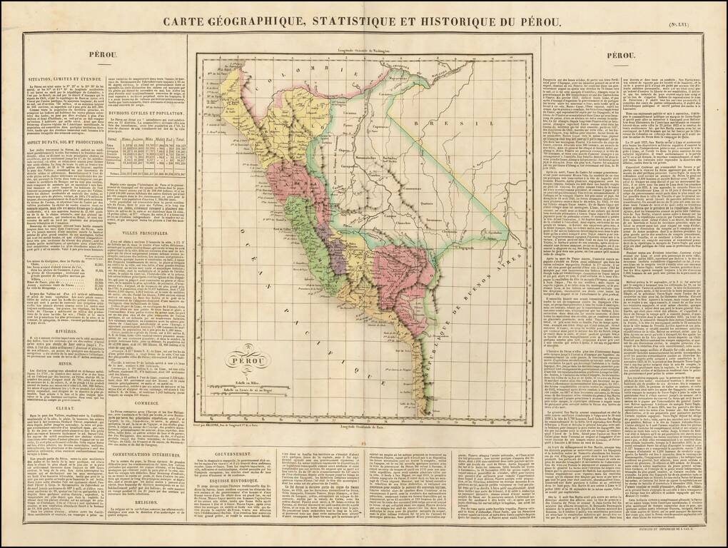
Nice example of the Buchon's map of Peru, pubilshed in Paris in 1825. The map is divided by regions. The map is exceptionally detailed, with Forts, Towns, Villages, Mountains, Rivers, etc. Overall plate size is 24 x 17 inches, surrounded by text...

Chile on the Eve of Complete Independence Nice example of Buchon's map of Chile, published in Paris in 1825, the year before last Spanish troops surrendered and the Chiloé Archipelago was incorporated into the Chilean Republic. The map covers Chile...
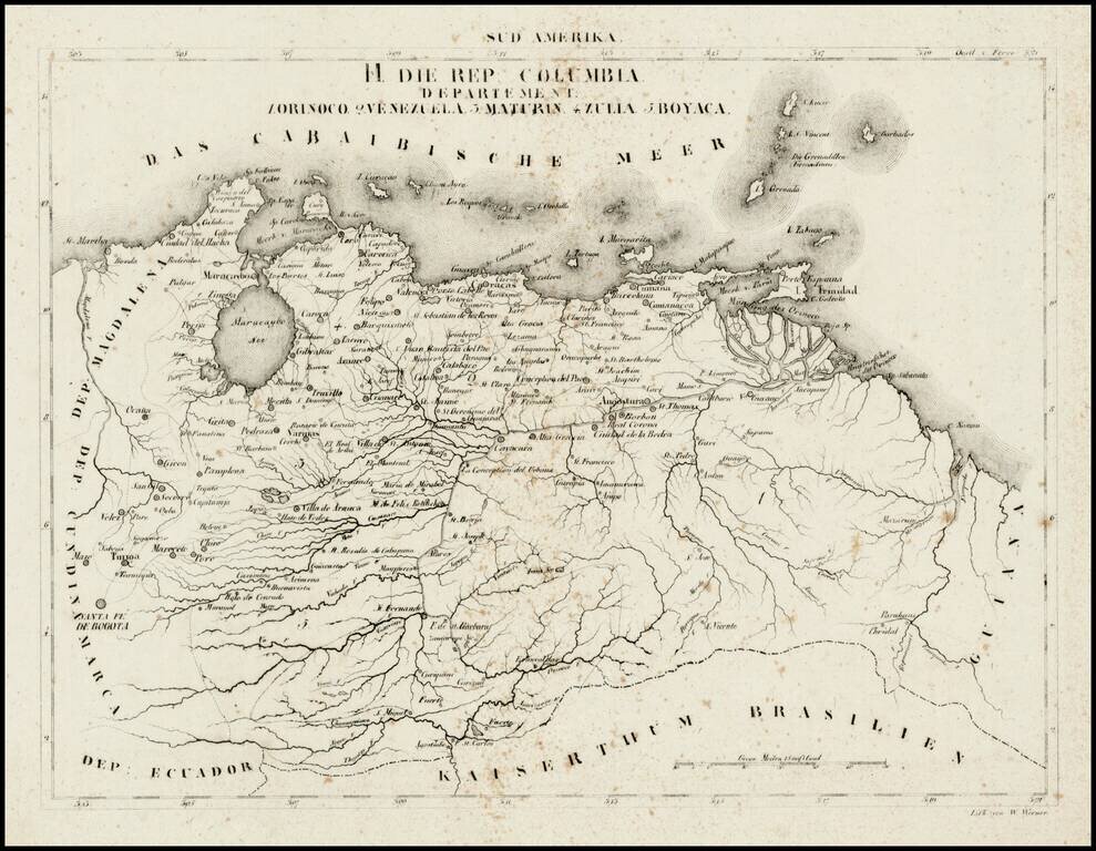
Rare map of the Republic of Colombia, divided into Departments, at a time when it included Venezuela. On December 17, 1819 the Congress of Angostura declared Gran Colombia an independent country. After two more years of war, the country achieved...
Decorative and detailed map of South America, from a rare late edition of Finley's New General Atlas. Wonderful color.
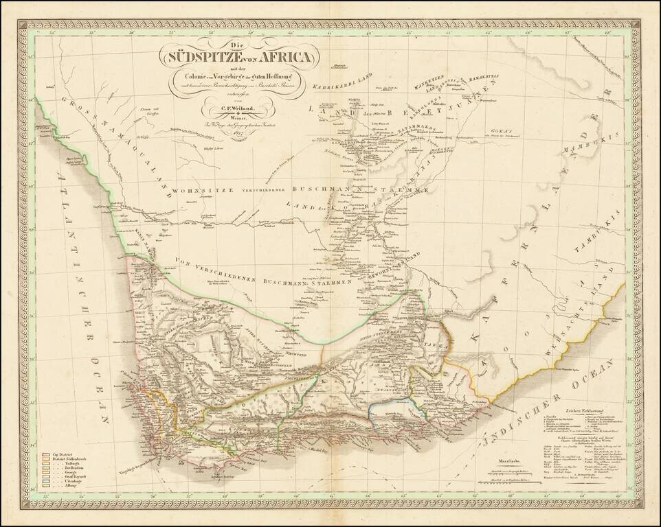
With Details of William Burchell's Travels in the Interior of South America Fine early map of Southern Africa and the Cape of Good Hope, published by CF Weiland in Weimar. The map provides a detailed look ath the southern part of the continent, with...
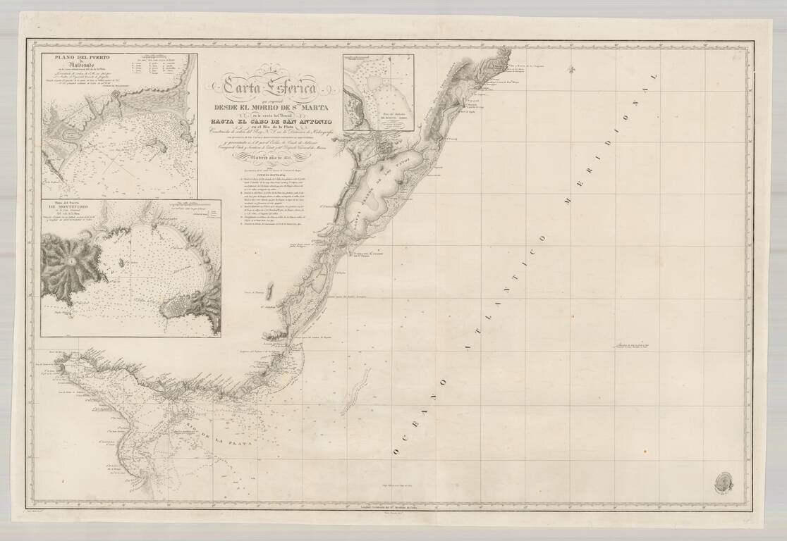
Scarce Spanish Sea Chart of the southern coast of Brazil and the Rio de la Plata, published by the Spanish Hydrographical Department. The chart includes large insets of Montevideo, Buenos Ayres and Puerto Maldonado.
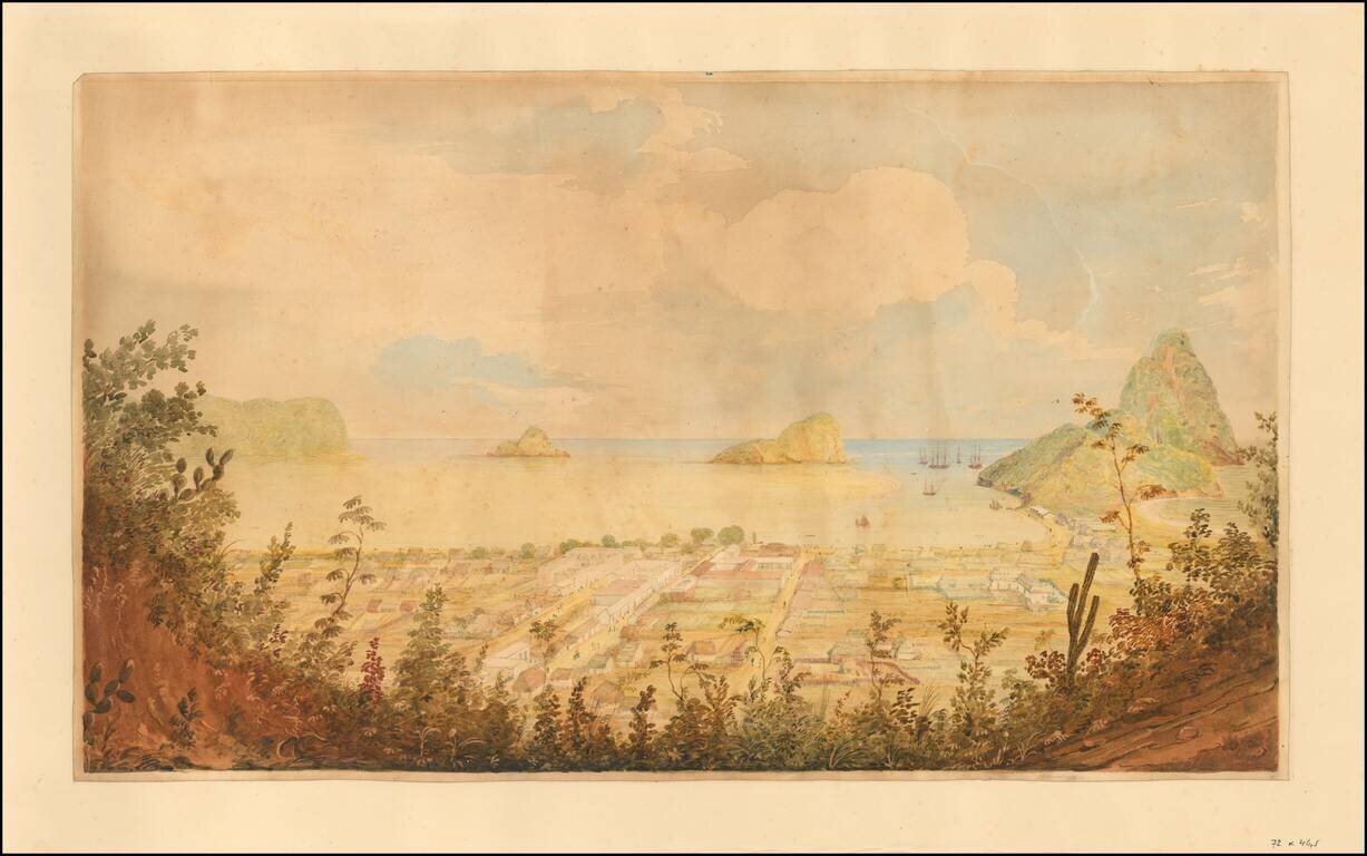
Original Watercolor View of Rio de Janeiro from 1833. Fine view of Rio De Janeiro, painting attributed to William Smyth during one of his visits to Rio as an officer in the British Royal Navy. Fine view of Rio from a high vista, looking southward...
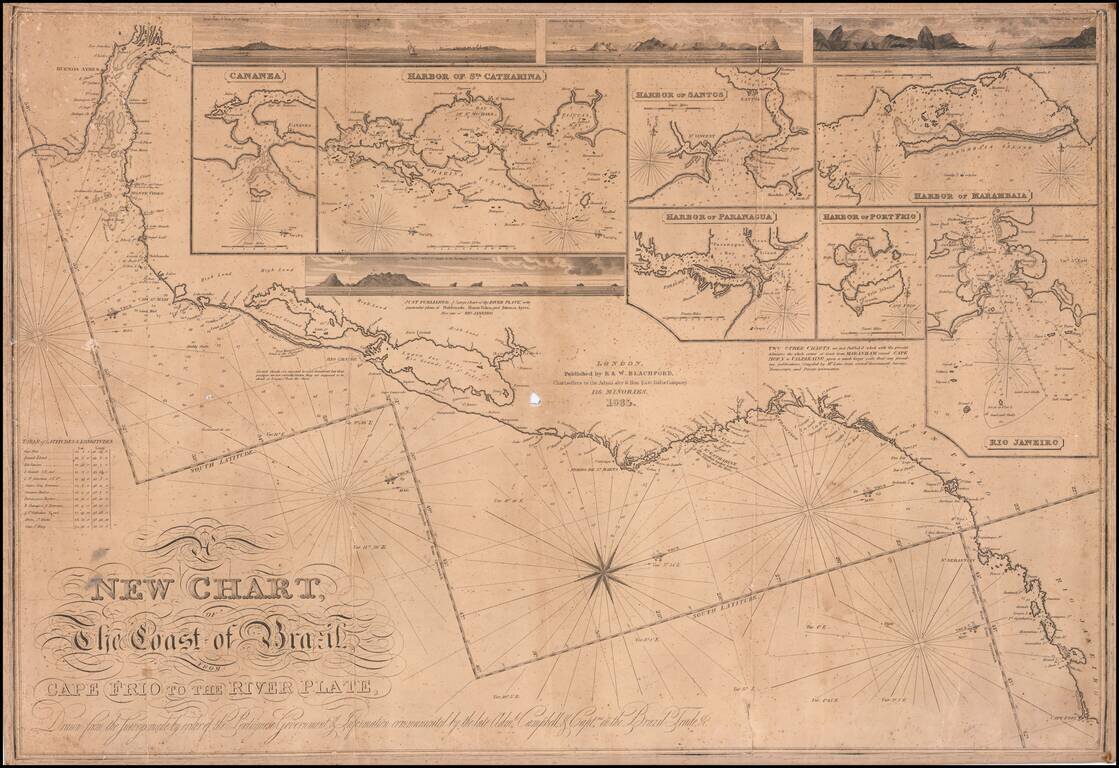
First state of this rare separately issued sea chart of the coast of Brazil, published in London by R & W Blachford. A finely detailed coastal chart, extending from Buenos Aires and the mouth of the Rio de la Plata to Cape Frio, just north of Rio...
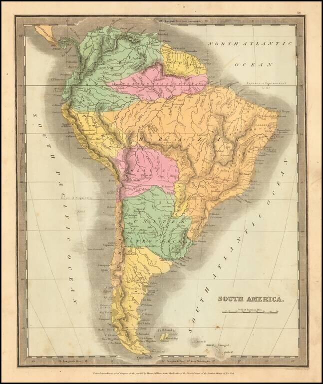
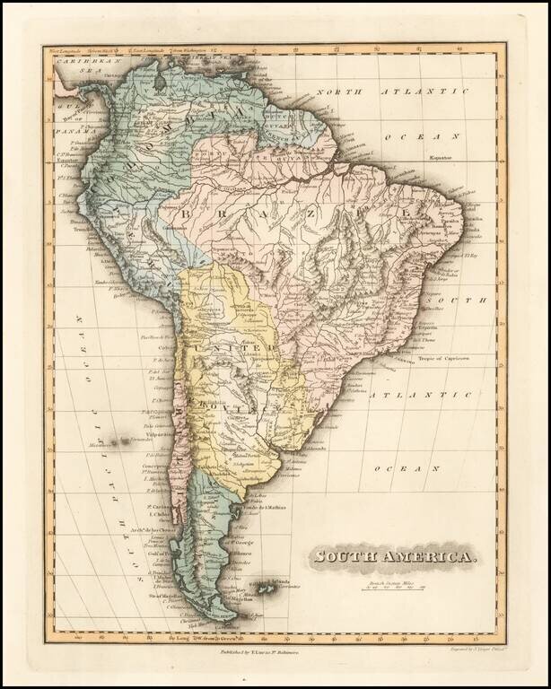
Elegantly colored map of South America, from one of the most interesting early 19th century American map publishers. South America is depicted at the end of its Revolutionary Period, with the Spanish presence now ended. The territorial divisions...

Fine set of 4 dissected maps of South American regions, in a custom slip case, formerly owned by Admiral Sir Edwin Gennys Fanshawe of the British Admiralty. E.G. Fanshawe is perhaps best remembered for a series of over 100 watercolors in the...