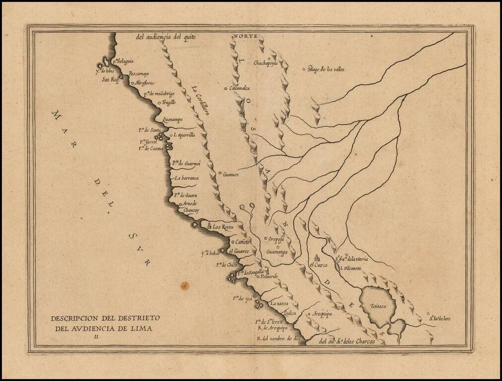
Rare early map of the Audiencia of Lima, locating rivers and settlements, the earliest map to include information from the previously secret manuscript maps of the Spanish cosmographer Juan López de Velasco. The map appeared in Herrera's Descripcion...
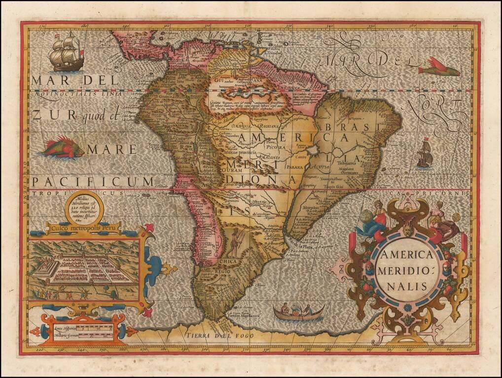
Nice example of one of the earliest obtainable decorative maps of the South American continent. The Strait of Magellan is shown, but Tierra Del Fuego is part of the large southern continent. Eastern Brazil is depicted as an island, made insular by a...
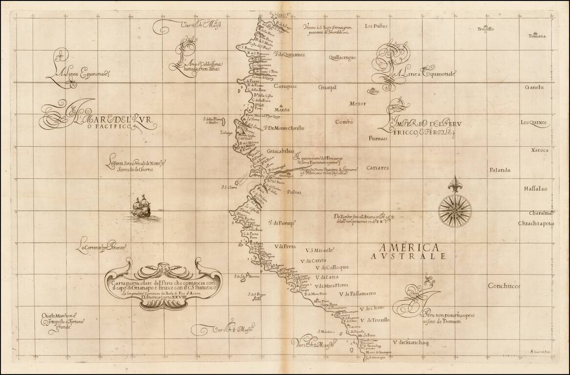
Fine example of the first state of Robert Dudley's chart of a part of the northwestern coastline of South America, the earliest obtainable chart of the region. The chart is centered on Quayquil and the coast of Ecuador, extending south to the area of...
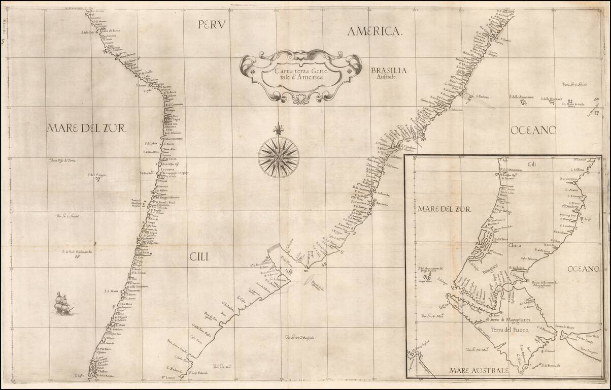
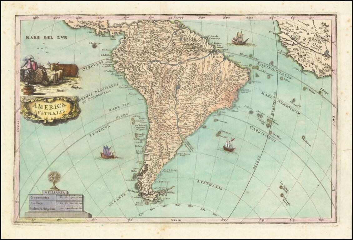
One of the Earliest Obtainable General Sea Charts of South America Nice example of the first state of Robert Dudley's general chart of the southern part of South America. The chart provides an exceptional overview of the Coasts of Argentina, Chile,...
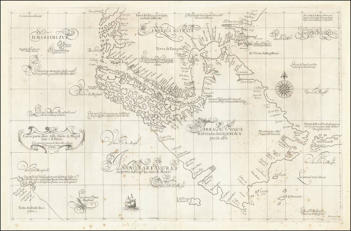
A Remarkable Early Sea Chart of the Strait of Magellan and Tierra del Fuego Important early map of the Straits of Magellan and the Straits of Le Maire, the latter of which was first discovered by Jacob Le Maire and Willem Schoten only 30 years prior...
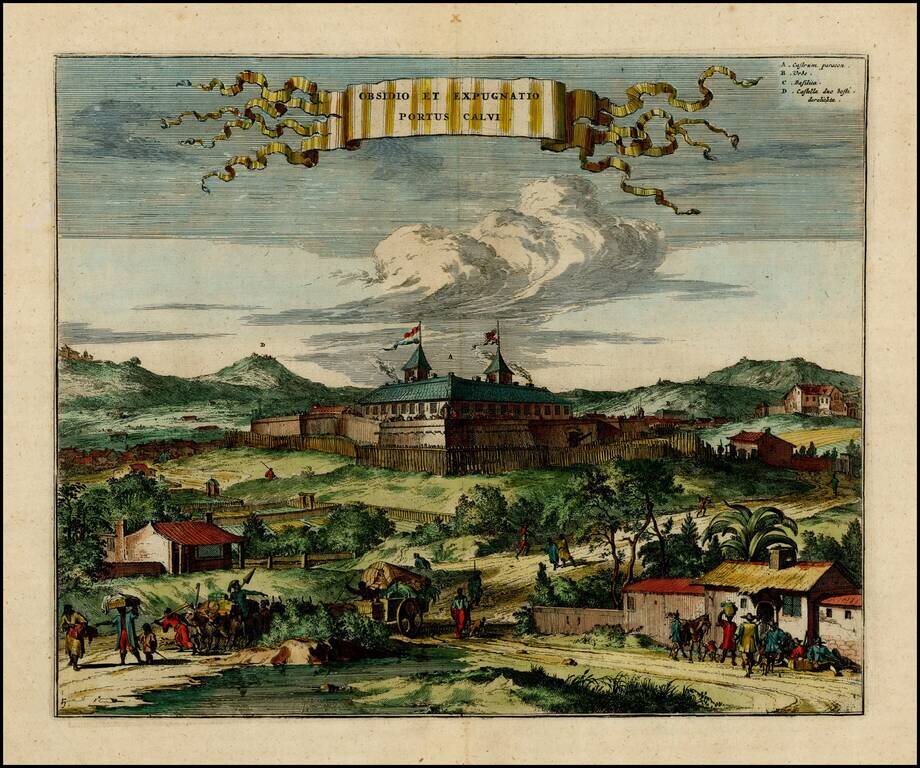
Early view of the Portuguese fort of Porto Calvo in Brazil. Porto Calvo in the Alagoas region, controlled the passage of the Manguaba River, and was at the frontline of Portuguese-Dutch hostilities in the early 1630's. Shown here as a simple wooden...
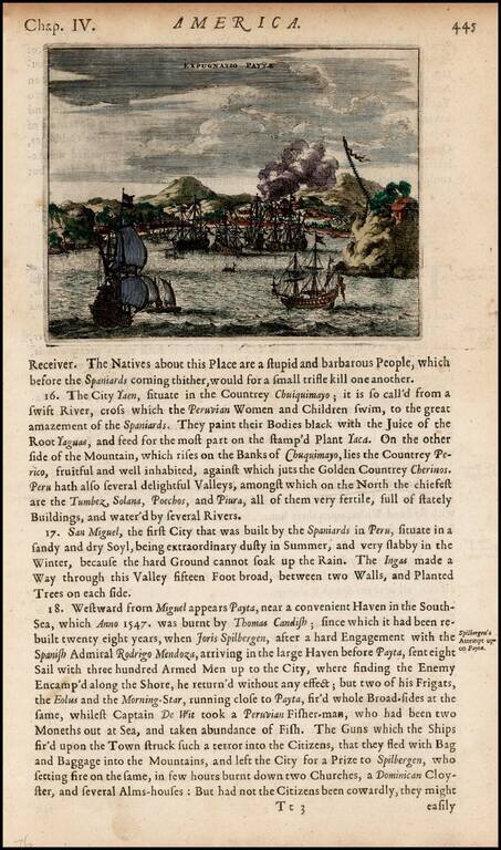
Detailed view of the harbor and town of Payta, burned by Thomas Cavendish in 1547 and visited by Joris Spilbergen in 1575.
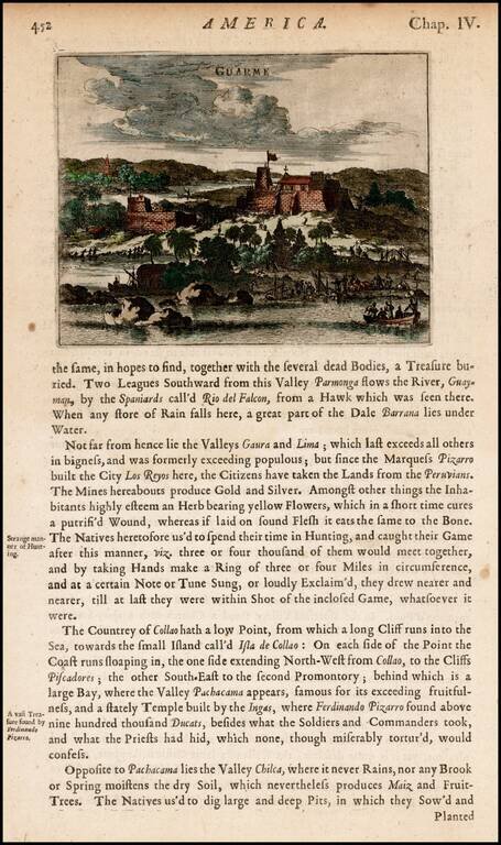
View of the fortifications at Guarme, or present-day Huarmey, Peru, from Ogilby's Complete History of America. Includes men landing goods and barrels from boats and a settlement with a church in a distance.
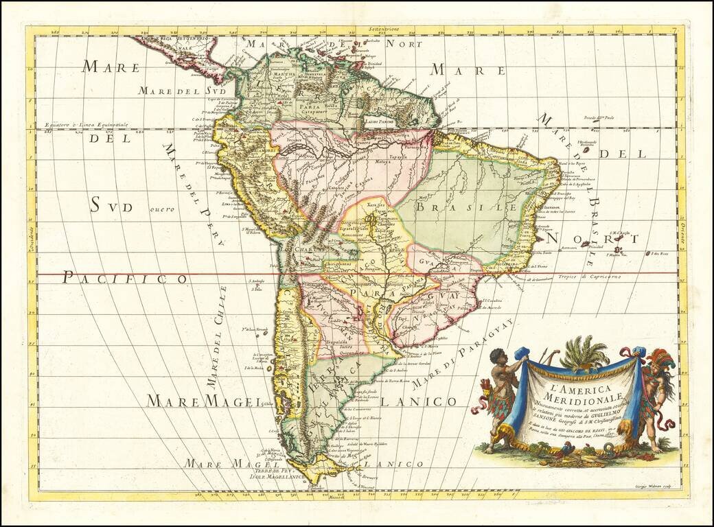
First edition of Rossi's map of South America, published in Rome. The map provides a fine detailed treatment of South America, based upon the work of Nicolas Sanson. The map is engraved by master engraver Giorgio Widman. A later edition was issued...
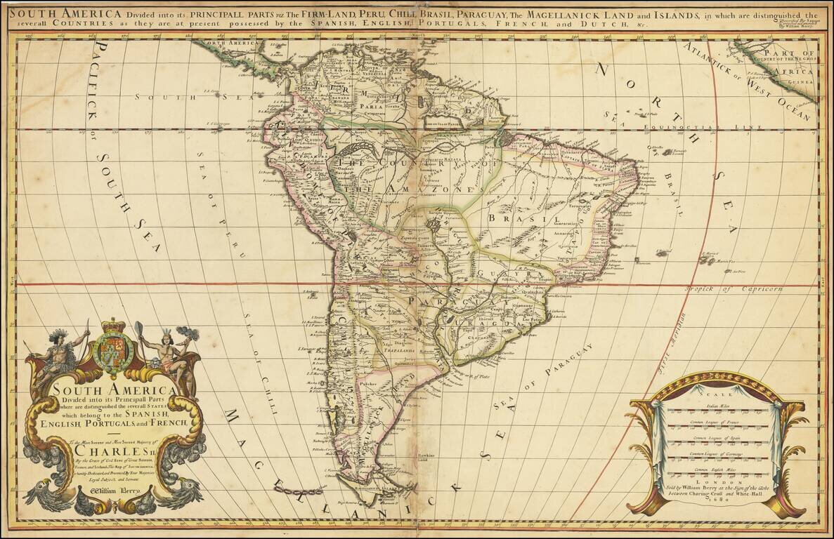
Rare two-sheet antique English map of South America, published by William Berry in London in 1681. William Berry and Robert Morden petitioned the King of England for a license to publish maps for a world atlas in 1678. By 1680, William Berry, then...
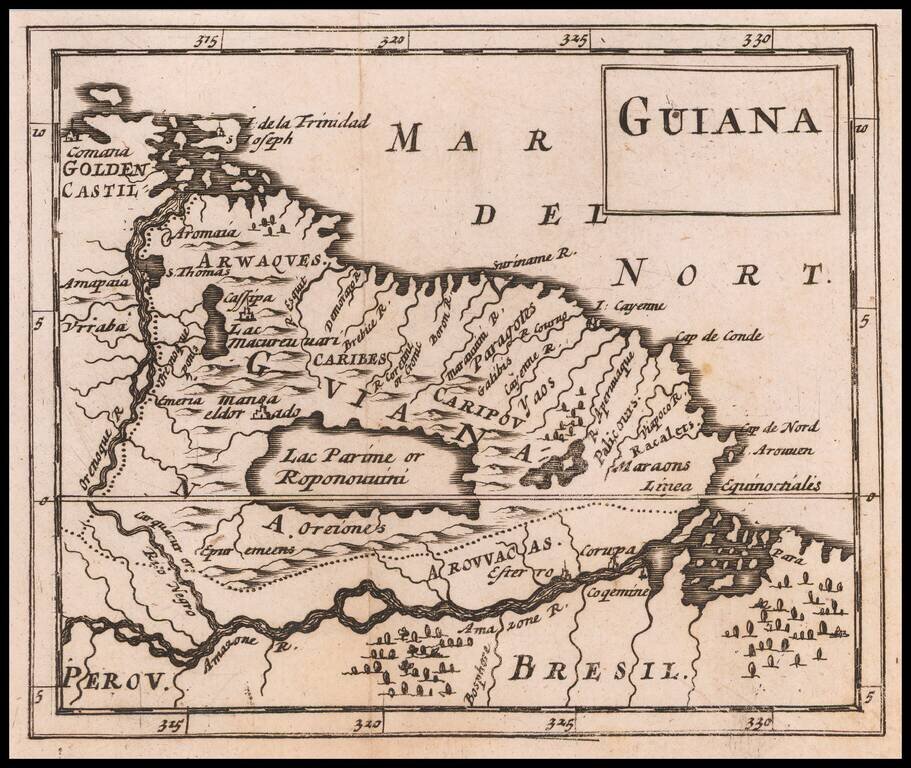
Rare Miniature English Map of Guiana, Including Manoa or El Dorado Rare map of Guiana, including the Lake Parime region, with the town of Manor or El Dorado shown, published by Sir Jonas Moore in London. The map appeared in Moore's A New Geography....
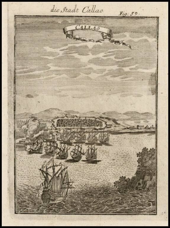
Excellen birdseye view of this Peruvian city from the harbor, featuring sailing ships and fortifications. Mallet's multi-volume work is one of the most famous and comprehensive illustrated works of the 17th Century, which is prized for its excellent...

Nice example of Valk & Schenk's map of South America. The map provides substantial detail in South America, along with a number of vignettes showing native scenes, animals, canoes and huts. Off shore a number of sailing ships, canoes and sea...
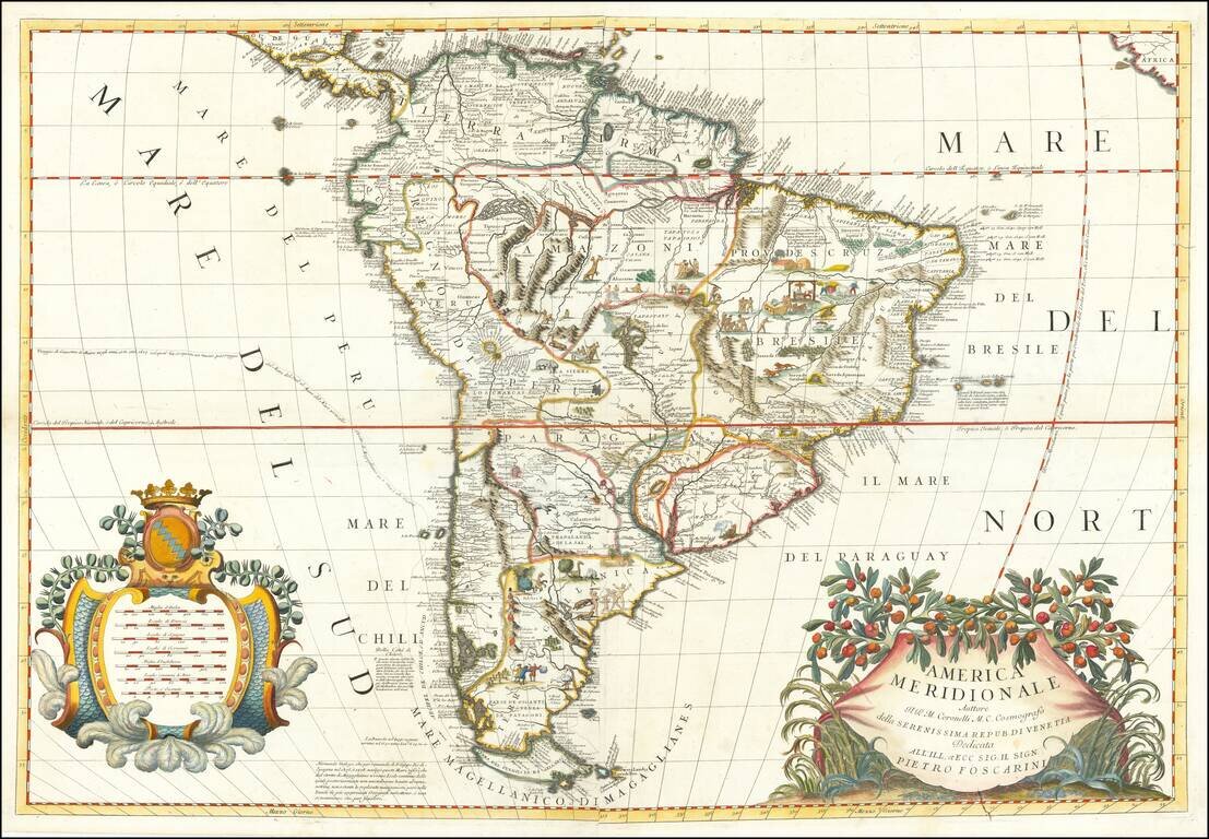
Finely Colored Example of Coronelli's Map of South America Striking example of Coronelli's spectacular 2 sheet map of South America, one of the most influential maps of South America published in the late 17th Century. An attractive large folio map...
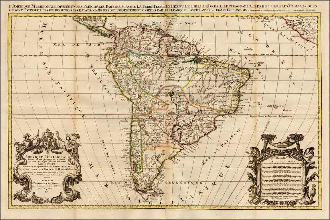
Fine Map of South America by Jaillot Handsome large-format map of South America, based upon the earlier maps of Nicholas Sanson. Jaillot’s map is well-framed, showing South America with portions of Central America, Africa, and the Cape Verde...
Richly engraved decorative map of South America, in Scherer's distinctive style. The map is filled with towns and pictorial representations of the mountainous topography. Near Guyana, the fictitious lake of Parime is named with the mythical city of...