Map size in jpg-format: 41.0848MiB
Click to open in high resolution (open in new tab).
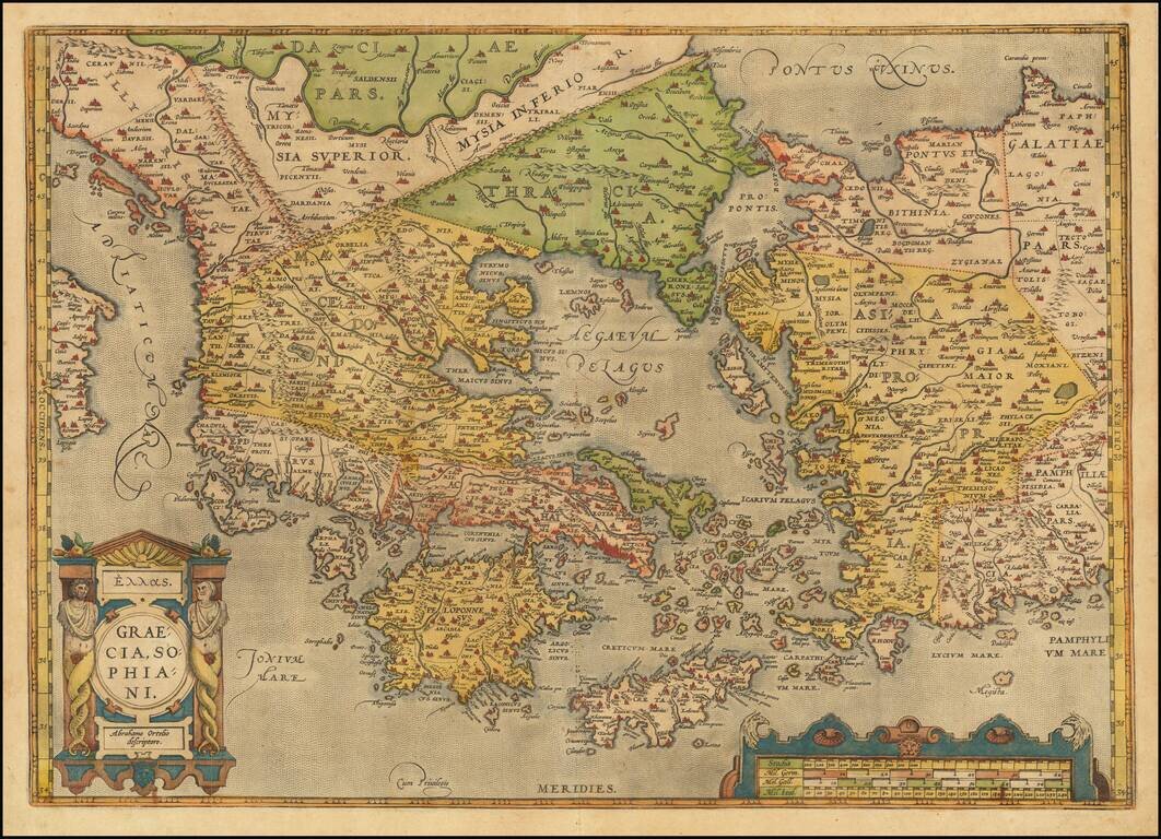
Old color example of Ortelius' decorative map of Greece, Turkey and Asia Minor, with neighboring islands, from Ortelius' Theatrum Orbis Terrarum, the first modern atlas of the world.
The map is embellished by a decorative cartouche and scale of miles. Based upon Nikolaus Sophianos' map of Greece around 1540 which was published by Johannes Oporinus in Basel in 1545 as an eight block woodcut map, and in 1552 as a four sheet engraved map.
If you are a student, write to us in telegram: @antiquemaps and indicate what material you need and for what work you need a map in high detail. We are ready to provide material on special terms. For students only!

![Patriarchatus Antiocheni Geographica Descriptio . . . [shows Cyprus]](/map/small/54177.jpg)
