Map size in jpg-format: 1.17136MiB
Click to open in high resolution (open in new tab).
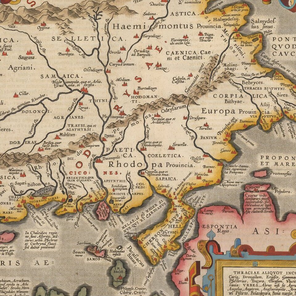
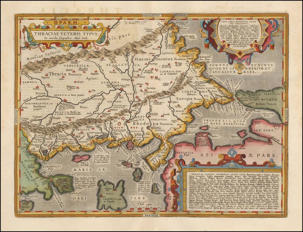
Fine map of ancient Thrace, extending from Byzantium (Istanbul) and the Bosphorus Straits to Macedonia, published by Abraham Ortelius.
The map is based on Gastaldi's 1560 map of South East Europe, and on information from numerous ancient sources, specifically Herodotus, Plinius, Strabo, Appianus, Virgilius, Plutarchus, and Sidonius.
Portions of the Black Sea, Sea of Marmara, and Thrakikon Pelagos, all stipple engraved and fully colored, make this a very handsome map. Three decorative, strapwork cartouches.
If you are a student, write to us in telegram: @antiquemaps and indicate what material you need and for what work you need a map in high detail. We are ready to provide material on special terms. For students only!

![Patriarchatus Antiocheni Geographica Descriptio . . . [shows Cyprus]](/map/small/54177.jpg)
