
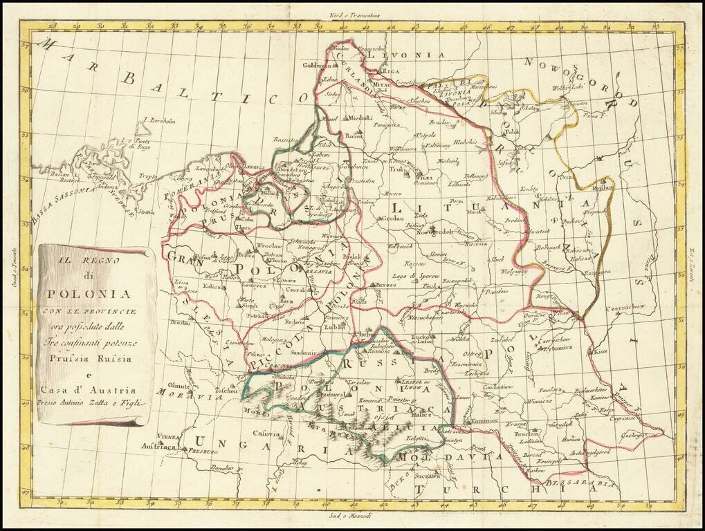
Rare map of Poland, in the midst of its dismemberments. The map locates the Polish territorial acquistions of Russia, Austria and Prussia in the second half of the 18th Century.
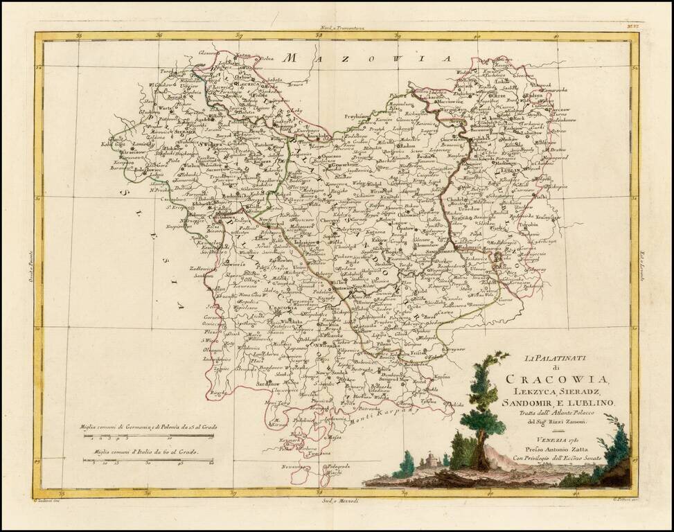
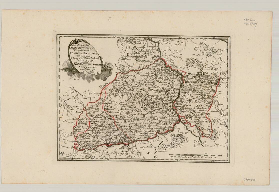
Decorative regional map of part of Poland. Major towns shown include Cracowia, Leczica, Sieradz, Radomisko, Ostzeszow, Lublin, and Sandomirsz. Issued as part of Zatta's Atlante Novissimo.
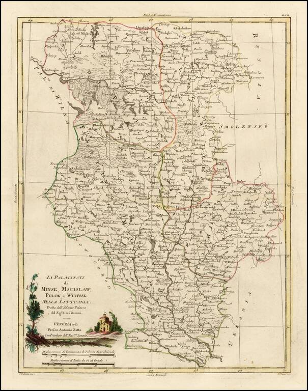
Decorative regional map of several Palatinates in modern day Belarus, centered on the Upper Dniepr River and Upper Dwina River. Issued as part of Zatta's Atlante Novissimo.
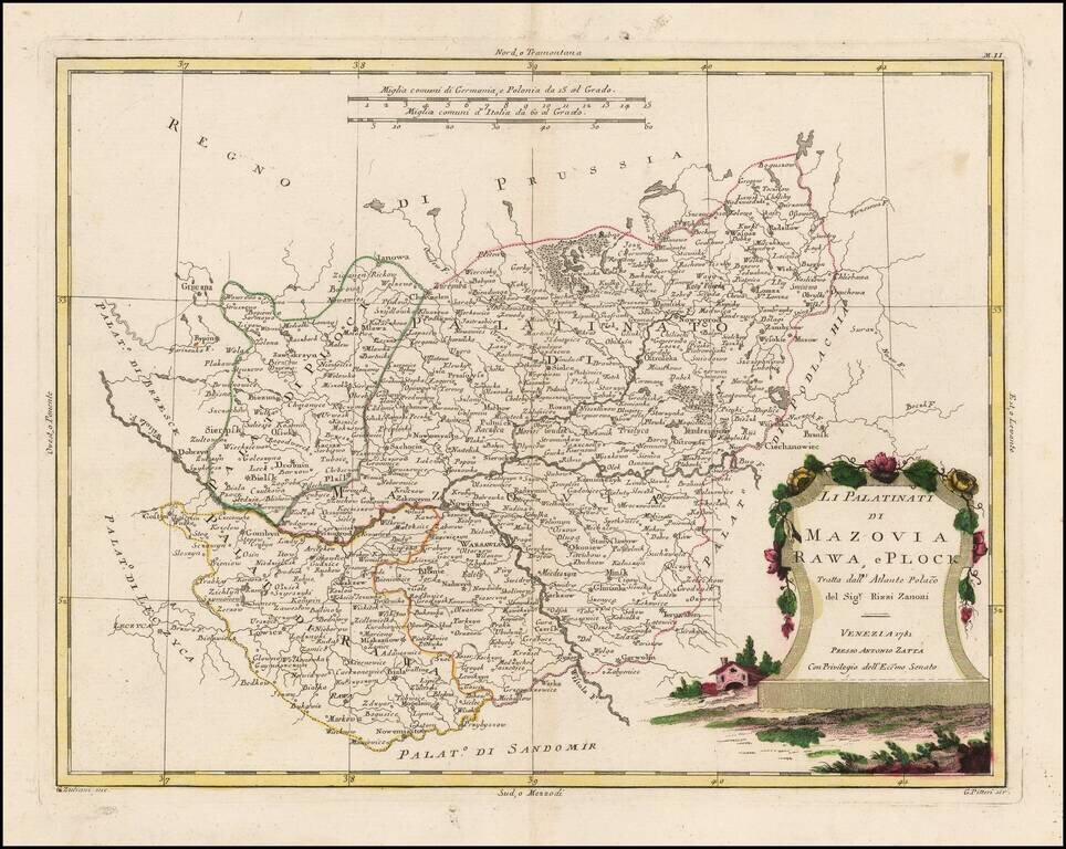
Decorative regional map of part of Poland. Major towns shown include Warsawia, Ieruzalem, Rawa, Lowicz, Ianowa, Nowidor, Radzilow, Nowygrod, Ciechanowiec, Minsk and Biala. Issued as part of Zatta's Atlante Novissimo.
Decorative regional map of several Palatinates in modern day Ukraine and Belarus. The map shows the region east of the Dniester River, centered on Kiev. Issued as part of Zatta's Atlante Novissimo.

A highly detailed map of Poland, published by Zatta. The map stretches from the Baltics to Hungary, Moldavia, the Ukraine and Russia. Shows, towns, rivers, mountains and other features. Based upon the work of Antonio Rizzi Zannoni.
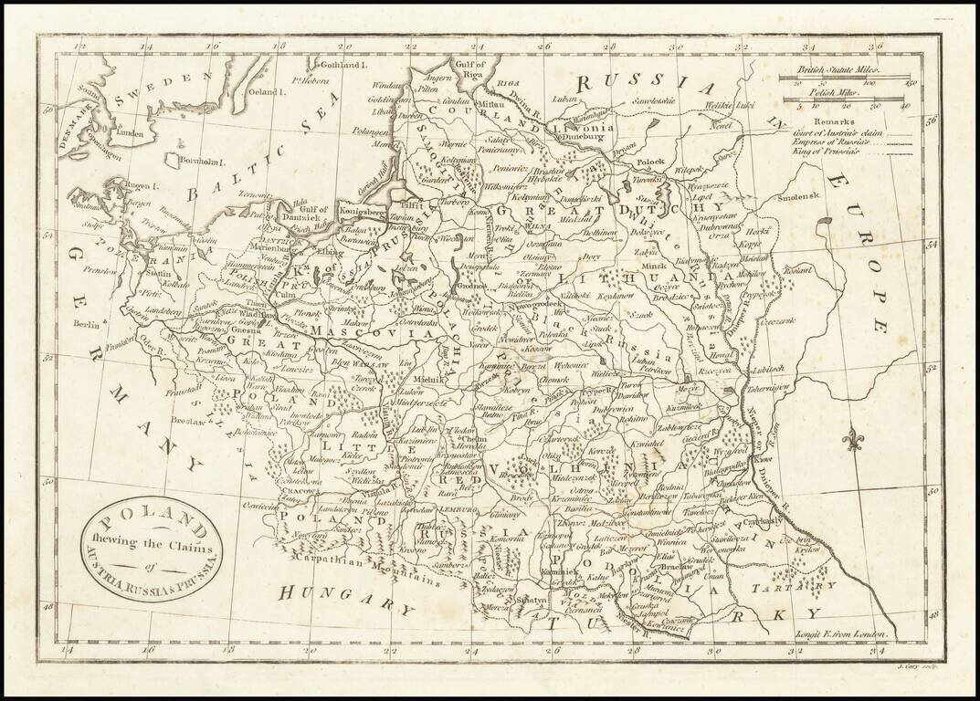
Scarce John Cary map of Poland published during "the Partitions." The map itself is detailed, showing the cities, rivers, lakes, and forests of Poland. Regions are named, including the Great Duchy of Lithuania, Polachia, Mascovia, Red Russia, Black...
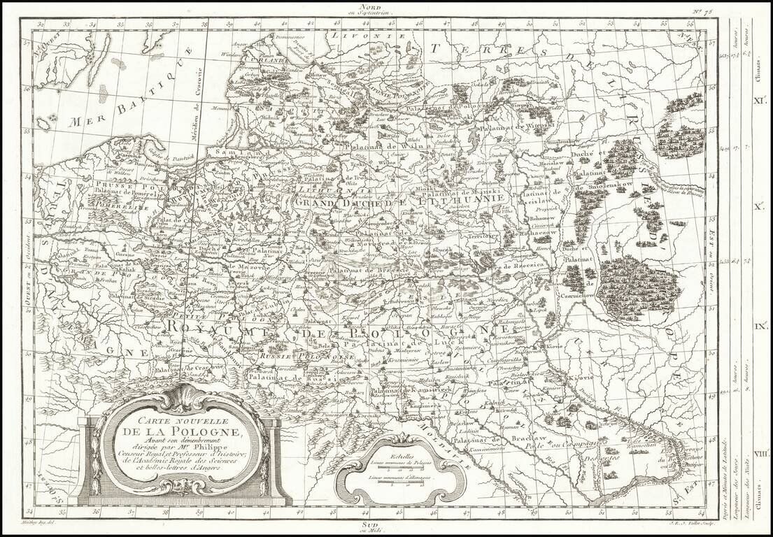
Rare map of Poland, depicting the dismemberment, published in Paris by Moithey and engraved by J.E.J. Vallet. The map is filled with information on the rivers, mountains, cities and villages.
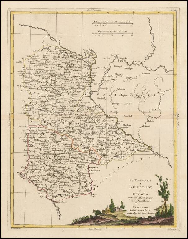
Very scarce regional map of Poland and the Ukraine, showing the region traversed by the Bug River and centered on Braclaw. Shows rivers, roads, towns, castles, forests, lakes and a host of other details. Quite possibly the most detailed map of this...
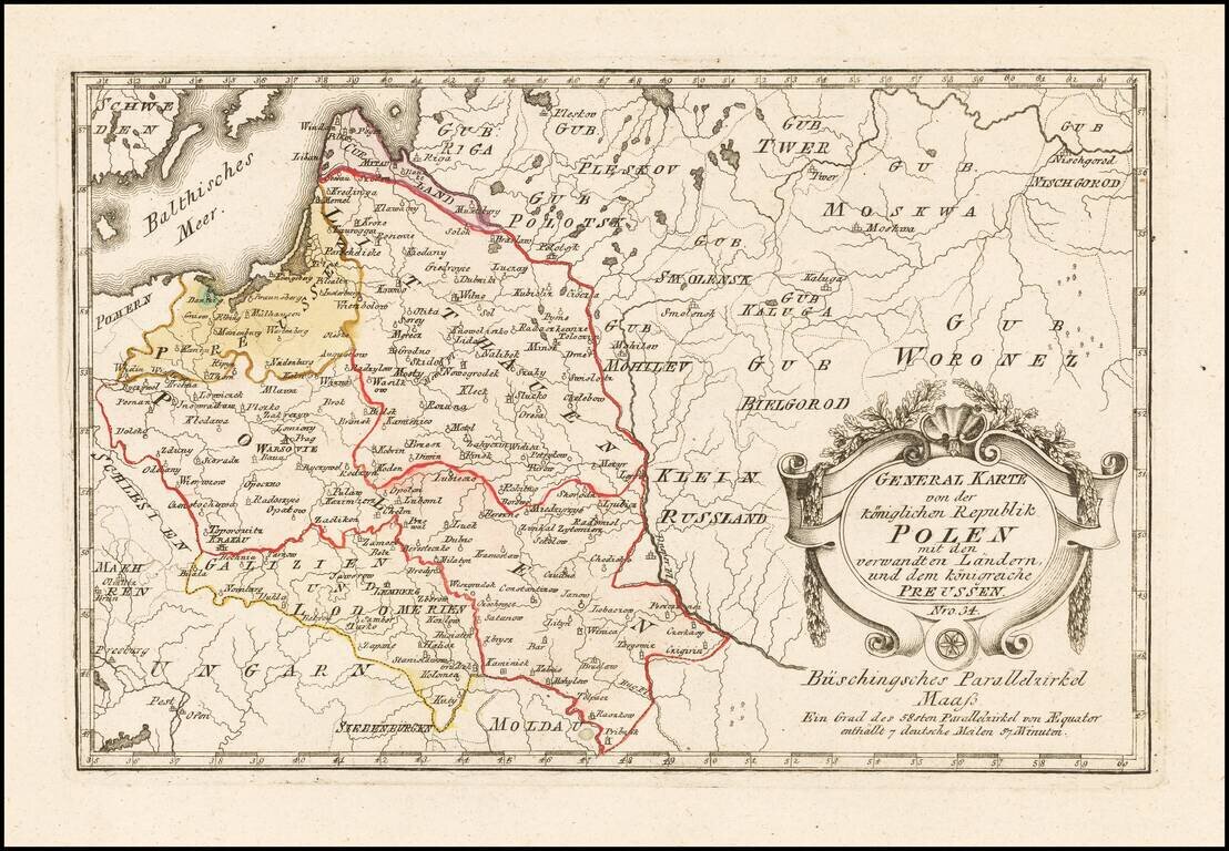
Scarce map of Poland, published by Von Reilly. The map was published during the period when Stanislaw II was attempting to reform Poland and implement a set of modern laws in tune with the Enlightenment. The Great Sejm convened by Stanislaw II August...
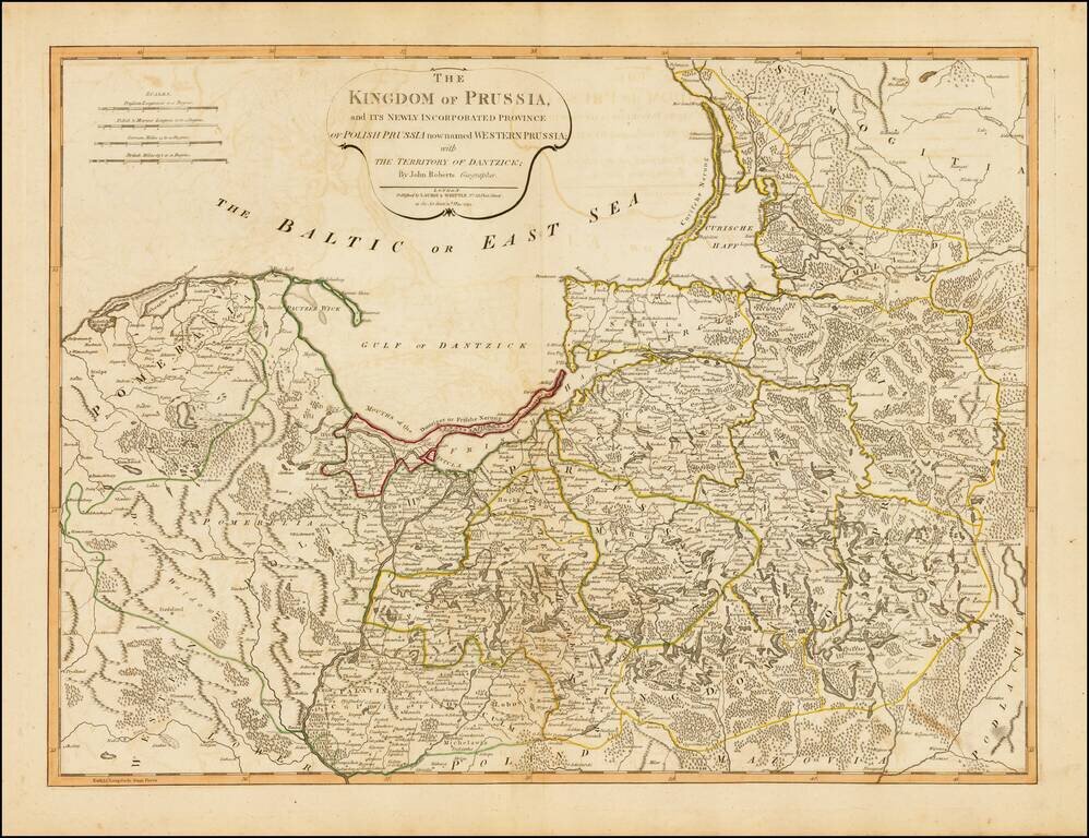
Strking full color example of this fine map of Prussia and Polish Prussia, following the Polish Dismemberment. Includes a significant section of modern Lithuania.
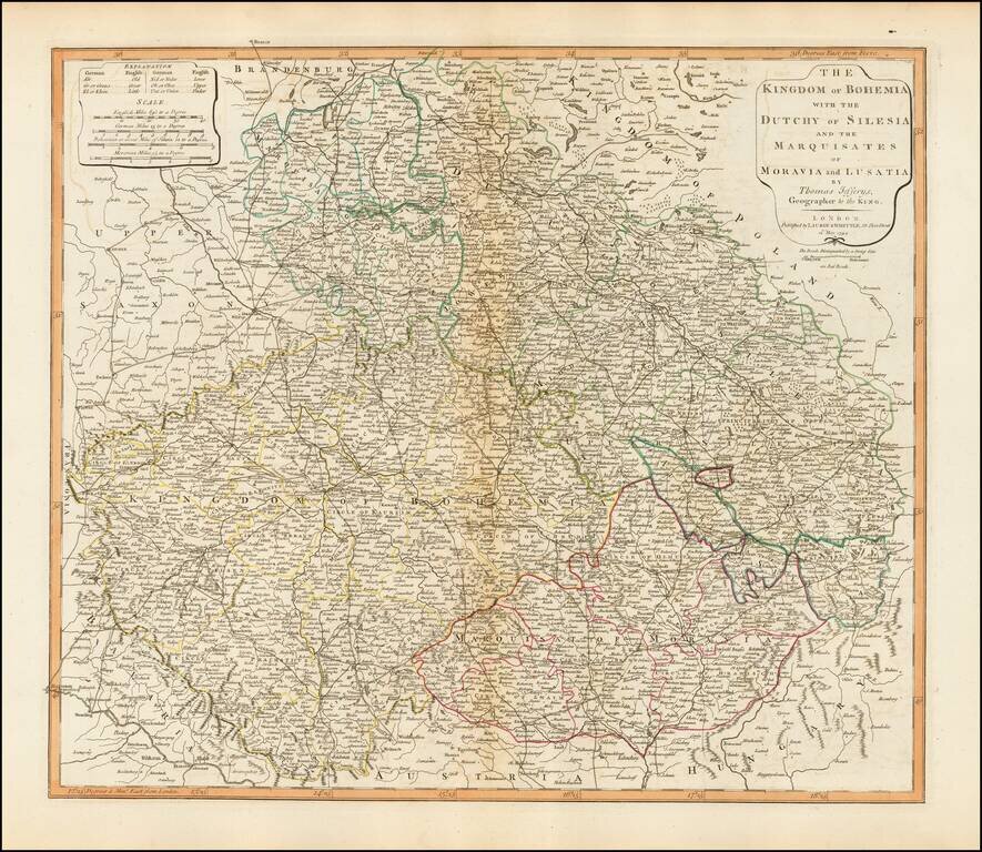
Detailed map of Bohemia, Moravia, Silesia and Lusatia, published in London by Laurie & Whittle. The map incorporates the modern day Czech Republic, Slovakia and the southern part of Poland.
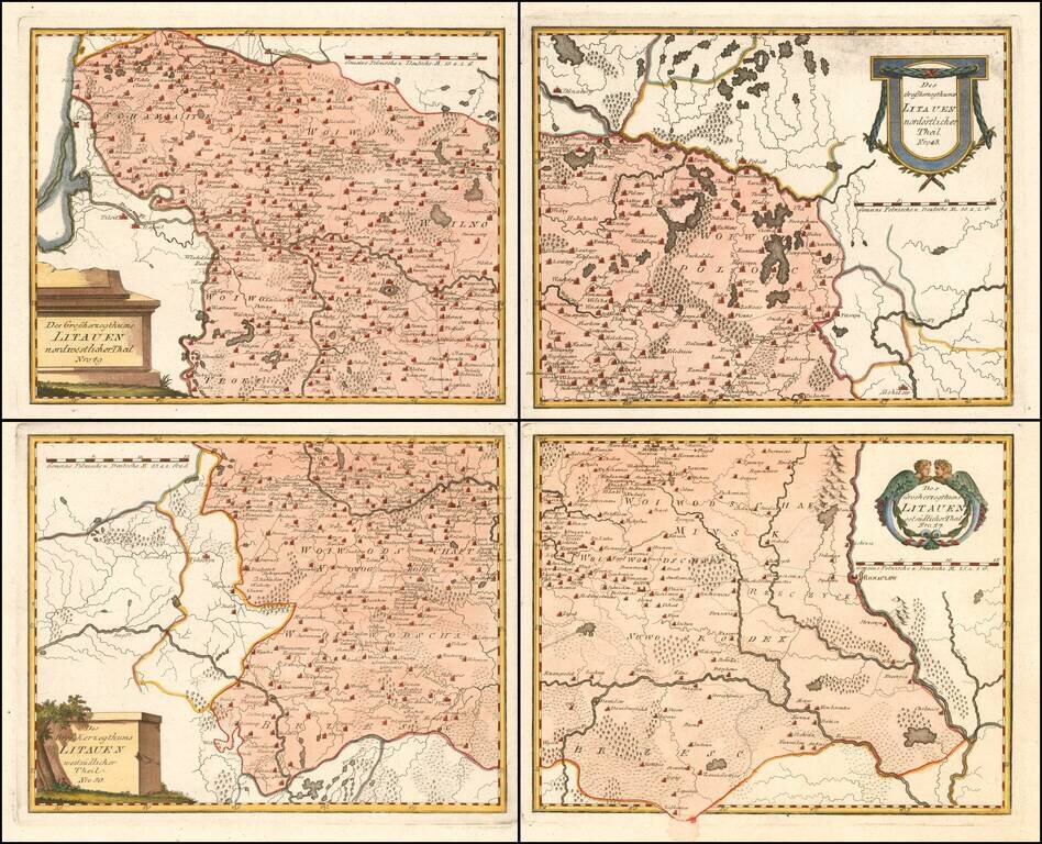
Scarce 4-sheet regional map of Lithuania, published by Von Reilly, The map shows region bounded by the Dnieper, Dwina and Wilia Rivers and including Mohilow, Polock, and Braslaw. Shows rivers, roads, towns, castles, forests, lakes and a host of other...
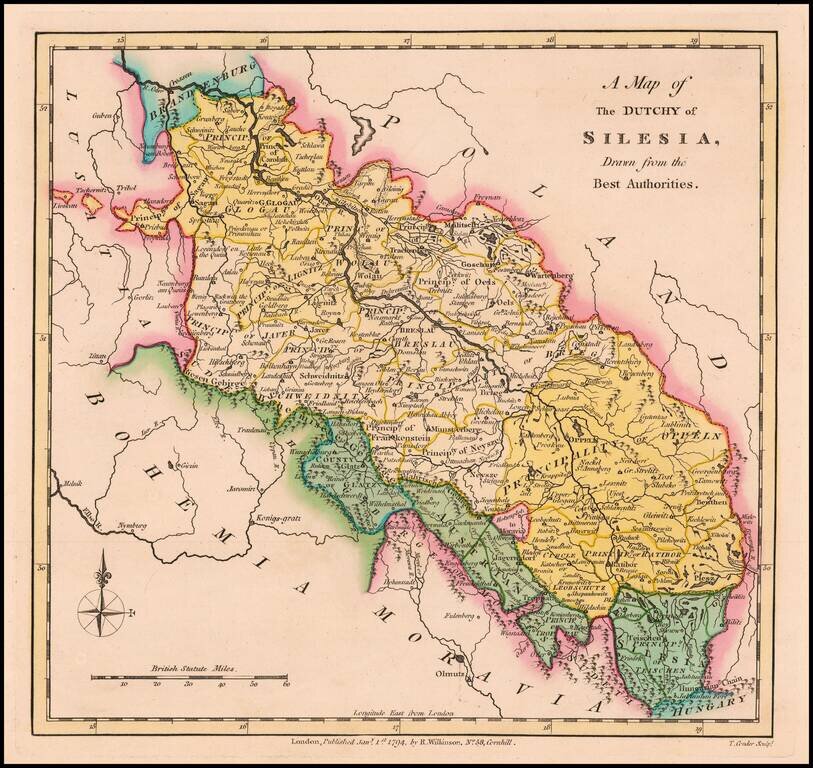
Scarce 18th Century English language map of Silesia, showing the region on either side of the Oder River. Includes Principalities of Glogau, Wolau, Lignitz, Oels, Breslau, Javer, Schweidnitz, Brieg, Oppeln, Neysze Trahenberg Sagan, Carolath,...
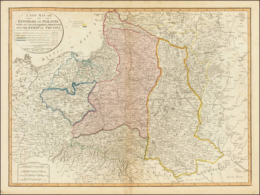
Striking full color example of this fine map of Poland, showing the provinces stripped from the control of Poland at the end of the 18th Century. The table notes the population of Poland before dismemberment (14,260,000), the populations of the...
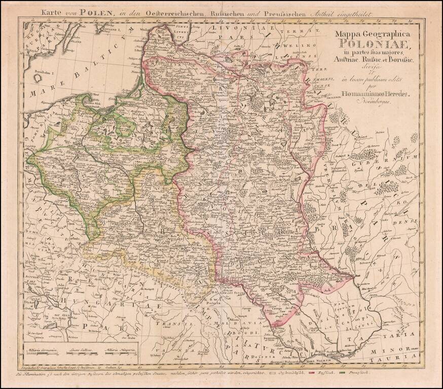
Rare map of Poland, published by the Homann Heirs is Nuremberg. This is the rare final state Tobias Mayer map of Poland. Additional title in upper margin: "Karte von Polen, in den Oesterreichischen, Russischen und Preussischen Antheil Eingetheilet"....