Map size in jpg-format: 40.0046MiB
Click to open in high resolution (open in new tab).
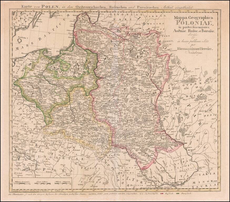
Rare map of Poland, published by the Homann Heirs is Nuremberg.
This is the rare final state Tobias Mayer map of Poland. Additional title in upper margin: "Karte von Polen, in den Oesterreichischen, Russischen und Preussischen Antheil Eingetheilet".
The map is colored to show the various regions controlled by the major European powers following the final partition, with the Austrian regions in yellow, Russian in red and Prussian in green.
If you are a student, write to us in telegram: @antiquemaps and indicate what material you need and for what work you need a map in high detail. We are ready to provide material on special terms. For students only!


![[Hand Drawn Prussian Military Encampment at Opole, Poland] Special Grund-Riss Des Kaeyserl Feldl Lagers bey Oppeln in Ober Schlesien](/map/small/59726.jpg)