Map size in jpg-format: 2.83779MiB
Click to open in high resolution (open in new tab).
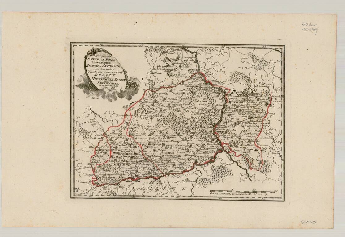
Very scarce regional map of Poland and the Ukraine, showing the region traversed by the Bug River and centered on Braclaw.
Shows rivers, roads, towns, castles, forests, lakes and a host of other details. Quite possibly the most detailed map of this region to appear in an 18th Century Atlas. From Von Reilly's exceedingly scarce Schauplatz der funf Theile der Welt. Von Reilley & Schaembl led a revival of map making in Vienna in the late 18th Century which included this and several other sought after works.
If you are a student, write to us in telegram: @antiquemaps and indicate what material you need and for what work you need a map in high detail. We are ready to provide material on special terms. For students only!


![[Hand Drawn Prussian Military Encampment at Opole, Poland] Special Grund-Riss Des Kaeyserl Feldl Lagers bey Oppeln in Ober Schlesien](/map/small/59726.jpg)