logo

1787. Carte Nouvelle de la Pologne Avant son demenbrement dirigee par Mr. Philippe . . .

  • Carte Nouvelle de la Pologne Avant son demenbrement dirigee par Mr. Philippe . . .

Carte Nouvelle de la Pologne Avant son demenbrement dirigee par Mr. Philippe . . . information:

Year of creation: 
Resolution size (pixels): 
 9860x6852 px
Disk Size: 
 16.5912MiB
Number of pages: 
 1
Place: 
 Paris

Print information. Print size (Width x height in inches):
Printing at 72 dpi 
  136.94 х 95.17
Printing at 150 dpi 
 65.73 х 45.68
Printing at 300 dpi 
 32.87 х 22.84

An example of detailing the file of this map of in a printable high-resolution:

Click to open in high resolution (open in new tab).
Attention! this is just the central piece (central area 960x960 px) of the map file!
This is an example, so that you can see and study the level of detail of a given map. The entire Map will be fully available after payment!

Carte Nouvelle de la Pologne Avant son demenbrement dirigee par Mr. Philippe . . .

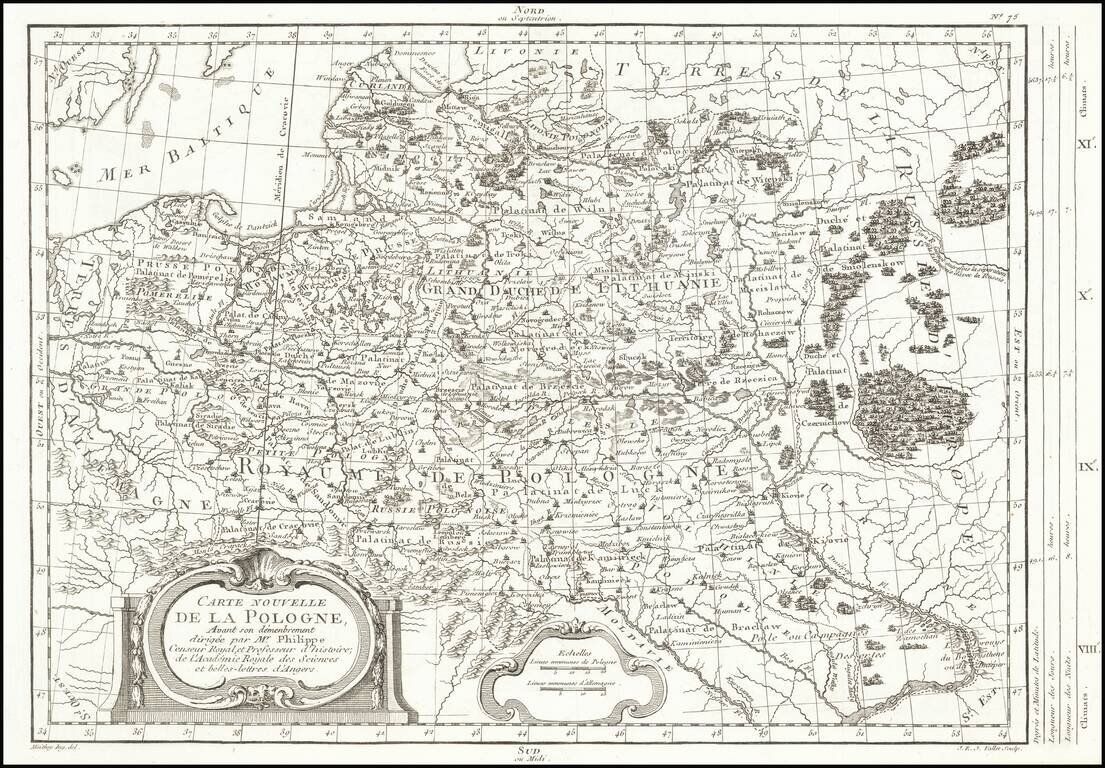
Rare map of Poland, depicting the dismemberment, published in Paris by Moithey and engraved by J.E.J. Vallet.

The map is filled with information on the rivers, mountains, cities and villages.

MCC 31, #274 (dated 1785).

Special conditions for students!

If you are a student, write to us in telegram: @antiquemaps and indicate what material you need and for what work you need a map in high detail. We are ready to provide material on special terms. For students only!

Item information:

Year of creation:
Size:
9860x6852 px
Disk:
16.5912MiB
Number of pages:
1
Place:
Paris
Author:
Maurille Antoine Moithey. Etienne-Andre Philippe De Pretot.
$14.99

Related item