Map size in jpg-format: 32.0245MiB
Click to open in high resolution (open in new tab).

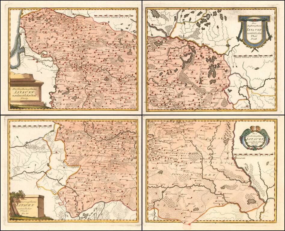
Scarce 4-sheet regional map of Lithuania, published by Von Reilly,
The map shows region bounded by the Dnieper, Dwina and Wilia Rivers and including Mohilow, Polock, and Braslaw.
Shows rivers, roads, towns, castles, forests, lakes and a host of other details.
From Von Reilly's Grosser Deutscher Atlas.
If you are a student, write to us in telegram: @antiquemaps and indicate what material you need and for what work you need a map in high detail. We are ready to provide material on special terms. For students only!


![[Hand Drawn Prussian Military Encampment at Opole, Poland] Special Grund-Riss Des Kaeyserl Feldl Lagers bey Oppeln in Ober Schlesien](/map/small/59726.jpg)