
![[Moscow] Moscua](/map/small/37897.jpg)
Striking birdseye view of Moscow, from Merian's Neuwe Archontologica Cosmica . . ., published in 1638. Shows detailed town plan, Moscua River, Iausa River, Neglina River, three sets of fortified walls, Kremlin, public buildings, churches, bridges,...
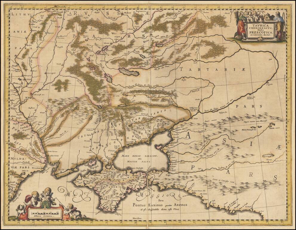
Detailed map of the Ukraine and surrounding regions between the northern coast of the Black Sea and Moscow. Shows ports, fortified cities and the mouths of the Danube. Two decorative cartouches.
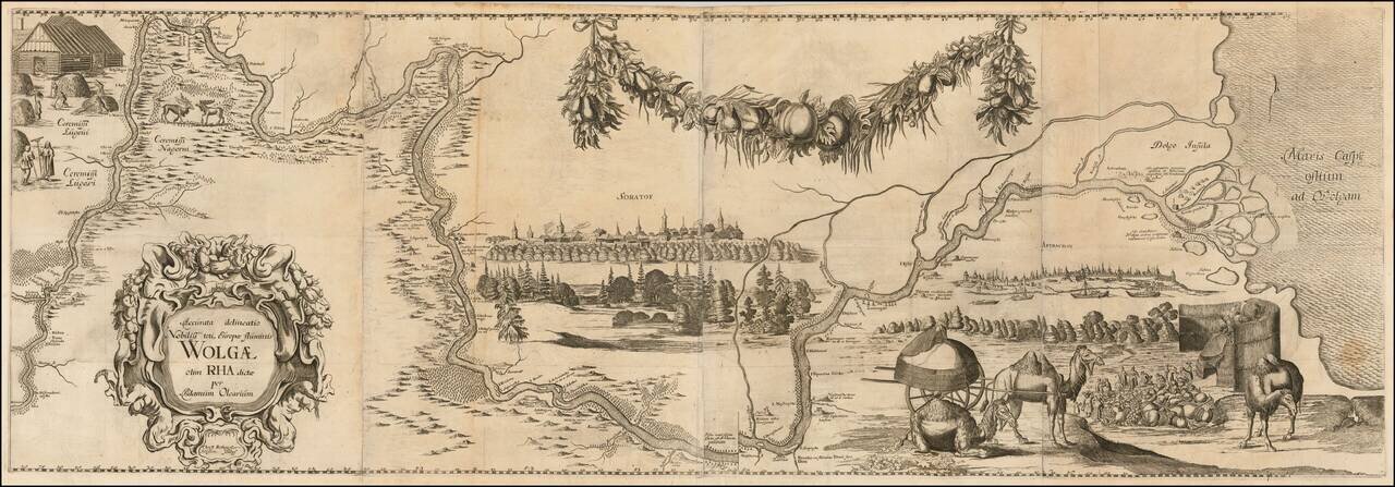
Rare First Edition of The First Great Map of the Volga River Nice example of Olearius' map of the Volga River, first issued in 1647 and engraved by Christian Rothgiesser. Shows the course of the Volga from Nischni Nowgorod to the Caspian. Includes...
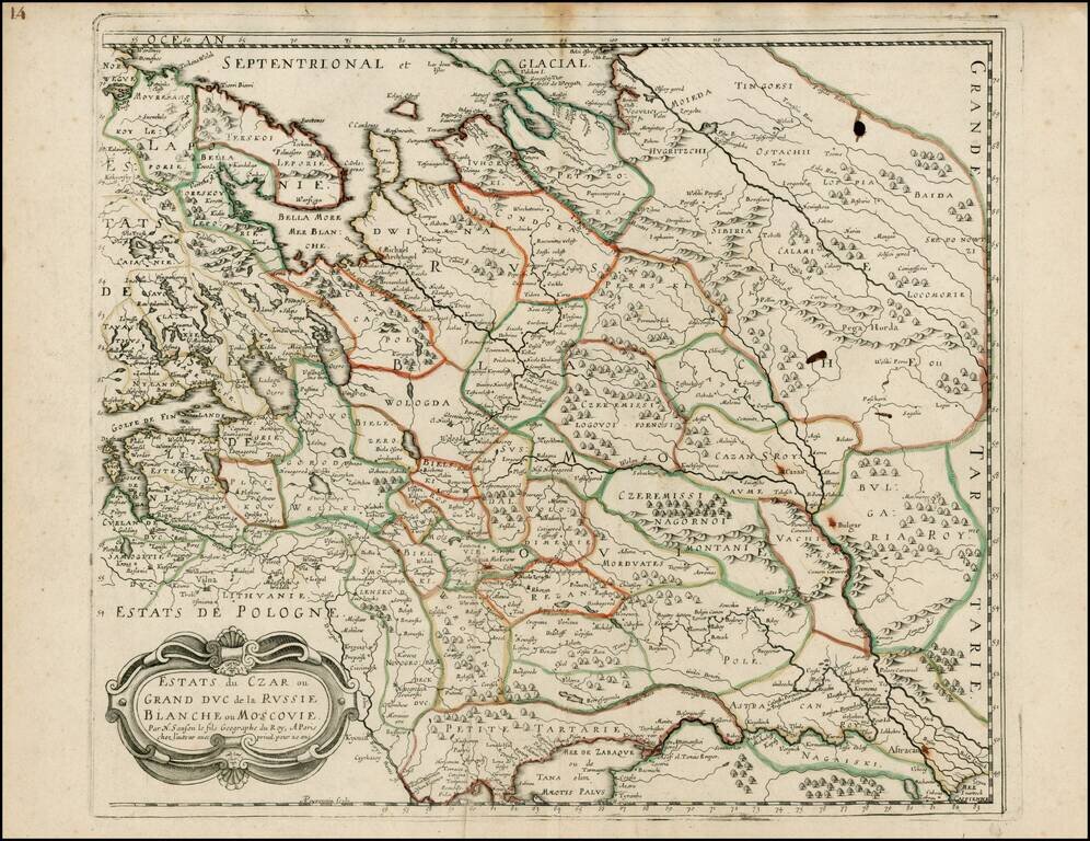
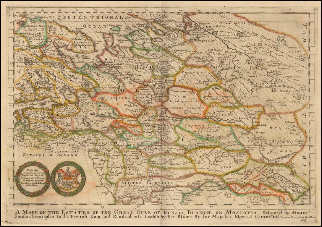
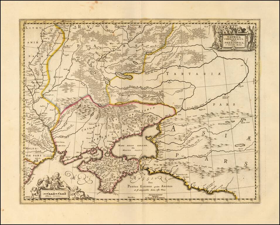
Striking example of Sanson's map of Russia, Poland and Ukraine, extending from the Gulf of Finland to Petite Tartary and to Bulgaria and Tartaria.
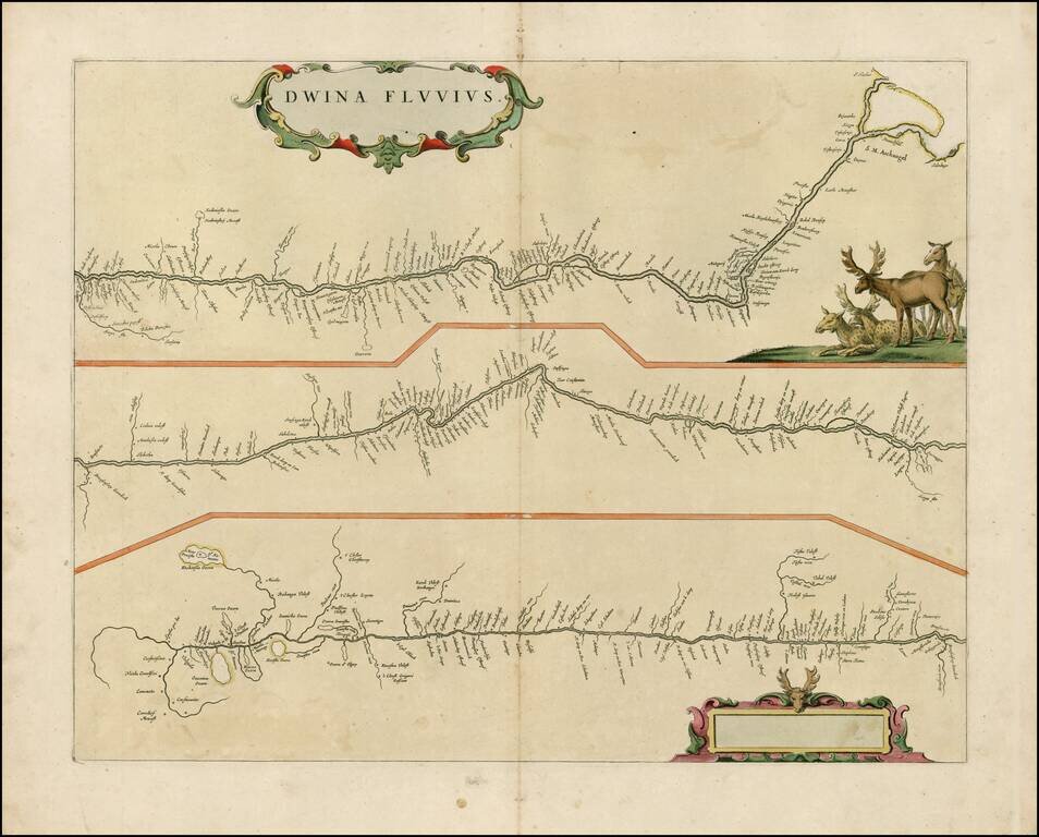
Rare late edition of Blaeu's map showing the course of the Dvina River in three separatre panels. The headwaters are at bottom left, with the mouth at Archangelsk at upper right. The map is decorated with a superb title cartouche surrounded by putti...
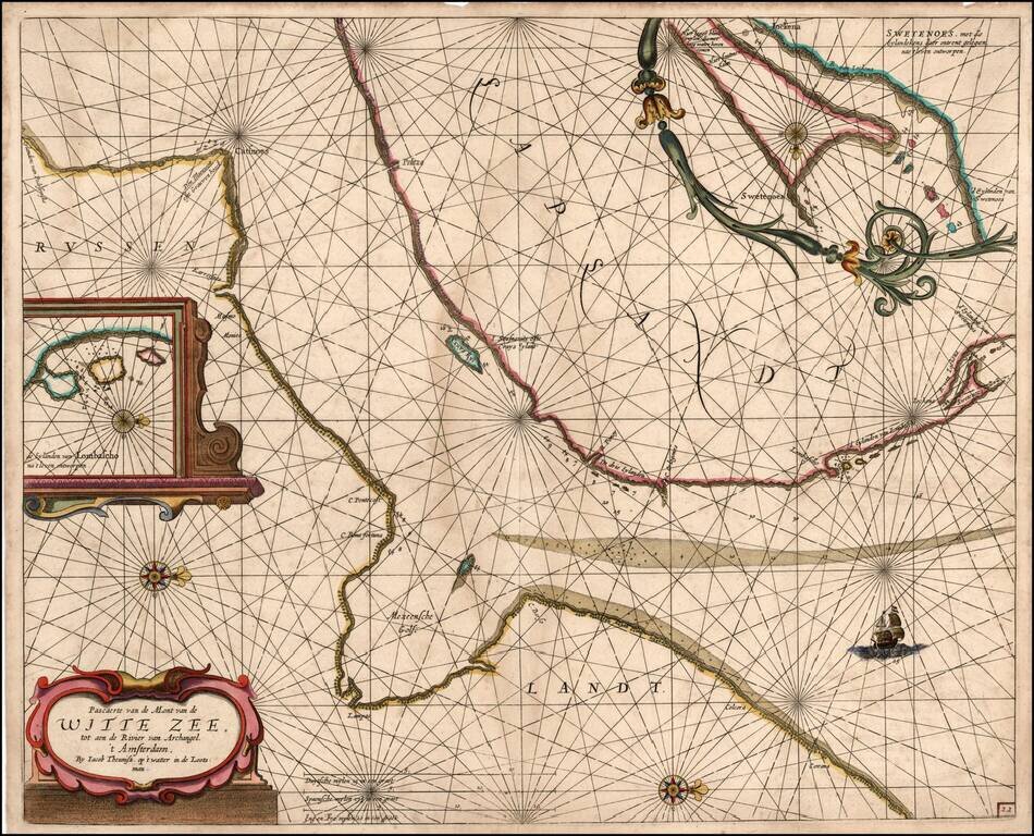
Rare sea chart of a part of the White Sea, published by Jacob Theunisz (Lootsman). At first Jacob adopted his father Anthonie's name, being known as Jacob Theunisz. Later with his brother, Caspar, in association, they added the name Lootsman to their...
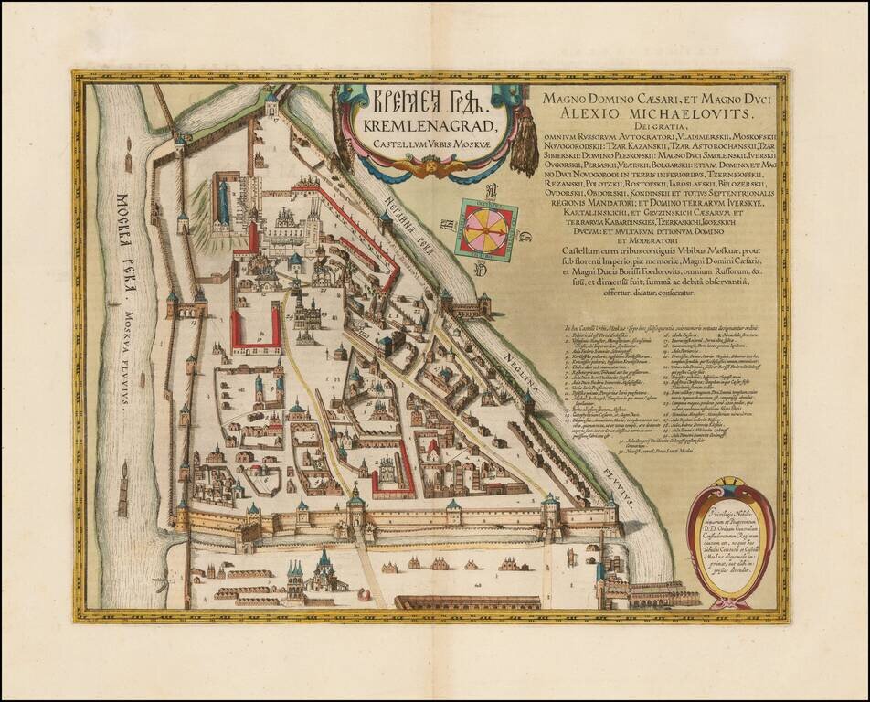
Refined, Intricate Plan of the Kremlin, from Blaeu’s Atlas Maior Fine, old-color example of Blaeu's rare plan of the Kremlin, which appeared only in his monumental Atlas Maior. The plan shows in exceptional detail the heart of Moscow's inner walled...
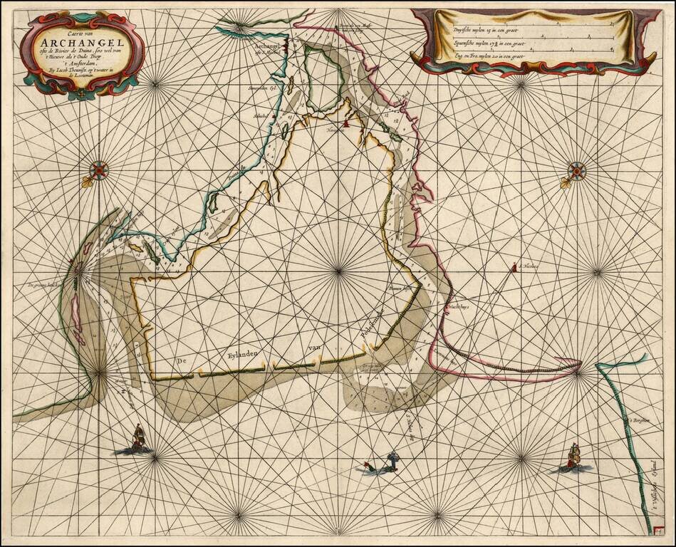
Rare sea chart of the mouth of the Duina River and the port town of Archangel, published by Jacob Theunisz (Lootsman). At first Jacob adopted his father Anthonie's name, being known as Jacob Theunisz. Later with his brother Caspar, in association,...
![De Zee Custen van Ruslant, Laplant, Finmarcken, Spitsbergen en Nova Zemla [Heightened in Gold]](/map/small/54892.jpg)
Detailed sea chart of the coasts of Russia, Finland, and Spitsbegen in old color. Includes an inset map of "De Reviere Dwina opte Reviere van Archangel". The chart includes a detailed plan of the coastlines, soundings, anchorages, coastal details,...
One of the Earliest Maps of Russia published in England. Old color example of Richard Blome's scarce map of Russia, the earliest folio sized map of the region to be engraved in England. The map reaches to the Caspian Sea and Ukraine in the South....
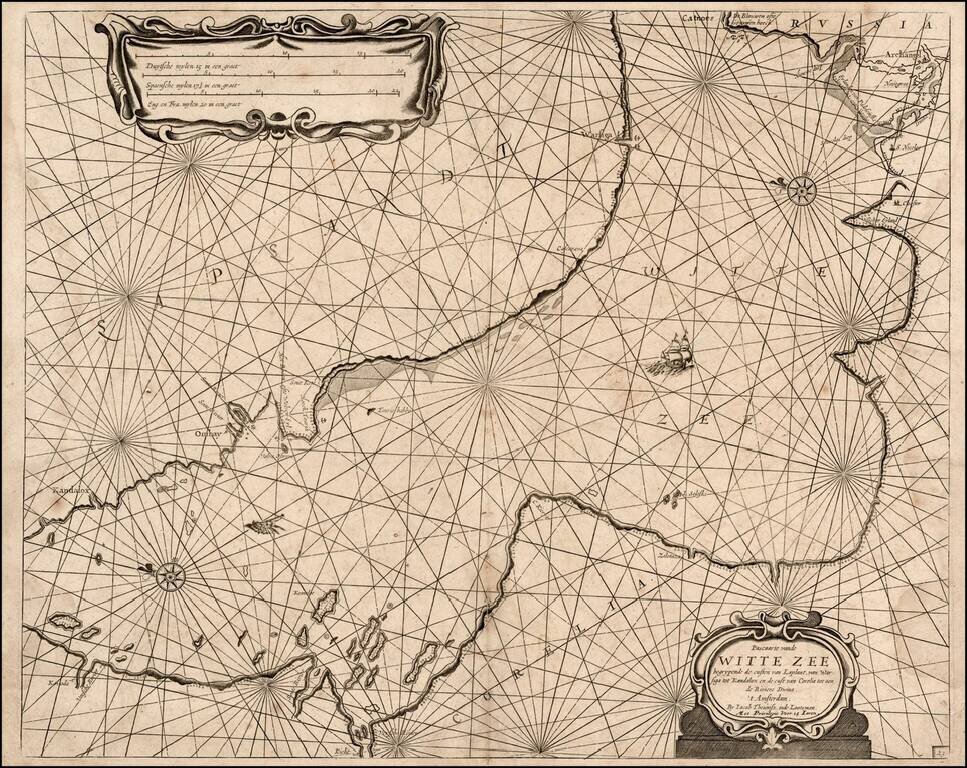
Rare sea chart of a part of the White Sea, published by Jacob Theunisz (Lootsman). At first Jacob adopted his father Anthonie's name, being known as Jacob Theunisz. Later with his brother, Caspar, in association, they added the name Lootsman to their...
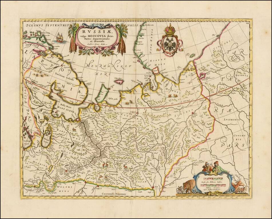
Fine example of the Moses Pitt re-issue of Blaeu's map of Russia, from Blaeu's Atlas Maior.
Detailed map of the Ukraine and surrounding regions between the northern coast of the Black Sea and Moscow. Shows ports, fortified cities and the mouths of the Danube. Two decorative cartouches.
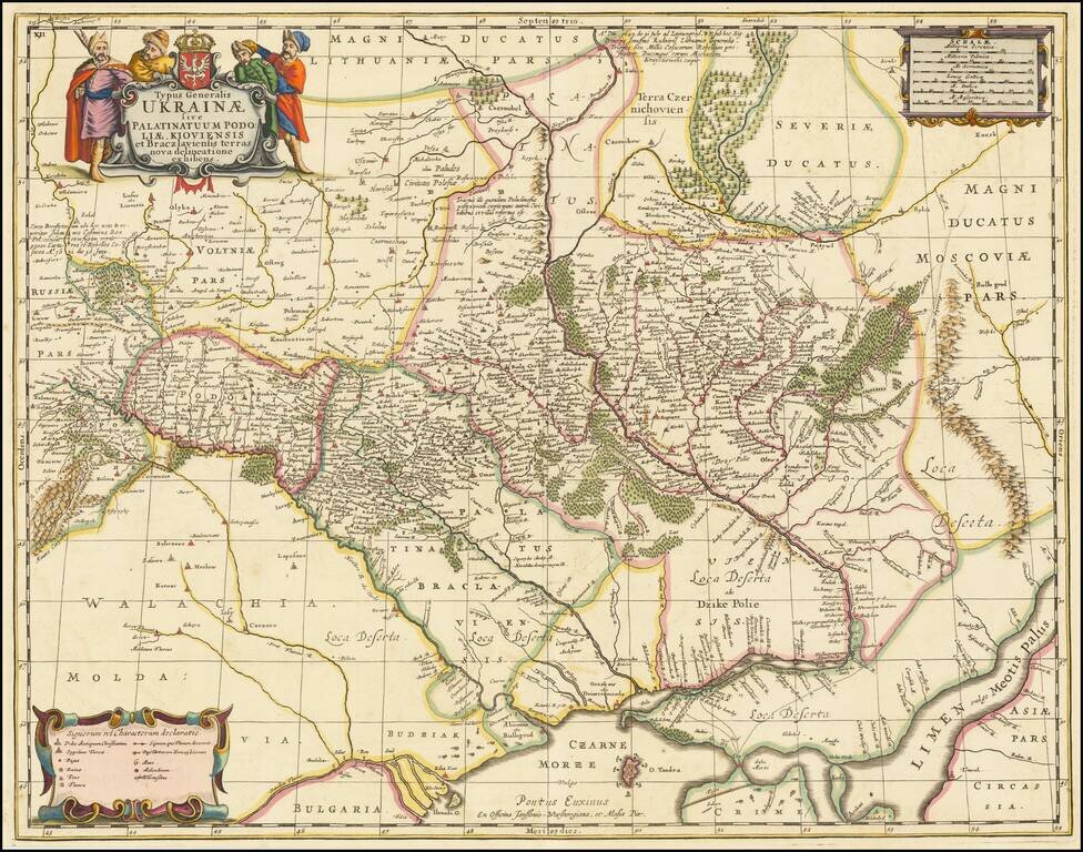
Finely colored example of Moses Pitt's map of Ukraine, divided into provinces, which appeared in a composite atlas by Abraham Wolfgang. Pitt's map, first issued by Jan Jansson in about 1657, is one of the earliest maps to include the name Ukraine in...
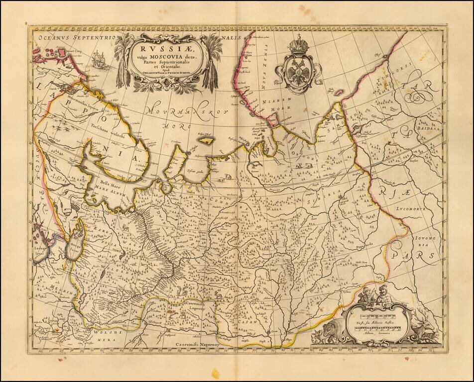
Nice example of the Valk & Schenk's map of the European part of Russia. Includes a Russian Imperial coat of arms and 2 cartouches.
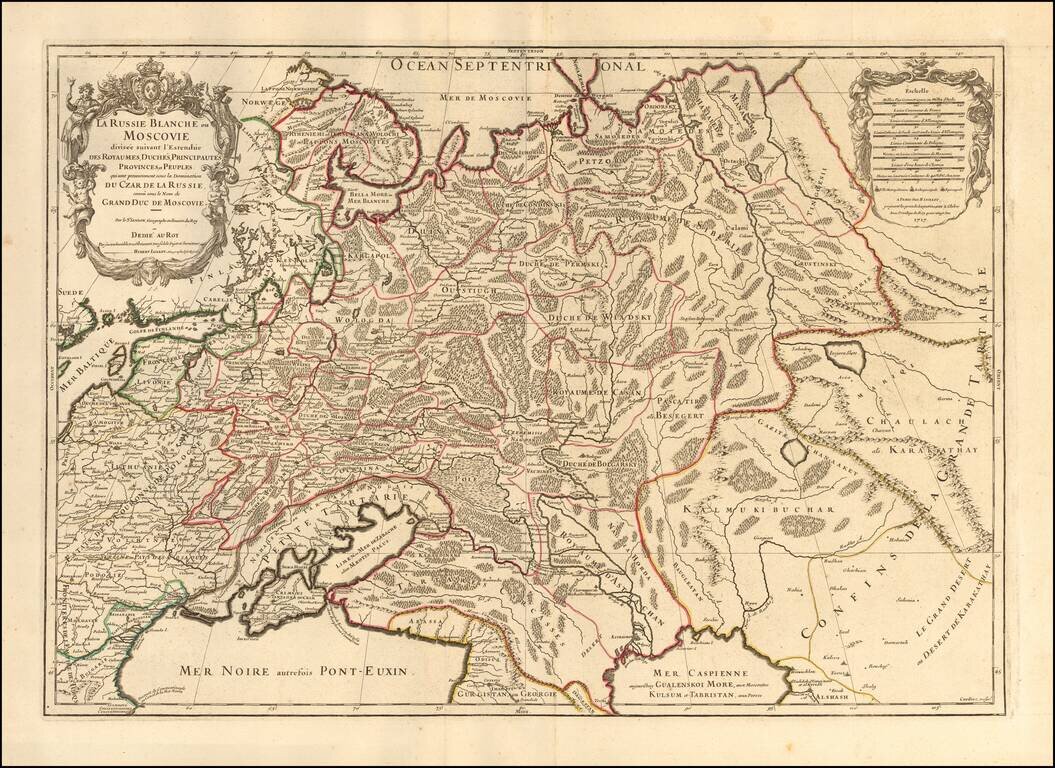
Striking large format map of Russia, extending from the Baltic and Black Seas to Grande Tartarie and the Grande Desert or Desert De Karkkathay, published by Hubert Jaillot. This map of Russia provides a highly detailed picture of European Russia and...