
![Europae Tabula VIII [Russia, Ukraine, Baltic, Scandinavia]](/map/small/44610.jpg)
Nice example of Gastaldi's map of the region bounded by the Baltic in the North and the Black Sea in the south, based upon Ptolemy. Giacomo Gastaldi is considered as the foremost Italian cartographer of the 16th century along with Paolo Forlani. From...
![Desciptione de la Moscovia per Giacomo Gastaldo piamo[n]tese, Cosmographo in Venetia MDL](/map/small/31057.jpg)
Extremely rare map of Russia, engraved by Gastaldi, based upon the work of Baron Sigismund von Herberstein. Herberstein, a diplomat from the Austrian Imperial Court, was sent to Russia twice between 1516-26, during which time he gathered enough...
![[Russia, Sweden, Finland, Estonia Latvia and Lithuania].](/map/small/36638.jpg)
A fine wide margined example of the northern sheet of the first edition of Gastaldi's 2-sheet map covering Russia, Sweden, Finland, Lithuania, Latvia and Estonia, published in Venice in 1562. The present offering is the northern sheet only (of 2) of...
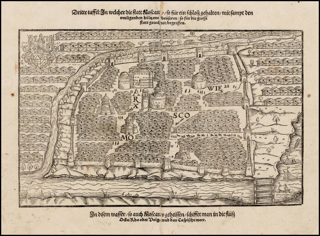
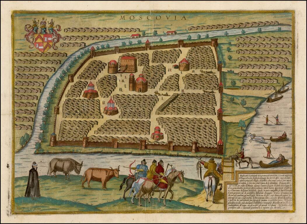
Nice example of the first printed plan of Moscow, from a German edition of Sigismund Herberstein's Moscoviter Wunderbare Historien, first published in Basel in 1563. Herberstein's view of Moscow would influence the depiction of the city for the next...
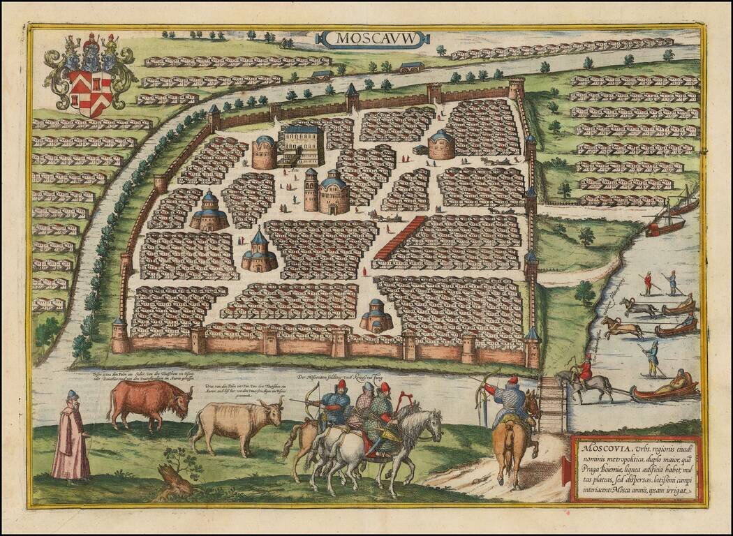
Decorative full color example of Braun & Hogenberg's first view of Moscow, from a slightly elevated viewpoint from across the frozen Moskva River, first published in 1575. The walled center of the old city is depicted with its many churches. The...
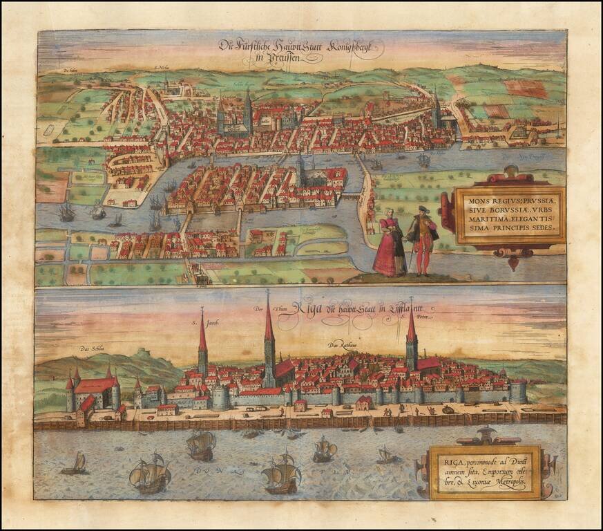
Fine early views of Kalingrad and Riga, first published by Braun & Hogenberg in 1581. The view is one of the earliest obtainable views of Kalingrad and Riga.
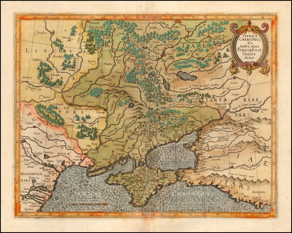
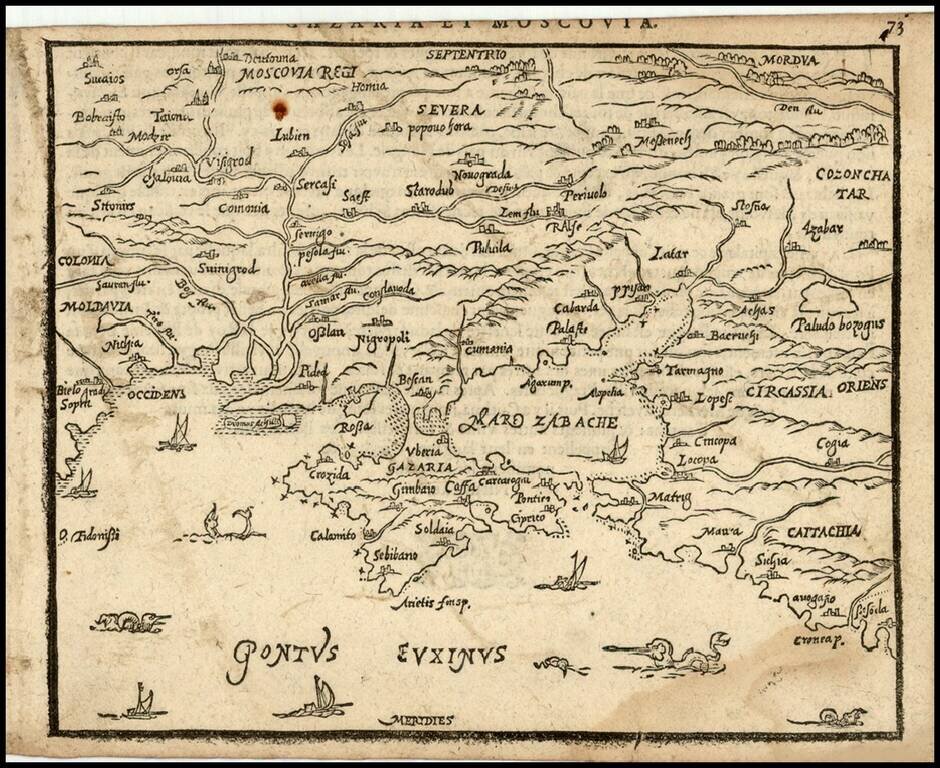
Detailed map of Southern Ukraine, Crimea and surrounding regions between the northern coast of the Black Sea and Moscow. Shows ports, fortified cities and the mouths of the Danube. Minor splitting along the towns, rivers, mountains, etc. Decorative...
Rare 16th Century map of Russia and Ukraine, published by Zacharias Heyns in his rare Le Miroir du Monde, ou, Epitome du Theatre d'Abraham Ortelius, published in Amsterdam in 1598. Zacharias Heyns was the son of Peter Heyns, who wrote the rhyming text...
Rare Italian view of Moscow, based upon Braun & Hogenberg's first view of Moscow. The walled center of the old city is depicted with its many churches. The map shows illustrations of people riding horse-drawn sleighs and a very early depiction of...
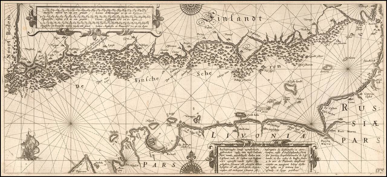
One of the Earliest Detailed Sea Charts of the Baltic Coastline Finely engraved sea chart Gulf of Finland, extending from St. Petersburg in the east to Estonia and the entire coast of Southern Finland. The chart appeared in Blaeu's Her Licht der...
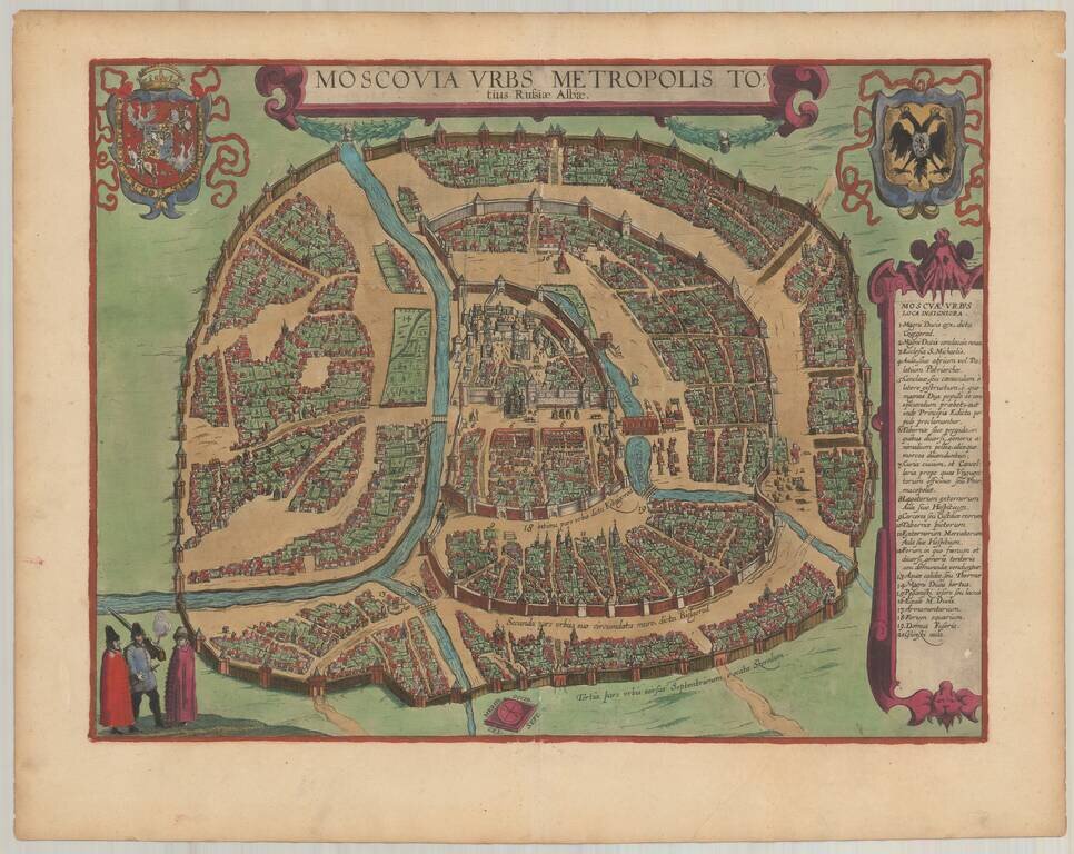
Finely colored example of Braun & Hogenberg's Plan of Moscow. This decorative and detailed plan of Moscow (Moskva) appeared in volume 6 of Braun & Hogenberg's of the Civitatus Orbis Theatrum. Because first appeared in 1617 in the final volume...
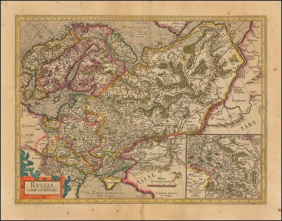
Nice outline color example of Mercator's first map of Russia. The map shows the region from Scandinavia to the Black Sea and the Oby River. Large inset of Russia Pars Amphisicata (Moscovia). Numerous Eastern European regions are shown, including:...
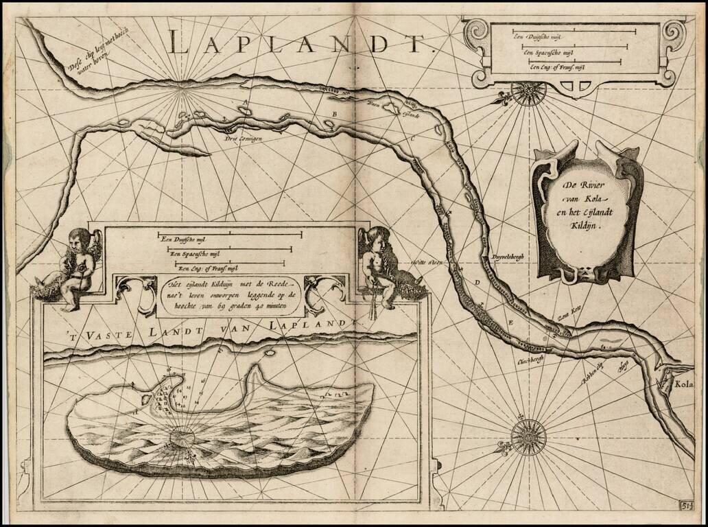
First edition of Blaeu's chart of part of Lapland, near Murmansk, from Blaeu's Zeespiegel, Inhoudende Een Karte Onderwijsinghe in de Konst de Zeevaert, en Eene beschrijvinghe der Seekusten van de Oostersche, Noordsche, en Westersche Schipvaert. The...
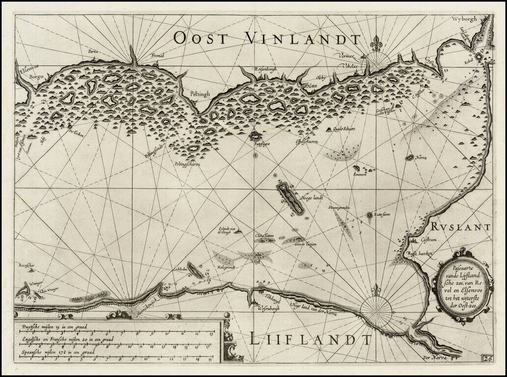
First edition of Blaeu's chart the Narva Bay and the area around St. Petersberg in Russia, from Blaeu's Zeespiegel, Inhoudende Een Karte Onderwijsinghe in de Konst de Zeevaert, en Eene beschrijvinghe der Seekusten van de Oostersche, Noordsche, en...
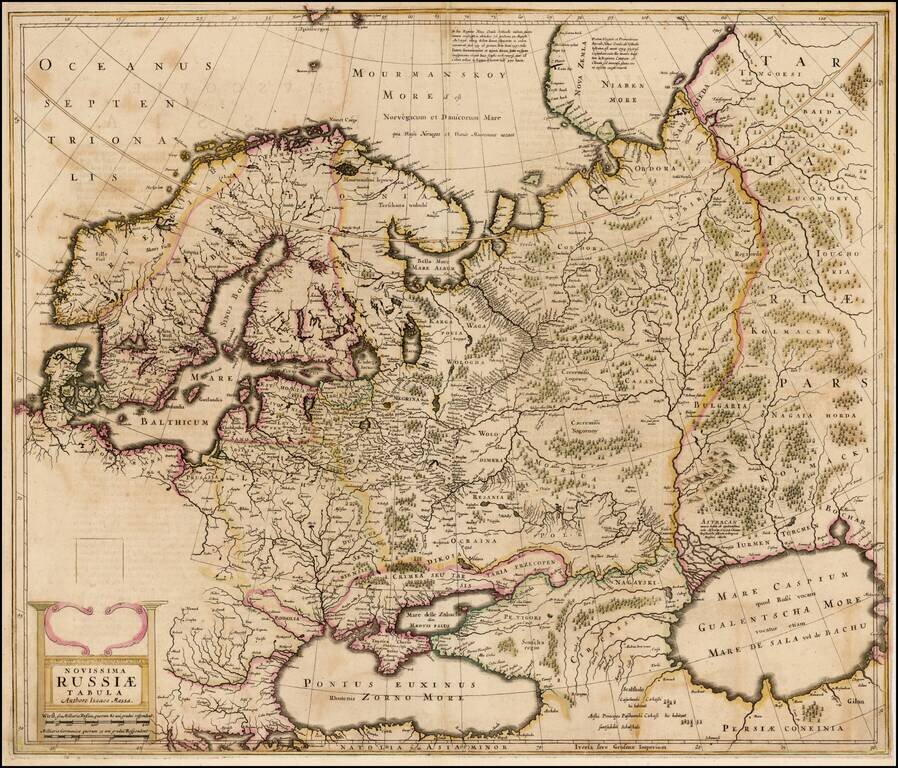
Old color example of the rare English language edition of the Mercator-Hondius map of the Russian Empire and Scandinavia . The present example of the map is a proof state. In the following year, the map would be finished, with 5 costumed figures and a...
![[Ukraine / Dniepr River] Lectori S. Hunc Borysthenis tractum ut ad nostrum Geographiae tabulam . . .](/map/small/63932op.jpg)
Striking 2-sheet map of the Dniepr River, engraved by Hessel Gerritzs. The map was originally issued as the eastern part of Blaeu's 6-sheet wall map of Lithuania. The map shows the course of the Dnieper River from Cherkasy to the estuary on the Black...