

Detailed map of the area centered on Meissen. Includes Dresden, Leipzig, Erfurt, and extending south to Prague. The present map was produced by two of the primary Cologne School mapmakers, Johann Bussemacher and Matthias Quad. The Cologne School of...

Detailed map of the north part of Germany, incluiding Brandenburg and Pomerania. Includes a portrait of Johan Georg of Brandenburg (1525 – 1598) Prince-elector of the Margraviate of Brandenburg (1571–1598) and a Duke of Prussia. The present map...

Detailed map of the Cleve region of Germany. Centered on the Maas and Rhein Rivers, Dusseldorf is at the bottom right corner and Nijmegen in the Netherlands at the top right. The present map was produced by two of the primary Cologne School...

Detailed map of the North Rhine-Westphalia region of Germany. Centered on the Maas and Rhine Rivers. Dusseldorf is at the top right corner and Cologne and Bonn are toward the bottom right, with the Maas River and the Dutch border to the left. The...
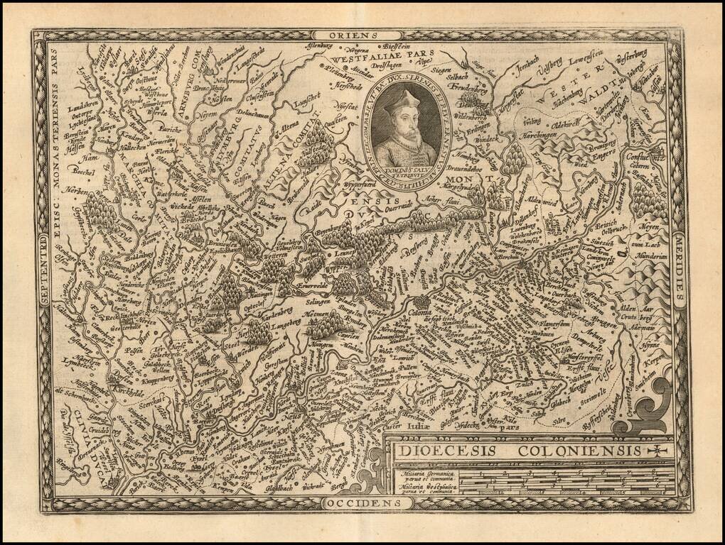
Detailed map of the Cologne region of Germany. Centered on the Rhine River with east at the top. Major cities shown included Cologne, Dusseldorf, Duisburg, and Wessel The present map was produced by two of the primary Cologne School mapmakers,...
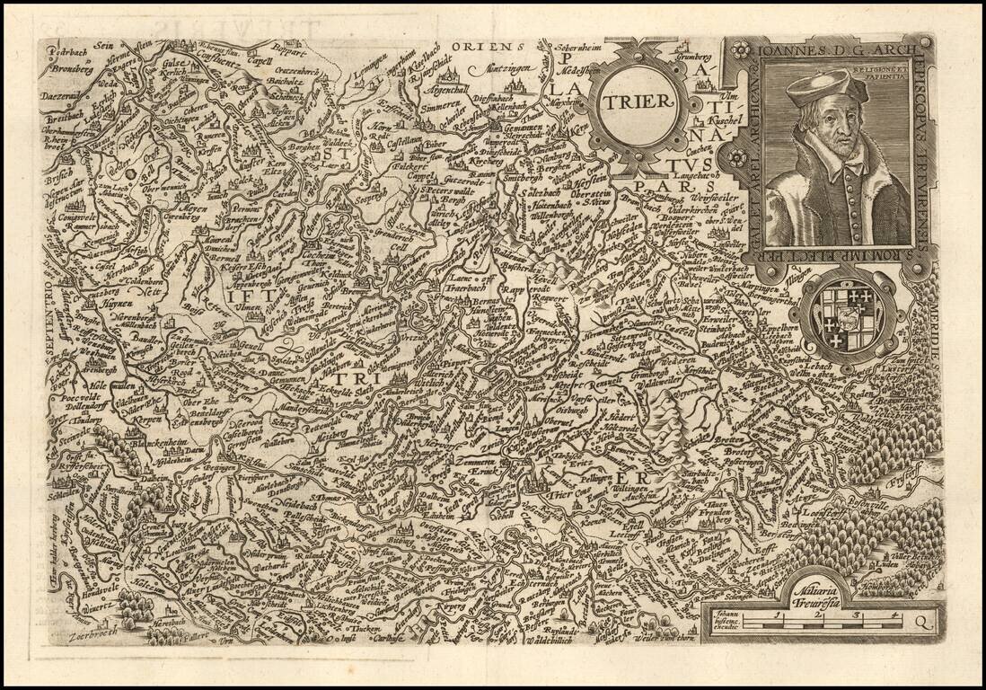
Nice example of this scarce map of Trier region, oriented with east at top of the map. The present map was produced by two of the primary Cologne School mapmakers, Johann Bussemacher and Matthias Quad. The Cologne School of cartography, was perhaps...
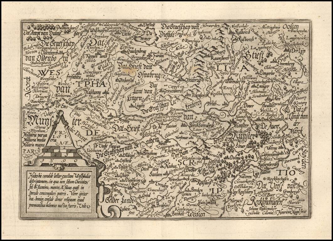
Detailed map of the Westfalia region, oriented with east at the top. Includes Munster, Osnabruck, Meppen, etc. The present map was produced by two of the primary Cologne School mapmakers, Johann Bussemacher and Matthias Quad. The Cologne School of...
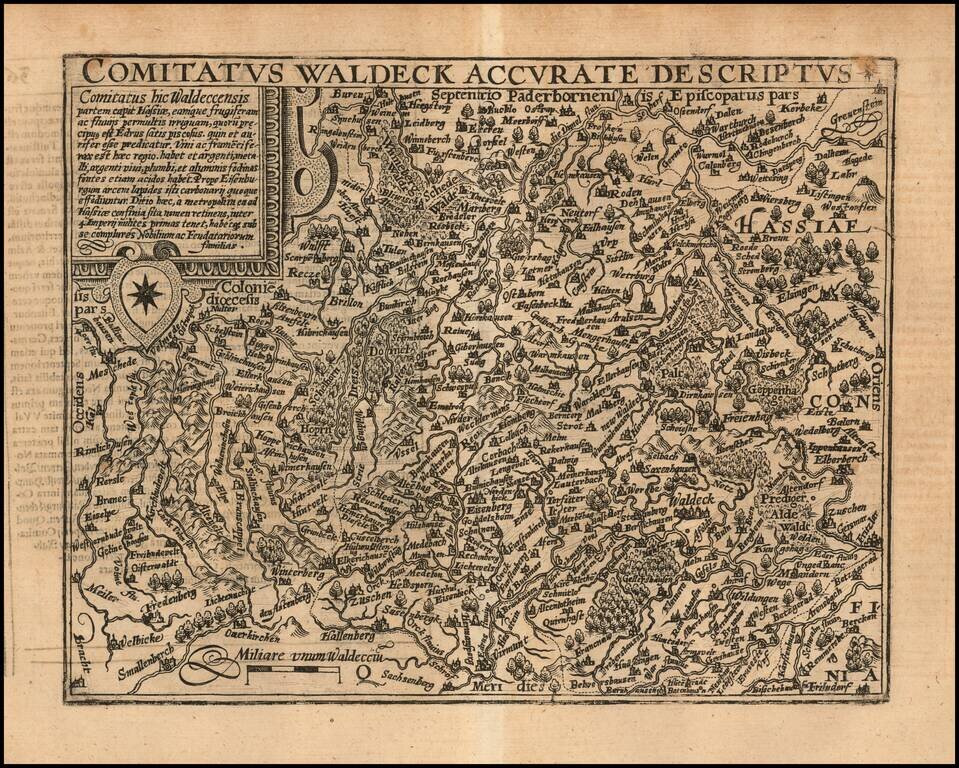
Detailed map of a part of the eastern section of Germany, centered near Mullhausen in Thuringa, with Waldeck in the southeastern corner. The present map was produced by two of the primary Cologne School mapmakers, Johann Bussemacher and Matthias Quad....
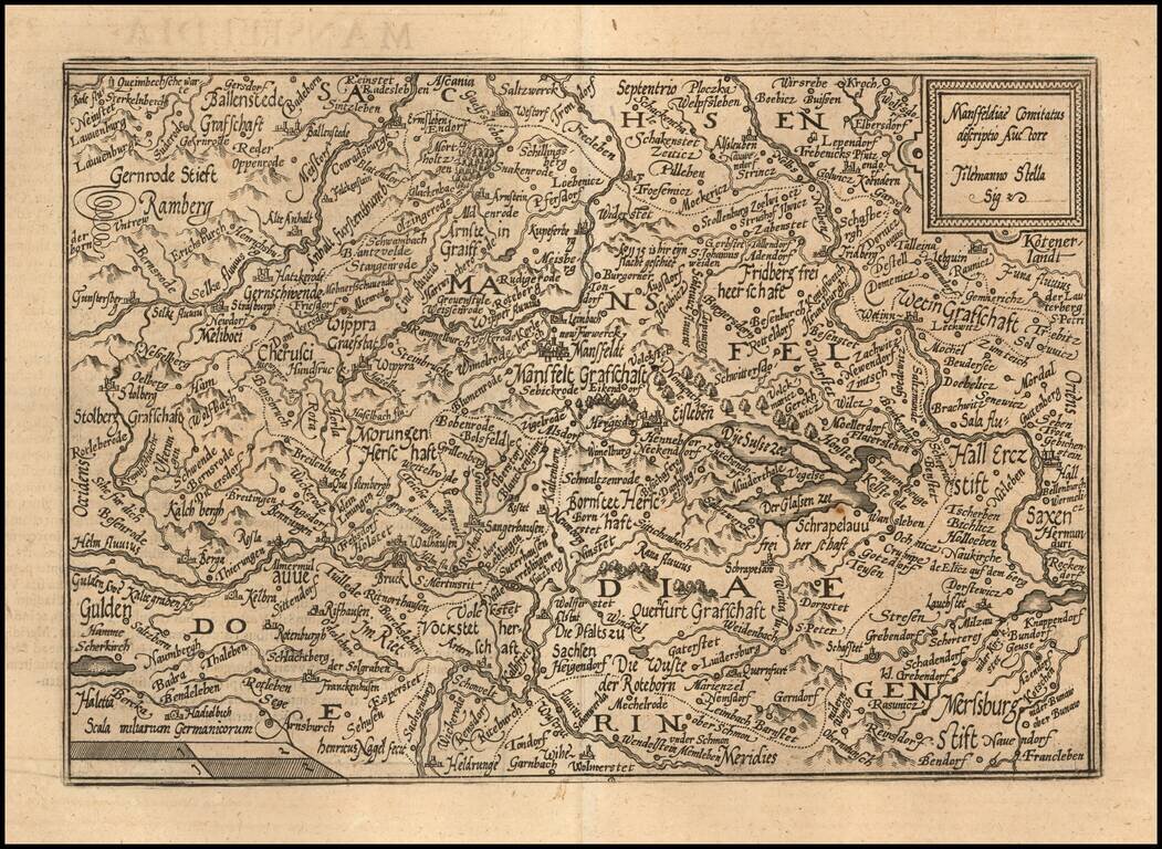
Detailed map of the region centered on Mansfeld. The present map was produced by two of the primary Cologne School mapmakers, Johann Bussemacher and Matthias Quad. The Cologne School of cartography, was perhaps the only group of mapmakers competing...
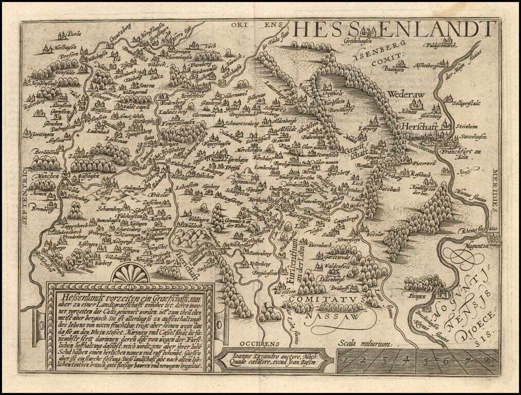
Fine map of the Hesse region of Germany, oriented with East at the top. Marburg is near the center of the map. Frankfurt on the Main River at the far right of the map. The present map was produced by two of the primary Cologne School mapmakers,...

Detailed map of the Westfalia region, oriented with east at the top. The Weser River is at the eastern (top part of the map), with the Netherlands at the west side of the map. Munster is near the center of the map. Also includes Osnabruck and...

Detailed map of the Luneburg region of Germany. Major cities shown on the map include Lunebourg, Hamburg, Bremen, Brunswick, Wolfsburg, The present map was produced by two of the primary Cologne School mapmakers, Johann Bussemacher and Matthias...
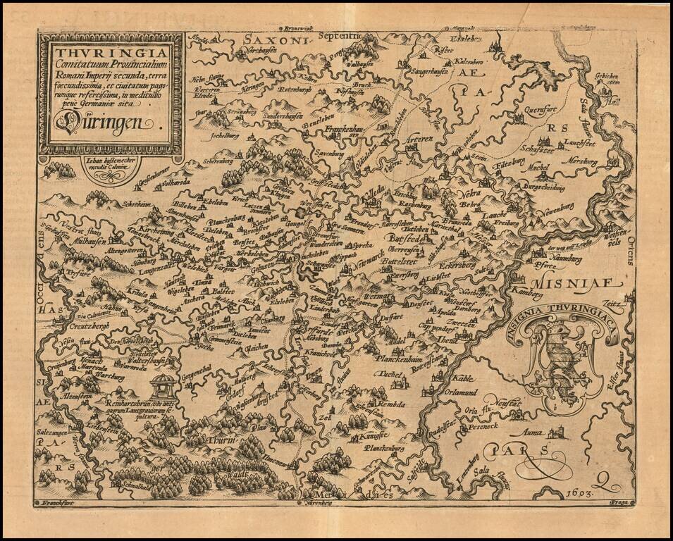
Detailed regional map of Thuringia in Germany. Shows the region between the Werra and Sala Rivers, centered on Erfurt. The present map was produced by two of the primary Cologne School mapmakers, Johann Bussemacher and Matthias Quad. The Cologne...

Detailed map of the Rhine Palatinate Region of Germany, oriented with South at the top. The map is centered on the Rhine River and includes Frankfurt and Mainz near the bottom of the map, along with Worms, Manheim, Stuttgart, Pforzheim and...

Nice example of this scarce map of the river traversed by the Rhine River, between Basel and regions to the North, published in Cologne. The map is oriented with West at the top. The present map was produced by two of the primary Cologne School...

Rare separately issued example of De Jode's map of Palatinus Rheni (no text on the verso, which more commonly appeared in De Jode's Speculum Orbis Terrarum, which along with Ortelius' Theatrum Orbis Terrarum are the earliest modern atlases of the...